Ravenna Gorge Hike: Black Forest Route, Distance and Access
The Ravenna Gorge hike pairs Hinterzarten's high moor with the Ravenna Viaduct and a narrow Black Forest gorge. Here are the route, distance and access.
On this page
The Ravenna Gorge hike delivers three landscapes in one circuit: a wooded valley approach, a narrow gorge crossed by a railway viaduct, and a high moor on the return leg above Hinterzarten. It suits hikers with good general fitness who want a half day of walking from a village with a railway station, not a high-alpine outing.
Trailhead and access
The loop starts and finishes at Hinterzarten train station, at 1.56 km (0.97 mi) into the route reaching the Löffeltalweg (Spoon Valley Trail) that leads toward Hofgut Sternen, and the same station is the end point at 12.0 km (7.5 mi). Because start and finish coincide, you can walk it without arranging a pickup or a second car.
Komoot lists the starting point as accessible by public transport, so the train to Hinterzarten puts you directly on the trailhead with no shuttle needed. Arriving by rail also removes the question of village parking, which matters on busy weekends and during the Christmas market season.
If you drive, plan on leaving the car in Hinterzarten for the day and walking from the station rather than repositioning it mid-route. The loop returns to the same point, so there is no reason to split the walk into two car-assisted halves.
Distance, ascent and time
The full moor-and-gorge loop measures 12.0 km (7.5 mi) with 330 m (1,083 ft) of ascent, rated moderate, and takes roughly 3 hours 35 minutes of walking. The route runs between a low point of 710 m (2,329 ft) and a high point of 1,020 m (3,346 ft), so most of the climbing is concentrated rather than spread evenly.
Komoot breaks the climbing into two main ramps: a 160 m gain over 1.89 km at an average of about 8 percent, and an 84 m gain over 928 m at about 9 percent. The second is the steeper of the two, so save some legs for it rather than treating the first climb as the day's effort.
Route description
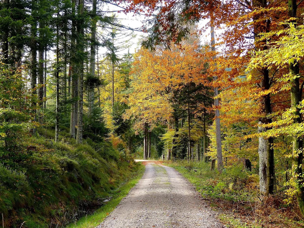
From Hinterzarten the route follows the Löffeltalweg (Spoon Valley Trail), a wooded path between the village and Hofgut Sternen that forms the gentle opening of the day. It is the longest single stretch of natural trail on the loop and sets up the gorge section that follows.
At 3.44 km (2.14 mi) you pass the small customs house at Hofgut Sternen, a replica of an 18th-century Hollsteig customs building at the entrance to the Ravenna Gorge. A few hundred metres later, at 3.48 km, the giant cuckoo clock at Hofgut Sternen provides the photo stop; it draws crowds on weekends and public holidays, so early starts pay off here.
The Ravenna Viaduct comes at 3.72 km (2.31 mi), a bridge that was blown up in its centre during the Second World War and rebuilt on its central pillars afterwards. It crosses high above the gorge, which is why the walk feels like two different hikes stitched together: valley floor first, then the moorland plateau above.
The gorge path at 3.87 km (2.40 mi) passes old saws, mills and a rope factory, so the narrowest section carries industrial history as well as scenery. The gorge runs roughly four kilometres from the Höllental up to the plateau at Breitnau, which tells you how much of the day's vertical gain is tied to this one feature.
The return leg reaches the Hinterzarten Moor at 10.8 km (6.71 mi), an open high-moor section that closes the loop with wide views instead of tree cover. The route runs through the Naturpark Südschwarzwald, and the moor is a protected area where staying on the marked path is the practical rule.
Surface and footing
The loop is a genuine mix underfoot: about 4.21 km of path, 3.27 km of hiking path, 2.28 km of street and 1.54 km of road, with smaller amounts of mountain hiking path and footpath. By surface that translates to roughly 3.98 km of gravel, 3.34 km of asphalt, 2.59 km of natural ground, 1.05 km of unpaved trail and under a kilometre of paving.
That asphalt and road share is why trail runners and fast walkers can keep a steady pace, but it also means footwear choice matters less than grip on the wet gorge and moor sections. Sturdy shoes with a real tread are the sensible call for the natural and unpaved parts rather than fell-running shoes.
When to go
Late spring through early autumn gives the most reliable ground conditions on the gorge path and the moor, when the natural and unpaved sections have dried out. The high point sits at 1,020 m (3,346 ft), so the plateau can feel exposed and cool even when Hinterzarten village is warm, and a windproof layer earns its place in the pack.
After rain the gorge path and the moor boardwalk sections turn slick, and the steep 9 percent ramp becomes the place where a slip is most likely. Time your start so you are off the gorge and back on the plateau before afternoon weather builds.
Huts and stops on the route
Hofgut Sternen is the main place to rest and eat, sitting at the gorge entrance with the customs house and the cuckoo clock beside it. It is the natural lunch stop, roughly a third of the way around, and the last easy place for a proper break before the climbing.
Beyond that the loop passes no serviced hut, so carry water and snacks for the moor section, which comes late in the day at 10.8 km. Filling up at Hofgut Sternen before the climb is the simplest plan.
The shorter gorge-only option
If 12 km is more than you want, a self-guided Ravenna Gorge hike of about 8 km (5 mi) covers the gorge itself and takes a fit walker 3 to 4 hours round trip. It drops the high-moor return and the full loop, so you see the viaduct and the gorge without the plateau section.
Choose the short version if your priority is the viaduct and the narrow gorge, and the full loop if you want the moor and the varied climbing. Both start from the Hinterzarten side, so the decision can wait until you see the weather on the day.
Practical kit and hazards
The gorge path demands sure-footedness on wet rock and timber, and the rating for the loop assumes mostly accessible paths with a few rougher sections. Poles help on the steep ramp and on the descent back into Hinterzarten.
The moor is open ground, so wind and rain arrive with little shelter, and the gorge can be darker and colder than the plateau. A waterproof shell and a warm mid-layer cover both extremes on the same day.
Where to base yourself
Hinterzarten is the obvious base: the station is the trailhead, the loop returns there, and the village sits close to the moor. Staying in the village removes any transport logistics and lets you start early ahead of the cuckoo-clock crowds.
Freiburg works as a city base with rail access to Hinterzarten, but it adds a journey at each end of the day and puts you on a timetable. For a single focused hike, staying in the Black Forest villages makes more sense; for a wider trip, mix the two. More options for the region are in our guide to black forest hiking. If you are weighing this against bigger mountain days, our guide to hiking in Switzerland covers the alpine equivalent of the same decision.
Christmas market at the gorge
The Ravenna Gorge hosts a seasonal Christmas market beneath the viaduct, which is a separate visit from the hike and draws heavy crowds. Walking the loop on a market day means sharing the gorge paths and Hofgut Sternen with day visitors, so pick a quieter date if the hike is the point.
What to hike next nearby
For a longer day with more ascent, the Feldbergsteig premium trail and the Three Gorges Trail both sit in the same part of the Black Forest and are rated harder than this loop. They reward a second day if you are basing in Hinterzarten.
Long-distance walkers can link this country to the Westweg, the classic north-south route through the Black Forest that passes through the same high ground. Our Westweg: A Complete Guide to Germany's Classic Long-Distance Trail sets out the stages for anyone extending the trip.
Plan Your Visit
Plan the Ravenna Gorge hike as a half-day loop from Hinterzarten station, allow roughly 3 hours 35 minutes of walking, and build in time at Hofgut Sternen. Start early to beat the cuckoo-clock crowds and to finish the moor before afternoon weather arrives.
If the full loop is too much, the 8 km gorge-only version gives you the viaduct and the narrowest section in 3 to 4 hours. Either way, the train to Hinterzarten keeps the logistics simple and lets you walk the route as a clean circuit.
Frequently Asked Questions
How long is the Ravenna Gorge hike?
The full loop from Hinterzarten station measures 12.0 km (7.5 mi) with 330 m (1,083 ft) of ascent and takes about 3 hours 35 minutes of walking at a moderate rating. A shorter gorge-only version runs about 8 km (5 mi) and takes a fit walker 3 to 4 hours round trip.
Where does the Ravenna Gorge hike start?
The loop starts and ends at Hinterzarten train station in the Black Forest. The first section follows the Löffeltalweg toward Hofgut Sternen at the entrance to the gorge, and the return comes back over the Hinterzarten high moor to the same station.
Can you reach the Ravenna Gorge hike by train?
Yes. Komoot lists the starting point as accessible by public transport, and Hinterzarten station is the trailhead for the loop. Arriving by train avoids village parking and puts you directly at the start.
How hard is the Ravenna Gorge hike?
It is rated moderate: 12.0 km with 330 m of ascent on mostly accessible paths, with sure-footedness needed on the gorge and moor sections. The steepest ramp is about 9 percent over just under a kilometre, so save energy for it.
Is the Ravenna Gorge hike a loop?
Yes, the route is a circuit from Hinterzarten station back to the station. It passes the Löffeltalweg, Hofgut Sternen, the customs house, the giant cuckoo clock, the Ravenna Viaduct, the gorge and the Hinterzarten Moor in that order.
When is the best time to hike Ravenna Gorge?
Late spring through early autumn gives the driest ground on the gorge path and the moor. The high point reaches 1,020 m, so carry a windproof layer even when the village is warm, and avoid starting late enough to meet afternoon weather in the gorge.
How long does the shorter Ravenna Gorge walk take?
The shorter self-guided gorge route covers about 8 km (5 mi) and takes a fit walker 3 to 4 hours round trip. It skips the high-moor return, so it suits anyone whose main goal is the viaduct and the narrow gorge.
Sources
Trail notes for your next trip
Optional updates when we add or revise hiking guides.
You might also like
Continue reading
More guides you'll find useful