Salto do Prego Hike: Azores Waterfall Trail Guide
Walk the Salto do Prego trail from Faial da Terra on São Miguel: the circular route, distance and time, terrain, Sanguinho village and the best season.
On this page
The Salto do Prego hike suits anyone who wants a short, shady forest walk ending at a waterfall rather than a summit. It begins in Faial da Terra, a small village on the south coast of São Miguel in the Azores, and climbs through dense laurisilva on a route that is modest in length but often wet underfoot. The reward is a fall dropping into a green amphitheatre, with the half-ruined hamlet of Sanguinho as a second objective on the full loop.
What the Salto do Prego hike is and who it suits
This is a half-day walk, not a mountain day. The valley sides are steep and wooded, the trail is narrow in places, and the interest lies in the forest, the water and the old settlement rather than in altitude or exposure. It suits families with older children, hikers on a rest day between bigger objectives, and anyone based in Furnas or Povoação looking for a short morning out.
Hikers who want distance and height gain should look elsewhere on the island. The waterfall route gives you a compact taste of São Miguel's wet upland forest, and the Sanguinho detour adds a slice of human history that most short trails lack. If you are building a week of walks, treat this as the gentle day between longer outings, and for a bigger-island contrast compare it with hiking in Tenerife.
Where the trail starts in Faial da Terra
The walk starts at Faial da Terra, on the EN1-1A coastal road east of Povoação. The village sits in a steep-sided valley with the stream running down to a small harbour, and the trailhead is reached by walking up through the village rather than by driving to the fall itself. Start early enough to walk in cool air, because the ascent is shaded but steady.
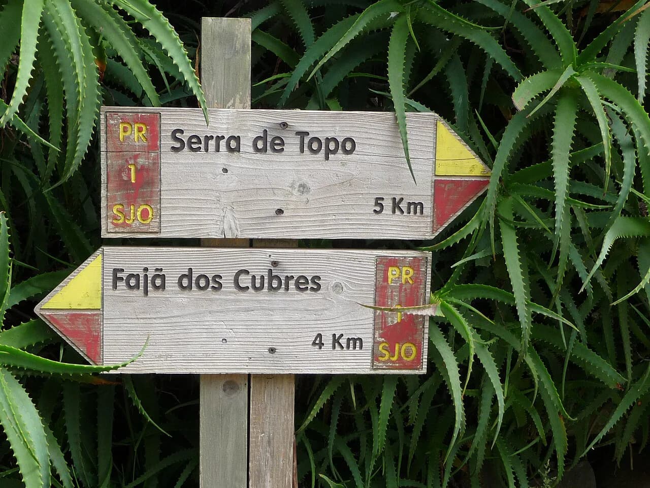
The route is one of the marked trails in the Azores network, and the official trail portal lists routes by island, difficulty and length, which is the place to match a trail to your plans. Markers are the red and yellow paint used across the archipelago's waymarked paths, and the portal's difficulty and extension filters let you see how this valley walk compares with the rest of the network before you commit a day to it.
Getting to Faial da Terra and parking
Faial da Terra is reached by road from Ponta Delgada via the south coast, or from Furnas over the hills through Povoação. A car is the practical way to get there, because the valley has no rail link and the trailhead is not on a lift or cable car route. Park in the village near the harbour or the lower streets and walk up; do not attempt to drive up to the waterfall.
Parking is on the village streets rather than in a dedicated trailhead lot, and no permit is needed to walk the trail. Set off from the village on foot and follow the marked path uphill along the stream. Allow the same walking time back down that you spent climbing, unless you finish the Sanguinho loop.
Distance, ascent and walking time
The circular route, including the waterfall and the Sanguinho return, covers about 4.5 km (2.8 miles), and the walk is commonly done in roughly two hours at an unhurried pace. Treat both figures as approximate: the terrain is slow going in wet conditions, and stops at the fall and in the hamlet add time.
Guided versions of the same outing, which combine the Sanguinho path and Salto do Prego with a visit to the Furnas hot springs, are described as taking around two hours on the trail itself. That is a useful sanity check on the distance, because it confirms this is a short walk rather than a full day. Published ascent figures for the loop are not consistent, so plan on continuous gentle climbing from the village to the fall and judge your pace from that.
Route description: from Faial da Terra to Salto do Prego
From the village the path climbs through gardens and then into forest, crossing the stream on wooden bridges and following the water up the valley. The gradient is steady rather than brutal, but the surface is uneven, with roots and wet rock where the trail hugs the stream. Near the fall the valley narrows and the noise of water replaces birdsong.
The final approach to Salto do Prego is the part that demands attention. Rock slabs and steps can be slick after rain, and the spray from the fall keeps the surrounding stone damp even in dry spells. Take the last section slowly and keep your hands free for balance rather than carrying a camera in one hand.
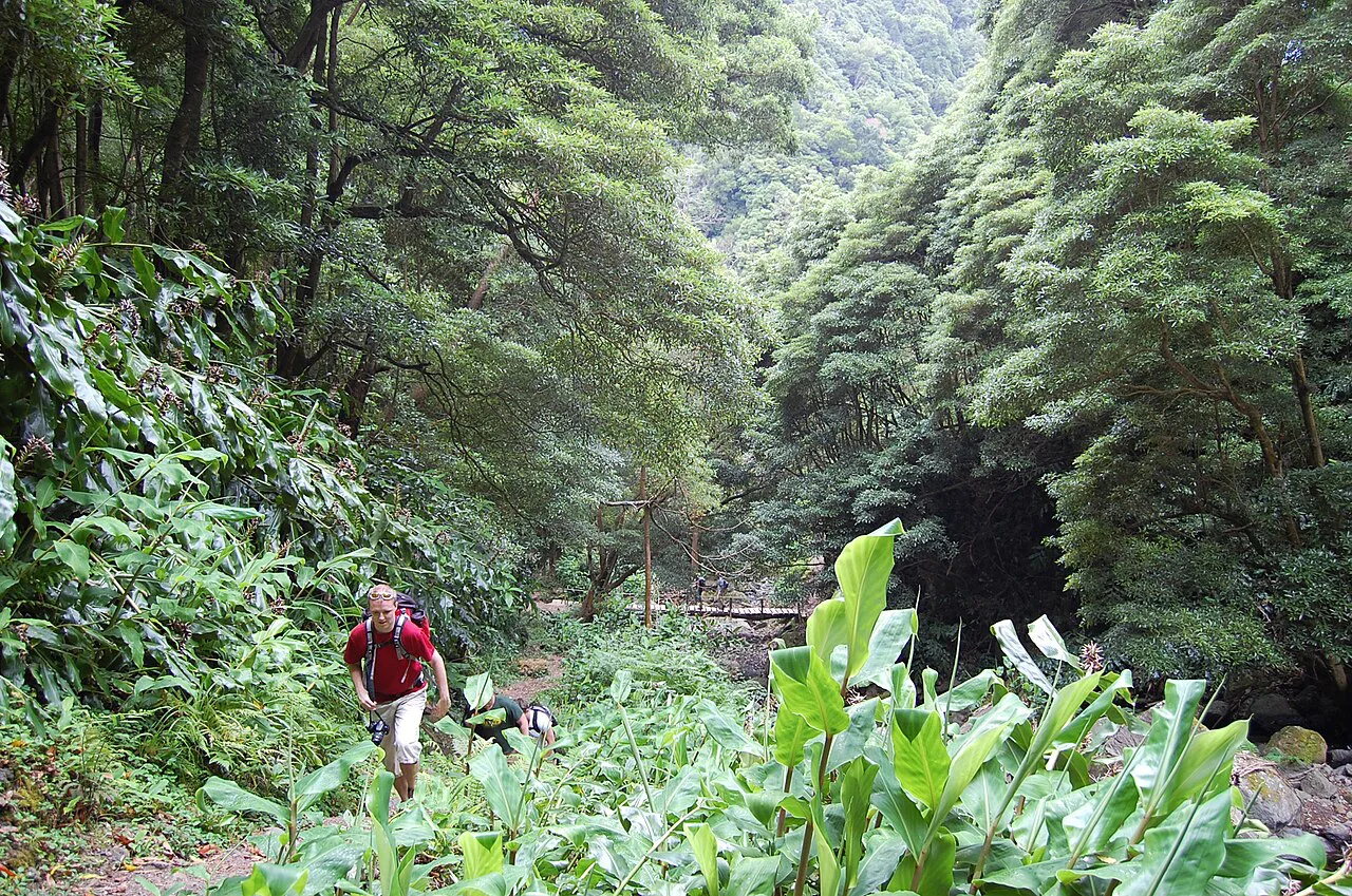
The waterfall and the return leg via Sanguinho
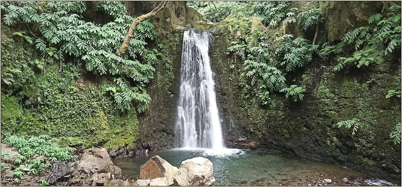
Salto do Prego drops into a mossy bowl surrounded by laurisilva, and the clearing at its base is the natural place to stop for lunch. Whether you can swim here is not something to assume, so read any on-site signage and follow what it says rather than planning the day around a dip. The pool is cold and the rocks slippery in any case.
The full loop continues from the fall to Sanguinho, an abandoned hamlet on a shoulder above the valley whose stone houses have been partly reclaimed. Walking through it is the most distinctive stretch of the day, and the descent back to Faial da Terra from here completes the circuit. If you prefer a simple out-and-back, retrace the stream path instead, which avoids the extra climb.
Surfaces, exposure and stream crossings
Expect mud, wet wood and loose stone for much of the route. The wooden bridges and the streamside sections are the slippiest parts, especially on the descent when you are tired, and a single walking pole helps more here than on dry mountain paths. There is no significant exposure, so the real risk is a twisted ankle rather than a fall from height.
Rain arrives quickly in this part of São Miguel, and the forest canopy hides the sky until you are out of the valley. Carry a shell jacket even on a bright morning and turn around if the stream rises noticeably while you are above it. After heavy rain, give the route a day to drain before walking it.
When to go: season, weather and water levels
The trail is walkable year-round, but late spring through early autumn gives the most reliable dry spells and the warmest conditions for stopping at the fall. March to June is a good window across the archipelago, with temperate weather and the chance of whale watching on the coast in the same trip.
Go in the morning. Afternoon cloud builds over the interior of São Miguel, and the valley feels darker and damper once the sun leaves it. Winter rain makes the wooden bridges genuinely hazardous, so check the day's forecast with the Azores weather service or your accommodation before setting out.
What to bring and footwear
Wear trail shoes or light hiking boots with real grip; smooth-soled trainers are a poor choice on the wet stone near the fall. Bring a waterproof layer, water, and a dry bag for anything you want to keep dry, since spray and rain are both likely. A towel and a change of socks in the car make the return to the village more comfortable.
Where to base yourself: Furnas and the northeast
Furnas, about half an hour away over the hills, is the best base for this walk, with hot springs and lakes to fill the rest of the day. Povoação, closer to Faial da Terra, is quieter and puts you on the coast road for the northeast. Ponta Delgada works as a base too, but the drive each way eats into a short walking day.
If you want a longer stay on the island's wetter, greener side, pair this valley with the crater lakes in the west on another day of your São Miguel itinerary. For a bigger challenge elsewhere in the archipelago, the climb up Portugal's highest peak is a very different proposition and worth planning separately on the Mount Pico Hike, Azores guide.
Extending the day: Furnas and the northeast coast
From Faial da Terra the coast road runs northeast to Povoação and inland to Furnas, where the caldeiras, botanical garden and lake make an easy afternoon. The Furnas valley is also the place to eat cozido, the local stew cooked in volcanic ground, if you have booked it in advance through a restaurant.
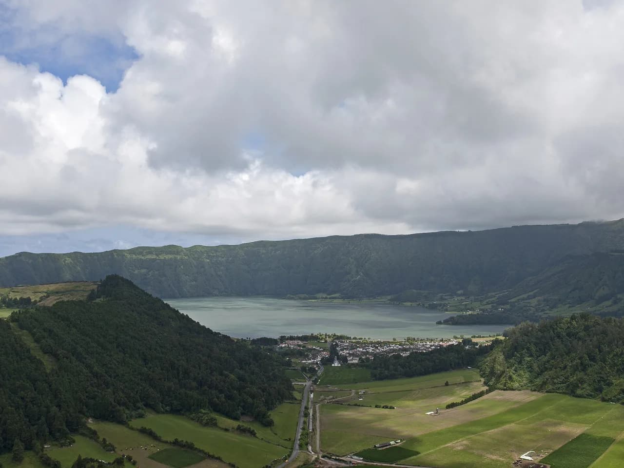
Away from São Miguel, the Azores' other islands offer crater-rim walks and vineyard trails that work well as an add-on to a longer trip. The Sete Cidades crater in the west of São Miguel is the island's most famous walk, but it is outside this valley and better saved for a separate day based near Ponta Delgada.
Plan Your Visit
The Salto do Prego hike works best as a short, early-morning outing from Faial da Terra, with the Sanguinho loop if you want the fuller circuit and the stream path if you want the quickest route to the fall. Give it half a day, wear shoes with grip, and build the rest of the day around Furnas.
Check the forecast and any signage at the trailhead before you set off, and leave the waterfall pool alone unless on-site information says otherwise. Beyond that, this is one of the simplest and most rewarding walks on São Miguel, and it fits easily into a week of Azores walking.
Frequently Asked Questions
How long is the Salto do Prego hike?
The circular route including the waterfall and Sanguinho is about 4.5 km, or roughly 2.8 miles, and is usually walked in around two hours. Allow extra time for stops at the fall and in the hamlet, and more in wet conditions when the path is slow.
Where does the Salto do Prego trail start?
It starts in Faial da Terra on the south coast of São Miguel, east of Povoação. Park in the village and walk up through it toward the stream and the marked forest path; the waterfall is not reachable by car.
Is the Salto do Prego hike difficult?
It is a short but steadily climbing forest walk with uneven ground, wet wooden bridges and slippery rock near the fall. Fit walkers with proper shoes find it straightforward, while the wet surfaces rather than the gradient are the main challenge.
Can you swim at Salto do Prego?
Follow the signage at the waterfall. The water is cold and the rocks around the pool are slippery, so even a paddle calls for care.
What is Sanguinho village on the Salto do Prego route?
Sanguinho is an abandoned hamlet above the valley whose stone houses have been partly restored. The full loop passes through it on the return leg to Faial da Terra, adding a short climb and the most distinctive section of the walk.
When is the best time to hike Salto do Prego?
Late spring through early autumn gives the most reliable weather, and mornings are quieter and clearer than afternoons. The trail is walkable year-round, but winter rain makes the bridges and rock slabs slippery.
Do I need a guide for the Salto do Prego hike?
No, the route is waymarked and short enough to walk independently. Guided day trips from Ponta Delgada combine the walk with the Furnas hot springs for those who prefer transport and a local guide.
Sources
Trail notes for your next trip
Optional updates when we add or revise hiking guides.
You might also like
Continue reading
More guides you'll find useful