Mount Pico Hike, Azores: Route, Difficulty and Guided Climbs
Plan the Mount Pico hike on Pico Island, Azores: steep volcanic terrain, weather windows, trailhead access, guided climbs and where to base yourself.
On this page
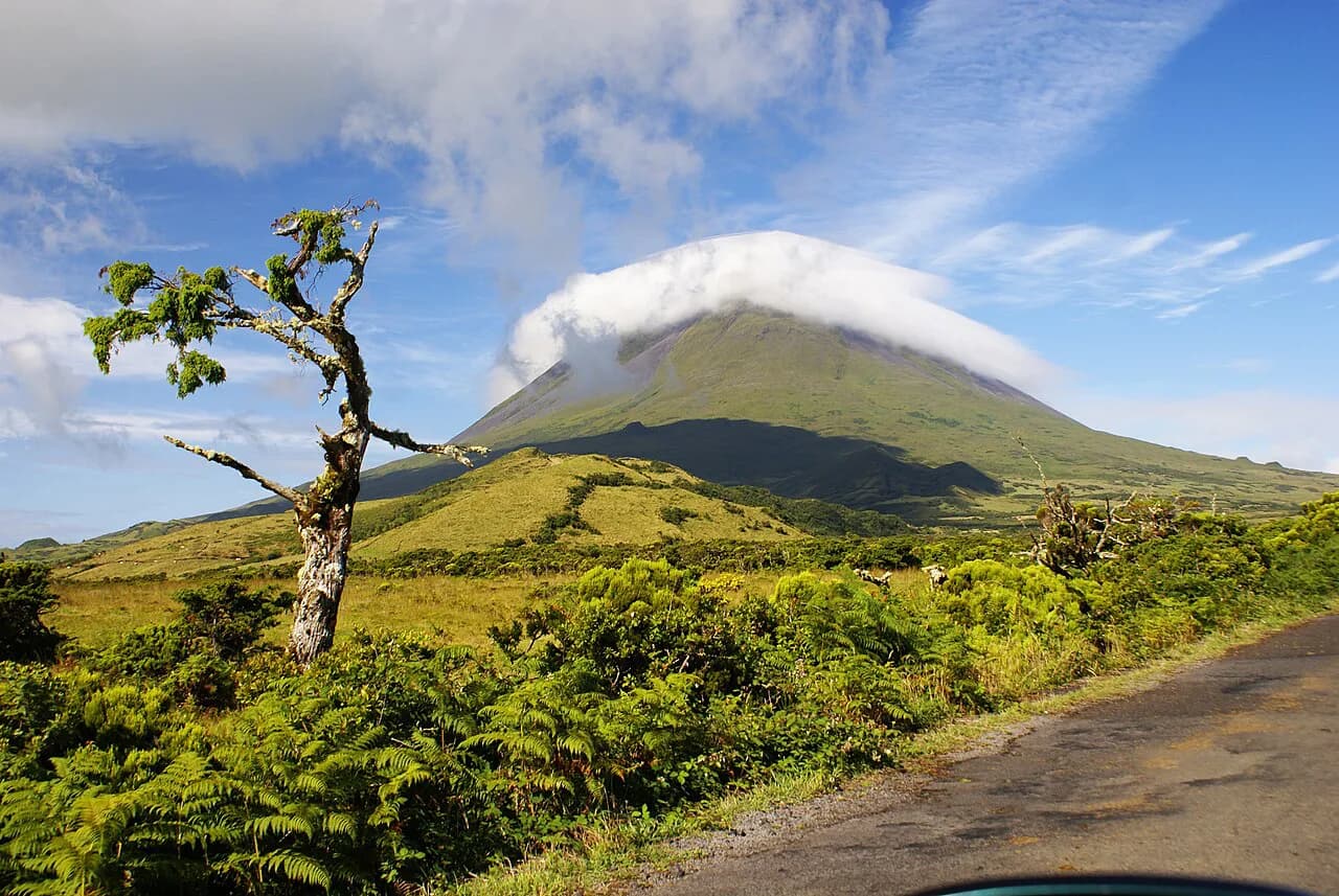
Mount Pico is the summit that gives Pico Island its shape and its name: a black lava cone standing alone in the central Azores, with the Atlantic on every side. Pico Me Up puts the top at 2,351 m (7,713 ft), which makes it the highest point in Portugal. The climb suits hikers with steady footing and a head for exposure rather than anyone looking for a gentle waymarked walk. If you are still choosing between islands, the wider hiking in Azores guide sets Pico alongside the archipelago's other walking destinations, and the Madeira hiking guide offers a contrasting island alternative with its levada walks.
The defining feature of this mountain is that the difficulty is not spread evenly. The approach across the crater floor is a long, uneven walk on volcanic ground, while the final ascent of the lava cone is the genuinely demanding section, steep and physically taxing. Reviewers describe the mountain as having no classic hiking trails, with climbing to be expected on a path that is steep and demanding. Plan your pacing and your turn-around point around that split rather than treating the day as one uniform gradient.
Where Mount Pico sits and who the climb suits
The mountain occupies the eastern half of Pico Island, the second-largest island in the central Azores group. Its upper slopes sit above the vineyard country of the Pico wine region and above the cloud line often enough that summit views come and go through the day. Everything on the climb lies within Pico Island, so you can plan the whole day around one island base without ferry hops.
This climb is a good fit for fit hikers who have scrambled on loose volcanic rock before and who are comfortable gaining height quickly on rough ground. It is a poor fit for anyone seeking a maintained trail with regular waymarks, and it is not a first mountain for children or for hikers uneasy on steep descents. The descent is where fatigue and loose ground combine, and it deserves as much planning as the ascent.
Because the summit stands free of higher ground, the weather on the cone is the deciding factor in whether a summit day is realistic. Winds, rain and fog are common on the mountain, and when they arrive they make the climb harder, particularly on the way down. A guided or independent plan should both include a spare day so that one bad forecast does not end the trip.
When to go: best months and weather windows
Summer gives the most reliable window, roughly June through September, when the island is warmest and the days are longest. Even then the summit can sit in cloud while the coast is sunny, so build the climb around a morning start and keep a second possible day in reserve. Spring and autumn can be clear and quiet, but you should expect more wind and rain and be ready to turn back if conditions on the cone deteriorate.
Winter climbing on Pico is a serious proposition: short daylight, frequent cloud and strong wind on an exposed cone with no shelter. If your trip falls between November and March, treat the climb as weather-dependent and plan low-level walks along the coast and through the vineyards instead. The same advice applies in any season when the forecast shows a front crossing the central group.
Reaching the trailhead on Pico Island
Almost all climbs on Pico begin from the area around the mountain's base, reached by road from the island's main towns. The climb starts from the mountain's base area and finishes at the same point on the way down, so there is no through-route to arrange transport around. Renting a car gives you the most flexibility, letting you move your attempt to the best forecast day without depending on a fixed departure.
Pico Island is served by flights from other Azorean islands and from the Portuguese mainland, and inter-island ferries connect it with Faial and São Miguel. If you are combining islands, the São Miguel Hikes collection covers the walking on the archipelago's busiest island and helps you sequence a multi-island trip. Allow a full day on Pico for the climb itself, separate from any travel day.
The route: crater rim, lava cone and summit
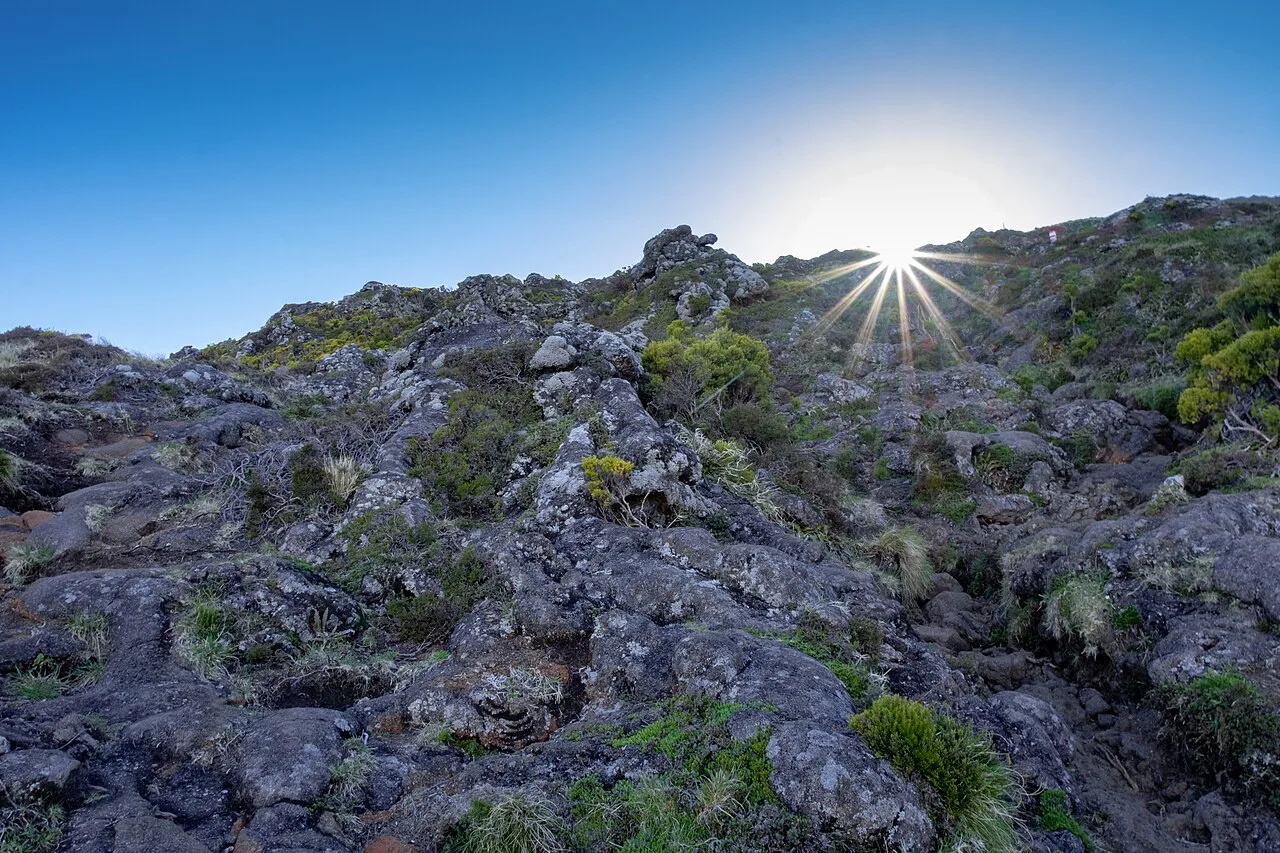
The route begins on the volcano's lower slopes and works up to the crater rim, where the ground opens into the caldera floor. Crossing that floor is a rough walk over volcanic rock and ash, with the crater walls rising on either side and the lava cone ahead of you the whole way. This section sets the tone: it is walking, not scrambling, but the surface is uneven and demands attention to footing.
From the crater floor the route climbs the lava cone itself, and this is the steep and demanding part of the day described in hiker reviews. The cone is where you gain height fast on loose, sometimes crumbly ground, and where the exposure becomes noticeable as the rim falls away below you. Take the cone steadily, keep your hands free on the steeper steps, and accept that the descent will feel longer than the ascent did.
The summit ends at the highest point in Portugal, with the Atlantic visible on every side when the cloud allows. The crater of the summit cone itself is a recognised landmark on the final approach, and the top is a small crater rim rather than a broad plateau, so space is limited and you should not linger if another group is arriving. Wind on the summit is usually stronger than anything you felt below, so layer up before you stop moving.
Distance, ascent, time and difficulty
Judge the climb by vertical gain rather than horizontal distance, because the cone packs the bulk of the ascent into a short, steep section. The widely quoted summit elevation of 2,351 m (7,713 ft) is the starting point for your own planning: subtract your trailhead altitude to get the gain, and remember that the descent puts the same load on your knees and quads in reverse.
Treat this as a full mountain day and start early enough to be off the exposed cone before the afternoon cloud builds. The technical difficulty is moderate rather than alpine climbing, but fitness and confidence on steep, loose volcanic rock matter more than any single figure. Anyone unsure whether their pace is adequate should book a guided climb, where the pace is set for the group and the guide reads the conditions.
Guided climb formats and what they include
Pico Me Up, an operator based on the island, runs three formats built around the same summit. The day climb ascends in full daylight; the night climb starts in darkness with headlamps and aims to be high on the mountain for sunrise; the overnight climb sleeps near the top so you wake for sunrise at the summit. All three are guided ascents, so the guide sets the route and the pace.
Booked prices are listed per person by Pico Me Up: the overnight climb at 200 euros, the night climb at 90 euros and the day climb at 75 euros when checked. Pico Me Up states more than ten years of guiding on Pico and 3,200+ summits with its team, and describes its guides as certified and first-aid trained. Treat the figures as that company's current listings and confirm the inclusions, meeting point and cancellation terms directly when you book.
Guides earn their fee mainly on the descent in poor visibility, when route-finding on loose volcanic ground is the hardest part of the day. Solo hikers with scrambling experience and a good weather window can climb independently, but a guided format shaves risk when the forecast is marginal. Choose the overnight option if sunrise from the top is the point of the trip and you can carry the extra clothing a night at altitude demands.
Huts and shelter on the mountain
Do not plan on a staffed mountain hut with beds, meals and a warden on this climb. The overnight format run by Pico Me Up is the organised way to be on the mountain at sunrise, and it includes shelter at the top rather than a serviced refuge below. If you intend to climb independently, treat the mountain as an unsheltered day objective and carry everything you need for the descent.
Weather on the summit can change quickly, which is why a bothy-style shelter at the top matters for guided groups and why leaving it out of an independent plan is a real commitment. Carry a windproof shell, an insulating layer and a headlamp even on a day climb, and add a bivvy bag or emergency shelter if you are climbing without a guide. Warm clothing for the summit stop is essential, since standing still in Atlantic wind chills fast.
Gear and mountain hazards
Loose volcanic rock, steep ground on the cone, strong wind and sudden fog are the hazards that define this climb. Wind, rain and fog increase the difficulty of the mountain when present, especially on the descent, so turning back at the crater rim is a sound decision rather than a failed day. Boots with good grip on scree and ash are more useful here than light trail shoes, and trekking poles help on the long descent.
Carry more water than you would for a comparable walk at sea level, because the climb is dry and the summit is exposed. Sun protection matters even when the coast is overcast, since the upper mountain often sits above the cloud. Pack a map or a downloaded track, a charged phone and a whistle, and tell someone on the island your plan and expected return time.
Safety, guiding and booking rules
Decide on a guide before you commit to a summit day, because availability on the island is limited and the overnight format needs to be reserved in advance. Pico Me Up's site lists the three climb formats and their per-person prices, and the booking terms, meeting arrangements and cancellation policy sit with Pico Me Up rather than with any park authority. If you climb independently, you are responsible for your own route-finding and for judging when to turn around.
Weather on Pico is the single variable worth building flexibility around: keep a spare day, watch the forecast for the central group and be prepared to swap the summit for a coastal walk. Group sizes, guide ratios and any age limits are set by Pico Me Up, so ask directly if you are bringing younger or less experienced hikers. For longer island itineraries, azores walking holidays shows how a guided trip packages days across the archipelago.
Where to base yourself on Pico Island
Madalena, on the western side facing Faial, is the island's main town and ferry port, with the widest choice of accommodation and restaurants. It puts you within driving distance of the mountain's base area and gives you the easiest arrival if you come by ferry. Staying here also gives you evening options after a long descent, when a short drive back to a bed matters.
The eastern side of the island, around São Roque and Piedade, is quieter and closer to the mountain's approach roads. If your priority is an early start on the cone, a base on this side cuts your pre-dawn drive. From either base you can add coastal and vineyard walks on rest days, and a copy of the island's walking routes from the local tourist office helps you choose.
What to do if the summit is clouded in
A clouded summit is not a wasted day on Pico: the crater rim and the caldera floor still give you a spectacular walk on volcanic ground, and the views open unexpectedly as cloud moves through. Set a turnaround time and stick to it, so that poor visibility on the descent does not catch you out. Hikers with limited time sometimes climb to the rim only, which delivers most of the scenery without the cone's steepest ground.
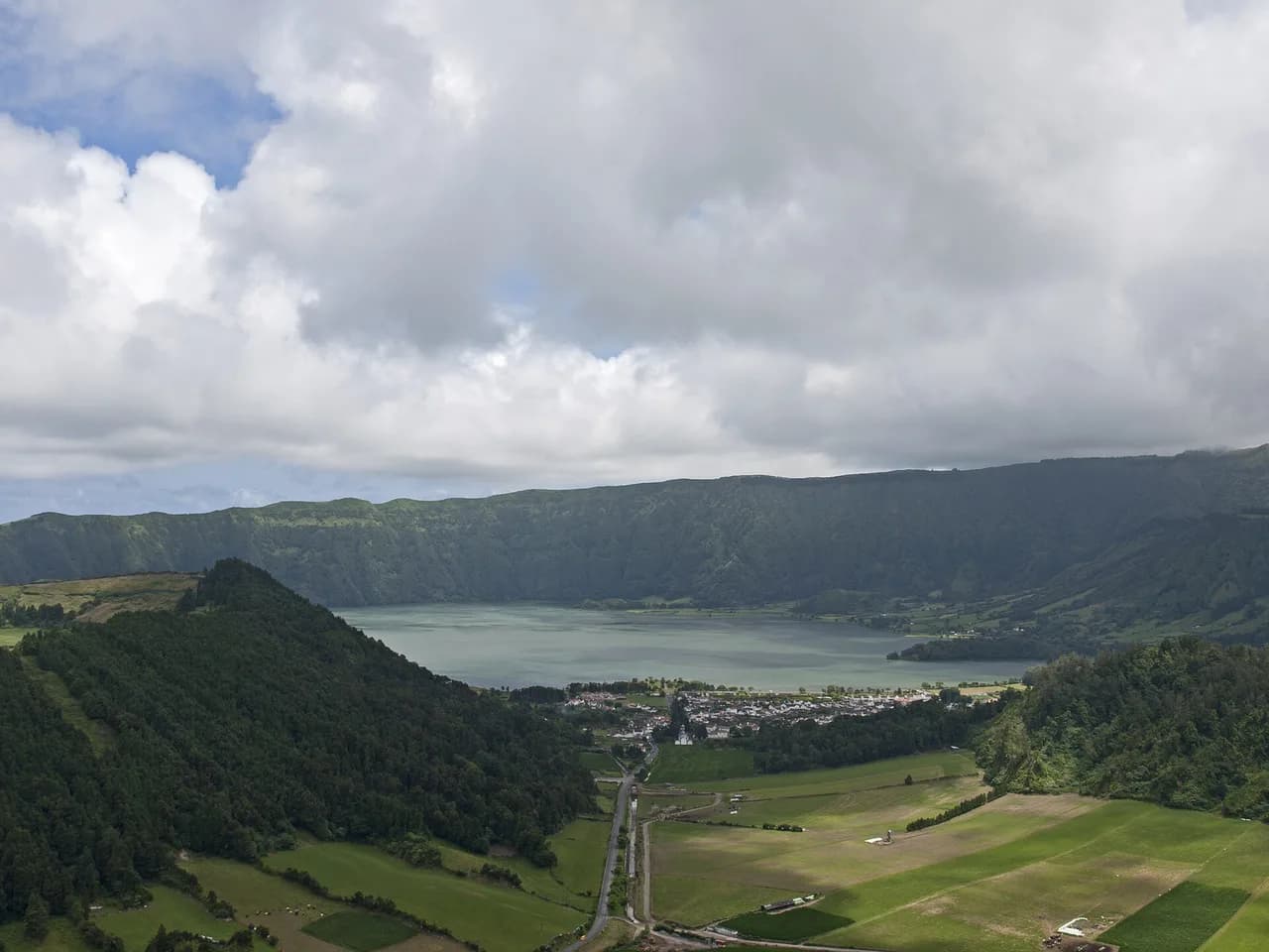
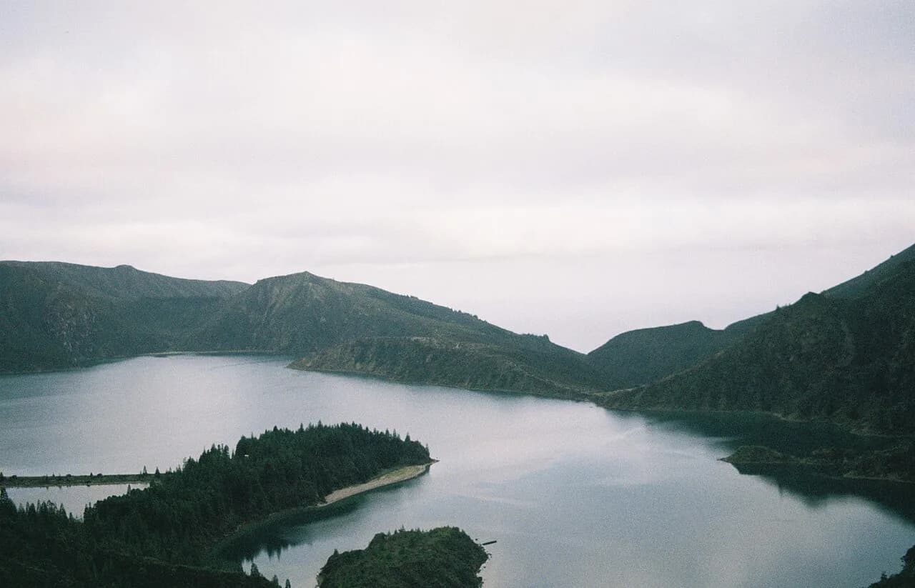
Off the mountain, the island's vineyards, lava-formed coastline and whale-watching trips from the west coast fill a spare day well. If you are island-hopping, the Sete Cidades hike on São Miguel is a caldera walk that pairs neatly with a Pico climbing trip, and the Lagoa do Fogo hike gives you a second short mountain day on the same island. Both are outside Pico Island and need a flight or ferry to reach.
Plan Your Pico Climb
The Mount Pico climb rewards hikers who treat it as a weather-dependent mountain day with a steep, loose summit cone: go in summer if you can, start early, keep a spare day and be ready to turn around at the rim. If the forecast is uncertain, a guided day or night climb shifts route-finding onto someone who knows the mountain. Book the format you want before you travel and confirm the details with Pico Me Up.
Frequently Asked Questions
Do you need a guide to climb Mount Pico?
No rule requires a guide, and experienced hikers with scrambling skills climb independently in good weather. A guide is most valuable in marginal conditions, when wind, rain or fog make the descent harder, and for anyone who wants the sunrise without route-finding at night.
How hard is the Mount Pico climb?
It is a demanding but non-technical climb. The approach over the crater floor is rough walking, and the final lava cone is steep and physically taxing on loose volcanic rock, so fitness and sure footing matter more than technical skill.
What is the best time of year to climb Mount Pico?
June to September gives the longest days and the most settled weather. Spring and autumn can be clear and quiet but windier, and between November and March the mountain is frequently in cloud, so plan around a spare day whenever you go.
Is there anywhere to stay on Mount Pico?
There is no staffed mountain hut with beds and meals on the climb. The overnight guided format sleeps near the top, while independent hikers should treat the mountain as an unsheltered day objective and carry their own emergency shelter.
How do I get to Pico Island?
Pico is reached by inter-island flights and by ferry, with connections to Faial and São Miguel. From the port or airport, a rental car gives the most flexibility for reaching the mountain's base area on the best forecast day.
Sources
Trail notes for your next trip
Optional updates when we add or revise hiking guides.
You might also like
Continue reading
More guides you'll find useful