Westweg Guide: Hiking the Black Forest North to South
Plan the Westweg from Pforzheim to Basel: west and east variants, stage distances and ascent, lodging and transport, and when to hike the Black Forest.
On this page
The Westweg is Germany's oldest long-distance trail, laid out by the Schwarzwaldverein in 1900 and still walked from north to south through the entire Black Forest. It gives you a ridge-and-forest traverse from Pforzheim to Basel that is far quieter than the Alps but carries just as much climbing. It suits fit walkers with one to three weeks who want a waymarked, well-serviced route they can link to buses and trains.
Think of it as a long high-level forest walk rather than an alpine expedition: the trail follows marked ridges, passes through small towns and open country, and gains just under 9,000 m (about 29,500 ft) across its full length. That total is what separates a comfortable two-week schedule from an ambitious ten-day one, so match your days to the ascent rather than to distance alone.
What the Westweg is and who it suits
The Westweg crosses the Black Forest lengthwise as a single signed route with two finish options. The Schwarzwaldverein designed it in 1900 and reshaped it in 2006 to fit modern walkers, including a designation as a Qualitätsweg Wanderbares Deutschland, and it belongs to the Top Trails of Germany group of long-distance routes. The route is maintained by the Schwarzwaldverein, which also takes reports of damage or problems on the trail.
It fits walkers who are comfortable with six to eight hours on their feet day after day, mostly on forest roads and narrower paths, and who want guesthouses and villages rather than mountain huts. Families with younger children are better served by picking short day stages, since the route is not technical but the cumulative climbing is real. The northern third from Pforzheim to Hausach is lower and gentler than the southern high ground, so it makes a reasonable shakedown before the Feldberg and Belchen sections.
Westweg at a glance: length, ascent and stage count
The Schwarzwald Tourismus gives 291 km (181 mi) over 12 stages for the west variant and 288 km (179 mi) over 13 stages for the east variant, each starting at Pforzheim and ending at Basel. Total ascent across the whole trail is just under 9,000 m (roughly 29,500 ft). The official page also describes the route with the round figure of about 285 km (177 mi), so use the variant figures as the planning numbers.
Stage lengths vary widely: the first day from Pforzheim toward Dobel is about 16.2 mi (26 km) with roughly 2,506 ft (764 m) of ascent, typically taking 6.5 to 7.5 hours. Later days run shorter or longer, each with its own profile, so plan each stage individually instead of an even daily average. Komoot's route breakdown shows stages ranging from around 13.4 km to 25.1 km, with ascent on individual days reaching well over 1,000 m; check current distances and elevation before setting out.
West variant vs east variant after Titisee
Both lines share the same northern approach as far as Titisee, where they divide. The west variant runs Pforzheim, Forbach, Alexanderschanze, Hausach, Kalte Herberge, Titisee, Hinterzarten, Feldberg, Belchen and Basel. The east variant follows the same towns but turns after Kalte Herberge through Bärental, Schweigmatt and Degerfelden before Basel.
Choose the west line if you want the highest ground of the Black Forest: the Feldberg and Belchen sections give long ridge walking, wide views and the highest points of the tour. The east line trades some altitude for a more varied mix of valley and ridge as it heads toward Basel. Neither variant is technically difficult; the difference is exposure to weather on high ground and daily climbing.
Getting to Pforzheim and back from Basel
Pforzheim sits at the northern edge of the Black Forest with rail links to the rest of Germany, and Basel is a major rail junction on the German-French-Swiss border, so both ends are accessible by train. Every stage endpoint and most overnight stops between them can also be reached by public transport, which lets you plan point-to-point days without a car.
The KONUS guest card gives free bus and rail travel through the Black Forest from Pforzheim to Basel and from Karlsruhe to Waldshut, but only for guests registered with a host in one of the roughly 150 participating holiday towns. If you book accommodation in a participating village, you can often end stages by bus or train rather than retracing on foot. If you don't, budget for regular tickets when linking stage endpoints.
Stage-by-stage: Pforzheim to Forbach
The opening stage climbs out of Pforzheim to Dobel over about 16.2 mi (26 km) with around 2,506 ft (764 m) of ascent, taking most walkers 6.5 to 7.5 hours. Komoot's breakdown divides the northern approach differently, with Pforzheim to Neuenbürg at 15.3 km, then Neuenbürg to Bad Herrenalb at 21.5 km, and Bad Herrenalb to Forbach at 19.8 km with about 1,010 m up and 1,340 m down.
The descent into Forbach is long, so wear footwear with grip and keep something in reserve for the final hour. This northern section mixes forest with valley crossings and is the easiest place on the route to build in a shorter day. Marking is a red diamond on a white background, and parts of the route narrow to a single-track path.
The northern high section: Alexanderschanze to Hausach
Between Forbach and Hausach the route climbs onto the higher ground around the Alexanderschanze, with stages of roughly 18 to 20 km and sustained daily ascent. Komoot's Forbach to Hochkopfstube stage runs 18.9 km with about 1,020 m up, and its Kniebis to Brandenkopf stage runs 25.1 km with around 620 m up and 630 m down. These are the days where the cumulative height gain starts to matter.
The drop into Hausach from Brandenkopf is steep in places, with 13.4 km covering only 140 m of ascent but 820 m of descent. Plan that as a downhill day with knees in mind, and treat the town as a natural resupply and rest stop before the trail turns south toward Kalte Herberge. Exposed ridges here catch wind and afternoon weather, so start early on days with rain forecast.
Kalte Herberge to Titisee: the split point
Kalte Herberge is the last shared overnight before the lines divide, and the stage from there to Titisee runs about 20.8 km with 330 m up and 490 m down. Titisee is the practical decision point: read your plan, commit to west or east, and adjust the remaining days accordingly. Both lines continue from the Titisee-Hinterzarten area toward Basel.
The west variant from Titisee climbs into the Feldberg area over about 21.2 km with 850 m of ascent on the Komoot stage breakdown, making it one of the more demanding days of the entire route. If you are carrying a heavier pack, consider arranging luggage transfer or reducing the day's distance before the high ground.
The west variant: Feldberg, Belchen and into Basel
The west line takes in the highest parts of the Black Forest around Feldberg and then follows the Belchen ridge south toward Basel. The stage from Hebelhof over Notschrei to Wiedener Eck runs 17.6 km with 340 m up and 540 m down, and Wiedener Eck over Belchen to Kreuzweghütte covers 14.4 km with about 610 m up and 580 m down. The Feldberg massif is the classic Black Forest high point, and the signed trail through the Feldberg area is a highlight of this variant.
Expect snow and icy paths on the high ground in winter, and early or late season snow on the passes and ridges. In summer, build mornings around the high sections and watch for afternoon storms. In the south, the trail traces the softer, sunlit slopes of the Southern Black Forest Nature Park as it approaches the Swiss border. If you want to compare this ridge-and-forest traverse with bigger alpine days across the border, our guide to hiking in Switzerland covers where to go, the best trails and seasons.
The east variant: Bärental, Schweigmatt and Degerfelden
The east variant leaves the shared route at Kalte Herberge and continues via Bärental, Schweigmatt and Degerfelden to Basel over 13 stages. It avoids the Feldberg high ground and the Belchen ridge, though it still crosses significant Black Forest climbing. If you want to be less exposed to weather and cover slightly more stops, the east line gives you more towns along the way.
This line is a good match for walkers who prefer villages to high ridges, and it spreads the southbound days over 13 stages instead of 12. The trade-off is that you miss the Feldberg and Belchen, the two great viewpoints of the trail. Pick it if the weather forecast for the high ground is poor, or if you want a more moderate profile into Basel.
Where to sleep: huts, guesthouses and trekking camps
The Westweg is not a high-alpine hut route: most overnight options are guesthouses, inns and small hotels in the towns and villages along the way. Some sections have simple trail huts and shelters, but you should plan to reach one of the trail towns each night. The Schwarzwald Tourismus page lists a downloadable brochure and a Westweg map, both of which show overnight stops along the route.
For an overnight under the sky, the region's camping sites, motorhome pitches and trekking camps are listed by Schwarzwald Tourismus. Book summer beds in advance on the Feldberg and Belchen sections, where accommodation is thinner. For a base outside the main line, the Schluchtensteig in the Southern Black Forest Nature Park shows how another long route in the region uses village lodgings and can be combined for a rest day.
Luggage transfer and organized walking packages
Schwarzwald Tourismus lists organized packages with luggage transfer, bed and breakfast, including a 15-day version and shorter 7-, 8- and 9-day options. Package prices change by season and operator, so check the booking page for current rates rather than budgeting from an old figure. The packages suit walkers who want point-to-point convenience without booking each night themselves.
If you prefer to book independently, a luggage transfer can be arranged locally in some trail towns, and the package descriptions show what such options usually cover. Weigh the flexible pace of a self-booked trip against the fixed schedule and included transport of a package. Neither approach changes the walking itself; both follow the same waymarked route.
Water, resupply and waymarking on the trail
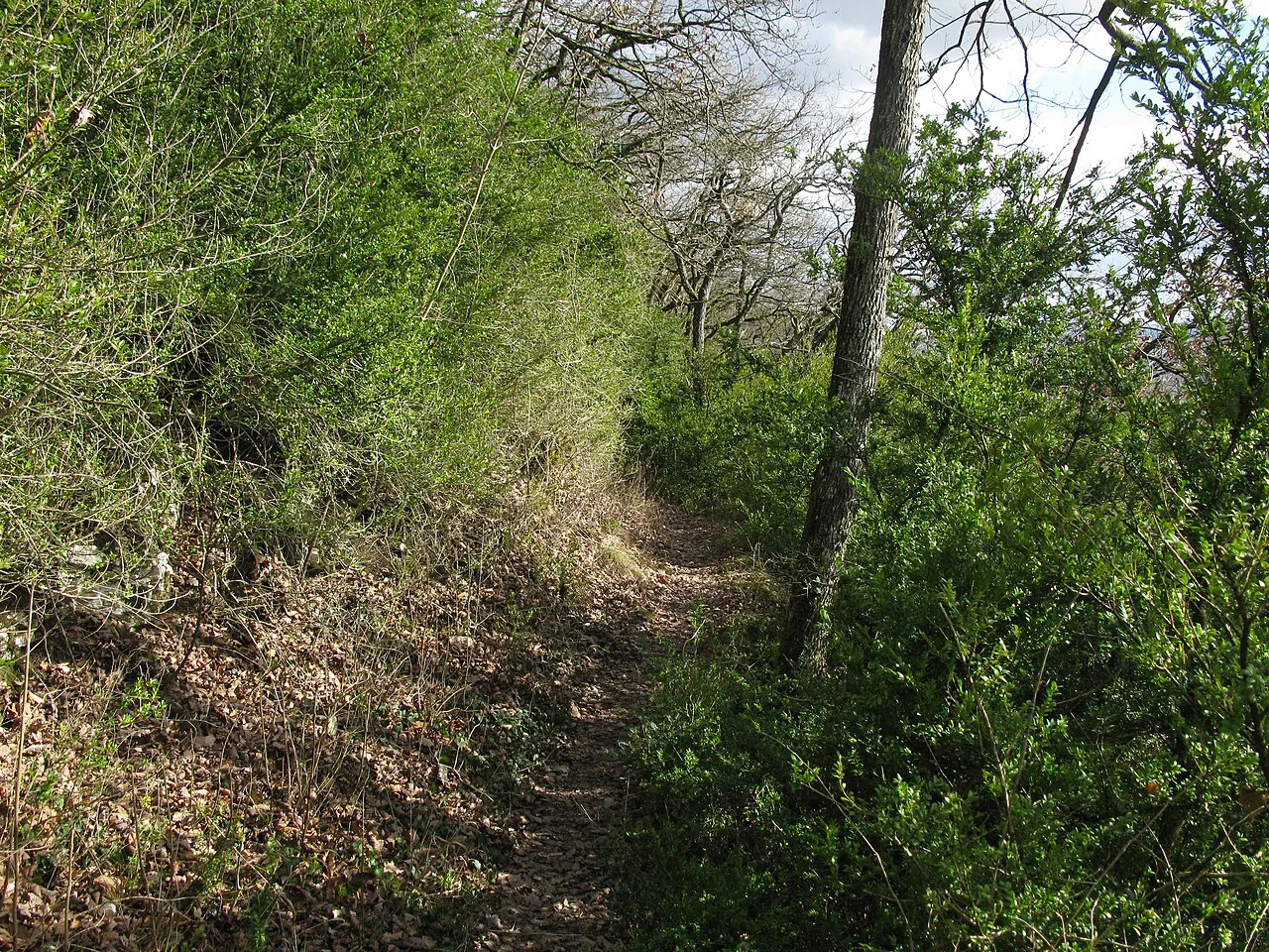
The Westweg is marked with a red diamond on a white background, and some sections are single-track paths in forest. Carry enough food for a full day, because resupply points are spaced through the day and some stages cross long stretches of forest. The Schwarzwald Tourismus lists drinking water refill stations along the route.
Fill bottles at the marked refill points and at towns along the way, and carry a bottle you can refill rather than relying on fountains. The trail passes the Schleifenbach stream in the southern section, though not all water along the route is treated for drinking. If a section marker is damaged or a path appears closed, report it to the Schwarzwaldverein or to Schwarzwald Tourismus.
When to go: seasons, snow and weather
The best months are late spring, summer and autumn. Winter brings snow and icy paths on the high ground, and early or late in the season snow can linger on the Feldberg and Belchen ridges. Plan a schedule you can reverse if a weather window closes on the high ground.
Afternoon storms are common on summer days, so start the high stages early and be ready to descend or shorten a day if thunder builds. Fog is more likely in the autumn and can remove views from the ridge sections, which is worth accepting on a long route. Valley towns around Titisee and Hinterzarten make natural rest stops or bad-weather alternatives.
Short sections and star tours from a base
You don't have to walk the whole route. Schwarzwald Tourismus lists star tours, which use a fixed base and walk out to nearby sections, a good option for anyone who wants day hikes on the Westweg without a full traverse. The town of Hinterzarten and the Titisee area give easy access to the split point and to the high ground around Feldberg.
Families with young children should pick short, low stages; the northern section from Pforzheim to Forbach has easier days, while the high southern sections demand more fitness. The Feldberg area is a natural place for a day hike, and the Feldberg gnome trail is a family-friendly way to see the same high ground.
Practical hazards on Black Forest high ground
The trail is not a technical alpine route, but the combination of just under 9,000 m (about 29,500 ft) of cumulative ascent, long days and changeable weather makes it a serious undertaking. Carry waterproofs and warm layers even in summer, especially on the Feldberg and Belchen, and know where your next village or shelter lies. The narrow single-track sections require care with footing, and the red-diamond waymark can be hidden by snow in early or late season.
If you plan to combine the Westweg with other Black Forest walking, the Ravenna Gorge Hike in the Black Forest offers a short, scenic alternative for a rest day near the southern high ground. Winter snow and ice on the high passes are the main seasonal risk: shorten the day or drop to a valley stage when the forecast turns.
Plan Your Visit
The Westweg is a two-week traverse of the Black Forest with a decision point at Titisee: a higher west line over Feldberg and Belchen or a gentler east line through Bärental and Schweigmatt. Match your days to the roughly 9,000 m of total ascent, use the KONUS guest card for transport if your lodging qualifies, and book lodging early on the high ground.
If you are still comparing Black Forest routes, the Black Forest hiking guide gives the wider context, while the Schluchtensteig offers a southern alternative. Check the Schwarzwald Tourismus page for the current brochure, map and package details before you commit.
Frequently Asked Questions
How long is the Westweg and how many stages does it have?
It runs 291 km (181 mi) over 12 stages on the west variant and 288 km (179 mi) over 13 stages on the east variant, from Pforzheim to Basel. The two variants split at Titisee.
What is the difference between the Westweg west and east variants?
The west variant climbs over the Feldberg and Belchen high ground, while the east variant runs through Bärental, Schweigmatt and Degerfelden. The west line offers the highest terrain; the east line has more towns and one extra stage.
How much ascent does the Westweg involve in total?
Just under 9,000 m (about 29,500 ft) across the full route. Individual days can exceed 1,000 m of ascent, so plan daily distances to match your fitness rather than averaging the total.
Where does the Westweg start and finish?
It starts at Pforzheim at the northern edge of the Black Forest and finishes at Basel on the German-French-Swiss border. Both ends are served by rail, and most stage endpoints can be reached by public transport.
Can you hike the Westweg using public transport between stages?
Yes, most stage endpoints and overnight towns are connected by bus and train. The KONUS guest card gives free travel through the Black Forest for guests registered with a participating host.
When is the best time of year to hike the Westweg?
Late spring, summer and autumn are the best seasons. Winter brings snow and icy paths on the high ground, and early or late season snow can linger on the Feldberg and Belchen ridges.
Are there huts and campsites along the Westweg?
Overnight stops are mostly guesthouses and inns in the towns and villages along the route, with some trail huts and shelters. Schwarzwald Tourismus lists camping sites, motorhome pitches and trekking camps along the corridor.
Sources
Trail notes for your next trip
Optional updates when we add or revise hiking guides.
You might also like
Continue reading
More guides you'll find useful