Cinque Torri Hike: Cortina d'Ampezzo Routes & Lift Guide
Plan the Cinque Torri hike from Cortina d'Ampezzo: trailhead access, summer shuttle rules, the short refuge walk and the Rifugio Nuvolau extension.
On this page
The Cinque Torri hike gives you five dolomite towers, two refuges facing them and a preserved World War 1 position, all within a short walk at around 2,200 m (7,218 ft). It suits hikers with half a day and moderate fitness who want big scenery without a long approach.
Two decisions shape the day: whether you ride the chairlift or walk up from Bai de Dones, and whether you stop at the Scoiattoli terrace or continue to Rifugio Nuvolau. The notes below separate the near-flat refuge-to-refuge walk from the longer circuit so you can match the route to your time and legs.
What the Cinque Torri hike offers and who it suits
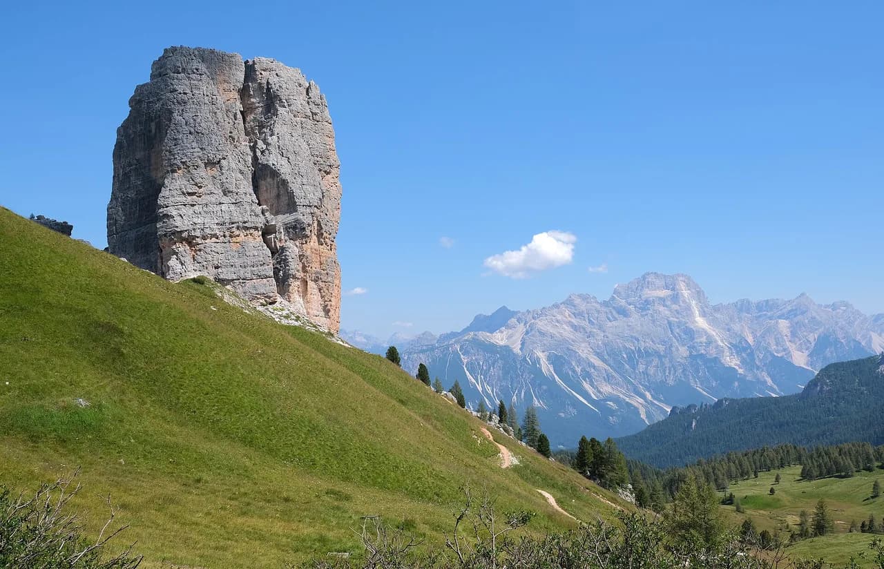
Five limestone towers stand shoulder to shoulder above open alpine grass, with the Cinque Torri and Scoiattoli refuges set directly opposite them. The towers are a climbing destination, so the terraces make good vantage points for watching parties on the walls.
The walking itself is gentle: the classic refuge-to-refuge route is graded easy and stays above 2,100 m (6,890 ft) on wide paths. Hikers who want a genuine half-day outing should treat the towers as the start and add the Nuvolau climb or a museum circuit.
Where the hike starts: Cinque Torri refuge and the SS 48 access road
The Rifugio Cinque Torri is the trailhead, sitting at 2,137 m (7,011 ft) and reached from the Great Dolomites Road SS 48 at Cianzopè, roughly 11 km (6.8 mi) from the center of Cortina d'Ampezzo. A small side road climbs from the highway to the refuge, where parking and the lift base are found.
From June 16 to September 21 the Cianzopè access road closes to vehicles around the clock, and a shuttle runs from Cianzopè to replace the drive. Outside that window you can drive up; inside it, plan on the shuttle and build the wait into your start time.
Getting to the trailhead: chairlift, car and bus from Cortina d'Ampezzo
The Impianti Averau chairlift serves the Cinque Torri area and cuts the climb from the valley side; its operating season, hours and fares are set by Impianti Averau S.r.l. and are worth checking before you commit to a lift-assisted start. Without the lift, paths reach the refuge on foot from Bai de Dones and from the SS 48, gaining height gradually through the grass slopes.
Buses from Cortina d'Ampezzo also serve the starting point, with timetables handled by Servizi Ampezzo from the bus station in town. Allow extra time on summer mornings, when shuttle traffic and hikers converge on the same narrow approach.
Distance, ascent and time: the short refuge-to-refuge walk
The direct route follows path 439 from the Cinque Torri refuge to a saddle, then turns right to the Scoiattoli refuge. It climbs 118 m (387 ft) from 2,137 m (7,011 ft) to 2,255 m (7,399 ft) and takes under an hour round trip at an easy grade.
That figure covers only the short link between the two huts, not a full day out. If you add the museum loop or the Nuvolau extension, your total distance and time grow well beyond the hour, so decide the shape of the day before you set off.
Route description: path 439 to the Forcella and the Scoiattoli terrace
Leaving the Cinque Torri refuge, path 439 climbs gently through open ground to the forcella in under 30 minutes. The saddle opens the view to the Scoiattoli refuge, which sits directly under the climbing walls of the towers.
The panorama terrace at Scoiattoli is the natural turning point for the short walk, with the towers close enough to pick out individual routes. Water and food are available at both refuges, so you can travel light and refill on the way.
The World War 1 Open Air Museum among the towers
Beside the Scoiattoli refuge, the 5 Torri Open Air Museum preserves trenches and restored positions from the mountain war. A visit takes about an hour and slots in neatly after the terrace, making the towers a history stop as well as a viewpoint.
Treat the museum as a route decision rather than a detour: with the extra hour you turn a short morning into a half day. Walk the trench lines at an unhurried pace and keep to the marked ground, since the restored positions sit on uneven terrain.
Extending to Rifugio Nuvolau: distance, ascent and time
From the Cinque Torri area, a circuit continuing to Rifugio Nuvolau is reported at 9.6 km (6 mi) with 600 m (1,969 ft) of elevation gain and about 3 hours 45 minutes of walking. Those are third-party figures, so pace them against your own fitness before committing.
A second reported option is a 7 km (4.3 mi) loop from the lift top at 2,255 m (7,399 ft), taking four to five hours. The Nuvolau summit sits above the saddle and the final pull is the steepest part of the day, so start early enough to be off the exposed ground before afternoon storms build.
When to go: best months and snow on the approach
The shuttle window from mid-June to late September marks the main summer season, when the access road is closed to cars and paths are clear. July and August bring the most traffic; June and September offer quieter trails with cooler starts.
Snow can linger on shaded ground and in the forcella early and late in the season, and the grass slopes above Bai de Dones hold moisture after rain. Check conditions with the refuge before a shoulder-season start, and carry traction if you plan the Nuvolau extension.
Huts and water on the route
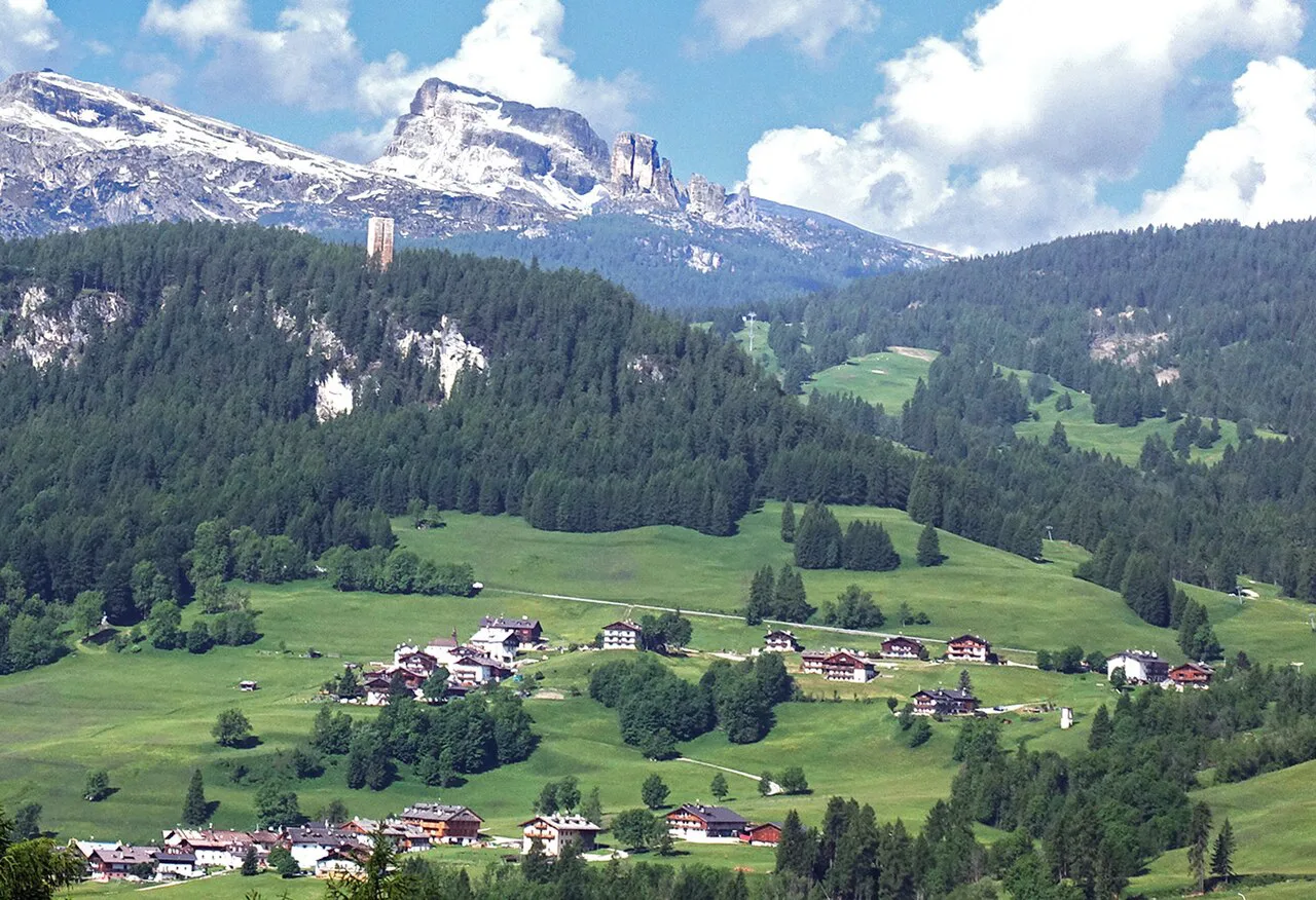
Both the Cinque Torri and Scoiattoli refuges serve food and drink and are positioned at either end of the short walk. The Scoiattoli terrace is the better lunch stop for the tower views, while the Cinque Torri refuge works well as a pre-walk base.
Rifugio Nuvolau adds a third option for hikers on the longer circuit, and each hut publishes its own seasonal opening and booking arrangements. Water points along the paths are limited, so carry a full bottle from the trailhead and refill at the huts.
What to wear and carry
The route notes list trekking boots, a backpack, a change of clothes, a rain jacket and a first aid kit, with water and provisions for the walk. Boots matter on the stony sections around the towers, and a shell earns its place when storms roll in from the south.
A map and a charged phone cover the junctions, and a warm layer helps on the terraces even in high summer. If you plan to watch climbers from below, binoculars add real value to the Scoiattoli stop.
Nearby options inside the Cortina area
The Lagazuoi Tunnels offer a war-history counterpart on the other side of the pass, with a route through restored galleries. Hikers wanting more open alpine walking can pair the towers with the Croda da Lago Hike, which uses a different approach from Cortina.
For a contrasting day on the Passo Tre Croci side, the Lago di Sorapis Hike reaches a turquoise lake on a balcony path. The Lago Federa Hike from Cortina d'Ampezzo suits a quieter afternoon among larch and meadow, and the broader Ampezzo Dolomites guide covers how these fit a week's plan.
Plan Your Cinque Torri Day
Pick the short path 439 walk if you have an hour and want the towers up close, and add the museum if you can spare the extra time. Choose the Nuvolau circuit if you want a proper half day with 600 m (1,969 ft) of climbing underfoot. If you are still weighing up your base for the trip, hiking in Val Gardena covers the same decision of refuge walks versus longer circuits in another Dolomites valley.
Fix your transport before you leave Cortina: the lift and bus for a fast start, or the Bai de Dones approach for an on-foot ascent. Between June 16 and September 21, budget time for the Cianzopè shuttle rather than driving to the refuge.
Frequently Asked Questions
How long is the Cinque Torri hike?
The short refuge-to-refuge walk on path 439 takes under an hour round trip and climbs 118 m (387 ft) between the Cinque Torri and Scoiattoli refuges. Add roughly an hour if you walk the World War 1 open-air museum, or plan most of a day for the Rifugio Nuvolau circuit.
Can you do the Cinque Torri hike without the cable car?
Yes. Paths reach the Cinque Torri refuge on foot from Bai de Dones, the SS 48 and the Scoiattoli side, gaining height gradually through open grass. That on-foot approach costs more time than the chairlift, which is the trade-off for skipping the ride.
Where do you park for the Cinque Torri hike?
Parking sits at the Cinque Torri refuge at the end of the side road from the SS 48 at Cianzopè. From June 16 to September 21 that road is closed to vehicles around the clock, so drivers leave the car at Cianzopè and take the shuttle to the trailhead.
Is the Cinque Torri hike difficult?
No. The route between the two refuges is graded easy, stays above 2,100 m (6,890 ft) and follows wide paths for under an hour. The Nuvolau extension is the harder option, with around 600 m (1,969 ft) of climbing and an exposed final pull to the summit.
How do you get to Cinque Torri from Cortina d'Ampezzo?
Drive or take the bus about 11 km (6.8 mi) to Cianzopè, then use the side road or the summer shuttle to reach the refuge, or ride the Impianti Averau chairlift from the valley side. Bus timetables come from Servizi Ampezzo at the Cortina bus station.
Can you hike from Cinque Torri to Rifugio Nuvolau?
Yes, and a reported circuit linking the two comes in at 9.6 km (6 mi) with 600 m (1,969 ft) of gain over about 3 hours 45 minutes. Start early enough to clear the exposed summit ground before afternoon storms build.
Sources
Trail notes for your next trip
Optional updates when we add or revise hiking guides.
You might also like
Continue reading
More guides you'll find useful