GR20 Guide: Hiking Corsica's Tough North–South Traverse
The GR20 crosses Corsica for roughly 180 km from Calenzana to Conca, with refuge huts, bergeries and rocky scrambling. Here is how to plan each half.
On this page
The GR20 crosses the whole spine of Corsica, from Calenzana in the northwest to Conca in the southeast, and it suits hikers who already move confidently on steep, rocky ground with a pack. It is one of the most celebrated long-distance routes among the best hikes in europe, and it is also one of the most physically demanding, so the planning that matters is fitness, stage length and how you use the hut system. This guide gives you the route structure, the access points, the season and the practical rules, and leaves the day-by-day decisions to you. If you want a contrast in hut-to-hut logistics and marked trails, compare it with hiking in Switzerland.
Almost everyone walks north to south, starting at Calenzana and finishing at Conca, and the reason is terrain: the northern half carries the slabs, chains and technical scrambles, so you meet it with fresh legs. The southern half is gentler and more open, with forests and sea views, which makes it the natural place to combine stages if you are running short on days.
Distance, ascent and time
The trail runs roughly 180 km (112 miles) between Calenzana and Conca, with about 12,775 m (41,900 ft) of ascent and 12,735 m (41,800 ft) of descent across the full route. Most hikers take between 8 and 16 days, depending on fitness and how many stages they combine. That range is wide on purpose: the daily vertical gain, not the horizontal distance, is what sets your pace.
The Cicerone guidebook divides the route into 16 stages of 3 to 17 miles, with estimated walking times of 4.5 to 8 hours per stage, each ending at a refuge or bergerie. Those estimates are generous, and strong hikers regularly combine stages to shorten the trip. Use the stage list as a menu rather than a schedule, and decide your own split once you know how you handle the northern rock.
North and south halves
The north, from Calenzana to Vizzavona, is the rugged part: jagged peaks, slabby rock, chains on exposed sections and technical scrambles. The rock is grippy with solid handholds, so in dry conditions the climbing is manageable and even enjoyable, but in poor weather those same sections become hazardous. Budget more time here than the distance suggests.
South of Vizzavona the grades ease, the terrain opens into plateaus and forest, and the sea becomes part of the view. This is where a hiker who is behind schedule can safely double up stages. If you only have one week, the southern half alone gives you a fair sample of the trail without the sustained exposure of the north.
Getting to the start at Calenzana
Corsica has four main airports, at Bastia, Calvi, Ajaccio and Figari, and Calvi is the closest to Calenzana at the northern trailhead. Flights from the mainland are limited, often one rotation a day on a given route, so an overnight stop before you start is a sensible buffer. From Calvi, a taxi covers the short transfer to Calenzana.
Ferries from France and Italy reach Bastia, Calvi, Ajaccio and Porto Vecchio, and the main operators include Corsica Ferries, Moby Lines, Corsica Linea and La Meridionale. Some hikers bring a car on the ferry, leave it at their finish point, and travel to Calenzana by public transport. Check sailing dates against your start date before you commit, since the island's services thin out outside summer.
Corsica has a single rail line linking Bastia, Ajaccio and Calvi, and it crosses the GR20 at Vizzavona, the midpoint of the trail. That makes the train your most useful fixed transport on the island, for reaching the trail from an arrival port or for bailing out mid-route. Timetables are limited, so plan your arrival day around the published service rather than the other way round.
Getting home from Conca
Conca sits in the southeast, well away from the northern airports, and the usual pattern is a transfer down to Porto Vecchio and onward travel from there. Hikers who park a car at the finish before starting often rely on a mix of public transport and lifts to reach Calenzana at the beginning. Add a spare day at each end: transport delays and weather are the two things most likely to disturb a tight itinerary.
Direction of travel
North to south puts the technical terrain first, when your legs and concentration are freshest, and it matches the flow of most other hikers, which makes the evenings sociable. South to north is quieter and finishes in the most dramatic scenery, but you spend your days passing crowds coming the other way. Choose on terrain and crowd preference rather than on habit.
Whichever way you go, the rhythm of the day matters more than the map. Early starts avoid the worst heat and the late-afternoon storms, and the trail empties out after mid-afternoon, so late walkers often get hours of quiet. Groups tend to move in the morning window around breakfast at the huts, and you can sidestep that cluster simply by leaving earlier.
The northern stages: Calenzana to Vizzavona
From Calenzana the route climbs to Refuge d'Ortu di u Piobbu, the first night for most northbound hikers, then continues over the chain scramble beyond the Carozzu refuge. This is where the GR20 establishes its character: short, steep, rocky stages with fixed chains on the exposed passages. Follow the red-and-white blazes closely through the scrambling, because they mark the easiest line over the rock.
Near Monte Cinto the trail passes Pointe des Éboulis at 2,607 m (8,553 ft), the high point of the GR20, where loose scree braids into several paths. A steep side trail continues to the summit of Monte Cinto at 2,706 m (8,878 ft), Corsica's highest mountain. Only take the side trip in settled weather, and keep track of the blazes on the descent through the scree.
Beyond the Cinto massif the route crosses the Camputile Plateau past Lac de Nino, an alpine lake in open meadows that many hikers rate as the finest landscape on the island. The Refuge de l'Onda and Petra Piana refuges anchor this stretch, and the ridge variant between them is harder and quieter than the standard line. Treat all variants as optional additions, not as part of the official route, and only take them with solid navigation skills and good weather.
Vizzavona marks the midpoint, with limited lodging, a train station and the only real bail-out option on the route. Resupply here is expensive, so carry what you need from Calenzana rather than counting on a bargain. The village is also the natural break point if you are splitting the GR20 into two trips.
The southern stages to Conca
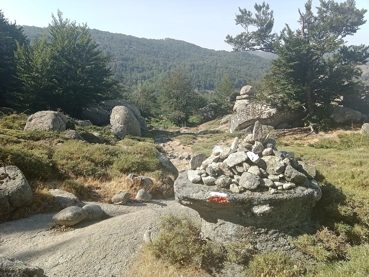
South of Vizzavona the trail climbs onto open plateaus, drops through forest, and trades the jagged skyline for broader ridges and sea views. The grades are gentler, the tread more consistent, and the daily distances easier to extend. If you are combining stages anywhere, do it here rather than in the north.
The route finishes at Conca, a small village in the southeast, where the lowland scrub and warmth feel a world away from the Cinto massif. The last day is a descent rather than a climb, which makes it a good place to relax your schedule after the exposed ridges. Book your onward transfer before you start the southern half.
Scrambling, exposure and navigation
Expect sustained scrambling on slabby rock, steep scree descents and short sections of vertical climbing, with chains on the most exposed passages. The technical difficulties concentrate in the north, and the mental load of constant foot and hand placement is as tiring as the physical effort. Hikers who dislike heights should think hard before committing, even though many nervous walkers find the moves more manageable than expected.
The trail is well blazed with red and white marks, but it braids into multiple paths in places, and the scree descents slow you down more than the map implies. Carry a paper map or an offline GPS track, since phone signal is scarce or absent for long stretches. A device with an SOS function adds a useful layer of security on remote sections.
Huts, tents and bergeries
The GR20 works as a hut-to-hut route: refuges offer bunks, toilets, showers, potable water, meals and designated campsites, and you can also pitch your own tent or rent a pre-set tent with a sleeping pad. Rates vary by refuge, and one hiker reported roughly 45 euros for a rented tent and about 20 euros to camp with your own, so treat those as illustrative; hut managers set charges refuge by refuge, so budget a little slack. Reservations are only needed for hut beds and rented tents, which gives tent-carrying hikers more flexibility.
Bergeries, the small shepherd homesteads along the route, sell homemade cheese, salami, bread, chestnut spread and canistrelli cookies, and some let you camp nearby for a fee. They are quieter than the refuges and a genuine highlight of the trip. One hiker found the food at the refuges easy to buy every few hours and regretted carrying too much from home, so plan to resupply on the trail rather than hauling a week of meals.
Food, water and resupply
Every refuge has potable water, and the refuges serve dinner, breakfast and a lighter lunch menu of soup, pizza and omelettes, with snacks for sale throughout. In the hottest weeks some natural sources dry out, so carry enough for the whole stage and filter water taken from rivers. Three liters a day was one hiker's summer baseline.
There are no true grocery stores on the route, and Vizzavona resupply is expensive, so buy what you need in Calenzana at the start. Fuel canisters are sold in Calenzana, Vizzavona and Conca, not on the trail itself. Many refuges also have shared kitchens with stoves, which reduces how much cooking gear and fuel you need to carry.
Money and cash
The GR20 is largely cash-only, and there are no ATMs on the route or at Calenzana, Vizzavona and Conca. One hiker carried about 500 euros and another advised budgeting generously for snacks, drinks and refuge charges. Work out your expected nights and meals before you leave, then add a buffer for a slower schedule.
When to go
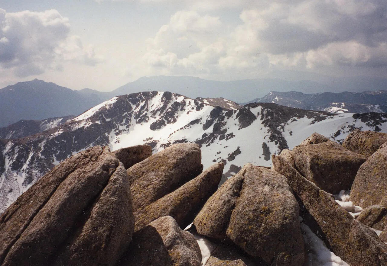
The season runs from June to mid-October, with refuges open and staffed through September. June brings lingering snow patches on the higher sections but fewer people and milder temperatures. September offers cooler days and thinner crowds, though some bergeries start to close and public transport is reduced.
July and August bring intense heat, exposed ridgelines and afternoon thunderstorms, with temperatures approaching 90°F at the height of summer. Start early, ask at the refuge about the next day's forecast, and be off the high ground before the storms build. Snow can linger on the higher sections into June, so check conditions and carry the gear the season demands.
Camping rules
Wild camping is prohibited in Corsica, and hikers must stay at established campsites near the huts or bergeries. Plan your nights around that system rather than around where you happen to be at dusk, since pitching a tent away from a designated site is not an option. Camping near the huts is rocky and often windy, which is worth knowing if your tent needs solid pitching.
Gear for a rocky traverse
Trail runners with excellent grip are the sensible footwear for slab and scree, and poles help on the steep descents even if you carry them folded for much of the day. You need reliable rain gear, sun protection, and warm layers plus hat and gloves for windy ridges. A sleeping bag rated for cool nights, a power bank and a European plug adapter complete the essentials, and there is nowhere on the trail to replace gear you left behind.
Sample itineraries
A classic 15-day split follows the Cicerone stages closely, giving you 4.5 to 8 hours of walking a day and leaving time to enjoy the refuges. A faster plan of 10 to 12 days combines pairs of stages, most naturally in the south where the grades are easier. Either way, keep one rest day in reserve for weather or a niggle, and do not book the return flight for the day you expect to finish.
Safety on exposed terrain
The main hazards are the exposed scrambles in the north, snow on the higher passes early and late in the season, afternoon storms, and the remoteness of long stretches with no phone signal. Leave your intended next refuge with other hikers if you walk alone, and turn back when weather or fatigue makes the technical ground feel beyond you. The GR20 rewards caution with far better days than it punishes it for.
For a sense of how other long European routes handle huts, transport and daily logistics, the Camino de Santiago shows a very different model of waymarked walking.
Plan Your Visit
The GR20 asks for real preparation: build your fitness for repeated steep days, learn to move on slab and scree with a pack, and decide early whether you want bunks or your own tent. Book hut beds for the northern stages, carry cash, and arrange your Calenzana arrival and Conca departure before you fly.
Pick your season deliberately: June for quieter trails and lingering snow, September for cooler conditions and fewer people, or July and August only if early starts and afternoon storms fit your style. Check refuge charges and the current transport timetable through the operator before you book, and leave a spare day at each end of the traverse.
Frequently Asked Questions
How long is the GR20?
The GR20 runs roughly 180 km (112 miles) from Calenzana to Conca, with about 12,775 m (41,900 ft) of ascent and a similar amount of descent. The Cicerone guide splits it into 16 stages of 3 to 17 miles, each with an estimated walking time of 4.5 to 8 hours.
How long does it take to hike the GR20?
Most hikers take between 8 and 16 days. Strong walkers combine stages, especially in the gentler southern half, while a classic itinerary follows the 16-stage guidebook split over about two weeks. Keep a spare day for weather or transport delays.
How difficult is the GR20 hike?
It is a sustained mountain traverse rather than a walk. The northern half has slabby rock, chains and short sections of vertical climbing, and loose scree descents slow you down. Experience on exposed alpine terrain and a good level of fitness make the difference; anyone uncomfortable with heights should think carefully.
What does GR20 stand for?
GR stands for Grande Randonnée, the French national long-distance path network, and 20 is the number assigned to this route across Corsica. The trail is marked with the standard red-and-white blazes used across the French GR system.
Do you need to book huts on the GR20?
Reservations are only required if you want a hut bed or one of the pre-set tents with a sleeping pad. Hikers carrying their own tent can pitch at the designated campsites without booking ahead. Book northern refuges early, since they fill in the peak summer weeks.
Can you wild camp on the GR20?
No. Wild camping is prohibited in Corsica, and hikers must stay at the established campsites near the refuges or bergeries. Plan each night around that system, and be ready to pitch on rocky, often windy ground.
When is the best time to hike the GR20?
The season runs from June to mid-October, with refuges staffed through September. June has lingering snow but fewer people, July and August bring heat and afternoon storms, and September offers cooler days with some bergeries closing and reduced public transport.
How do you get to the start of the GR20?
Most hikers fly into Calvi, the closest airport to Calenzana, then take a short taxi transfer to the trailhead. Ferries reach Bastia, Calvi, Ajaccio and Porto Vecchio, and a single rail line crosses the trail at Vizzavona, which also serves as the main bail-out point.
Sources
Trail notes for your next trip
Optional updates when we add or revise hiking guides.
You might also like
Continue reading
More guides you'll find useful