Harder Kulm Hike from Interlaken: Route, Time and Ascent
Walk from Interlaken up to Harder Kulm on a steep forest path, with route, ascent and walking time, plus the funicular option for the way back down.
On this page
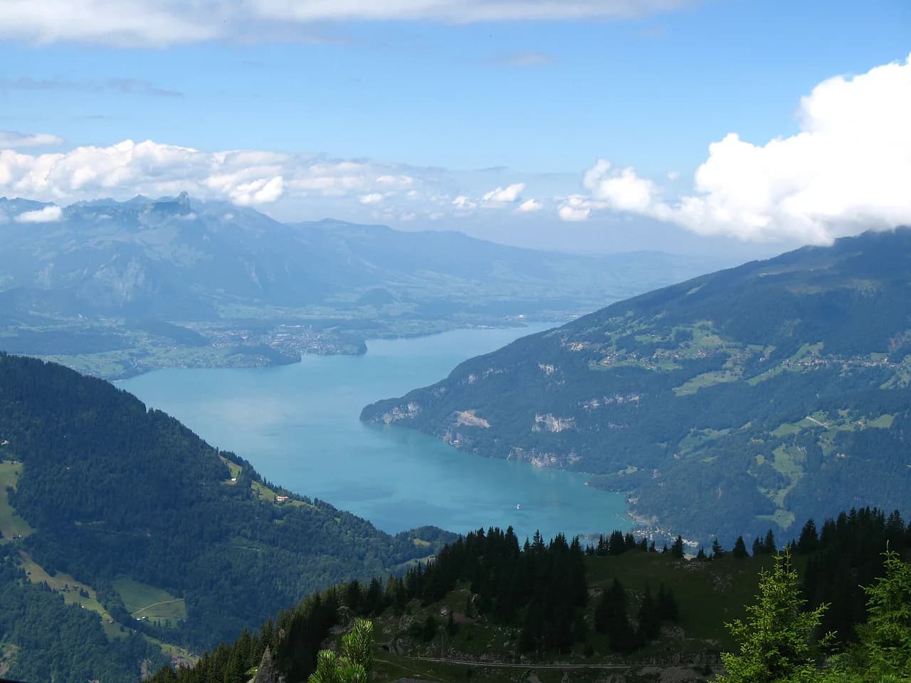
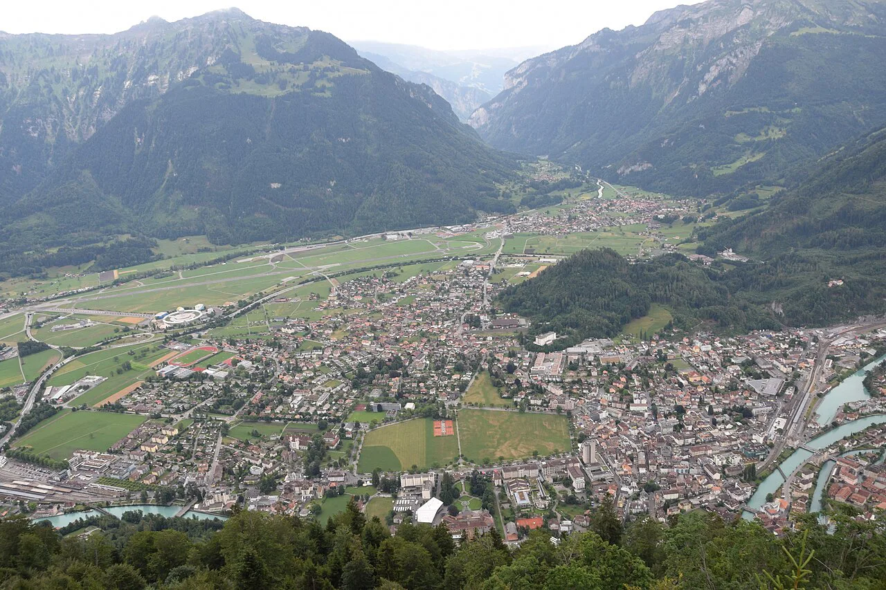
Harder Kulm rises to 1,322 m (4,337 ft) directly above Interlaken, close enough that the summit terrace looks down on the town's rooftops and both lakes at once. The climb on foot is short in distance but relentless in gradient, so it suits hikers with good footwear and a reasonable level of fitness rather than anyone after a casual stroll. The reward is the Two Lakes Bridge platform beside the Panorama Restaurant, with Lake Brienz on one side, Lake Thun on the other, and the Eiger, Mönch and Jungfrau filling the skyline to the south.
If you are building a few days around town, this climb works well as a half-day outing that leaves the afternoon free; the wider hiking in interlaken includes longer ridge and lakeside routes for other days. The funicular gives you a way out if your legs or the weather turn, which makes the ascent a low-risk choice even for a first mountain day of the trip.
Trailhead and access
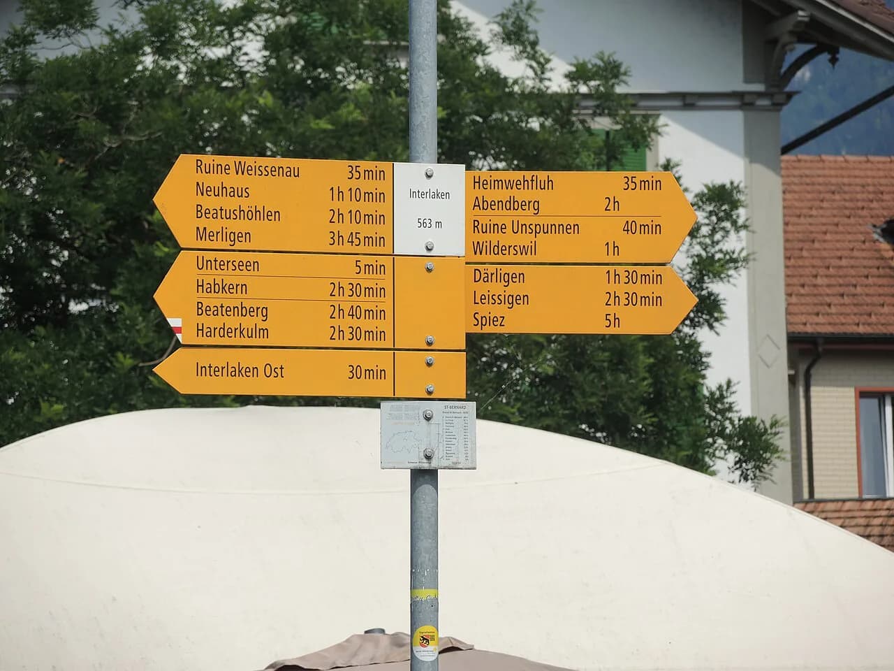
Start at Interlaken Ost station, walk west along the Aare and cross the bridge, then head for the valley station of the Harderbahn funicular. The path up begins right beside that station. Arriving by train from Bern puts you at the trailhead without any transfer, and drivers can use the town car parks rather than hunting for parking at the base.
Treat the first minutes as the real start of the day: fill water in town, since the climb is continuous and the summit is the only reliable stopping point. Hikers staying centrally can walk to the funicular station in about 20 minutes, which makes the whole route car-free from door to summit.
Distance, ascent and time
The direct climb from Interlaken gains about 750 m (2,461 ft) of ascent and takes one to two hours depending on fitness and how often you stop for the view. Plan for the upper end of that range if you are carrying a pack or hiking in warm weather, because there is no flat warm-up section to settle into.
Trail databases publish a different figure for the Harder Kulm Loop, a circuit of 5.3 mi (8.5 km) with 2,483 ft (757 m) of gain and a walking time of roughly 4.5 to 5 hours. That number describes the loop, not the straight up-and-down from town, so choose which one you are walking before you compare it with your day's budget.
Route description
The path climbs immediately from beside the funicular station, with no gentle approach. Most of the route runs through forest on a narrow, bendy trail that switches back repeatedly, and you cross the funicular line several times as you gain height. Short breaks in the trees reveal the lakes and town below, growing larger with each section.
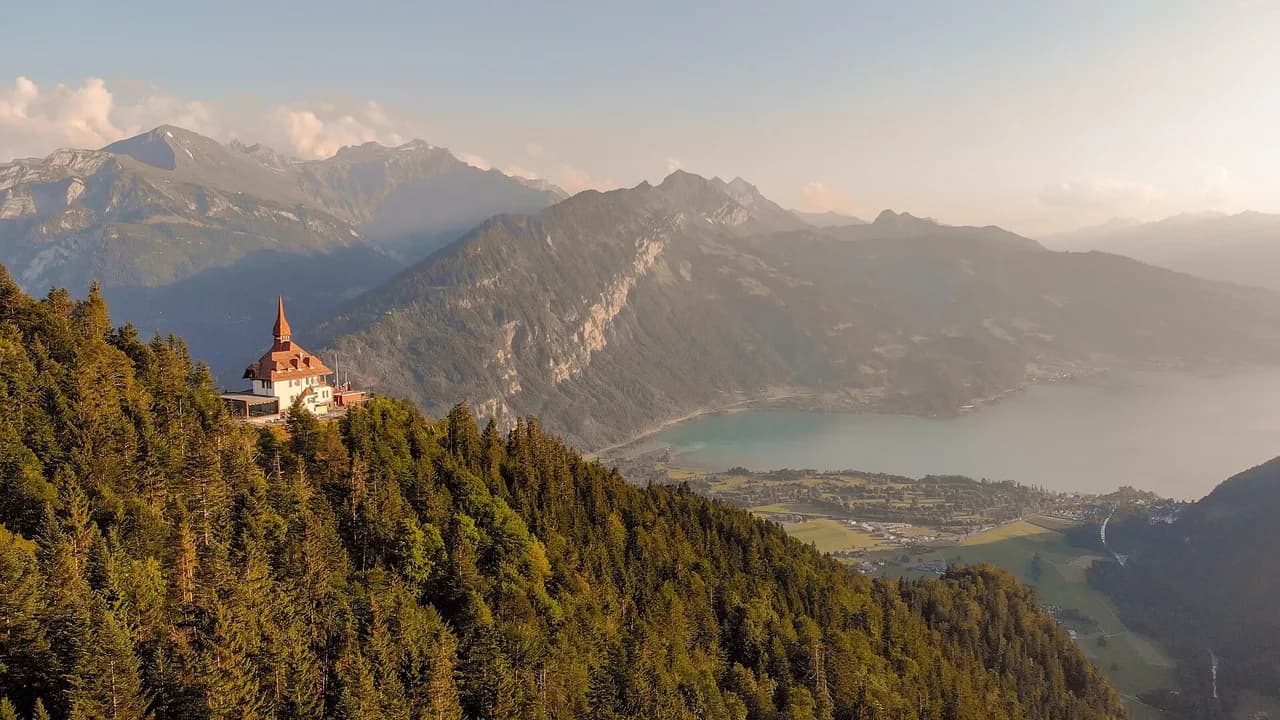
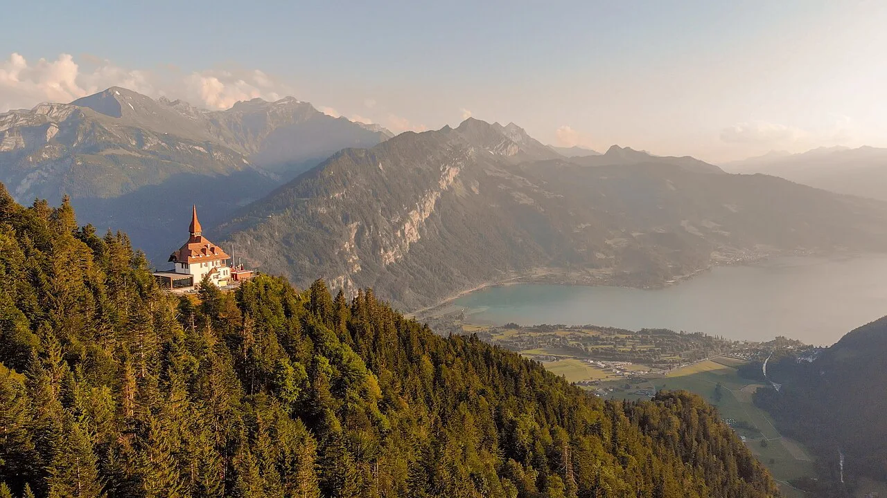
Near the top the gradient eases across a clearing, giving your legs a break before the final push. That last stretch tightens into small, steep bends and delivers you onto the terrace in front of the restaurant with its turret and red tiled roof, which looks more like a small castle than a mountain hut. The descent follows the same path, so watch your footing on the way down when the legs are tired.
The summit and the Two Lakes Bridge
The Panorama Restaurant sits five minutes from the mountain station and serves Swiss dishes on a sun terrace; it is the natural place to eat after the climb. Next to it, the Zwei-Seen-Steg viewing platform juts out over the drop, with Lake Brienz's turquoise water to the left and the deeper blue of Lake Thun to the right. In clear weather the Eiger, Mönch and Jungfrau dominate the view south.
If you have a head for heights, step onto the overhanging platform itself for the widest angle over the valley. Stay for the evening and the same view turns gold as the sun drops behind the ridges, which is why the funicular runs sunset trips.
Coming down
You can retrace the forest path on foot or ride the Harderbahn down, and one-way use of the funicular is the choice most hikers make after a hard ascent. The railway is more than 100 years old and covers the climb from Interlaken in about ten minutes, so check the last return trip before you commit to a late afternoon on the terrace.
The funicular operates from mid-April to the end of November and is generally closed from December to mid-April, so a winter visit means walking both directions or choosing another objective. If you want the ride down, plan your date inside the operating season and look up current times and tickets on the Harder Kulm funicular website rather than assuming a departure will be waiting.
The funicular as an alternative
Riding up and walking down flips the effort: you get the summit views fresh and save your legs for the descent, though descending a steep forest path is harder on the knees than many expect. Walking up and riding down suits hikers who want the climb as training but not the pounding on the way back. The funicular also rescues a day when cloud builds faster than forecast.
When to go
April to October covers the main on-foot season for the climb, matching the months the funicular normally runs. Early and late in that window, snow can linger on the upper forest and wet roots make the steep sections slippery, so shoes with real tread matter more than they do in midsummer.
Summer afternoons bring thunderstorms to the ridge above town, and the summit terrace and the Hardergrat beyond it are exposed. Start in the morning, watch the sky over the Jungfrau peaks, and be ready to take the funicular down if thunder approaches. The same ridge gives the Schynige Platte walk its character, and the weather pattern is similar there.
Extending from the summit
A short 12-stage circular path near the Panorama Restaurant traces part of the Hardergrat ridge and explains the history of the funicular, which makes an easy add-on once you are up. It is a gentle way to spend another hour at height without committing to a full ridge traverse.
Strong hikers can continue from Harder Kulm along the ridge toward Augstmatthorn via the Suggiture, a far longer and more exposed proposition than the town climb. That route demands an early start, water and confidence on narrow ground; for a comparable full-day outing with cable-car access, the Schynige Platte hike is the classic alternative.
What to wear and carry
Wear proper hiking shoes with grip for a steep mountain path; the proximity to town misleads people into trainers, and the descent is where that shows. Carry at least a litre of water per person, a wind layer for the exposed terrace, and a light rain shell, since the forest shields you on the way up but the summit does not.
Where to stay in Interlaken
Basing yourself in Interlaken puts the trailhead within a 20-minute walk of central hostels and hotels, so you can start early without worrying about transport. Interlaken Ost is the most convenient area for this climb and for trains onward to other trailheads in the region. Staying in town also lets you keep a rest day flexible if the weather closes in.
Plan Your Ascent
Decide first whether you are climbing for the workout or the view: if it is the workout, walk up and ride down; if it is the view with family or tired legs, take the funicular both ways. Either way, start at Interlaken Ost, follow the Aare to the funicular station and expect a steep forest path with few flat moments. If you want to compare this climb with the valley routes nearby, the Lauterbrunnen hiking guide covers a different set of trails.
Check the funicular's operating season before you rely on it for the descent, then build the rest of your trip around day hikes on the surrounding ridges, including the Lake Thun side of the valley.
Frequently Asked Questions
How long does it take to walk up to Harder Kulm?
Allow one to two hours for the ascent from Interlaken, depending on fitness and how often you stop. The climb gains about 750 m (2,461 ft) on a steep forest path with no real warm-up, so slower hikers should plan for the upper end.
Where does the Harder Kulm hike start?
The path begins beside the Harderbahn valley station in Interlaken. From Interlaken Ost station, walk west along the Aare, cross the bridge and continue to the funicular station.
Can you hike to Harder Kulm instead of taking the funicular?
Yes. The walking route climbs through forest on a narrow, bendy path and crosses the funicular line several times. Many hikers walk up and ride the funicular down to save their knees.
Is the Harder Kulm funicular open in winter?
The funicular generally operates from mid-April to the end of November and is usually closed from December to mid-April. Check current dates and times before setting out.
What can you see from the Harder Kulm viewing platform?
The Two Lakes Bridge beside the Panorama Restaurant looks over Interlaken, with Lake Brienz to the left and Lake Thun to the right. The Eiger, Mönch and Jungfrau dominate the view to the south.
Is the Harder Kulm hike difficult?
It is short but steep, gaining about 750 m (2,461 ft) on a mountain path with sustained gradients. Good footwear and a reasonable fitness level are essential; it is not a casual stroll from town.
Sources
Trail notes for your next trip
Optional updates when we add or revise hiking guides.
You might also like
Continue reading
More guides you'll find useful