Lydford Gorge Walk: Whitelady Waterfall Route Guide
Walk the Lydford Gorge waterfall trail past the 30m Whitelady Waterfall, with route layout, distance, ascent, trailhead and parking details for Dartmoor hikers.
On this page
The Lydford Gorge walk packs a river-carved ravine, a 30 m (98 ft) waterfall and a swirling rock pool into a short half-day outing on the western edge of Dartmoor. It suits hikers who want dramatic scenery without a long approach, and families with children steady enough for steep, wet rock steps.
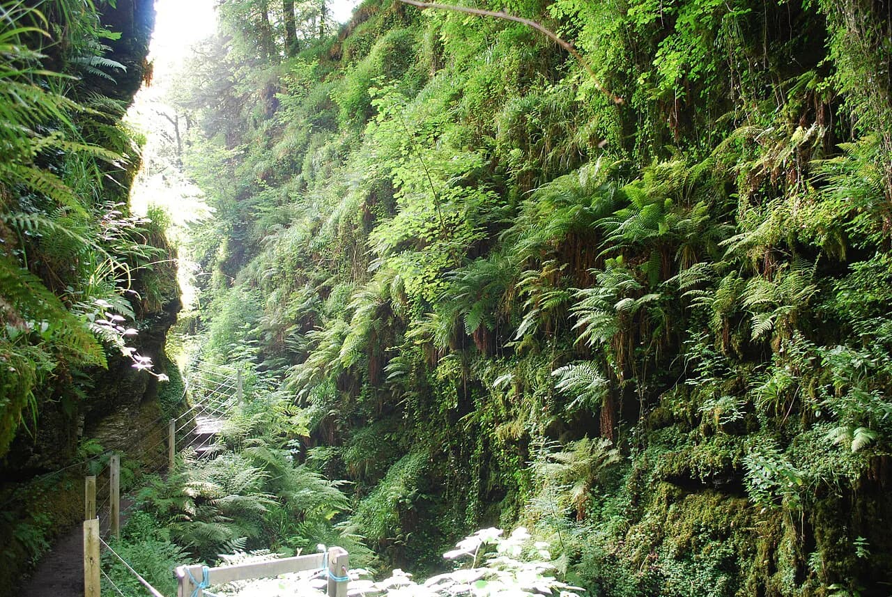
The path runs through ancient woodland along the River Lyd, with the water almost always in earshot and often in view. Expect a shaded, humid atmosphere under oak canopy, mossy rock walls and a series of stepped sections rather than open moorland.
Treat the walk as a short, intense route rather than an easy stroll: the rewards come quickly, but the footing demands attention. Boots with grip matter more here than on most moorland circuits.
Where Lydford Gorge sits on Dartmoor
Lydford Gorge lies just north of Tavistock in the far west of Dartmoor National Park, where the River Lyd has cut a deep, wooded cleft into the surrounding upland. The gorge sits close to the village of Lydford and the A386, which makes it one of the most accessible dramatic landscapes in the park.
Its position on the park's western fringe makes it a natural add-on to a wider tour of the moor. If you are stringing together several days of walking, the gorge works well as a short first or last outing before or after longer routes.
The surrounding countryside is farmland and wooded valley rather than open high moor, so the walk feels enclosed and sheltered compared with routes on the exposed granite tors further east.
Trailhead and parking
The walk begins at the National Trust car park for Lydford Gorge, reached from Tavistock by following Drake Road northwest and then continuing on the main road toward Lydford before turning left to the parking area. From the car park you head southwest into the woodland and pick up the riverside path.
Parking, entry and any ticket arrangements are handled by the National Trust at the gorge entrance, so settle that before setting off. Arrive early on weekends and school holidays, when the car park fills with families rather than serious hikers.
Lydford village and Tavistock are the nearest practical bases, and both put you within a short drive of the trailhead.
Distance, ascent and time
The route guide measures the walk at 4.5 km (2.8 mi) with about 145 m (476 ft) of total elevation gain, rated moderate, and estimates 1 to 1.5 hours for most walkers. That figure counts all the ups and downs along the gorge, not just the climb to a single high point.
The layout is a lollipop: you walk out from the car park on a shared spine, complete the loop through the gorge, and retrace the spine back. Budget the extra time for photography at the waterfall and the cauldron, where most people linger.
Slower walkers and families with young children should add time for the stepped sections, where progress is paced by careful foot placement rather than distance.
Route description: into the gorge
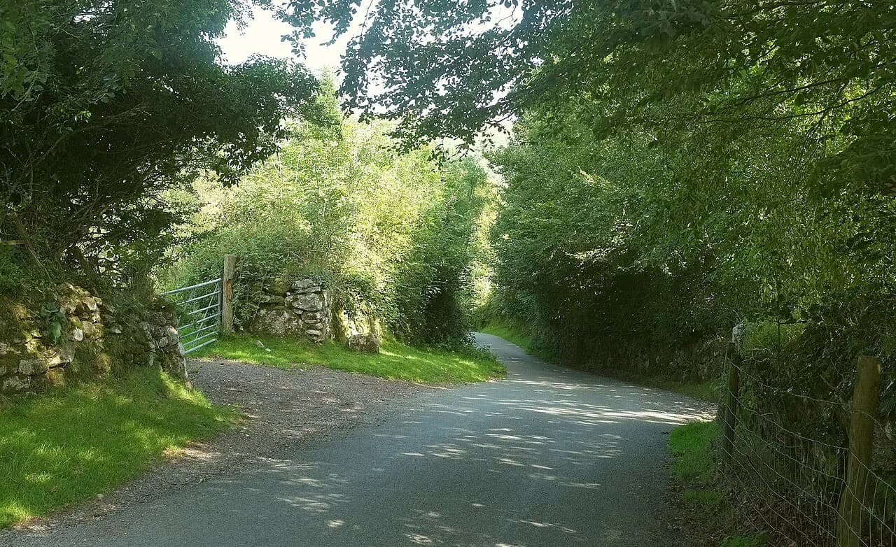
From the car park the path heads southwest through quiet woodland, dropping gently to follow the winding bank of the River Lyd upstream. The walking is easy at first, with the river running beside you and the valley walls gradually steepening.
As the gorge narrows, the path is forced close to the water and onto rock-cut steps, with sections that are slippery when wet. The National Trust describes the gorge as steep-sided, and the trail feels it once the walls close in.
The Whitelady Waterfall
The 30 m (98 ft) Whitelady Waterfall is the turning point of the outbound leg and the visual highlight of the walk. The falls drop into a rocky basin, and the National Trust's waterfall trail loops past them before returning through ancient woodland.
Give yourself time here rather than pushing straight on; the spray and the enclosed setting are the reason most people come.
The return leg through ancient woodland
Beyond the falls the path climbs away from the water and turns back northeast through old oak woodland, with mossy trunks and a quieter, more enclosed feel than the riverside stretch. This is the loop section of the lollipop, and it rejoins the outward path near the Devil's Cauldron.
The woodland section is a good place to slow down on a hot day, since the canopy keeps the route cool even in midsummer.
Devil's Cauldron and the rock-cut steps
The Devil's Cauldron is a churning whirlpool set in weathered rock, reached by a series of slippery steps cut into the gorge wall. These steps have no handrail, so the descent to the viewpoint is the crux of the route and needs care in wet conditions.
The footing is the issue rather than the exposure: the steps are uneven, often wet, and demand a deliberate pace in both directions. Good boots and, in wet weather, a hand on the rock beside you make the difference.
Terrain and difficulty
The gorge route is rated moderate, and the difficulty comes from rock steps, roots and wet surfaces rather than length or altitude. Stairs hewn into the rock can be very slippery and lack handrails, so proper walking boots with secure grip are essential.
Walking poles are of limited use on the steep stepped sections, where you will want your hands free for balance. Hikers with knee problems should take the descent steadily and consider turning back before the cauldron steps if the rock is greasy.
Winter opening and closures
From Monday 2 November 2026, only the waterfall trail and the railway path stay open for walks, and all other facilities, including the toilets, close. Plan a winter visit around the waterfall rather than the full circuit, and do not expect the cauldron section to be part of the day.
Outside that period the full walk is the one to plan for, but the waterfall trail alone still delivers the headline sight if you are short of time or the weather is closing in.
Family suitability, dogs and signage
The route is listed as family friendly, with signage rated average and moderate crowd levels, so expect to share the path at popular times. Dogs are allowed on a leash, which matters given the narrow steps and the number of families on the trail.
Signage is adequate rather than abundant, so keep an eye on the junction where the loop rejoins the outward path. Children will manage the distance easily; the steps are the part to watch.
When to go
The route is listed as a year-round walk, and the wooded gorge gives it a character that changes with the seasons rather than closing down. Spring and autumn bring the most comfortable temperatures for the stepped sections, while summer draws the biggest crowds.
After heavy rain, expect the rock steps to be at their most slippery and the river at its most energetic. Winter visits are shorter and more focused because of the November change to the open route.
Where to stay near Lydford and Tavistock
Lydford village puts you closest to the gorge entrance, while Tavistock, a few miles southeast, offers more choice of accommodation and places to eat. Either works well as a base for combining the gorge with other outings across the moor.
For a longer stay, the gorge pairs naturally with the open moor and river valleys elsewhere in the park. The Two Moors Way crosses Dartmoor on its long traverse and gives a sense of how the national park links together. If you want to trade inland ravines for sea cliffs, the Jurassic Coast hiking guide covers similar short, dramatic routes along the Dorset coast.
Safety on the gorge path
Wet rock is the main hazard: the rock-cut steps and riverside slabs are slick after rain, and there are no handrails on the steepest sections. Wear boots with aggressive tread and take the steps one at a time, especially on the descent to the Devil's Cauldron.
Stay on the marked path beside the river, since the banks are steep and the water moves fast through the narrows. Keep children close on the stepped sections and hold the lead short with dogs where the path is narrow.
Walking the gorge with a dog
Dogs are welcome on the Lydford Gorge Walk, but they must be kept on a leash for the whole route. The 10Adventures route guide lists the walk as pet-friendly on that condition, so a lead is the one piece of kit you cannot leave behind.
The path itself shapes how the day goes with a dog in tow. The route runs 4.5 km with 145 m of ascent and takes most walkers 1-1.5 hours, crossing rocky terrain along the river's edge. Parts of the walk require traversing a series of stairs hewn into the rock that can be very slippery and are without a handrail, both on the way to the White Lady Waterfall and again at the slippery rock steps cut into the gorge near the Devil's Cauldron. Proper walking boots are recommended for secure footing, and a short lead keeps your dog close on these sections.
Timing matters if you are visiting in the colder months. From Monday 2 November 2026, only the waterfall trail and railway path will be open for walks, and all other facilities, including the toilets, will be closed. Plan the walk around that narrower offering rather than expecting the full circuit and its facilities to be available.
The waterfall itself is the highlight of the circular walk: the Whitelady Waterfall stands 30m high, and the route returns through ancient woodland afterwards. It is a steady, manageable outing for a leashed dog rather than a long day out, so it fits neatly into an afternoon based near Tavistock or Lydford.
Plan Your Visit
The Lydford Gorge walk is a compact, high-reward route: 4.5 km (2.8 mi), roughly 145 m (476 ft) of ascent and a waterfall and whirlpool within an hour or so of the car park. Plan it as a half-day outing from Lydford or Tavistock and leave time at the water.
If you visit after early November, build the day around the waterfall trail and railway path rather than the full circuit. Either way, boots with grip are the one piece of kit that decides how much you enjoy the steps.
Frequently Asked Questions
How long is the Lydford Gorge walk?
The recorded route is 4.5 km (2.8 mi) with about 145 m (476 ft) of total elevation gain, and most walkers take 1 to 1.5 hours. Allow longer if you stop at the Whitelady Waterfall and the Devil's Cauldron, and add time for the stepped sections in wet weather.
Do you have to pay to go to Lydford Gorge?
The gorge is managed by the National Trust, and entry and parking arrangements are handled at the site. Ticket and membership details are published by the National Trust rather than fixed here, so check the current terms before you travel.
Is the full walk open in winter?
Not in the same form. From Monday 2 November 2026, only the waterfall trail and the railway path stay open for walks, and other facilities including the toilets close. Plan a winter visit around the waterfall rather than the full circuit.
Can you reach the Devil's Cauldron viewpoint?
The cauldron is reached by rock-cut steps that are slippery and have no handrail, which makes them the hardest part of the route. In wet conditions, judge the footing before committing and turn back if the rock is greasy.
Where does the Lydford Gorge walk start?
It starts from the National Trust car park at the gorge, reached from Tavistock by following Drake Road northwest and continuing toward Lydford before turning left to the parking area. Lydford village and Tavistock are the nearest bases.
Is the walk suitable for children and dogs?
The route is listed as family friendly and dogs are allowed on a leash, though the stepped sections need close supervision for children and short leads for dogs. Signage is average, so watch the junction where the loop rejoins the outward path.
Sources
Trail notes for your next trip
Optional updates when we add or revise hiking guides.
You might also like
Continue reading
More guides you'll find useful