Triglav Hike: Routes, Huts and How Many Days You Need
Plan the Triglav hike in Slovenia's Julian Alps: distances, ascent and times from each valley, huts en route, the secured summit ridge and the best months.
On this page
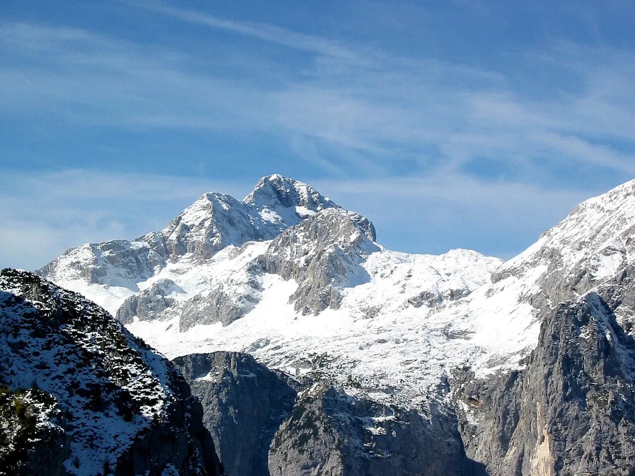
Triglav rises to 2,864 m (9,396 ft), the highest point in Slovenia and the Julian Alps, and its summit carries the small Aljaž Tower that has made it a national symbol since 1895. The climb is an intermediate mountain objective rather than a walk: every route ends on a steep, exposed, cable-protected ridge, so a head for heights matters more than raw fitness alone.
You choose your Triglav hike mainly by which valley you start in, because each approach buys a different balance of distance, steepness and crowds. The Vrata valley routes are short and steep under the kilometre-high north face, while Krma, Pokljuka and the Triglav Lakes trade a longer walk for a gentler gradient and a night in a mountain hut.
What the Triglav hike involves
Triglav is rated an intermediate climb, but the final hour is fixed: all routes converge on one of three secured Via Ferrata sections, either from the Kredarica or Planika huts or through Triglavska Škrbina. There is no path to the top that avoids steel cable, exposed rock and a steep final ridge, which is worth knowing before you pick a route on gradient alone.
Rockfall is a real hazard on the popular Vrata approaches because of the volume of climbers above you, so a helmet is a must and a via ferrata set is strongly recommended. If you have not used via ferrata equipment before, a certified local guide turns the exposed sections into a manageable day rather than a gamble.
Fitness expectations are concrete: children on guided routes should be over 12 and able to walk roughly six hours consecutively, and adults should be comfortable with 1,600 m to 2,500 m of ascent in a day. If that sounds like a stretch, the hut-based two-day format is the sensible version of this climb.
Where the Triglav hike starts
The classic start for the north side is Aljažev dom at the end of the Vrata valley, reached by road from Mojstrana, which has the widest choice of beds before the climb. Aljažev dom itself is the other option if you want to be walking within minutes of parking.
Other trailheads spread around the mountain: the Krma valley for the most straightforward ascent, the small Kot valley for the quietest, the Pokljuka plateau for a high, gentle start, Lake Bohinj at Savica or Planina Blato for the Triglav Lakes, and the Zadnjica valley near Trenta for the western mule-track approach. Each has parking at or near the trailhead, and each commits you to a different return leg, so plan the descent before you set off.
Public transport reaches the area but is thin at the valley ends, so most hikers drive to Aljažev dom, Krma or the Zadnjica roadhead and treat a village such as Mojstrana, Bled or Bohinj as the base. Bus and shuttle timetables shift by season, so the tourism office in Mojstrana or Bohinj is the place to pin down your transfer.
Routes from the Vrata valley
Čez Prag is the most popular line from Aljažev dom and the easiest of the three Vrata routes: 8.2 km (5.1 mi) one way with 1,860 m (6,102 ft) of ascent and about 6 hours 10 minutes of walking. It crosses the eastern plateau near the Stanič hut before reaching Kredarica, and includes an almost vertical 10 m (33 ft) step secured by steel cable. If you want shorter warm-up days before committing to the summit, compare it with the hiking in Lake Bled.
Tominškova pot branches left of the Prag route and rejoins it on the plateau: 5.9 km (3.7 mi) one way, 1,860 m (6,102 ft) of ascent, about 6 hours, slightly harder and shorter than Prag. Most parties climb it and descend by Prag, which gives you a circuit without repeating the exposure.
Čez Plemenice is the hardest and most scenic Vrata option, continuing toward the end of the valley and the Sphinx rock before a via ferrata onto the western plateau: 7.1 km (4.4 mi), 1,849 m (6,066 ft), about 6 hours 30 minutes. Expect to wear helmet and harness at the Luknja saddle and to descend by one of the other two routes.
All three Vrata routes are steep and rocky from the first hour, so they suit fit hikers who would rather climb hard and short than walk long and gentle. The trade-off is exposure and traffic: this is the busiest side of the mountain in August and September.
Routes from Krma and Kot
Krma is the most popular route overall because it is the most straightforward below the summit ridge: 11.5 km (7.1 mi) one way, 1,955 m (6,414 ft) of ascent and about 6 hours. The forest and pasture gradient is gentle, and halfway up you choose between the Planika and Kredarica huts, which lets you build a circuit up one and down the other.
The Kot valley approach is the least visited and adds iron pegs and steel cable on the way to the Stanič hut: 8.5 km (5.3 mi), 2,050 m (6,726 ft), about 6 hours 10 minutes. Choose it when you want quiet below the huts and accept that Kredarica will still be busy.
The Krma line is the best one-day option for a strong hiker with an early start, because the gentle gradient saves legs for the secured ridge above the huts. Its length makes the descent punishing on the knees, so allow for a slow, deliberate return.
Pokljuka and the Triglav Lakes
From the Pokljuka plateau the route passes pastures and saddles to the Vodnik hut on Velo Polje, then climbs to Planika before the summit ridge: 11.8 km (7.3 mi), 1,650 m (5,413 ft) and about 6 hours. It has the lowest ascent of the main routes but the longest high-level walk, and the Vodnik hut has its own drinking water.
The Triglav Lakes route starts at Lake Bohinj, at the Savica hut or Planina Blato, and follows the valley past Prehodavci and Hribarice to the Dolič hut: 17.5 km (10.9 mi), 2,530 m (8,300 ft) and about 8 hours 45 minutes one way. This needs at least two days, sleeping at Dolič or adding a night at Vodnik or Planika for a three-day hut round; the Seven Lakes Valley Hike is the highlight of the first day.
These longer approaches reward hikers who want the national park as much as the summit, and they spread the effort over two or three days. The cost is more booking, since the huts fill and the season is short.
From Trenta via Zadnjica
The western approach begins in the Zadnjica valley near Trenta and follows a wide mule track built for military use between the world wars up to the Dolič hut: 13.9 km (8.6 mi) one way, 2,215 m (7,264 ft) of ascent and about 7 hours 15 minutes. From Dolič you continue over the western plateau and Triglavska Škrbina to the summit.
Because of that elevation gain, plan a night at Dolič and treat the summit as a second-day objective. It is the natural route for hikers coming from the Soča valley rather than from Bled or Mojstrana.
AllTrails lists the Trenta to Triglav summit line as a 17.9-mile out-and-back rated challenging, which reflects the full return rather than the one-way valley figures. Treat such app distances as a cross-check, not a substitute for the route description above.
Distance, ascent and walking time by route
Use these one-way figures to compare approaches on equal terms. Krma: 11.5 km, 1,955 m, 6 hours. Pokljuka: 11.8 km, 1,650 m, 6 hours. Vrata via Prag: 8.2 km, 1,860 m, 6 hours 10 minutes. Vrata via Tominškova: 5.9 km, 1,860 m, 6 hours. Vrata via Plemenice: 7.1 km, 1,849 m, 6 hours 30 minutes. Kot: 8.5 km, 2,050 m, 6 hours 10 minutes. Triglav Lakes: 17.5 km, 2,530 m, 8 hours 45 minutes. Trenta via Zadnjica: 13.9 km, 2,215 m, 7 hours 15 minutes.
Add descent time and the summit ridge to every figure, and remember that the final secured section is slower than its length suggests when there are queues. A one-day Vrata ascent and descent is a long, hard day, and inexperienced parties are better served by splitting it at a hut.
Route description: valley to hut, hut to plateau, the final via ferrata
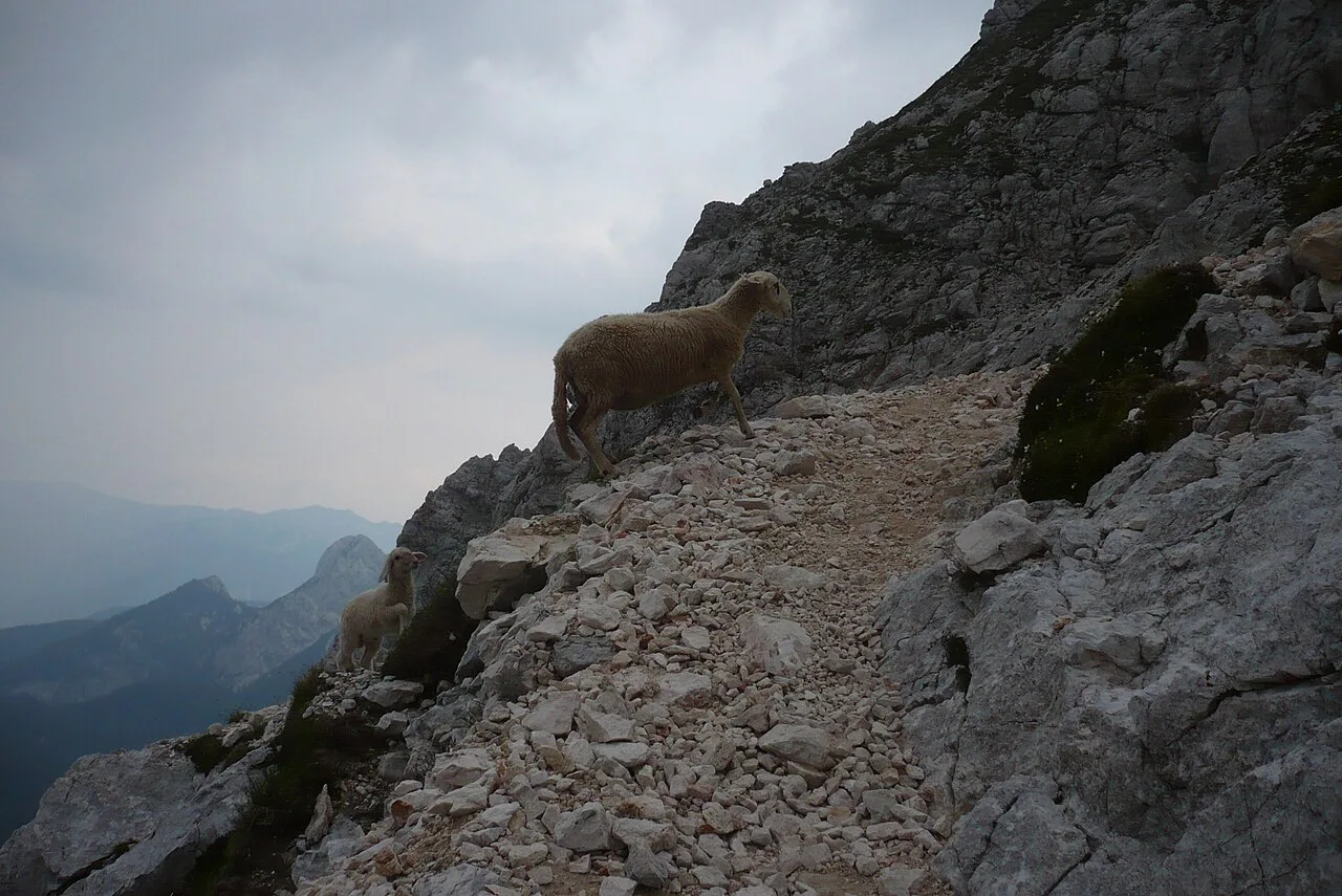
Below the huts the routes are ordinary mountain paths: forest and pasture from Krma, rock and scree from Vrata, plateau walking from Pokljuka, lakes and karst from Bohinj. On the Vrata side expect steep traverses and short cable steps well before Kredarica, and on the karst plateau watch for water-formed holes that are easy to stumble into.
The final chapter is the same from every direction: a steep, exposed ridge on steel cable to the Aljaž Tower, with the drop on one side and hands-on rock in places. Go early, keep the party tight, and turn around if the rock is wet or the cloud is building, since afternoon storms are frequent in summer.
The descent is where most accidents happen: tired legs, loose rock and a queue of climbers coming up. Descend deliberately, stay out of the fall line of those above you, and allow more time than the ascent took you.
Huts on the route: Kredarica, Planika, Dolič, Vodnik and Stanič
Kredarica sits at 2,515 m (8,251 ft) with 341 beds, the highest hut in the country and the most convenient base for the summit. Planika at 2,401 m (7,877 ft) has 143 beds and is roughly 1.5 hours below the top, while Vodnik at 1,817 m (5,961 ft) has 70 beds and its own water source.
Dolič at 2,151 m (7,057 ft) has 74 beds and a quieter alpine feel above the Trenta valley, and Stanič at 2,332 m (7,651 ft) with 97 beds serves the Vrata routes. Except for Kredarica, the huts operate June to September, and Planika, Dolič and Stanič open July to September.
Booking well ahead is normal on Triglav, with August and September weekends filling first. Sort your beds before you fix dates, and if you want the full circuit, the hut to hut format across the Julian Alps is the way to extend the trip.
Food and drink are available at the huts, but carry at least 1.5 liters of liquid per person and high-energy snacks, because water on the mountain is scarce above the huts.
One day or two days
A one-day climb suits experienced hikers on the shorter Vrata routes or on Krma, starting before 6 a.m. to be off the ridge before the afternoon build-up. Vrata one-day pushes are common but leave little margin for queues or weather.
The two-day format is the better plan for most people: walk in to a hut on day one, sleep high, summit in the early morning and descend by a different valley. It costs a night's booking and a heavier pack but buys you calm weather, fewer people on the cables and a far better descent.
Gear, via ferrata kit and guides
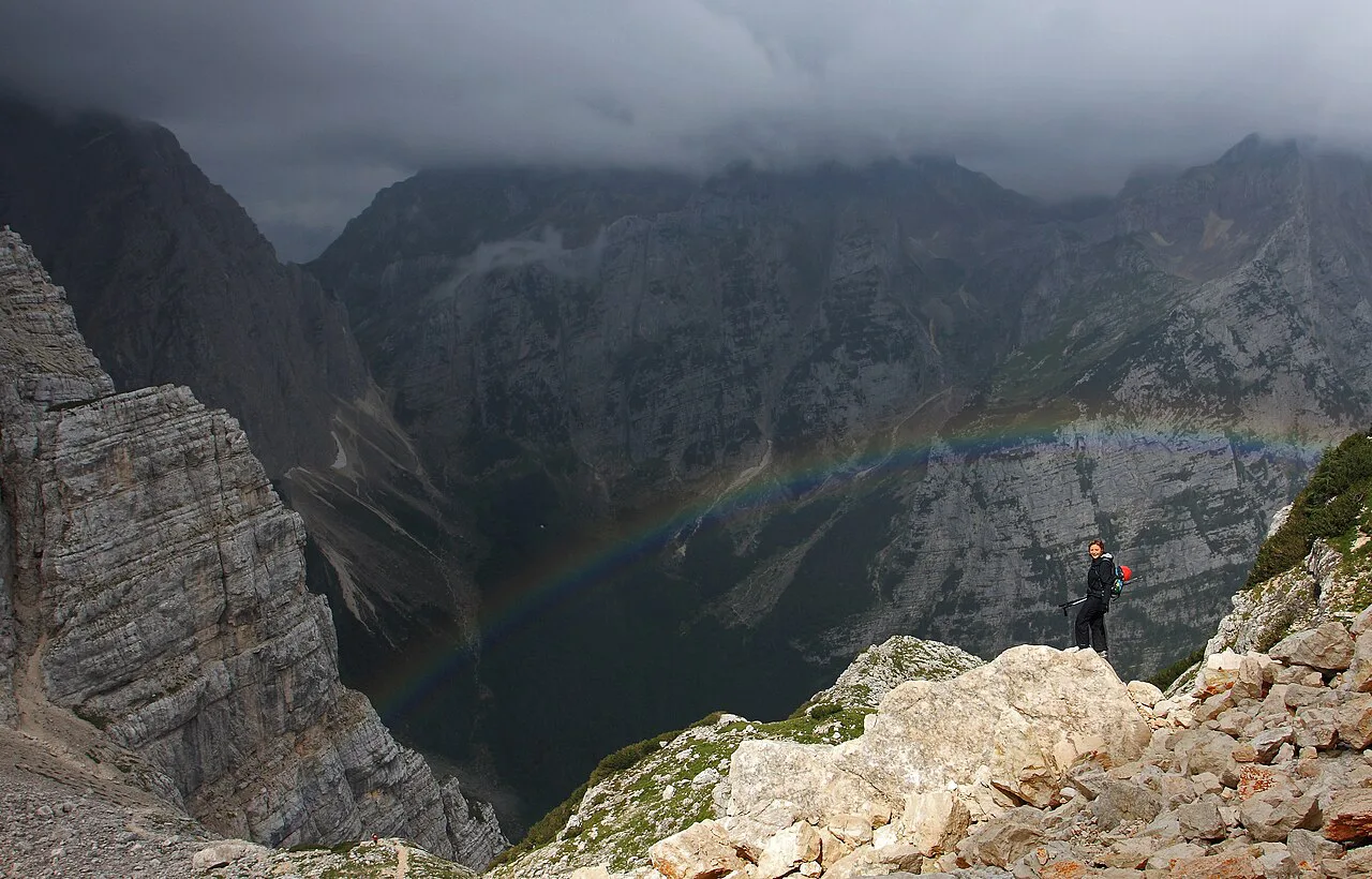
Bring hiking boots or grippy shoes, a helmet, and a via ferrata set for the secured sections; trekking poles help on the long descents and a headlamp matters on early starts. Dress in layers with a rain jacket and gloves, since the summit is cold even in midsummer.
A local certified guide is worthwhile if you have no via ferrata experience, are climbing with children, or want to attempt a north-face route. The north face above Vrata is guided alpine climbing, not a hike, and only appropriate with a guide and prior experience.
When to go
June to October is the dry season, with late June and early July the most rewarding window for fewer people and fresh scenery. Peak season falls in August and September, when more than 2,000 climbers can ascend daily, and winter ascents are for experienced mountaineers only.
Snow lingers on north-facing routes into June, so check conditions and choose a route without snowfields unless you carry the kit and skills for them. Summer mornings are usually clear with storms building after midday, so an early start is the single most useful planning decision.
Getting there and where to base yourself
Mojstrana is the best base for the Vrata and Kot routes, Bled and Bohinj for the Triglav Lakes and Pokljuka, and the Soča valley near Trenta for Zadnjica. From any of them you reach the trailhead by car in under an hour, and Bled is also a relaxing place to recover afterwards.
If you want to walk between villages rather than drive, the Juliana Trail circles the national park and links the valleys below Triglav. Pair it with a hut night to build a longer trip around the summit.
Safety on the exposed sections and the descent
The real risks are simple and predictable: exposure on the secured ridge, rockfall on busy routes, snow early and late in the season, and afternoon storms on the summit. Wear a helmet, rope up with a via ferrata set if you are unsure, start early enough to descend before the weather turns, and turn back without hesitation when conditions change.
Plan Your Triglav Hike
Pick the route by the day you can give it: Vrata for a short, steep climb, Krma for a straightforward one-day ascent, Pokljuka or the Triglav Lakes for a longer hut-based walk, and Zadnjica for the western approach. Then book your bed, fix an early start and carry a helmet and via ferrata kit.
Confirm hut availability and the mountain forecast through the hut operator and Triglav National Park before you travel. With the logistics settled, Triglav is a demanding but attainable summit for a prepared hiker.
Frequently Asked Questions
How long does it take to hike Triglav?
The main approaches take about six hours of walking one way, with the Triglav Lakes route at roughly eight hours and forty-five minutes and the Zadnjica route at about seven hours and fifteen minutes. Add descent time, hut stops and the secured summit ridge to get the real day.
Can a beginner climb Triglav?
Triglav is rated intermediate, and the final secured sections are steep and exposed on every route. A beginner with good fitness can manage it on a guided two-day trip with a hut night, but should not attempt a one-day solo push without via ferrata experience.
How difficult is the Triglav hike?
It is a long mountain day with 1,650 m to 2,530 m of ascent depending on the route, plus a cable-protected ridge at the top. Rockfall, exposure and summer storms are the main hazards, so a helmet, via ferrata set and early start are standard.
Is it possible to climb Triglav in one day?
Yes, most easily from Krma or by the shorter Vrata routes, but it requires an early start and leaves little margin for queues or weather. Most hikers get a better day by sleeping at Kredarica or Planika and summiting at dawn.
Which Triglav route is the easiest?
Krma is the most straightforward below the summit ridge, and the Prag route is the easiest of the Vrata options. Every route still finishes on a secured via ferrata, so none avoids exposure near the top.
Do you need via ferrata gear for Triglav?
A helmet is essential because of rockfall, and a via ferrata set is strongly recommended for the secured sections. Hikers without ferrata experience should hire a certified local guide.
Sources
Trail notes for your next trip
Optional updates when we add or revise hiking guides.
You might also like
Continue reading
More guides you'll find useful