Cliffs of Moher Walk: Doolin to Hags Head Trail Guide
Plan the Cliffs of Moher walk from Doolin to Hags Head: route, distance, walking time, trailhead parking, the guided cliff walk and the closed Liscannor section.
On this page
The Cliffs of Moher walk is the classic Irish cliff-top day out: a path that follows the rim of County Clare's Atlantic edge past O'Brien's Tower, with the Aran Islands to the west and the mountains of Connemara to the north on a clear day. It suits hikers with a basic level of fitness and a good head for heights, not scramblers or ridge runners.
Most people walk it in one of two ways. You can set off independently from Doolin, or join the guided Doolin Cliff Walk that leaves Fisherstreet each morning and finishes with a taxi back to the village. Whichever you choose, the route logic is the same: keep the sea on one side, the farmland on the other, and plan your exit before you start.
Where the Cliffs of Moher walk runs and who it suits
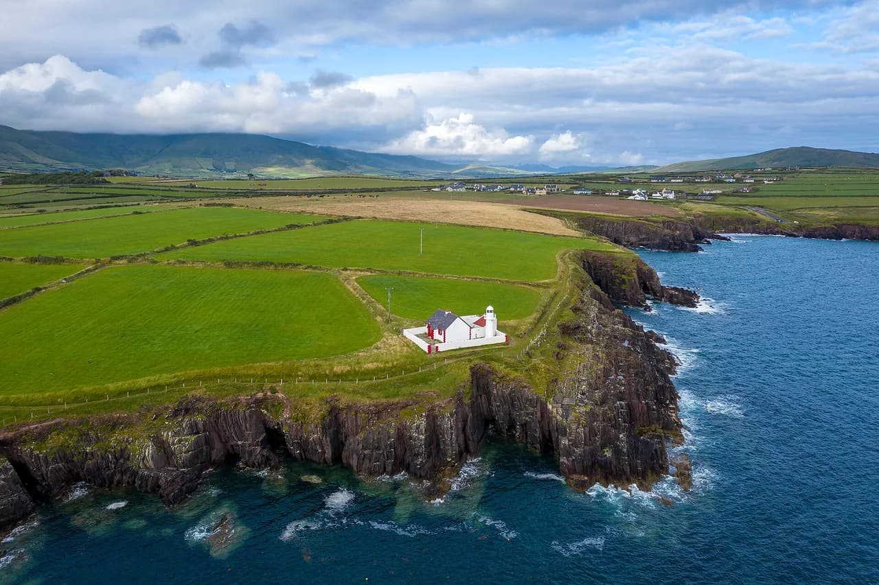
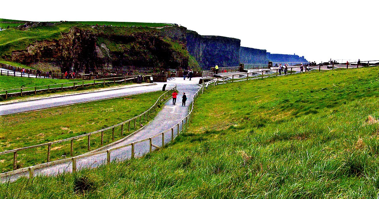
The walkable cliff-top trail runs along the Clare coast between Doolin in the north and Hags Head in the south, passing the visitor centre and O'Brien's Tower near the high point. The guided version begins on Fisherstreet in Doolin, follows the road briefly toward Doonagore Castle, then leaves the road after about half a kilometre to pick up the trail.
This is a coastal path, not a mountain route. Doolin Cliff Walks, which runs the guided walk, describes it as requiring a basic level of fitness and a good head for heights, with a gravel surface, flagstone steps across drains and streams, and steeper steps on the inclines. If you are comfortable on uneven ground and can handle a long day near a big drop, it fits; if you want hands-on scrambling or solitude, look elsewhere.
Trailheads, parking and getting to Doolin or Hags Head
From Doolin, the practical trailhead is the Coastal Walk Trail Head at the Micho Russell Community Centre, where Doolin Cliff Walks directs walkers to park. That car park sits roughly 1.5 km (about 1 mile) from the Fisherstreet starting point, so budget a short road walk before you reach the trail proper.
If you start at the southern end instead, the Hags Head parking area is the natural trailhead for the walk north toward Doolin. Local bus and shuttle services connect Doolin, the visitor centre and nearby villages, but timetables change by season, so look up the current schedule before you rely on it and plan a one-way walk with a return leg.
County Clare is only one chapter of a much larger trail network, and hikers who like this kind of waymarked coastal and farmland walking often go on to the Wicklow Way Guide for a longer multi-day route closer to Dublin.
Distance, ascent and walking time on the cliff-top trail
The full coastal trail from Hags Head to Doolin runs about 13 km (8 miles) and takes roughly 4 to 5 hours for most walkers, with the visitor centre sitting about 5.6 km (3.5 miles) from Hags Head. Treat those as walking-only figures: add time for photographs, the O'Brien's Tower viewpoint and any detour into the visitor centre.
The guided Doolin Cliff Walk covers the northern stretch in a fixed morning block, starting at 10am and finishing at approximately 2pm near the highest point of the cliffs, where transport waits to bring the group back to Doolin. That gives you a reliable four-hour window rather than a full through-walk.
The route from Doolin to O'Brien's Tower, section by section
Leaving Fisherstreet, you walk the road toward Doonagore Castle, which sits on raised ground to your left overlooking the bay. After about half a kilometre you leave the tarmac and join the cliff-top trail, and from here the cliffs rise gradually ahead of you rather than all at once.
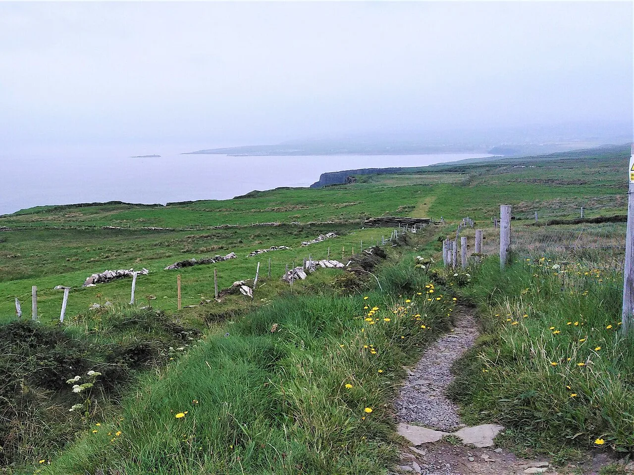
The middle section is farmland edge: you cross the lands of local farmers on a gravel path with flagstone steps cut through the wet drains and streams and on the steeper pulls. Keep dogs on a leash and follow the country code, because livestock and working fields sit right beside the path.
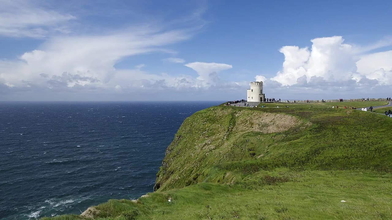
The high point of the route stands 214 m (702 ft) above sea level, and O'Brien's Tower sits near it as a long-established viewing platform. On a clear day you can pick out the Aran Islands to the west, the Twelve Pins and Connemara mountains to the north, and Loop Head and the Dingle Peninsula away to the south.
Hikers who enjoy this blend of cliff and farmland often add the Dingle Way or the Croagh Patrick hike to a longer Irish trip, but both lie well outside Clare and need their own travel days. If you want more woodland and lake trails rather than more coastline, the Killarney hiking guide covers another Irish option worth its own trip.
Exiting at the visitor centre or continuing toward Hags Head
The visitor centre makes the simplest early exit: it sits partway along the coastal trail, so you can break off, use the facilities and arrange transport back to Doolin rather than committing to the full southern leg. This is the sensible option if the weather is turning or your legs are done after the tower.
Continuing south toward Hags Head takes you along the remaining cliff-top stretch, which is where you need to watch the clock and the forecast. There is no continuous shelter on this section, and the last kilometres are exposed to whatever the Atlantic is doing. Plan your turn-around or pick-up point before you leave the tower.
The guided Doolin Cliff Walk: start time, fee and what's included
The guided Doolin Cliff Walk leaves Fisherstreet outside Doolin Inn each morning at 10am and runs with the farmer who created the trail, so you get the farming and local history alongside the views. The walk fee is 30 euros per person, reduced rates are available for groups, and the fee includes the taxi from the end of the walk back to Doolin; rates are subject to change, so confirm when booking.
Doolin Cliff Walks states the walk is not considered suitable for children under the age of ten, and that dogs must be on a leash. Book directly with Doolin Cliff Walks rather than turning up, and treat the walk as cancelled or postponed if severe weather hits, since the company reserves the right to call it off.
Difficulty, exposure and weather on an Atlantic cliff path
The path is moderate rather than technical, but it is genuinely exposed: you are walking beside a vertical drop for hours, and the flagstone steps get slick in rain. A good head for heights matters more here than raw fitness, and anyone who freezes on narrow ground beside a big drop should choose the visitor-centre viewpoints instead.
Atlantic weather moves fast. Rain jackets earn their place even on a bright morning, and wind on the high sections can make the steps and the tower area awkward. Turn back or shorten the day when visibility drops or the wind picks up, and keep the group together on the narrow stretches.
When to go: best months and daylight
Late spring through early autumn gives the longest daylight and the best odds of the clear views that make the Aran Islands and Connemara visible from the high point. Summer also brings the most walkers, so an early start keeps the trail quieter and leaves room for a slow finish.
Winter days are short and the cliff path is wet and windswept, which turns a four-hour walk into a tighter schedule with less margin for error. If you go outside the main season, start earlier than you think you need to and keep the route short by exiting at the visitor centre.
What to carry and how to walk farm land responsibly
Carry a light snack, water, a rain jacket, walking boots or shoes, sun cream and a hat, and eat a proper breakfast before you set off. Fisher Street in Doolin has several places to eat, and Doolin Cliff Walks notes that breakfast is available there before the guided walk.
This is working farmland, not a theme park. Stay on the marked trail, close any gates you open, keep dogs leashed around livestock, and leave no trace of your visit. Small courtesies keep walkers welcome on land that has been handed down through local families for generations.
The closed Liscannor section and how it changes route planning
The coastal walk between Liscannor and the Cliffs of Moher Experience, a 6 km (3.73 mile) stretch, is fully closed because of severe safety concerns, so you cannot plan a through-walk that links Liscannor to the visitor centre on foot. Build your day around the Doolin to Hags Head corridor instead, and arrange transport for the Liscannor end rather than expecting to walk it.
Check the official cliff site before you set out in case the status changes, and do not follow older route descriptions that still send walkers along the closed stretch. The closure is the single biggest planning constraint on the southern approach.
Where to stay: Doolin as a base for the cliff walk
Doolin works as a base because the guided walk starts on its main street and the community-centre car park serves independent walkers. Staying in the village removes the need for a dawn drive, and it puts you close to the pubs and breakfast spots on Fisher Street before an early start.
Book accommodation well ahead for summer weekends, and ask your host about the current bus and shuttle options to the visitor centre and Hags Head so you can set up a one-way walk. For a longer Irish itinerary, compare this coastal day with the Causeway Coast Way in the north or the Kerry Way in the southwest.
Plan Your Visit
Decide first whether you want the guided morning from Fisherstreet or a self-guided day between Doolin and Hags Head, because that choice fixes your start time, your transport and your finish point. Then match the length to the daylight and the forecast rather than to an optimistic plan.
Build the walk around the open trail only, keep the Liscannor stretch out of your route, and carry for rain and wind even in midsummer. With the exit at the visitor centre as your fallback, the Cliffs of Moher walk works as a full day out or a shorter cliff-top sampler.
Frequently Asked Questions
How long does the Cliffs of Moher walk take?
From the Hags Head parking area north to Doolin, the cliff-top trail covers about 13 km (8 miles) and takes most walkers roughly 4 to 5 hours, with the visitor centre around 5.6 km (3.5 miles) from Hags Head. The guided Doolin Cliff Walk runs from its 10am start to about 2pm near the highest point, a shorter northern stretch with a taxi back to the village.
Can you walk the Cliffs of Moher without paying?
Yes. The cliff-top trail between Doolin, the visitor centre and Hags Head is a public walking route you can follow independently, and the guided Doolin Cliff Walk is a separate paid option with a set start time and a taxi transfer back to Doolin. If you walk on your own, plan how you will return to your starting point, since the route is linear.
How difficult is the Cliffs of Moher walk?
It is a moderate coastal path rather than a technical mountain route, on gravel with flagstone steps through drains and on the steeper inclines. The guided walk's operator asks for a basic level of fitness and a good head for heights, and exposure beside the drops is the real challenge on windy or wet days. Anyone uneasy on narrow ground beside a big drop is better served by the viewpoints near O'Brien's Tower and the visitor centre.
Where do you park for the Cliffs of Moher walk in Doolin?
The practical option in Doolin is the Coastal Walk Trail Head at the Micho Russell Community Centre, about 1.5 km (roughly 1 mile) from the Fisherstreet start of the guided walk. From the southern end, Hags Head has a parking area that puts you straight onto the trail heading north.
Is the coastal walk from Liscannor to the visitor centre open?
No. The 6 km (3.73 mile) coastal walk between Liscannor and the Cliffs of Moher Experience is fully closed because of severe safety concerns, so a through-walk from Liscannor on foot is not possible. Plan your day on the Doolin to Hags Head corridor and arrange transport for the Liscannor end instead.
Sources
Trail notes for your next trip
Optional updates when we add or revise hiking guides.
You might also like
Continue reading
More guides you'll find useful