Croagh Patrick Hike: Route, Distance and Trailhead Guide
Plan the Croagh Patrick hike from Murrisk: the pilgrim path to the summit chapel, the loose scree on the final climb, and how to reach the trailhead.
On this page
The Croagh Patrick hike puts you on Ireland's best-known pilgrim mountain, a cone-shaped peak of 765 metres (2,056 feet) that rises straight from the shore of Clew Bay in County Mayo. The route is short but never gentle: a long grassy climb, a short level breather, then a steep pitch of loose stone to a summit chapel. It suits hikers with steady boots and a head for changeable Atlantic weather rather than anyone chasing a quiet, easy summit.
You start and finish at the same car park below the mountain at Murrisk, so there is no transport logistics mid-route and no need for a shuttle. The trade-off is that the whole day hinges on weather: the summit is exposed, cloud can swallow the path, and the descent is harder than the climb for many people.
The Mountain Above Clew Bay
Croagh Patrick, or Cruach Phádraig in Irish, stands near Westport on the shore of Clew Bay and has drawn people to its summit for well over 3,000 years, first as a harvest site and later as a Christian pilgrimage. Mayo County Council describes a soaring cone above the bay with views from the top over the Nephin Beg mountains and the islands scattered across the water.
That history shapes the day: this is a pilgrimage path as much as a hiking trail, marked by stations of reflection from the foot of the mountain to the summit. Treat the mountain with the patience the pilgrims do, and it stays within reach of fit walkers who are prepared for rough ground.
If you want a wider set of Irish routes to compare before committing, our hiking in ireland guide sets this climb against longer trails elsewhere on the island. For a contrasting lowland day of lakes and woodland rather than exposed mountain, you might also weigh this summit against hiking in Killarney.
Distance, Ascent and Walking Time
The round trip from the car park to the summit runs roughly 7 kilometres (4.3 miles), with one account giving 4.22 miles and another about 7.2 kilometres (4.5 miles). Allow about two hours for the climb and an hour and a half down at a steady pace, so roughly three and a half hours in total from car park back to car park.
The climb is continuous rather than technically difficult, but the upper section is steep and the surface is loose. Budget extra time for the descent rather than the ascent, and do not plan the day tight against a bus or train back from Westport.
Getting to the Trailhead at Murrisk
The path begins at Murrisk on the R335, about 9 kilometres (5.6 miles) west of Westport, where a large pay-and-display car park sits at the foot of the mountain. Westport has regular trains from Dublin and buses from regional towns, but onward public transport to the mountain is sparse, so most hikers drive or take a taxi the last stretch.
If you want to arrive by bus, Bus Éireann Route 450 between Westport and Louisburgh passes Croagh Patrick; ask the driver for the Murrisk stop and plan your walk around the service you can actually catch. The nearest airport is Ireland West Airport Knock, with flights to Britain and European airports.
Route Description: The Lower Path
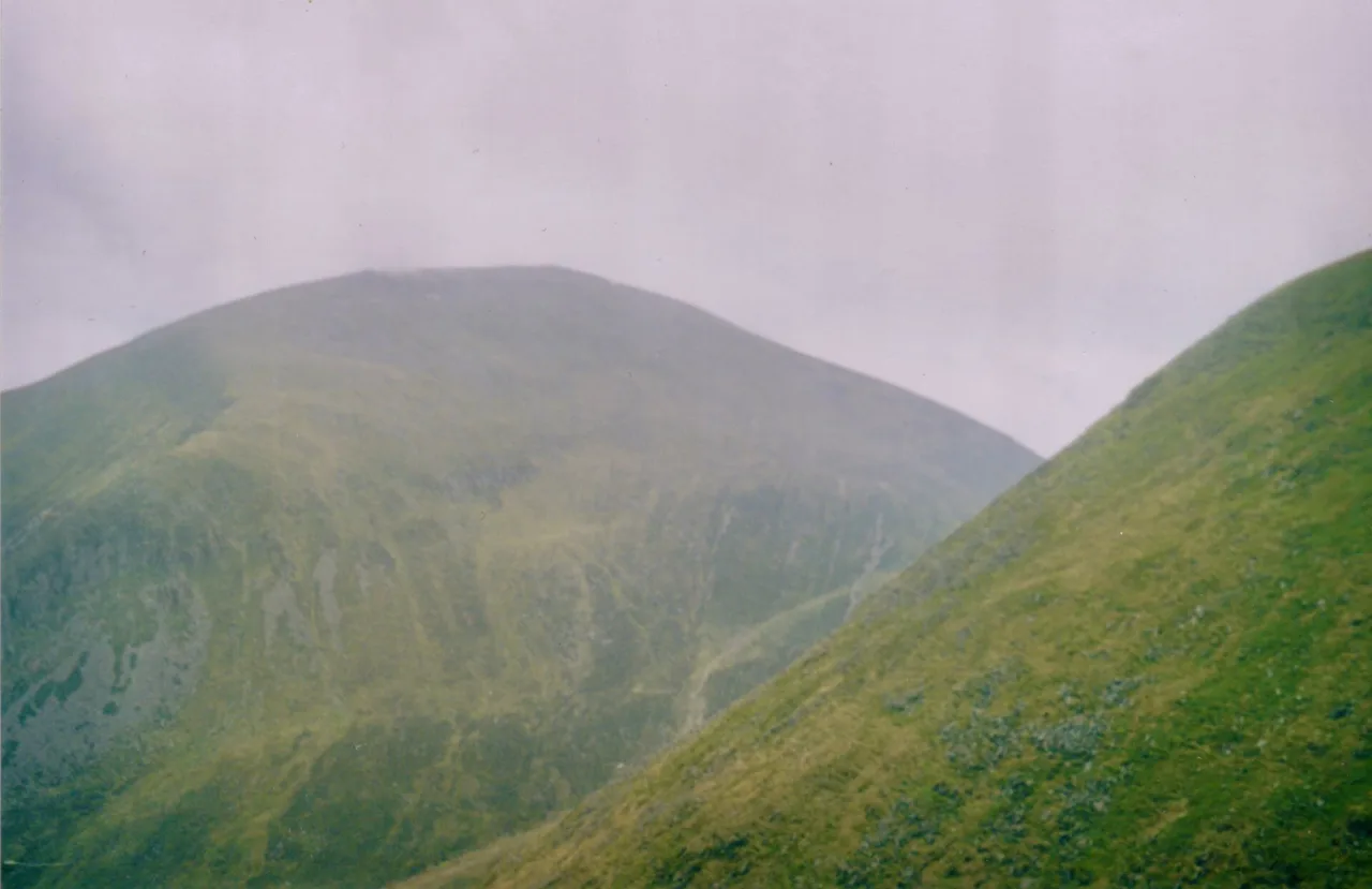
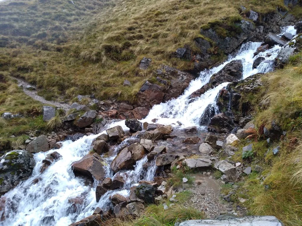
From the car park the pilgrim path climbs gradually through grass and heather alongside a stream, scattered with loose pebbles and larger rocks. Keep the pace easy here, because this long opening ascent is where you gain most of the height before the ground turns steep.
Turn around as you climb: this lower section gives the best views of Clew Bay and its drumlin islands, and the bay will be behind you and less visible once you are on the upper cone. The stream on your right also makes a sensible place to stop for water and food before the ground steepens.
The Flat Rest Before the Final Push
At the top of the grassy section the path reaches a level stretch of ground, the natural place to regroup before the hardest part of the climb. Use it: eat something, adjust layers and decide whether the weather overhead is good enough for the exposed cone above.
Above this point there is no shelter and no easy line of retreat, so this is the decision point. A short break here also lets faster walkers in your group go ahead and slower ones follow at their own pace.
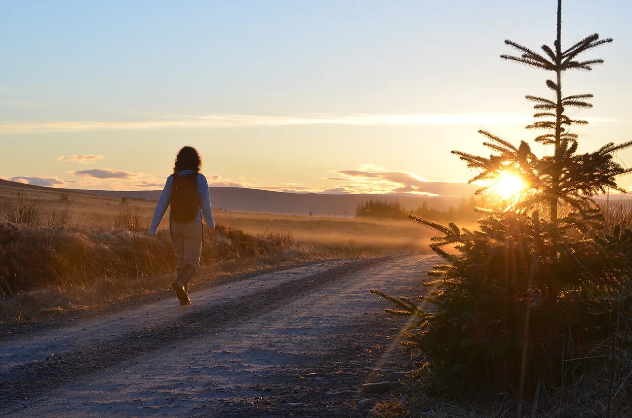
The Summit Cone and St Patrick's Oratory
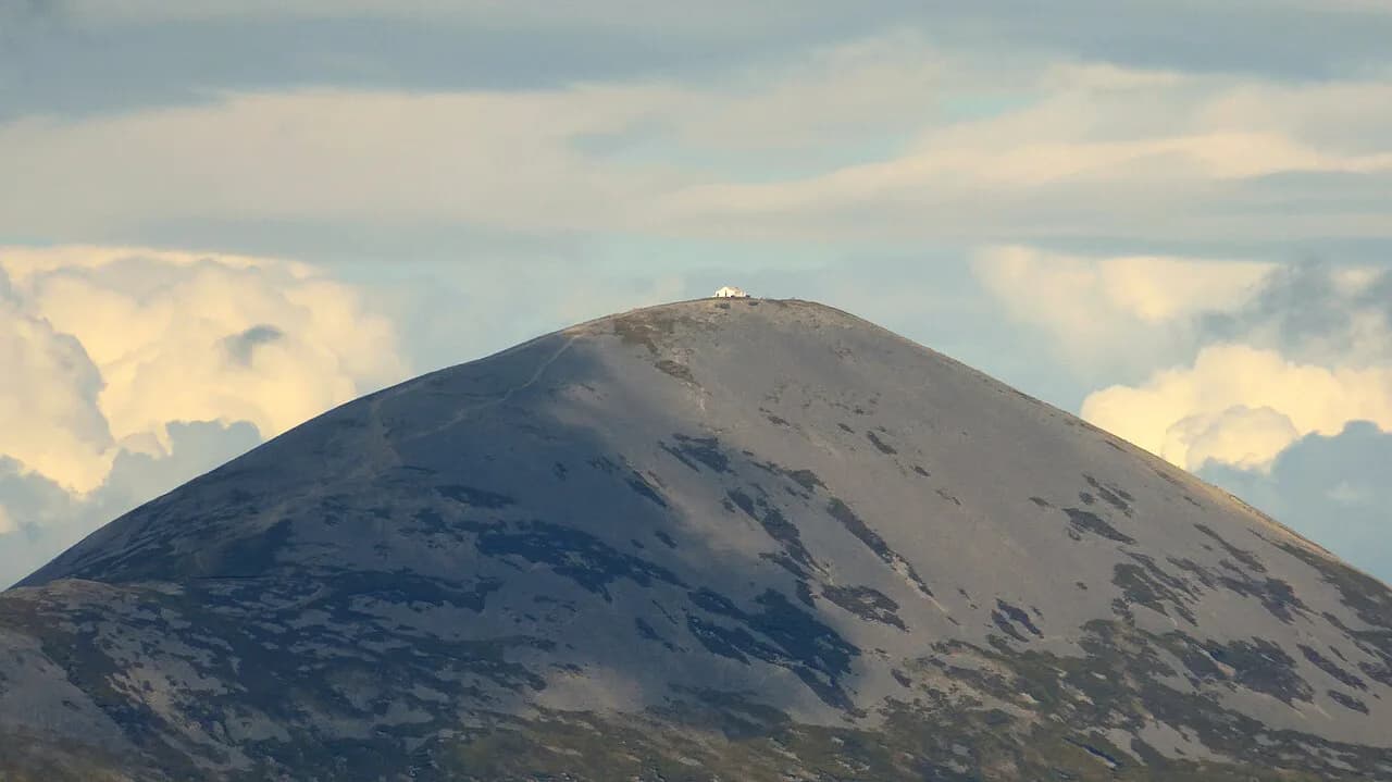
The final ascent is the crux: a steep, conical slope of loose shingle and quartzite boulders where the ground slips underfoot. Zig-zagging across the slope rather than going straight up makes the loose stone easier to manage, and trekking poles help on both the climb and the descent.
The summit is crowned by St Patrick's Oratory, the small white chapel built in 1905 by twelve local men from stone found on the mountainside. Masses are held in it on Reek Sunday, and its white walls are the marker that the hard work is over.
Mayo Mountain Rescue advises pilgrims not to climb barefoot because of the number of callouts and airlifts from the mountain, so keep boots on even if you are walking for religious reasons. The scree is unforgiving and the weather at the top can be far colder and windier than in the car park.
The Descent over Loose Stone
The descent is as demanding as the climb: the upper slope is mostly loose stones and gravel, and it is easy to lose your footing on the way down. Stay alert when legs are tired, take the zig-zag line rather than the direct fall line, and keep your weight back on the steepest sections.
Once back on the grassy path the walking becomes straightforward again, and the views over the bay return on your left. Arriving back at Murrisk, the visitor centre and the National Famine Monument sit close to the car park, so allow a little time before driving on.
Summit Views and the Clew Bay Islands
On a clear day the summit gives panoramic views of Clew Bay and its hundreds of drumlin islands, with the Nephin Beg mountains and the Wild Atlantic Way coastline beyond. The summit is exposed, so enjoy the view but keep moving if the wind picks up or cloud begins to form below you.
When to Go: Weather, Season and Reek Sunday
The weather on Croagh Patrick is extremely changeable, so check the forecast on the morning of your climb and postpone on days of high winds or low cloud. In practice that means keeping a spare day in your Westport itinerary rather than treating the climb as fixed.
The mountain's busiest day is Reek Sunday, the last Sunday in July, when the county council records around 20,000 to 25,000 pilgrims climbing the mountain. Hike on an ordinary day if you want space on the scree and a quieter summit; join Reek Sunday only if the pilgrimage itself is the point of your trip.
What to Bring
Pack warm and waterproof layers, food, plenty of water and sun protection in one bag, because the west coast can turn from sunshine to rain within the climb. Sturdy hiking boots with grip matter far more than on a grassy lowland walk, given the loose shingle on the upper section.
Where to Stay: Westport and Murrisk
Westport is the natural base, with the widest choice of accommodation, the railway station and the bus links to Murrisk; the town also gives you options for the evening after the climb. For a shorter morning, Croagh Patrick Hostel at the foot of the mountain puts you at the trailhead, while The Old Mill Holiday Hostel sits in Westport and fills quickly in summer.
Facilities at Murrisk
The Croagh Patrick Visitor Centre stands in Murrisk near the National Famine Monument and is the place to ask about the path and local services before you set off. Treat it as a pre-walk stop rather than a full-day facility and carry what you need for the mountain with you.
Beyond the Mountain
If you have spare time, the coastal towns and beaches around Clew Bay repay a slow drive: Newport and Westport to the north, Clare Island and Louisburgh to the south, and signposted beaches such as Silver Strand and Carrownisky off the R335. For a longer Irish walking trip after this one, compare the Wicklow Way with the western routes, and check current prices and dates before booking.
Walking Croagh Patrick with a Dog
The existing sections cover weather, kit and pilgrimage tradition, but not whether a dog can join the climb. One point is clear from the sources: the main pilgrimage route runs from the car park at the foot of the mountain to the summit and back, a distance of 4.22 miles, with the first part a long, gradual ascent over grass and heather and a trail scattered with loose pebbles alongside a stream. The upper mountain is where the going changes: the final push to the summit cone and the descent over loose stone are the hardest stretches, and a dog would need to be steady on that ground for roughly three and a half hours of up-and-down walking, the time generally given for a complete climb.
Timing matters more with a dog than without one. The weather on Croagh Patrick is extremely changeable, and the advice is to check the forecast in the morning and postpone the climb on days of high winds or cloud cover. Reek Sunday, the last Sunday of July, brings up to 25,000 pilgrims to the mountain, many walking barefoot despite Mayo Mountain Rescue now advising pilgrims not to undertake the hike barefoot at all because of the increase in callouts for help and emergency airlifts from the mountain. A crowded summit path is not the day for an uncertain dog.
For a base near the start, Croagh Patrick Hostel sits at the foot of the mountain and The Old Mill Holiday Hostel is in Westport; both are in high demand during the summer season. The closest towns are Westport, Leenaun, Louisburgh, Carrownisky and Murrisk, and the Croagh Patrick Visitor Centre in Murrisk is the contact point for the mountain. Plan the day around the climb itself and the ground underfoot.
Plan Your Croagh Patrick Hike
Plan Croagh Patrick as a half-day mountain day, not a quick stop: start from Murrisk with boots and layers for wind and rain, pace the long grassy climb, and treat the loose cone and the descent as the real work. Book your base in Westport or at the foot of the mountain first, then fit the forecast around your climb.
Frequently Asked Questions
How long does the Croagh Patrick hike take?
At a steady pace the round trip from the car park to the summit takes most walkers about three and a half hours, with roughly two hours up and an hour and a half down. Loose shingle on the upper section slows the descent considerably, so leave a buffer.
How far is the Croagh Patrick hike?
The route from the car park to the summit and back runs roughly 7 kilometres (4.3 miles), with one account giving 4.22 miles and another about 7.2 kilometres (4.5 miles). It is short, but the steep loose upper section makes it feel longer than the distance suggests.
How difficult is the Croagh Patrick hike?
The lower path is a long but walkable climb through grass and heather. The difficulty comes from the steep final cone of loose shingle, which demands good boots, sure footing and cautious descent, and from the mountain's fast-changing weather.
How do you reach the Croagh Patrick trailhead without a car?
Take the train or bus to Westport, then Bus Éireann Route 450 towards Louisburgh, which passes the mountain at Murrisk. A taxi is the fallback if the bus times do not fit your walking day.
Where do you park for the Croagh Patrick hike?
A large pay-and-display car park sits at the foot of the mountain in Murrisk, directly at the start of the pilgrim path. It is the only trailhead for the main route.
What is Reek Sunday?
Reek Sunday is the main pilgrimage day, the last Sunday in July, when around 20,000 to 25,000 people climb Croagh Patrick, some traditionally barefoot. Mayo Mountain Rescue now advises against climbing barefoot, and ordinary hikers usually prefer a quieter day.
Can you climb Croagh Patrick barefoot?
Traditionally pilgrims walked barefoot, but Mayo Mountain Rescue advises against barefoot climbing because of the callouts and airlifts from the mountain. Boots with grip are the sensible choice on the loose scree.
When is the best time to hike Croagh Patrick?
Choose a day with a settled forecast and no high winds or low cloud, since the weather on the mountain is extremely changeable. Outside Reek Sunday the summit path is far quieter, and a spare day in Westport lets you wait for better conditions.
Sources
Trail notes for your next trip
Optional updates when we add or revise hiking guides.
You might also like
Continue reading
More guides you'll find useful