Craster to Dunstanburgh Castle Walk: Route, Distance and Return
Walk from Craster to Dunstanburgh Castle on a 7 km (4.3 mile) circuit via Embleton Bay, with parking, route detail, tide notes and castle entry.
On this page
Few half-day walks pack in as much as the circuit from Craster to Dunstanburgh Castle, where a medieval ruin stands on a headland above the North Sea and a wide sand bay opens up behind it. The route suits beginners, families with older children and anyone wanting a gentler day between bigger hill days in the north of England.
The circuit runs about 7 km (4.3 miles) with barely any climbing, so the effort goes into timing rather than fitness: how long you linger at the castle, whether you drop onto the beach at Embleton Bay, and how much you want to eat in Craster afterwards. This guide splits the loop into its coastal outward leg and its farmland return, because the two halves ask different things of you.
Why this short coastal circuit earns the walk
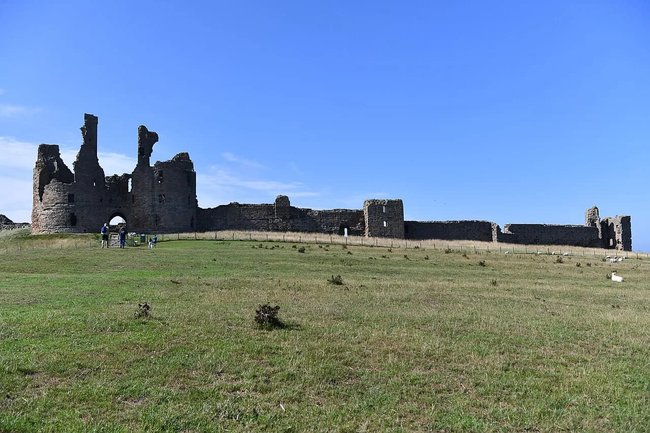
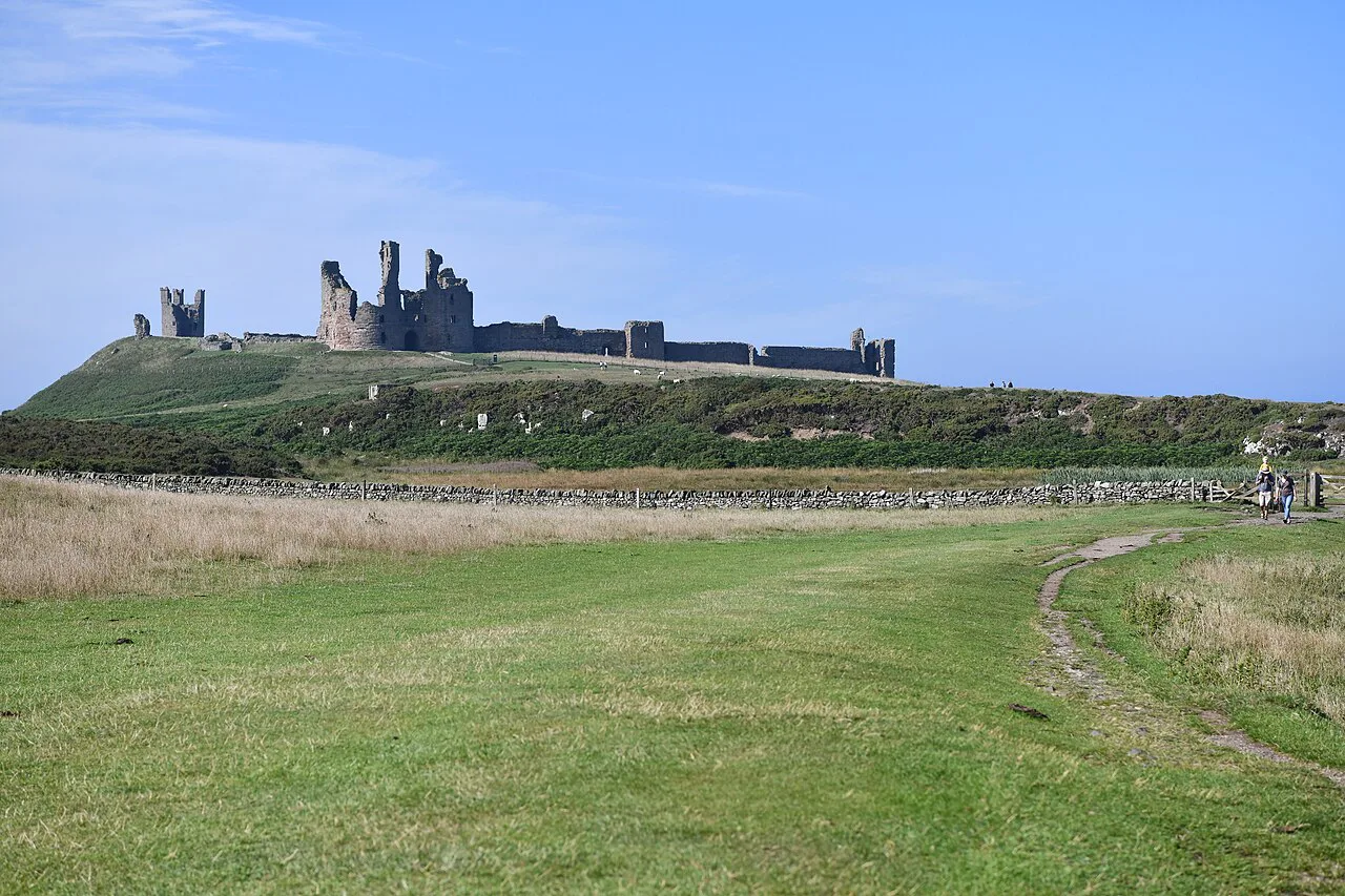
Dunstanburgh Castle sits on a headland of hard dolerite known as the Great Whin Sill, which gives the ruin cliffs on its northern and eastern sides and makes the approach from Craster one of the most photographed coastal scenes in northern England. Construction began in 1313 under Thomas, Earl of Lancaster, and the huge gatehouse was as much a statement of status against Edward II as a fortification.
The appeal is the sequence rather than any single view: stone cottages and fishing boats at the start, open farmland beside the sea, the castle growing larger ahead of you, then the pale sand and dunes of Embleton Bay. The return leg crosses working fields, which gives the loop variety and a different angle back towards the towers. For a wider look at how this fits with the rest of the county, see the guides to walks in Northumberland. If you enjoy this kind of low-level coastal circuit, the Yorkshire Dales hiking guide shows how similar valley and field walks compare in distance and difficulty.
Trailhead and parking
Start at Craster Tourist Car Park (postcode NE66 3TW) just outside the village center, which is the main visitor car park and the practical base for the route. From there you walk downhill through the village to the harbour and pick up signs for the castle and the coast path.
There is no public road or visitor parking beside the castle itself, so arriving by car means leaving it in Craster and walking in. Both the outward coastal path and the inland return bring you back to the village, so you finish where you started and climb the short rise to the car park at the end.
Getting there by public transport
Craster is served by coastal bus routes connecting Alnwick, Alnmouth and villages along the Northumberland coast, so a car-free day is realistic if you match the timetable to your walking time. Alnmouth is the nearest useful railway station for most visitors, with a bus connection onward to Craster.
Sunday services and out-of-season timetables thin out, so check the current timetable with the bus company before relying on an evening bus. If you are stringing several days together along this shore, the Northumberland Coast Path covers the same coast in longer stages.
Distance, ascent and time
The circuit measures 4.3 miles (7 km) and takes most walkers 2 to 2.5 hours at an easy pace. The high point is only about 25 m (82 ft), and the route is mostly flat on well-trodden paths with some grassy and sandy sections, so walking shoes or light boots are enough.
Treat those figures as walking time only. Exploring the castle enclosure, stopping for photographs on the approach and a spell on the sand at Embleton Bay can easily stretch the outing to half a day, which is the main trade-off on a short route with this many distractions.
Route description: Craster to the castle
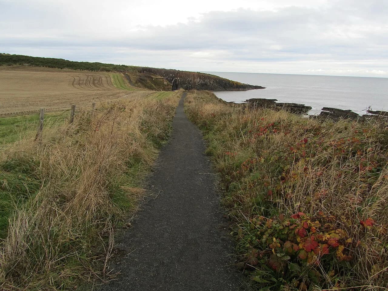
Follow the road down from the car park into Craster, past the stone cottages and the harbour, and continue through the village on the signed way to the castle. A gate leads onto open farmland beside the sea, with the North Sea on your right and a clear path through tall grass all the way to the headland.
There are a couple of gentle dips, and the surface turns muddy after heavy rain. Livestock graze the fields between Craster and the castle, so keep dogs under close control and on a lead whenever animals are near, and close gates behind you.
The towers appear early and grow steadily as you round the rocky shoreline, which is why the approach matters as much as the ruin. Dark rock shelves and small bays open below the path, and the wind here is often stronger than it feels back in the village.
Castle entry, tickets and opening periods
Walking the circuit does not require a ticket, but going inside Dunstanburgh Castle does during staffed opening periods, when admission is charged. English Heritage members enter free, and because the property is owned by the National Trust and managed by English Heritage, National Trust members also get in free.
Opening days and times shift through the year, and the castle shop sells drinks and snacks only when the site is open, so carry your own water. Inside the walls you find a grass-covered enclosure, ruined towers and the great gatehouse, with steep drops, uneven ground and steps in places; do not climb the unstable masonry.
Decide before you set out whether you are walking past or going in, because a proper visit adds an hour or more and changes the shape of the day. The castle's status as an English Heritage site explains why membership cards, not walking boots, are what get you through the gate.
Dunstanburgh Castle to Embleton Bay
Continue north past the castle along the coastal path, where the drops toward the sea are serious and strong winds make the exposed edges hazardous; keep children and dogs well back. As the path rounds the headland, the broad curve of Embleton Bay opens ahead, with pale sand, dunes and the golf course behind.
You can follow part of the beach or stay on the paths beside the dunes, depending on the tide. Firm sand is pleasant walking, but sections of beach become restricted at different stages of the tide, and the local advice is to check tide times before setting out and never pass beneath cliffs or around rocky sections where rising water could cut you off.
When conditions are uncertain, the higher path beside the dunes is the safer choice and still gives the best look back at the castle rising above the beach. The bay also draws oystercatchers, eider ducks, terns and wading birds, so a little distance from the shoreline helps both you and them.
The inland return to Craster
Leave the beach or dune path and turn inland across the fields between Embleton Bay, Dunstan Steads and Craster, following farm tracks, gates and grassy field paths. The junction count rises here, so this is the half of the loop where a downloaded route or map earns its keep.
Crops and livestock may be present, so stay on the public right of way and follow the Countryside Code. Expect mud and uneven ground after wet weather, and note that the ruined towers often stay visible behind you across the fields before slipping out of sight.
The final stretch follows lanes back into Craster, with the harbour buildings and stone cottages returning into view before the short climb to the visitor car park. Navigation is easy once you are among the houses.
When to go
The route works year-round, but spring through early autumn brings longer daylight and a better chance of finding the castle staffed and open. Spring and early summer are also the strongest months for coastal birdlife along Embleton Bay.
Wind is the constant here in every season, and the coast can feel far colder than the village even on a calm-looking day. Carry a waterproof jacket and an extra layer in summer as well as winter, and expect mud on the inland fields after prolonged rain.
Weather and coastal hazards
The real risks are exposure and the sea rather than the terrain: powerful waves in rough weather, wind on open ground, slippery mud on the return and soft sand on the bay. Keep well back from cliff edges, avoid exposed sections in severe winds and wear footwear with decent grip.
Mobile reception is patchy beside the cliffs, on the beach and across the inland fields, so download the route and offline maps before leaving Craster. Dogs are allowed on the route but must be on leads inside the castle grounds and around livestock and nesting birds.
Food and overnight bases in Craster
Craster has pubs, cafes and a smokehouse, and the Jolly Fisherman near the harbour is the best-known stop for seafood with views over the water. It gets busy in peak periods, so eating early or later in the afternoon is the practical move.
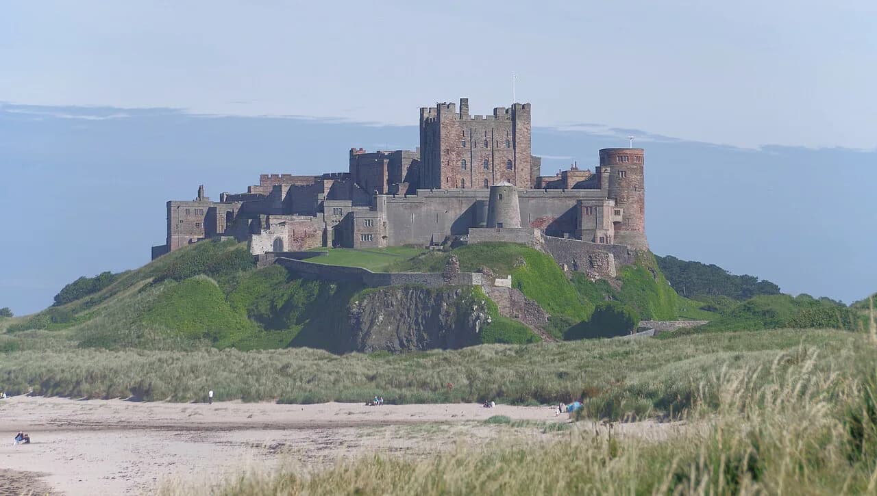
Staying in the village makes the walk a relaxed half-day, while Alnwick a short drive inland offers a bigger choice of beds and a base for other days out. From either, you can add the Bamburgh Castle and Budle Bay walk on another day.
Longer option: Seahouses to Craster
If you want a full day on the same coast, walk the one-way route from Seahouses to Craster, which runs 17.5 km (10.9 miles) with about 154 m (505 ft) of elevation gain and takes most walkers 3.5 to 5 hours. It is rated moderate and passes through Beadnell and Low Newton-by-the-Sea before reaching the castle and dropping into Craster.
This is a point-to-point walk, so you need either a second car or public transport back to the start near Seahouses Post Office on Main Street. Signage is inconsistent in places, so carry a map or GPS, and book castle tickets in advance if you plan to go inside.
Walking it in the reverse direction from Craster adds the same distance to a day that already includes the castle. Either way, keep the circuit as a separate half-day option rather than trying to fold both into one outing.
Plan Your Visit
Decide up front whether you are walking the 7 km loop, visiting the castle, or both, and plan your start time around the bus timetable if you are arriving without a car. Leave the car at Craster Tourist Car Park, and keep the higher dune path in reserve if the tide is filling the beach.
Hikers with more days in the county can pair this coast with inland routes such as St Cuthbert's Way, or head for the hills of Northumberland National Park for a very different day out.
Frequently Asked Questions
How long is the Craster to Dunstanburgh Castle walk?
The circular route from Craster via Dunstanburgh Castle and Embleton Bay is about 7 km (4.3 miles), with a high point near 25 m (82 ft). Most walkers take 2 to 2.5 hours, and a castle visit or time on the beach will extend that.
Where do you park for the Dunstanburgh Castle walk?
Use Craster Tourist Car Park, postcode NE66 3TW, on the edge of the village. There is no public road or visitor parking beside the castle itself, so the walk in and out is part of the route.
Can you reach Craster by bus or train?
Coastal buses link Craster with Alnwick, Alnmouth and other villages along the Northumberland coast, and Alnmouth is the nearest useful railway station. Match your walking time to the published timetable, especially in winter and on Sundays.
Do you have to pay to go inside Dunstanburgh Castle?
Walking past the castle is free, but entering during staffed opening periods requires a ticket. English Heritage and National Trust members get in free, and opening days and times vary through the year.
Can you walk on the beach at Embleton Bay?
Yes, depending on the tide, though sections become restricted at different stages of the tide. Check tide times before setting out and stay off the beach beneath cliffs or around rocky sections where rising water could cut you off.
Is the Dunstanburgh Castle walk suitable for beginners and families?
The route is short, mostly level and free of technical ground, which suits beginners and active children. Expect mud, uneven paths and soft sand, so very young children and pushchairs will struggle on parts of it.
Can you take dogs on the Craster to Dunstanburgh walk?
Dogs are allowed, but much of the route crosses farmland with cattle and sheep. Keep them on a lead around livestock, nesting birds and cliff edges, and inside the castle grounds.
Is the walk from Seahouses to Craster a good alternative?
It makes a full day instead of a half day: a one-way 17.5 km (10.9 miles) route with about 154 m (505 ft) of ascent and a 3.5 to 5 hour time range. You will need transport back to Seahouses or a second car.
Sources
Trail notes for your next trip
Optional updates when we add or revise hiking guides.
You might also like
Continue reading
More guides you'll find useful