The Cheviot Walk: Harthope Valley Route, Distance and Ascent
Walk The Cheviot from Harthope Valley: roadside parking at the road end, a 9-mile (14 km) circuit over Cairn Hill, the flagged summit path and about 5 hours.
On this page
The Cheviot gives you the highest ground in Northumberland, a wild and lightly walked upland that suits fit hikers wanting solitude rather than a polished viewpoint. The summit rises to 816 m (2,676 ft) and sits among the empty valleys and rounded ridges of the Cheviot Hills, so most of the reward comes from the approach rather than the top itself.
This walk is best for experienced hillwalkers comfortable with navigation, wet ground and fast-changing weather. If you want a shorter or lower-level day first, the wider choice of walks in Northumberland ranges from coastal paths to border ridges, and those give a useful taste of the region before you commit to a county top.
Where the walk starts: Harthope Valley road end
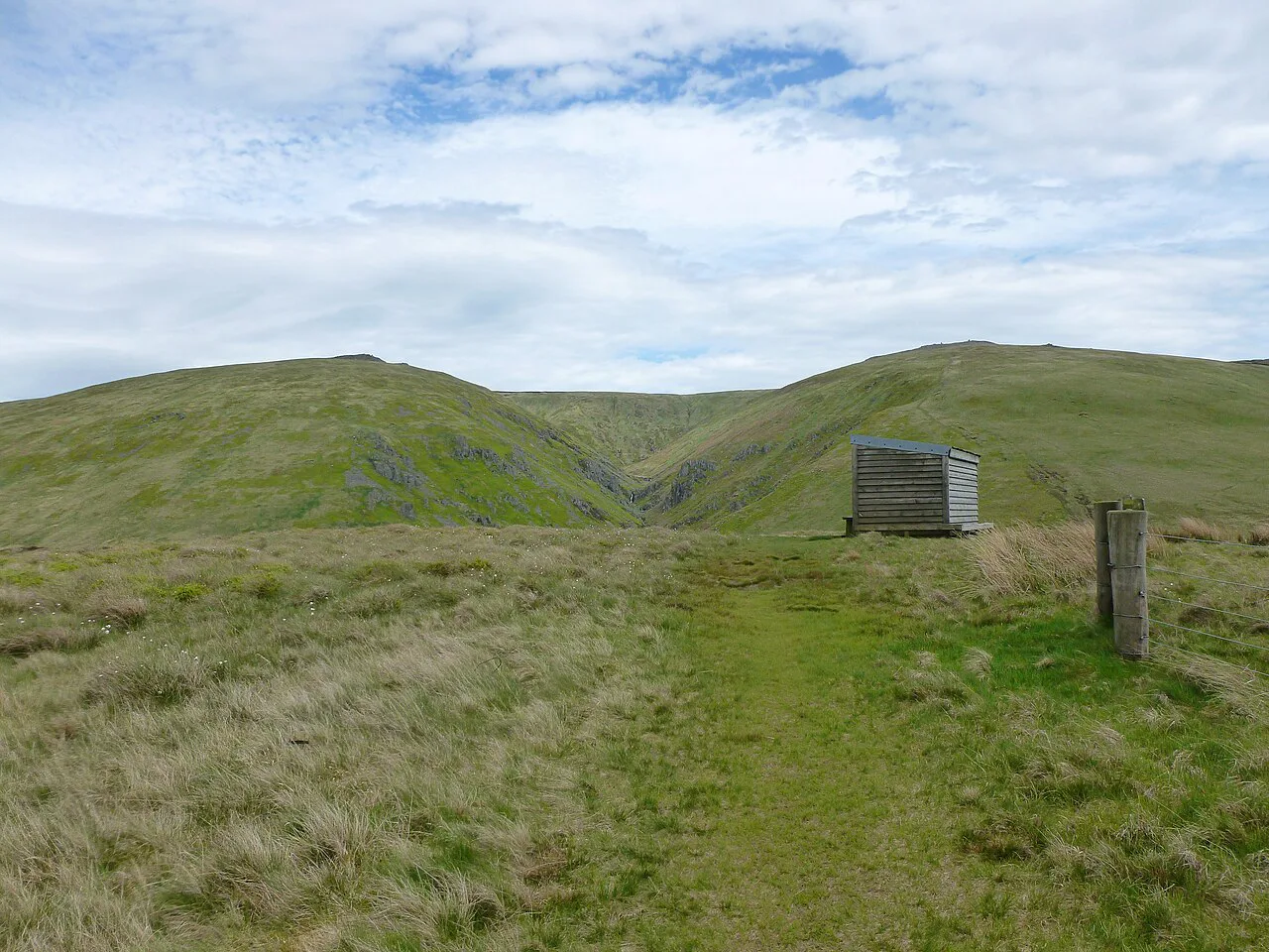
The Harthope Valley route begins at the end of the road into the valley, where cars park roadside and a small sign marks the last of the parking options. The walk then follows the valley track, initially a metalled road that becomes a grassy track as it pushes deeper in.
Harthope Valley is tucked into the Cheviot Hills inside Northumberland National Park, and it is reached by minor valley roads rather than by rail or bus. Arriving early gives you the pick of the roadside spots and a full day of daylight on the hill.
Distance, ascent and walking time
The circular route from Harthope Valley covers 9 miles (14 km) and takes about 5 hours at a steady pace, graded moderate to strenuous. The day includes a long valley approach, a steep climb onto Cairn Hill and a flagged crossing of the summit peat, so the effort is spread rather than concentrated in one burst.
No total ascent figure is given for this circuit, so plan on a full hill day with a steady gradient for the first half rather than judging it by distance alone. Allow extra time in wet conditions, when the peat section slows progress considerably.
Route description: up the Harthope Burn
From the parking area the route heads up the valley beside the Harthope Burn, passing Harthope Linn waterfall, whose surrounding trees and ferns make it the standout stop of the lower valley. The track climbs gently and the scenery stays fairly constant, so treat this stretch as a warm-up and keep an eye on the small channels where you cross the burn.
After roughly two hours the valley narrows and a fence line marks the point where you leave the burn and start the climb. This is the natural place for a break and a look back down the valley before the gradient stiffens.
The climb to Cairn Hill and the Pennine Way
The ascent to Cairn Hill is the toughest section of the day, steep under tired legs but over quickly, and it opens up wide views across the Cheviot Hills. At the top the gradient eases and the ground turns peaty, with the route joining the Pennine Way as it crosses the plateau.
This is remote country with few walkers, and the path is the main reference point once the fence line is behind you. Keep the map handy here, because the plateau offers little in the way of landmarks.
The flagged path across the peat
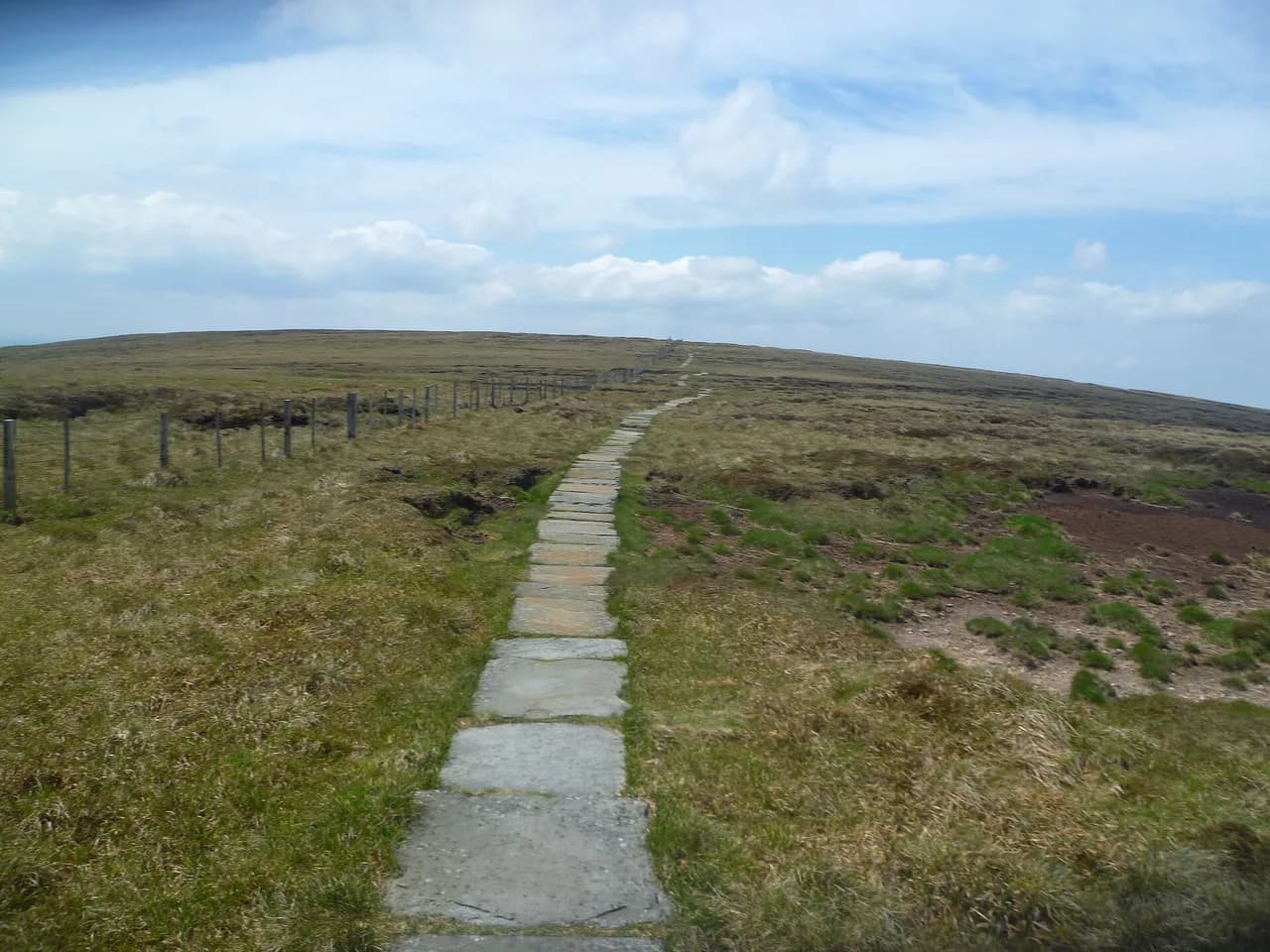
A stone-flagged path now crosses the worst of the peat, built from reclaimed millstones, so the crossing to the summit stays cleaner and safer than the old bog trot. The flags run along the Pennine Way and protect the fragile moorland as well as your boots.
Stay on the flags where they exist, because the surrounding peat hags can hold deep, waterlogged holes even in a dry spell. The final easy stretch to the top follows the same line for around a kilometre once the ground levels out.
The summit: trig point and what you can see
The trig point stands on a concrete slab at the top, installed because earlier markers kept sinking into the peat, and the summit itself is broad and flat rather than a sharp viewpoint. On a clear day the Cheviot Hills roll away in every direction, while the reputed glimpses of the Lakes and Edinburgh are not reliable.
Set your expectations accordingly: the best vistas come from the climb and the descent, and Cold Law on a longer circuit is often judged the finer viewpoint.
The return leg back down Harthope Valley
From the summit the route descends away from the peat hags, and the views improve with every step as Hedgehope Hill and the Harthope Valley open up on the right. The descent demands a little more navigation than the climb, but a fence line gives a useful handrail back toward the valley floor.
Back in the valley the walking is easier and the distance to the car passes quickly, with a single gully near the end to cross on tired legs. Look for dippers on the upper reaches of the Harthope Burn as you rejoin the water.
Best months and weather on the Cheviot
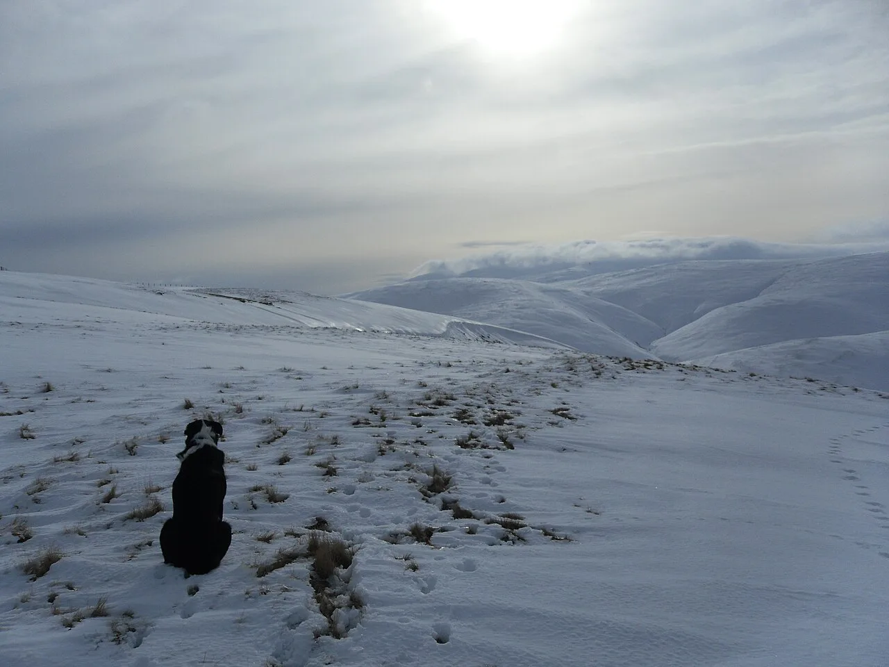
Aim for a dry spell, because the peat section is manageable on firm ground and slow going after rain. Late spring, summer and early autumn give the best daylight and the driest conditions, while winter brings short days and snow on the plateau without any change in the route's seriousness.
Weather in these hills can change quickly even on a settled forecast, so carry waterproofs, warm layers and emergency food as standard. Plan your turn-around time before you set off and keep enough daylight in reserve for the descent.
Bogs, stream crossings and navigation
The route is boggy in parts and the burn crossings come with small channels that trip tired feet, so poles and steady footwork help on the valley stretch. The flagged path takes care of the worst peat, but the ground either side remains soft after rain.
Bring a map and compass and know how to use them, because the plateau has few features and the fence lines are the main clue to your position. This is a route for hikers who have already warmed up on shorter days rather than a first outing, much like the bigger days in the Yorkshire Dales hiking guide.
Dogs, livestock and access land
Much of the access land in the Cheviots carries dog restrictions, so the practical approach is to follow public rights of way for the whole circuit. This nine-mile route stays on public footpaths and includes three stiles, one of them a ladder stile.
Sheep graze most of the route, and water is plentiful in the valley but scarce once you are on the hill, so carry extra for a dog. Keep animals close through the birdlife-rich upper valley and around any cattle near the start.
Alternative approaches: College Valley and the up-and-down route
The most common line is a straight up-and-down from the Harthope Burn valley, which is direct but can feel uninspiring. A longer circular that adds Cold Law and Broadhope Hill gives a far richer day, with Cold Law arguably offering better views than the summit itself.
Deep valleys flank the hill on several sides, including the College Valley, and each approach changes the length and character of the day. Choose according to how much time you have and how comfortable you are with remote ground rather than chasing a single best route.
Is The Cheviot a mountain? Height and county top status
The Cheviot is the highest point in Northumberland and the dominant feature of the Cheviot Hills, standing at 816 m (2,676 ft). That makes it a county top and a classic hill bagger's objective rather than an alpine peak.
Its broad, flat profile means the summit can be reached on foot without technical difficulty, but the distance, peat and weather give it real weight as a day out. If you are comparing Northumberland tops, this one wins on height and isolation together.
Where to stay and how to reach Harthope Valley
Base yourself in the Wooler area or another Cheviot Hills village, which puts you within a short drive of the Harthope Valley road end and gives easy access to the College Valley too. There is no rail or bus service into the valley, so a car is the practical way in.
If you want to extend the trip, St Cuthbert's Way crosses the region and finishes at the Holy Island of Lindisfarne, giving a low-level counterpoint to a day on the county top.
Plan Your Cheviot Walk
The Cheviot rewards hikers who treat it as a full hill day: park at the Harthope Valley road end, walk the burn to Harthope Linn, climb to Cairn Hill and follow the flags to the trig point. Go in a dry spell, carry water and navigation, and allow about five hours for the nine-mile circuit.
If you want extra summits and better views, add Cold Law and Broadhope Hill to the day, and treat the flat summit as the turning point rather than the highlight. From there, the descent through the quiet upper valley is the part most walkers remember.
Frequently Asked Questions
How tall is The Cheviot?
The Cheviot reaches 816 m (2,676 ft), making it the highest point in Northumberland and the dominant summit of the Cheviot Hills. The trig point stands on a concrete slab on a broad, flat top.
Where do you park for The Cheviot walk?
Park roadside at the end of the road into the Harthope Valley, where a small sign marks the last of the parking options. From there the route follows the valley track beside the Harthope Burn. Arrive early on fine weekends to secure a spot.
How long does it take to walk The Cheviot?
The circular from Harthope Valley covers 9 miles (14 km) and takes about five hours at a steady pace, graded moderate to strenuous. Wet ground on the peat section will slow you down, so build in extra time.
What is the best time of year to walk The Cheviot?
Late spring through early autumn gives the longest daylight and the best chance of dry ground underfoot. The peat section is far easier in a settled dry spell, while winter shortens the day and adds snow to the plateau.
Do I need a map and compass for The Cheviot?
Yes. The plateau has few features beyond fence lines, and the flagged path helps only on the peat crossing. Carry a map and compass, know how to use them, and save enough daylight for the descent.
Can you take dogs on The Cheviot walk?
Much of the access land in the Cheviots carries dog restrictions, so stay on public rights of way for the whole circuit. The Harthope Valley route stays on public footpaths and crosses three stiles, with sheep for most of the way.
Is there a shorter route to The Cheviot summit?
The common alternative is a straight up-and-down from the Harthope Burn valley, which is shorter but less varied. A circular adding Cold Law and Broadhope Hill takes longer and gives better views and more interest.
How do you get to the Harthope Valley?
The valley is reached by minor roads from the Wooler area and has no rail or bus service to the trailhead. A car is the practical option, with roadside parking at the end of the valley road.
Sources
Trail notes for your next trip
Optional updates when we add or revise hiking guides.
You might also like
Continue reading
More guides you'll find useful