Curbar Edge Walk: Froggatt and White Edge Circular Route
Plan the Curbar Edge walk from Curbar Gap: a 9.4 km (5.8 mile) circuit over Froggatt and White Edge, with parking, ascent, timing and terrain notes.
On this page
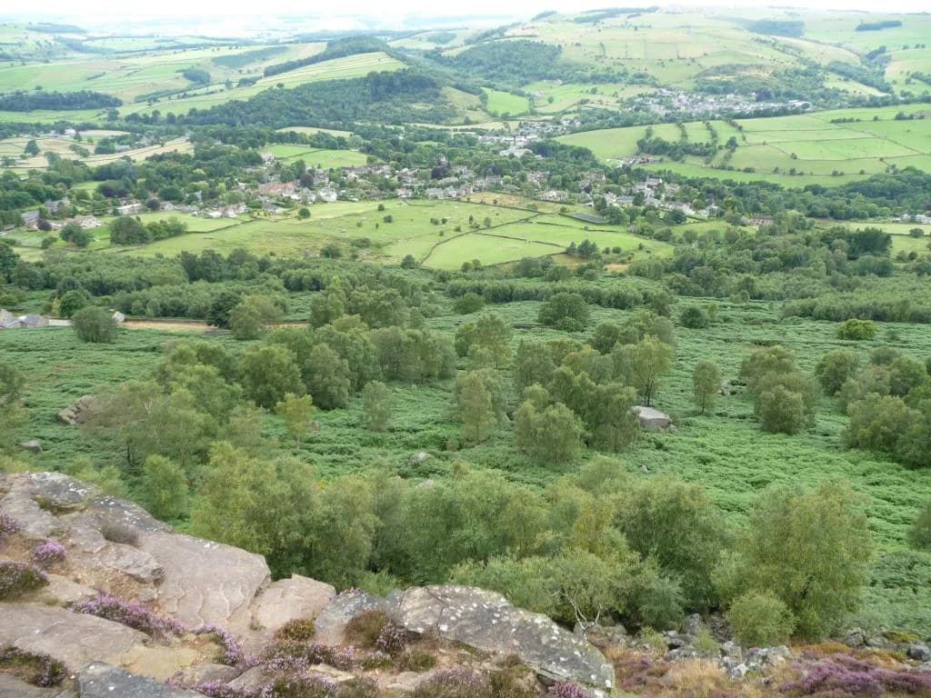
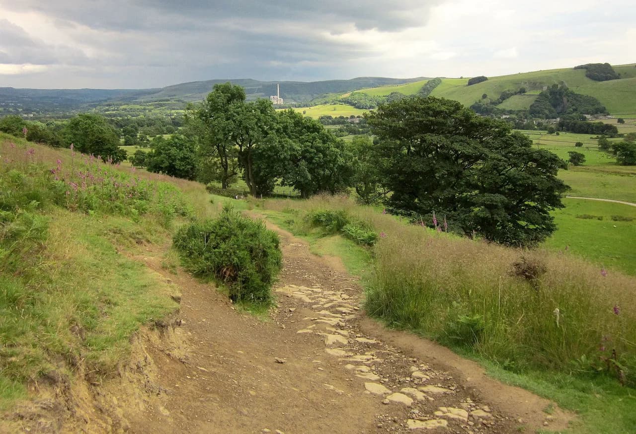
The Curbar Edge walk strings together three gritstone escarpments above the Derwent valley in the Peak District National Park, and it earns its reputation on the final stretch: the boulder-strewn top of Curbar Edge itself, where the ground falls away sharply east and the views open across Big Moor. The full circuit suits hikers who want a half day of steady walking with a real summit-style finish, while the shorter version to Curbar Edge alone fits an evening or a low-energy afternoon.
Where the Curbar Edge walk goes and who it suits
This is an edge walk rather than a summit climb: you traverse White Edge, drop to the valley floor, then return along Froggatt Edge and Curbar Edge with the land dropping away to your right for the last third of the route. The anticlockwise circuit puts the clambering on the boulder sections at the end rather than the start, which keeps the best views as a reward and leaves the big rock playgrounds for when legs are tired but spirits are high. It suits hikers comfortable with 9.4 km (5.8 miles) and 209 m (686 ft) of ascent, and the terrain is mostly clear path with short stone-step climbs.
Anyone nervous about unfenced drops should weigh the trade-off honestly: the edge-top paths run close to the rim, so the walking is straightforward but the exposure is real. Families with confident older children tend to enjoy it, while hikers wanting a gentler introduction to the area have easier options in the guide to Peak District hiking.
Trailhead and parking at Curbar Gap
The walk starts and finishes at Curbar Gap car park, grid reference SK 2621 7468, which sits right at the top of the pass between Curbar and Baslow. National Trust and RSPB members park free, and everyone else pays by cash or card, with charges set at four-hour and all-day rates; the National Trust's own description of the Frogatt, Curbar and White Edge deer walk is worth reading before you go if you want the estate's framing of the route.
This car park fills on weekends and school holidays, so aim to arrive by 9:30am if you want a space without circling. Do not park on the double yellow lines along the approach road, because enforcement there is active. A printable route description from Peak District Kids gives the charges and a map point for the car park entrance, and there are no toilets at the car park or anywhere along the circuit.
There is no public transport to Curbar Gap itself, so you need a car or to arrange a lift from Baslow or Calver for this trailhead.
Distance, ascent and walking time
The full circuit measures 9.4 km (5.8 miles) with 209 m (686 ft) of total ascent: modest figures that hide how much time you can spend lingering on the edges. Without children, budget about 3.5 hours of walking; with younger children the same route can stretch to five hours or more, so treat it as a full day out and start early.
Keep those numbers tied to this specific loop. The Curbar Edge and Baslow Edge circular recorded on AllTrails is a different route, and its distance and elevation gain should not be read as this circuit's statistics.
The grade is moderate: no scrambling is required, but there is a sustained climb on stone steps early, a road crossing, and open, uneven ground along the tops where progress slows in wind or mud. If you enjoy this style of edge walking and want to compare it with similar terrain elsewhere, hiking in Lake District offers plenty of ridge and fell routes at a comparable level.
Route description: White Edge and the trig point first
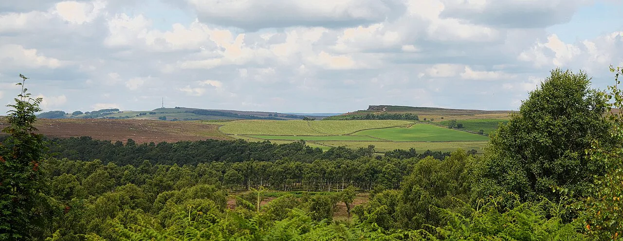
From the car park entrance, take the footpath through the wooden gate toward White Edge and keep straight at the fork after roughly 120 m (130 yd). Stone steps climb past a stone bridge and brook, and you follow the drystone wall on your left with wooden signs pointing the way to White Edge. About 900 m (0.6 miles) along the top, a short obvious detour leads to the White Edge trig point, which is worth the extra minute for the view back over Big Moor.
Continue along White Edge to a footpath junction at a drystone wall about 2.3 km (1.4 miles) from the trig point, then turn left downhill on signs toward the Grouse Inn, passing through a band of woodland. At the bottom, cross the field toward the pub; the road here carries fast traffic, so cross with care and use the path alongside the road rather than the verge.
The Grouse Inn and the Longshaw Estate crossing
Almost halfway around, The Grouse Inn gives you the only facilities on the route: food, a pint and a break from the wind, though only paying customers can use the facilities and children are seated in the dining area at the back rather than the main bar. It is the obvious place to split the walk and the reason many hikers choose this circuit over a bare edge traverse.
Just beyond the pub, a footpath on the right climbs diagonally across a field through a gap in the wall, entering the Longshaw Estate. Continue over the next field, through a wooden gate, and into woodland, then bear left keeping the small car park on your left. The path drops to a brook and rises to the road, where you cross and pick up the path on the other side, climbing briefly before the gradient eases.
Froggatt Edge to Curbar Edge: gritstone and drops
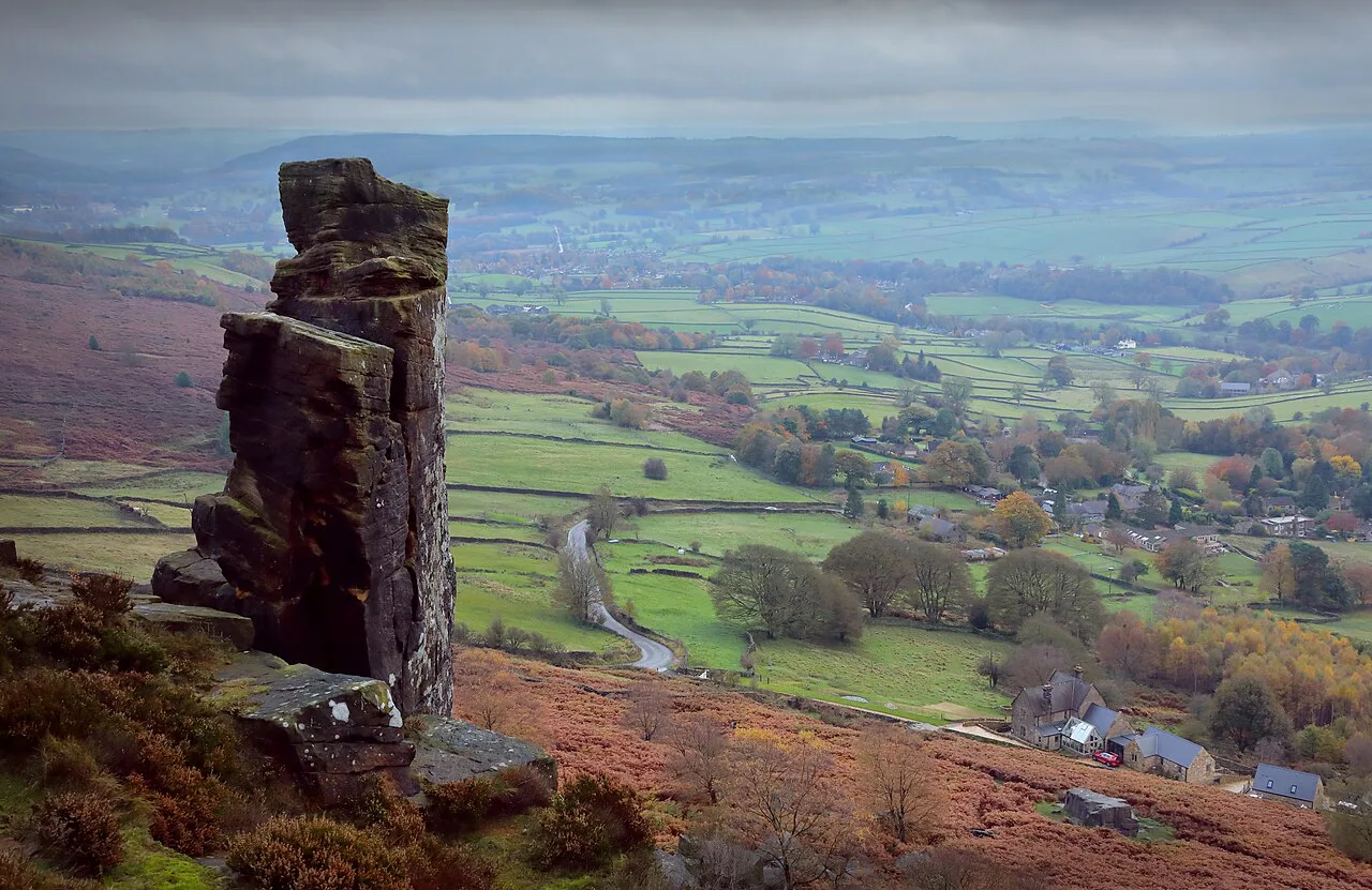
A wooden gate marks the start of Froggatt Edge, and 200 m (220 yd) beyond it a small stone circle sits just off the path on the left, easy to miss if you are watching your feet. Then comes the first group of boulders, a natural stopping point for children, before the path runs directly onto Curbar Edge with its own boulder field and the best views of the day. The drops are unfenced and sudden, so keep children close and stay on the main line rather than cutting toward the rim.
The same path carries you all the way back toward the car park; pass through a gate near the end and follow the path around to the left, with steps on your right leading into the car park. If you want a longer day on this escarpment, the Bamford Edge walk picks up a nearby gritstone edge with a similar outlook and less company.
The short Curbar Edge option and the Baslow Edge extension
If 9.4 km (5.8 miles) is more than you need, a short 3.3 km (2.1 mile) circular from the same car park reaches Curbar Edge and its boulder field without the White Edge and pub sections. It keeps the best viewpoints and the exposure, cuts out the road crossing and the valley-floor crossing, and works well at sunset when Curbar Edge is at its most photogenic. A 2.7 km (1.7 mile) loop over Baslow Edge also starts from Curbar Gap, so you can add it on for extra edge time without committing to the full three-edge circuit.
Weigh the three options by what you want from the day: the full circuit delivers variety and a halfway pub, the short circuit delivers views with minimal time, and the Baslow add-on extends an existing walk rather than replacing it. Anyone chasing a longer valley-floor day closer to Bakewell should look at the monsal trail, reached at Blackwell Mill and near Chee Dale, rather than trying to stretch this edge route further.
Weather, exposure and the edge-top terrain
You are fully exposed along these edges, and the weather up here is routinely wilder than down in the Derwent valley, so pack an extra layer even on a mild morning. Rain and wind make the gritstone slippery and the stone steps slow, and in winter the edge tops can hold ice while the valley stays clear. If you want to climb above the valley on a shorter schedule instead, the mam tor walk gives you a paved ridge ascent with a quicker return.
The two genuine hazards are simple: the unfenced drops near the boulders on Froggatt and Curbar Edges, and the fast road at the Grouse Inn crossing. Keep back from the rim when the wind is strong, cross the road where you can see traffic, and turn around rather than push on if fog closes in, since the edge path runs close to the crag line throughout.
When to go: seasons and quiet times
Late spring through early autumn gives the longest daylight and the most reliable dry rock, with heather color on White Edge and Big Moor in late summer. Summer weekends and school holidays bring crowds and a full car park, so use the early-morning window or an evening start to have the edges to yourself. The National Trust's deer walk on Big Moor is a reminder that red deer roam this moorland; keep your distance and keep dogs under control.
Autumn and winter walking is quieter and often clearer, but the short days and early dusk make a headtorch sensible on the full loop, and ice on the stone steps demands care. If reservoir-side lowland miles suit the season better, the Ladybower Reservoir walks offer gentler winter options nearby.
What to carry on the edges
Carry Ordnance Survey Explorer OL 24 (White Peak) on paper even if you navigate by phone, since the network is patchy along the edges and the boulder sections can pull you off line. Bring water and food for the whole circuit because the pub is your only resupply, and pack a warm layer and waterproof shell for the exposed tops.
Good grippy footwear matters more than boots on the dry paths, but the stone steps and wet gritstone justify real tread. Add a paper map, a charged phone and a headtorch for winter starts, and leave the barbecue at home because the national park bans them.
Plan Your Visit
Decide first which version of the walk you want: the full 9.4 km (5.8 miles) three-edge circuit with the Grouse Inn stop, the short 3.3 km (2.1 mile) loop to Curbar Edge, or the full loop plus the Baslow Edge add-on. Then book your start time around the car park, which fills early on sunny weekends and holidays, and build in time for the boulders and the views rather than treating this as a route to rush.
Check the car park charges and any National Trust guidance for the Longshaw estate before you travel, and pack for wind and rain regardless of the forecast down in the valley.
Frequently Asked Questions
How long is the Curbar Edge walk?
The full anticlockwise circuit over White Edge, Froggatt Edge and Curbar Edge covers 9.4 km (5.8 miles) with 209 m (686 ft) of total ascent, starting and finishing at Curbar Gap car park. A shorter 3.3 km (2.1 mile) circular from the same car park reaches Curbar Edge without the White Edge and pub sections, and a 2.7 km (1.7 mile) Baslow Edge loop can be added on to either.
How long does the Curbar Edge circular walk take?
Without children, allow about 3.5 hours of walking for the full circuit. With younger children the same route can easily stretch to five hours, so plan a full day and start early, especially if you want a space at Curbar Gap car park. The boulder sections near the end of the walk tend to absorb the most time.
Where do you park for the Curbar Edge walk?
Curbar Gap car park sits at the top of the pass between Curbar and Baslow, at grid reference SK 2621 7468, and the route leaves directly from its entrance. Spaces go early on weekends and school holidays, so arriving by 9:30am is the practical target. Parking on the double yellow lines along the approach road risks a ticket.
Is Curbar Edge a difficult walk?
The full circuit is moderate: no scrambling is involved, but there is a sustained stone-step climb early, a fast road crossing at The Grouse Inn, and open, uneven ground along the tops. The real challenge is exposure, with unfenced drops close to the path on Froggatt and Curbar Edges, and weather that runs wilder than in the valley below.
Is there a walk to Curbar Edge from Baslow?
The marked routes start from Curbar Gap car park rather than Baslow village itself, so most hikers drive or take a lift up to the pass. Baslow Edge has its own waymarked loop from the same car park, which pairs neatly with the Froggatt and White Edge circuit if you want a longer day.
Sources
Trail notes for your next trip
Optional updates when we add or revise hiking guides.
You might also like
Continue reading
More guides you'll find useful