Chatsworth Walks Guide: Peak District Routes to Choose
Chatsworth walks range from a 2 km loop past the Hunting Tower and aqueduct to 10 km circuits to Pilsley and Bakewell. Here is how each route fits your day.
On this page
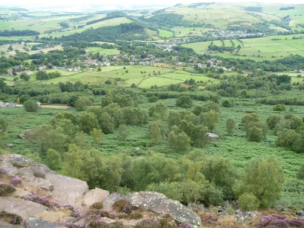
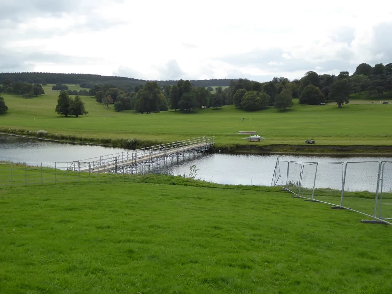
Chatsworth sits in the Derwent valley in the Peak District National Park, with its parkland, the wooded slope of Stand Wood and the gritstone edge at Birchen Edge all within a half-day's walking. That range makes the estate unusually flexible: you can climb to a 1570s hunting tower in under an hour or spend three hours crossing farmland to a village pub. The routes below are grouped by how much time and climbing they ask of you, so you can match one to your fitness and the daylight you have.
Which Chatsworth walk suits your day
If you have half a day, take the Hunting Tower and aqueduct circuit: 2 km (1.2 miles) with about 134 m (440 ft) of ascent, roughly 50 minutes of walking and about 1.5 hours at a family pace. It delivers the estate's best landmarks — the tower, the Sowter Stone Waterfall and the aqueduct arches — in a single short loop, though the opening climb is steep and the ground rocky in places.
With a full day, choose between the two long circuits. The Chatsworth to Pilsley route runs 10.5 km (6.5 miles) in about three hours and passes pubs and tea rooms, while the Chatsworth to Bakewell circuit covers 10 km (6.2 miles) in about three hours through woodland and along the river. The estate grades both as easy; the Pilsley version is the more sociable choice, the Bakewell one the more scenic.
For a proper hill day with an edge, the Birchen Edge to Chatsworth circuit is a 7 mile (11 km) loop that adds Nelson's Monument, the Three Ships rocks and the Dobb Edge path to the Hunting Tower. It brings real moorland exposure and a busy road crossing, so it suits hikers with more stamina and a full day rather than a first outing. If you enjoy this kind of edge walking and want more of it, the Yorkshire Dales hikes offer a similar mix of gritstone and open moor.
Trailheads and parking
The main estate car park gives the shortest access to Stand Wood: enter at the back, follow signs for the Farmyard and Adventure Playground, and take the gate on the right into the wood just before the farmyard entrance. Parking is sold as a full-day ticket, so a short loop costs the same as a long stay — plan to add the riverbank or the garden to make it worthwhile.
Buses reach the estate from Bakewell, Matlock, Buxton, Chesterfield, Sheffield and Manchester, which makes a car-free day realistic if you check current times before travelling. The car park sits at postcode DE45 1PN and fills on sunny weekends and school holidays, so an early or late arrival is the practical tactic.
Calton Lees car park is the start for the two short estate circuits, and the Birchen Edge route can begin at three points: Birchen Edge car park by the Robin Hood Inn, Chatsworth car park itself, or Baslow village car park. Starting at Birchen Edge puts the moorland edge first and the house last; starting at Chatsworth reverses that and leaves the climb to the tower for the middle of the day.
Access and what the estate charges for
The trails through the park and Stand Wood are open to walkers throughout the year, so the woodland is not tied to house opening times. Walking the park paths is free; you pay for parking, and house, garden and farmyard tickets are booked online in advance. That means a riverbank picnic or a wood-and-tower loop needs nothing more than the car park ticket.
Stand Wood has its own printed walk map for the paths behind the house, and the entrance sits by the farmyard and adventure playground as marked on the welcome map at the main car park entrance. Pick one up before you climb, because not every path in the wood appears on standard mapping.
Hunting Tower and aqueduct circuit: route description
From the back of the car park, head toward the farmyard, pass through the gate on the right into Stand Wood and climb the path ahead. At the road go straight across onto the path opposite and straight on again at the next junction, then cross a small stream; the steps beyond are the steepest section of the day and, in summer, the wood closes in like a tunnel of vegetation. The path tops out at the Hunting Tower, a high prospect built in the 1570s, with a wide view over the estate and a good picnic ledge.
Take the footpath to the right of the tower and continue through the wood, ignoring a right turn with steep steps down, until you reach Sowter Stone Waterfall. Pass to the left of the fall and around the back to descend on the far side, then follow the switchbacks down toward the aqueduct, where four tall arches carry the water and finish in a second waterfall. This stretch is at its most impressive after rain.
Cross the road in front of the aqueduct and take the path immediately opposite, which drops to a second road with Chatsworth House framed ahead. Turn right and follow this very quiet estate road back to the car park; only estate vehicles use it. Expect rocky, uneven footing throughout and a route that is not suitable for prams or wheelchairs, with no facilities between start and finish.
Walks from Calton Lees
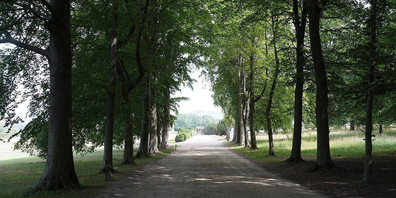
Two waymarked circular routes leave Calton Lees car park: a 3 km (1.9 mile) option of roughly 1.5 hours and a 5 km (3.1 mile) option of about 2 hours. Both stay on estate paths and are the easiest introduction to the park, with modest climbing and clear lines back to the car park. They work well for a short winter day when the longer circuits would finish in the dark.
Between them, the two loops let you scale the day to your legs rather than commit to a fixed distance; the 5 km version is the better choice if you want a proper couple of hours of walking without the steep Stand Wood steps. Either way, both routes start and finish at Calton Lees car park, so carry water and snacks from the start.
Chatsworth to Pilsley circuit
The Pilsley circuit is 10.5 km (6.5 miles) and takes about three hours at an easy pace, crossing estate land to a village with pubs and tea rooms. It is the route for a group that wants a long lunch stop built into the day rather than a summit or a viewpoint; the trade-off is more time on tracks and lanes and less time in woodland.
Because the walking is graded easy, the day's success depends on timing rather than effort: leave enough margin to sit down for food in Pilsley and still walk back in daylight. Carry a map and the estate's written route description, since the value of the route lies in linking refreshment stops rather than following an obvious single trail.
Chatsworth to Bakewell circuit
This 10 km (6.2 mile) circuit takes about three hours and combines woodland, the river and a stop for lunch or refreshment in Bakewell. It gives you more variety underfoot than the Pilsley route and a town with shops and cafés at the halfway point, but the riverside sections can be muddy after wet weather.
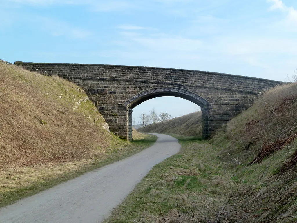
If you want to extend the riverside walking, the monsal trail runs through the Wye valley nearby and can be joined at Bakewell, with Blackwell Mill and Chee Dale further along. Treat that as a separate outing rather than a detour on the Chatsworth circuit.
Birchen Edge to Chatsworth
Starting from Birchen Edge car park by the Robin Hood Inn, the route leaves the northern end of the edge and drops through heather and moorland, crosses the A621 and climbs a minor road before joining an old track with a high wall on your right. About three-quarters of a mile along you reach the Wellington Monument, with the Eagle Stone on your right, then descend the walled track to Bar Road and into Baslow.
From Baslow, cross the A619, pass the Café on the Green Tea Rooms, cross the bridge and turn right through the Cannon Kissing Gate into the estate. Keep straight past White Lodge, then follow the estate road to the house and climb through Stand Wood past the farmyard until you turn left onto a narrow woodland path and climb the 148 steps to the Hunting Tower.
Higher up, the route reveals Nelson's Monument at 1,000 ft (305 m) above sea level, erected in 1810, and the Three Ships rocks carved with the names Victory, Defiant and Royal Sovereign. From there a concessionary path traces Dobb Edge — narrow, rocky and undulating with stiles — before dropping to the A619 opposite the Robin Hood. Watch for traffic on both crossings of that road.
When to go
The park and woodland paths are open all year, which makes Chatsworth a viable winter walk when higher moorland routes are wet or windy. The waterfalls are at their best after rain, so a damp week is not a reason to cancel the Hunting Tower loop; the trade-off is slippery rock on the switchbacks below Sowter Stone.
Summer brings thick vegetation in Stand Wood and busy weekends and school holidays, when the car park fills early and the tower gets crowded. Start early or late in the day, and keep an eye on the weather on the exposed Birchen Edge section, where there is little shelter from wind or a passing shower.
Facilities on the route
Public toilets are by the entrance to Chatsworth House, and a food cart often stands nearby; there are no facilities at all on the Hunting Tower loop itself. Edensor tea rooms are a short walk from the house, and the Wheatsheaf at Baslow has a beer garden with a playground. Build the stop into your route rather than expecting something on the hill.
The long circuits each have refreshment stops at their turning points, in Pilsley and Bakewell respectively, so you can walk with a light pack and eat properly halfway. On the 7 mile Birchen Edge circuit, Baslow is the natural pause before the climb back through Stand Wood.
Plan Your Visit
Match the route to your hours: the 2 km Hunting Tower and aqueduct loop for a short visit, the Calton Lees circuits for an easy half day, Pilsley or Bakewell for a three-hour day with food stops, and Birchen Edge when you want an edge, a monument and a longer walk in one. Decide where you will park before anything else, because the estate car park charges by the day and the alternative starts change the shape of the route.
If you are basing yourself in the valley for several days, add a contrasting day on the gritstone ridges with the Mam Tor walk or the bamford edge walk above Hathersage, and use the Ladybower Reservoir Walks for a gentler waterside afternoon. Each lies outside the Chatsworth estate but within easy reach of the same bases.
Frequently Asked Questions
What are the best walks around Chatsworth?
The Hunting Tower and aqueduct circuit is the best short walk, at 2 km with about 134 m of ascent and the tower, Sowter Stone Waterfall and aqueduct arches in one loop. For a longer day, the Pilsley and Bakewell circuits each run around 10 km in about three hours, and the Birchen Edge route adds Nelson's Monument and Dobb Edge over 7 miles.
Can you walk around Chatsworth without paying?
The park and Stand Wood trails are open to walkers throughout the year and walking them is free. You pay for parking, which is sold as a full-day ticket, and house, garden and farmyard tickets are booked online in advance if you want to go inside.
How long does it take to walk around Chatsworth?
Allow about 50 minutes of walking for the 2 km Hunting Tower loop, or roughly 1.5 hours with children and photo stops. The Calton Lees circuits take about 1.5 to 2 hours, while the Pilsley and Bakewell circuits each run to around three hours.
What is the Bakewell to Chatsworth circular walk?
It is a 10 km circuit of about three hours that links the estate with Bakewell through woodland and along the river, with a lunch or refreshment stop in town. It is graded easy, so the main planning question is timing the return in daylight and coping with muddy riverside ground after rain.
How far is the Chatsworth Hunting Tower walk?
The loop from the main car park is 2 km (1.2 miles) with around 134 m (440 ft) of ascent. The opening climb up the Stand Wood steps is steep and the ground rocky, and the route is not suitable for prams or wheelchairs.
Where does the Chatsworth to Pilsley walk start?
It starts from the Chatsworth estate, and the shorter Calton Lees circuits begin at Calton Lees car park. Either way, sort out parking first, since the estate car park charges a full-day rate and fills early on sunny weekends.
Where is the entrance to Stand Wood?
It sits by the farmyard and adventure playground, marked on the welcome map handed out at the main car park entrance. Walk to the back of the car park, head toward the farmyard and take the gate on the right just before the entrance.
Do I need a map for the Chatsworth walks?
The estate publishes a Stand Wood walks map, and not every path in the wood appears on standard mapping, so take a copy. For the Birchen Edge circuit, follow the written directions closely through Baslow and the Dobb Edge section.
Sources
Trail notes for your next trip
Optional updates when we add or revise hiking guides.
You might also like
Continue reading
More guides you'll find useful