Castleton Walks: Cave Dale, Mam Tor and Winnats Pass Routes
Plan Castleton walks from the village centre: Cave Dale, Mam Tor and Winnats Pass routes with distance, ascent, walking time, parking and bus access.
On this page
Castleton packs three genuinely different walks within a few minutes of the market square, which is why it works so well as a base for a day on foot in the Peak District National Park. You can be squeezing between limestone walls in Cave Dale, grinding up the Winnats Pass verge or standing on the Great Ridge without moving your car once. The question is not whether to walk from the village but which of the circuits fits your legs, your timetable and the weather.
Cave Dale suits anyone who wants real scenery in under three hours, families included, provided everyone can handle rough rock underfoot. Mam Tor rewards fitter walkers with a summit and a ridge traverse that takes most of a morning or afternoon. Winnats Pass is the middle option: a steep, dramatic gorge that you can climb and return from in an hour and a half to two hours.
Where Castleton sits in the Peak District
Castleton sits at the western edge of the Hope Valley in Derbyshire, in the Dark Peak half of the national park. Ordnance Survey sheet OL1, Peak District (Dark Peak Area), covers every route described here, so one paper map handles the whole trip. The village itself is compact: the visitor centre and main car park on Cross Street, the market square, and the lanes toward Peak Cavern all sit within a couple of minutes of each other.
That layout shapes the walking. Cave Dale opens directly off the top of the square, the Winnats Pass approach begins past Peak Cavern and up Goosehill, and the ridge routes climb from the same village lanes. You choose a direction at the square rather than driving to a trailhead, which is the main practical advantage of basing yourself here rather than in a quieter hamlet such as Edale.
Cave Dale short walk: distance, ascent and time
The Cave Dale circuit runs 2 miles (3.3 km) with 205 m (672 ft) of total ascent, topping out at 378 m (1,240 ft). Allow 1.5 to 2.5 hours, which covers the rocky climb and the easy grassy return with time to look at Peveril Castle from above. The route is a figure-of-eight in effect, climbing through the dale and doubling back along its western rim.
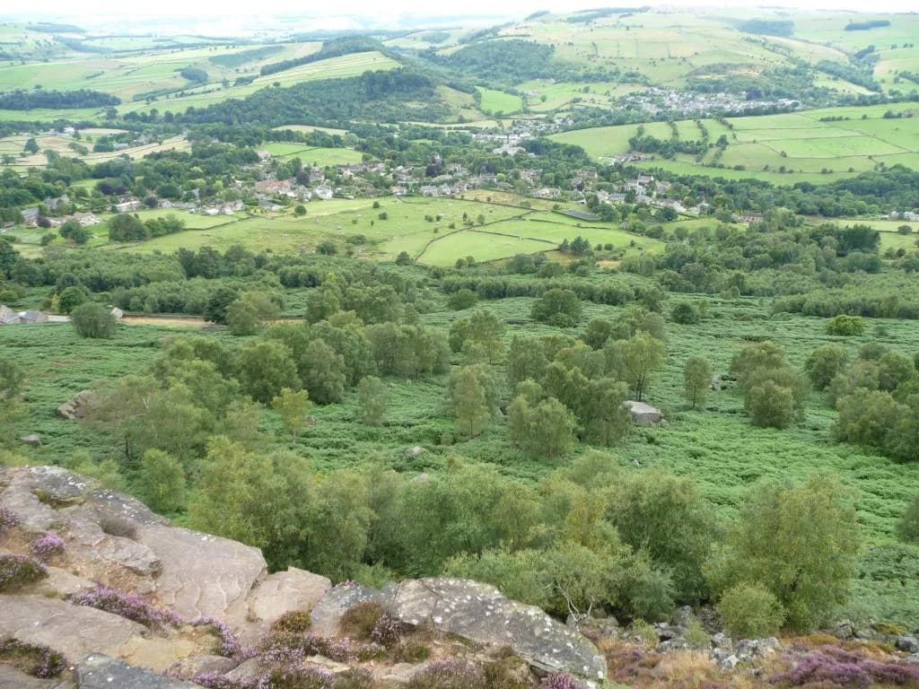
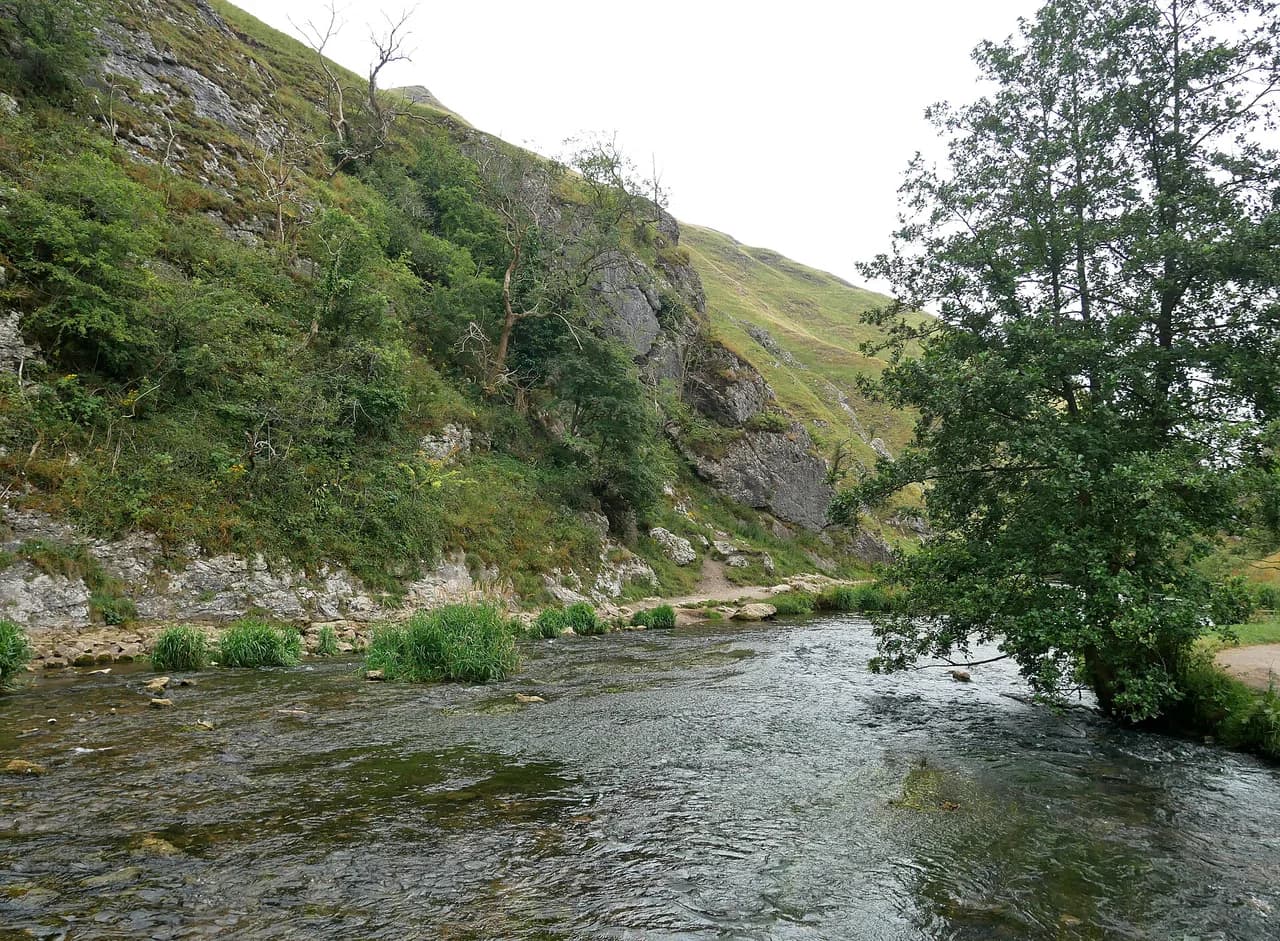
Expect a short, steep and genuinely rough climb rather than a flat valley stroll, and plan around one climb instead of a day of sustained ascent. In return you get a limestone gorge, castle views, and a descent with Mam Tor and the Great Ridge laid out in front of you.
Cave Dale route description
Start at the Castleton Visitor Centre and walk up toward the Bull's Head, then turn down the road beside the Castle and George pubs to the war memorial. Turn left, climb past the houses, and pick up the signed path into Cave Dale between buildings. The gate at the bottom marks the start of the Limestone Way, a long-distance route that begins here, so the first section is a proper trail rather than a village lane.
The dale narrows immediately, with Peveril Castle on your right and better views of it the higher you go. Keep to the rocky path with the boundary wall on your right until you pass through a gate and reach a footpath sign where the climb levels out. That sign is the marker for the return leg, so don't overshoot it.
From the sign, double back on the wide grassy track heading uphill almost parallel to the lower path, going through a wide gap in the stone wall. The faint track gradually descends toward Castleton; a short detour right gives views down into the dale from above. As you near the trees, follow the track through its switchbacks, then turn right on the lower path and walk through a gate onto a small road. Follow the stream past the Blue John Workshop, cross the road, and you are back at the car park.
Cave Dale terrain and exposure
The floor of the dale is rough limestone and awkward in places, so hiking footwear matters more here than on the grassy sections. Cave Dale also funnels wind, and it can feel distinctly colder inside the gully than in the village, so carry a layer even on a mild morning.
Above the dale the ground falls away steeply on all sides and turns slippery when wet. Stay on the village side of the fence on the western rim; the view down to the dale and the castle keep is good enough from the path without stepping past it.
Mam Tor walk via Winnats Pass: distance and time
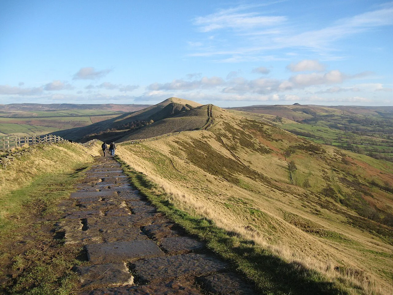
The Mam Tor loop climbs out of Castleton through Winnats Pass, crosses the summit and returns down the ridge to Hollins Cross and the village in roughly three hours. Treat that timing as a walking estimate rather than a promise: the road section up the pass and the climb to the summit both add time on a windy day.
This is the walk to choose if you want one big summit view over Hope Valley and Edale rather than a gorge. It is longer and more exposed than Cave Dale, and a good part of the outward leg shares a road corridor. If you enjoy ridge traverses like this, the Yorkshire Dales hiking guide covers similar terrain on another classic northern circuit.
Mam Tor route description
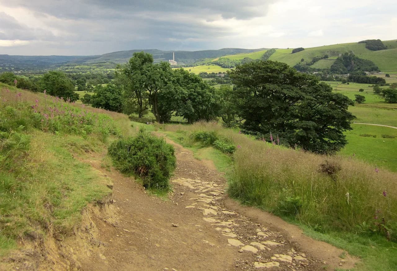
Leave the market square on the narrow lane toward Peak Cavern, cross Peakshole Water and continue straight up Goosehill instead of turning left to the cavern. Where the tarmac ends, follow the wall-side path above the fields to the road below Speedwell Cavern. Follow that road up through Winnats Pass, keeping on the wide verge rather than in the carriageway; the verge narrows near the top, where you take the stile on the right and pass behind Winnats Head Farm.
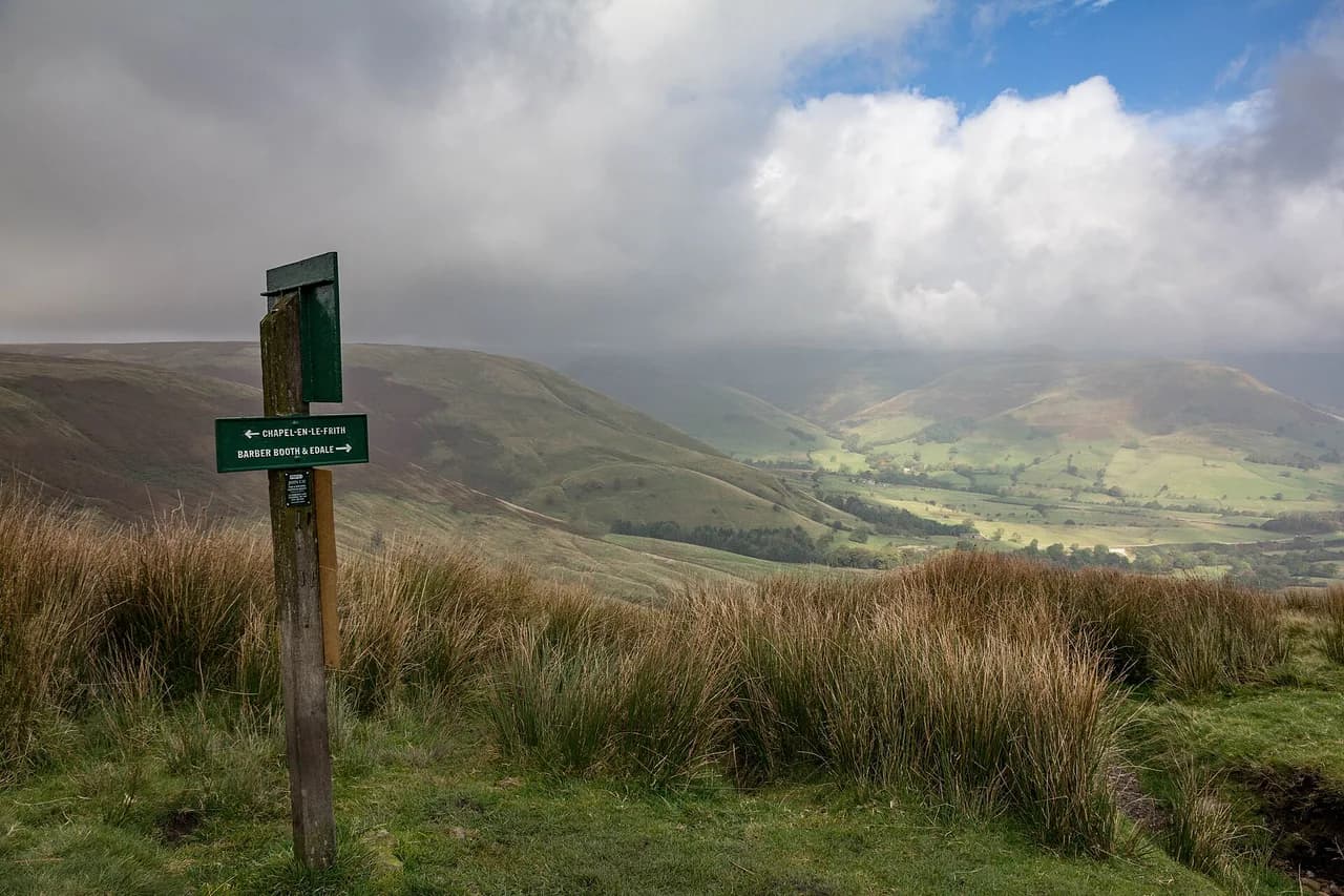
Cross the B6061 at the top of the pass, continue in the same direction to a footpath, and follow it right before crossing the A625. Climb straight uphill to the minor road below Mam Nick, go a few yards up it, then through the stile onto the paved path to the summit. From the top, traverse Mam Tor along the ridge to Hollins Cross, where the Edale-to-Castleton path crosses; turn right and descend by the old sunken path to the road back into the village.
Plan the climb for a settled day. The ridge is exposed to wind and cloud, afternoon storms build quickly over the Kinder Scout side of the valley, and the summit can be in mist while the village is in sun. Carry a shell and a paper map rather than relying on a phone screen on the tops.
Winnats Pass walk: the shorter gorge circuit
If you want the gorge without the full summit day, the Winnats Pass circuit covers about 2.8 miles (4.5 km) with 229 m (751 ft) of ascent in 1.5 to 2 hours. Start along the road to Speedwell Cavern, climb the steep road and track above the pass for the valley views, then return through fields to the village. The gradient and slippery sections make it a moderate outing rather than an easy one.
Walking the road itself is the main trade-off: it can be busy, and the verge is your protection rather than a pavement. Early starts and evenings are quieter, and the light on the limestone buttresses is better then too.
Getting to Castleton by train and bus
Hope is the nearest station, about 2 miles (3 km) east of the village on the Hope Valley line. The 271 and 272 buses connect the main road outside the station with Castleton in about eight minutes. They run roughly once an hour, so check the timetable before committing to a train connection, because a missed bus means a three-kilometre walk along the valley road.
Coming by car, the visitor centre car park on Cross Street is the obvious target; the Peak Cavern car park a little further down the road is the overflow. Arriving early at weekends is the practical fix when the village is busy.
Parking in Castleton
Charges at the visitor centre car park are listed by tariff band, from 1–2 hours at £2.50 up to 4–10 hours at £6.00, with payment by card, coins or the PaybyPhone app. Treat published figures as the listed charges rather than a guarantee of what the machine will ask for on the day, and have the app set up before you lose signal.
The Peak Cavern car park down the road has an all-day rate and a lower evening rate, with a refund for cavern customers. There is also a small amount of free lay-by parking on the main road on weekdays, with charges applying at weekends and bank holidays. If you are walking Cave Dale, the visitor centre puts you closest to the start.
When to go
Castleton and nearby Edale are extremely popular, so midweek or evening visits give you a quieter Cave Dale and a better chance of a parking space. Weekend visitors should arrive early. The village pubs and cafes make an evening circuit through Cave Dale an appealing option in summer, when the light lasts long enough to climb the dale comfortably.
Season matters more on the ridge than in the dale. Snow and ice linger on the Mam Tor path and the descent to Hollins Cross, and the paved summit path can be slick after rain. Cave Dale drains quickly but the rocky floor stays greasy in wet weather.
Kit, footwear and water
Good hiking footwear is essential for Cave Dale's rocky floor, and the same boots handle the Winnats Pass road gradient and the ridge descent. A paper OL1 map and compass back up whatever app you navigate with, and a windproof layer earns its place in the dale even in summer.
Carry at least a litre of water per hour of walking for the Mam Tor circuit and refill in the village before you set out. There are public toilets next to the visitor centre, listed as open from 10am to 5pm, so time your start accordingly.
Pubs, cafes and village facilities
The Bull's Head and the Castle both sit near the car park with outdoor seating, and the village has shops, cafes and restaurants for after your walk. The George and the Castle mark the turn toward the war memorial and the Cave Dale path, so the pubs double as route landmarks.
Stock up on snacks in the village before setting off; the Cave Dale circuit and the Winnats Pass circuit have no refreshments en route. Save the pub lunch for the return rather than planning around it mid-route.
Walks from Castleton beyond these three
Other Castleton circuits add the Great Ridge and Lose Hill for a longer day, and the Cave Dale route links naturally with Mam Tor for a five-mile version if you want both the gorge and the summit. The village also works as a base for the limestone country further east, where the Monsal Trail and the Chee Dale and Blackwell Mill sections offer gentler rail-trail walking.
Further afield but still within the national park, Bamford Edge and Stanage Edge give gritstone views for a change of geology, and the Ladybower Reservoir paths suit a flatter day. Treat these as separate outings reached by car or bus from Castleton rather than additions to the three village circuits.
Plan Your Visit
For a first visit, walk Cave Dale in the morning while the village is quiet, then spend the afternoon on the Winnats Pass circuit if your legs still have climbing in them. Save the Mam Tor summit and ridge for a full day with a settled forecast, and keep the car parked once you have found a space.
Book accommodation in Castleton or Hope early for summer weekends, confirm the 271/272 bus times for your arrival day, and carry a paper map alongside your phone. Everything else here comes down to footwear, layers and starting before the car parks fill.
Frequently Asked Questions
How long is the Cave Dale walk from Castleton?
The circuit is 2 miles (3.3 km) with 205 m (672 ft) of ascent, and most walkers take between 1.5 and 2.5 hours. The climb through the dale is short but rocky, so allow extra time if anyone in the group is new to rough ground.
What is the easiest walk from Castleton?
Cave Dale is the shortest of the three village circuits and the easiest to fit into a half day, though it still climbs steeply over rough limestone. The Winnats Pass circuit is a middle step up, and the Mam Tor route is the longest and most exposed.
Can you walk from Castleton to Mam Tor?
Yes. One village route climbs through Winnats Pass and Goosehill to Mam Nick before following the paved path to the summit, then returns along the ridge to Hollins Cross and down to the village in about three hours. A five-mile version also links Cave Dale with Mam Tor.
Where do you park for Castleton walks?
The visitor centre car park on Cross Street puts you closest to the Cave Dale start, with the Peak Cavern car park as overflow further down the road. Both charge by tariff band, with card, coin and app payment at the visitor centre site.
Is there a bus or train to Castleton?
Hope station is about 2 miles (3 km) east of the village, and the 271 and 272 buses run from the main road outside the station into Castleton in roughly eight minutes. They are hourly, so match your arrival train to a service before setting out.
Are Castleton walks dog-friendly?
Footpaths around Castleton are open access for walkers with dogs, but livestock graze the fields on the upper tracks and the ridge. Keep dogs under close control, particularly on the Cave Dale rim and the descent from Hollins Cross.
How hard is the Winnats Pass walk?
It is a moderate outing of about 2.8 miles (4.5 km) with 229 m (751 ft) of ascent in 1.5 to 2 hours. The road section is steep and can be slippery, and the verge narrows near the top of the pass, so it is not a flat valley stroll.
Which Castleton walk is best for families?
Cave Dale works best for families who can manage a short rocky climb, because it is under two miles and has castle views and a grassy return leg. The Winnats Pass road section and the exposed Mam Tor ridge suit older children with more hill experience.
Sources
Trail notes for your next trip
Optional updates when we add or revise hiking guides.
You might also like
Continue reading
More guides you'll find useful