Dovedale Walk: Stepping Stones, Thorpe Cloud and Milldale Route
Plan the Dovedale walk from the National Trust car park past the stepping stones to Milldale, with the steep Thorpe Cloud climb, timings and parking details.
On this page
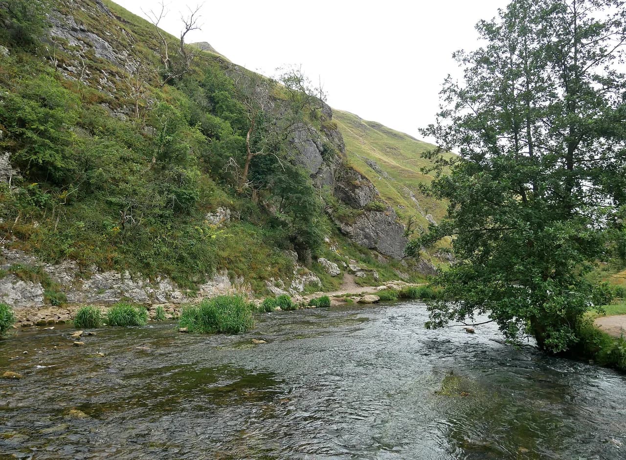
Dovedale is the Peak District at its most theatrical: a shallow limestone gorge where the River Dove slips between ash woods, rock spires and natural arches. It suits anyone who wants a big-landscape walk without a big day out — families can reach the stepping stones in twenty minutes, while fitter hikers can push the full length of the dale to Milldale and climb Thorpe Cloud on the way back. The trade-off is popularity, so the timing of your arrival matters as much as your route choice.
Where the Dovedale walk starts and how to reach the trailhead
The valley runs for just over 3 miles (5 km) between Milldale in the north and a wooded ravine near Thorpe Cloud and Bunster Hill in the south, so you can walk it in either direction. Most people start at the National Trust's Dovedale car park near Thorpe, where a short walk over a wooden bridge brings you to the River Dove and the first view of Thorpe Cloud. If you are building a wider trip around the White Peak, this walk fits naturally into a Peak District National Park itinerary alongside the bigger ridge days.
Milldale works as an alternative start if you want to walk down the dale to the stepping stones, and it also links into Wolfscote Dale and Beresford Dale for a longer circuit. Arriving by car is the norm here; the lanes around Thorpe and Ilam are narrow and the National Trust asks drivers to use designated spaces only, keeping roads and verges clear for farm tenants, residents and emergency services. There is no need to book a space.
Dovedale car park: prices, opening hours and the morning rush
Parking at Dovedale costs £5 for up to 4 hours and £7 for all day, and the machines are cash-only because there is no reliable signal in the dale, so bring the right change. National Trust members park free with a membership card to scan or show. Dovedale car park opens at 9am and closes at 7:30pm, while the nearby Ilam Park car park opens at 8:30am and stays open until dusk; neither allows overnight parking.
Spaces become very limited by 9am on weekends, bank holidays and school holidays, which means the early slot is effectively gone before the car park has even settled into its day. Have a fallback plan ready — starting from Ilam is the obvious alternative — and never queue on the narrow lanes or park on grass verges. Prices and hours are set by the National Trust and can change, so check the listing before you travel.
Route description: car park to the stepping stones
From the car park, cross the wooden bridge and follow the west bank of the River Dove beneath Bunster Hill. The famous stepping stones sit half a mile from the car park, and the flat out-and-back to them and back takes about 20 minutes over a mile — the shortest and most family-friendly version of the walk. Watch your footing on the stones themselves; they are polished by traffic and the river runs between them.
Once across the stones, a double squeezer stile leads to rock steps climbing to Lover's Leap, the first real viewpoint over the lower dale. From this high point you can pick out the Twelve Apostles, a row of limestone pinnacles rising from the ash woods on the opposite side. The wooded cover has thickened since grazing was withdrawn from the dale, which is why winter and early spring give the clearest views of the rock formations.
Lover's Leap, Reynard's Cave and the middle of the dale
Steps drop from Lover's Leap past the yew-clad needles of Tissington Spires, and a few minutes further on Reynard's Cave appears high on the right. The arch is the remnant of an old cavern exposed as the Dove cut down through the limestone, and the cave behind it, Reynard's Kitchen, produced a hoard of late Iron Age and Roman coins found in 2014. The scramble up to the arch is steep, slippery and eroded, so treat it as an optional detour rather than part of the main path.
Beyond the cave the dale narrows into The Straits, where the footpath runs on raised wooden duckboards above the river — a section that floods when the Dove is high. The path passes directly beneath Lion's Head Rock before the valley opens slightly at a footbridge facing Ilam Rock, a 25 m (82 ft) leaning finger of reef limestone with rock climbs on its sides. Opposite, Pickering Tor has a gaping cave at its foot.
Dove Holes, Raven's Tor and Milldale
Past Ilam Rock the path swings east opposite Hall Dale to pass the water-worn cavities of Dove Holes, then follows a series of weirs beneath the vertical cliff of Raven's Tor. A gentler meadow stretch rich in lime-loving flowers such as rockrose and thyme leads into Milldale, entered over the narrow packhorse bridge known as Viator's Bridge. The little barn near the bridge serves as a National Trust information point for the Dovedale estate.
Return options: riverside path or the high-level loop
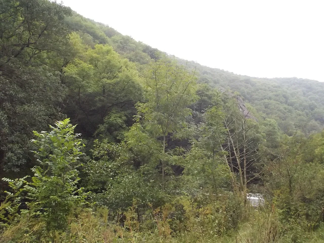
From Milldale you have a genuine choice. Retracing the riverside path gives you the dale from the opposite direction, with the rock features seen from new angles, and totals 6 miles (about 9.7 km). The high-level alternative climbs out of Milldale on a narrow lane, crosses fields and stiles to Hall Dale, and follows Ilam Moor Lane before contouring around the slopes of Bunster Hill above Ilam; this loop totals 6.5 miles (about 10.5 km) and finishes back at the Dovedale car park.
Take the high route if you want open views across the lower Manifold Valley and a quieter second half; take the riverside return if the weather is closing in or legs are tired, since it keeps you low and close to the water. Either way, allow 4 to 5 hours for the full dale. If you enjoy this kind of short valley walk, our guide to hiking in Yorkshire Dales covers similar limestone-dale routes at every level.
Distance, ascent and time
Three distances cover most plans. The stepping-stones out-and-back is 1 mile (1.6 km) and about 20 minutes; the full dale with a riverside return is 6 miles (9.7 km); the high-level loop over Ilam Tops and Bunster Hill is 6.5 miles (10.5 km), with 4 to 5 hours given for the full walk.
No official figure is published for total ascent on the full dale walk, so judge it by the shape of the route: the riverside path is close to flat apart from the short climb to Lover's Leap, while the high-level return adds the climb out of Milldale and the contouring around Bunster Hill. Budget more time than the distance suggests if you plan to detour to Reynard's Cave or linger at Ilam Rock.
The Thorpe Cloud climb
Thorpe Cloud is the isolated limestone reef knoll guarding the southern entrance to the dale, with a summit at 287 m (942 ft). The circular route from Dovedale car park, combining the summit with the stepping stones, is 1.5 miles (2.4 km). The climb is short but steep, and the descent turns slippery in wet weather — good walking boots make a real difference here.
Do it as a standalone outing if you are short on time, or tack it onto the full dale walk at the start or finish. The reward is a panoramic view over the Staffordshire and Derbyshire countryside and a clear read of the gorge's layout before you commit to the riverside path.
When to go: seasons, crowds and conditions underfoot
Winter and early spring give the best views of the rock scenery, because the ash woods that now clothe the dale obscure many of the pinnacles and arches in full leaf. Spring also brings the lime-loving flora of the meadow stretches into flower. Summer weekends are the busiest, and the car park fills by 9am on weekends, bank holidays and school holidays, so an early start or an Ilam start is the practical answer.
The riverside path can be muddy after rain, and The Straits floods when the Dove is running high — the raised duckboards exist for exactly that reason. After heavy rain, expect to turn back at the duckboards rather than push through standing water. Snow is rare on the valley floor but can linger on Thorpe Cloud and the high-level return above Ilam.
Rules on the route: dogs, BBQs and wild camping
Dovedale is a National Nature Reserve, and dogs must be on leads at all times to protect the wildlife. BBQs, campfires and outdoor cooking equipment of any kind are not allowed anywhere in the Peak District National Park. Wild camping is only allowed with landowner permission, and there is no wild camping on National Park Authority or National Trust land, so book a campsite if you want to stay overnight.
Take all litter home, including dog mess and tissues, as bins are not provided across the dale. Stay on the footpaths to avoid disturbing ground-nesting birds and delicate wildflowers. These rules apply across the reserve, not just at the honey-pot spots.
What to wear and how to handle the slippery sections
Good walking boots are the single most useful piece of kit. The two places that catch people out are the descent from Thorpe Cloud, which turns slick in wet weather, and the eroded scramble up to Reynard's Cave. Take both slowly, use your hands on the cave scramble, and turn back if the rock is greasy.
The riverside path is generally easy underfoot but muddy after rain, and the stepping stones demand a moment's care even in dry conditions. A light waterproof layer and a change of socks cover most days in the dale.
Facilities on the route
There are public toilets at Dovedale with a 20p charge, so bring change. Light refreshments are available near the car park, which is useful for a pre-walk coffee or a post-walk snack. There are no shops or cafes along the riverside path itself, so carry water and food for the full dale walk.
Plan Your Visit
Dovedale rewards a bit of planning more than most short walks: choose your distance by fitness and time, arrive early or start from Ilam to beat the car park crunch, and carry cash for parking and toilets. The 1-mile stepping-stones stroll, the 6.5-mile full-dale loop and the steep 1.5-mile Thorpe Cloud circuit each deliver a different day out from the same trailhead.
If you want more White Peak days after this one, the Monsal Trail offers a gentler rail-trail alternative, while the Great Ridge and Mam Tor give you bigger climbs and views. Both make good companions to a Dovedale walk in a longer Peak District trip.
Frequently Asked Questions
How long does it take to walk Dovedale?
The short out-and-back to the stepping stones takes about 20 minutes over 1 mile. The full dale walk to Milldale and back along the river is 6 miles and takes 4 to 5 hours, or 6.5 miles if you return by the high-level loop over Ilam Tops and Bunster Hill.
How far are the Dovedale stepping stones from the car park?
The stepping stones are half a mile from the Dovedale car park, reached by crossing the wooden bridge and following the west bank of the River Dove. The round trip is about a mile and 20 minutes on flat, clear path.
How long does it take to climb Thorpe Cloud?
The circular route from Dovedale car park that takes in Thorpe Cloud and the stepping stones is 1.5 miles. The climb is short but steep and the descent is slippery in wet weather, so allow extra time and wear boots.
Where is the best place to park for Dovedale?
The National Trust Dovedale car park is closest to the stepping stones, but it fills by 9am on weekends, bank holidays and school holidays. Ilam Park car park is a good alternative, opening at 8:30am and staying open until dusk.
What time does Dovedale car park open?
Dovedale car park opens at 9am and closes at 7:30pm. Ilam Park car park opens at 8:30am and stays open until dusk. Neither allows overnight parking.
Can you walk from Milldale to Dovedale?
Yes — Milldale is at the northern end of the dale and the riverside path runs the full 3 miles down to the stepping stones near Thorpe Cloud. Starting at Milldale gives you the dale in the quieter direction and links into Wolfscote Dale and Beresford Dale for a longer circuit.
Sources
Trail notes for your next trip
Optional updates when we add or revise hiking guides.
You might also like
Continue reading
More guides you'll find useful