Mam Tor Walk: Great Ridge Routes, Parking and Distance
Plan the Mam Tor walk in the Peak District: short summit path from Mam Nick, the Broken Road loop, Castleton ridge routes, distances, ascent and winter ice.
On this page
Mam Tor is the Peak District's most economical big view: a 517 m (1,696 ft) summit with a flagstone path up from the car park and a sinuous green ridge running east toward Lose Hill. Any hiker who can climb the 550 m of steady stone steps from Mam Nick can stand on the trig point within half an hour of leaving the car, while fitter walkers can stretch the same hill into a four-hour traverse over Back Tor and Lose Hill.
The choice comes down to three realistic formats: the short summit path from Mam Nick car park, the 4.2 km (2.6 mile) Broken Road loop around the hill, and the full ridge walk from Castleton. They differ in effort, parking and how much of the Great Ridge you actually see, so pick your format before you book a bed.
What the Mam Tor walk offers and who each route suits
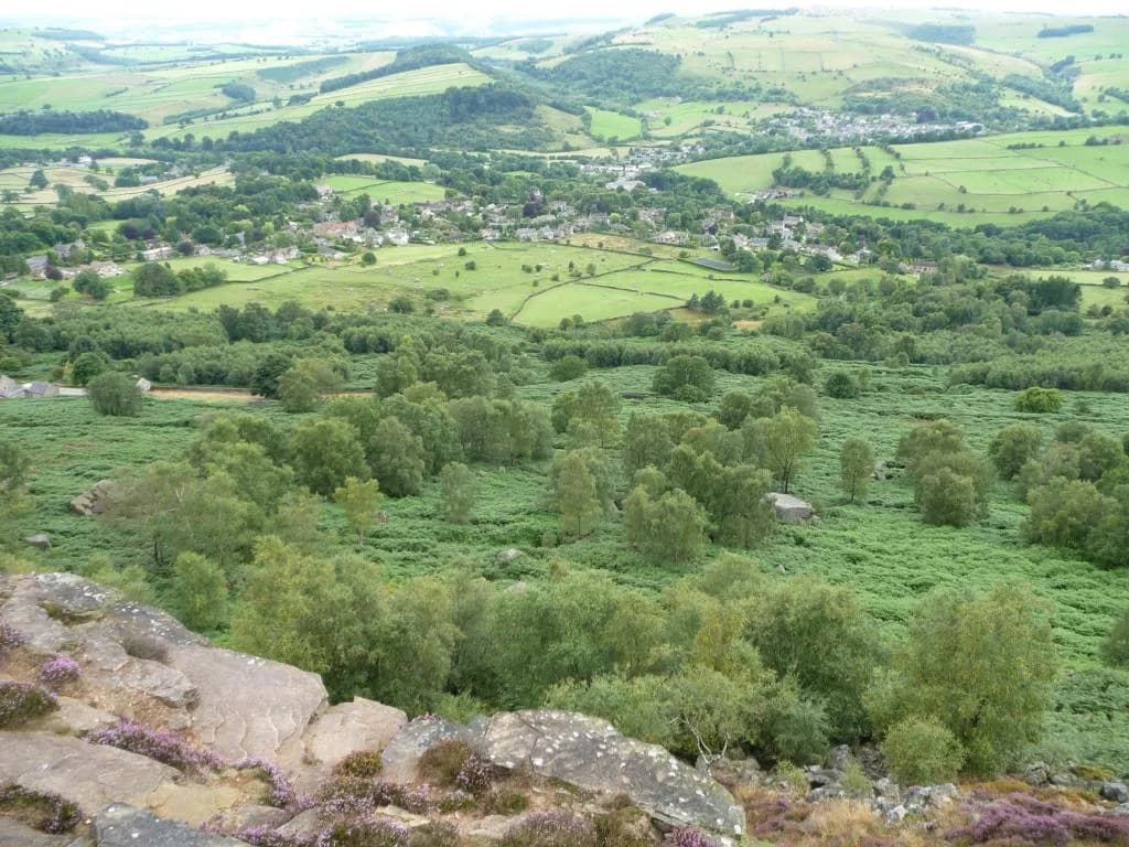
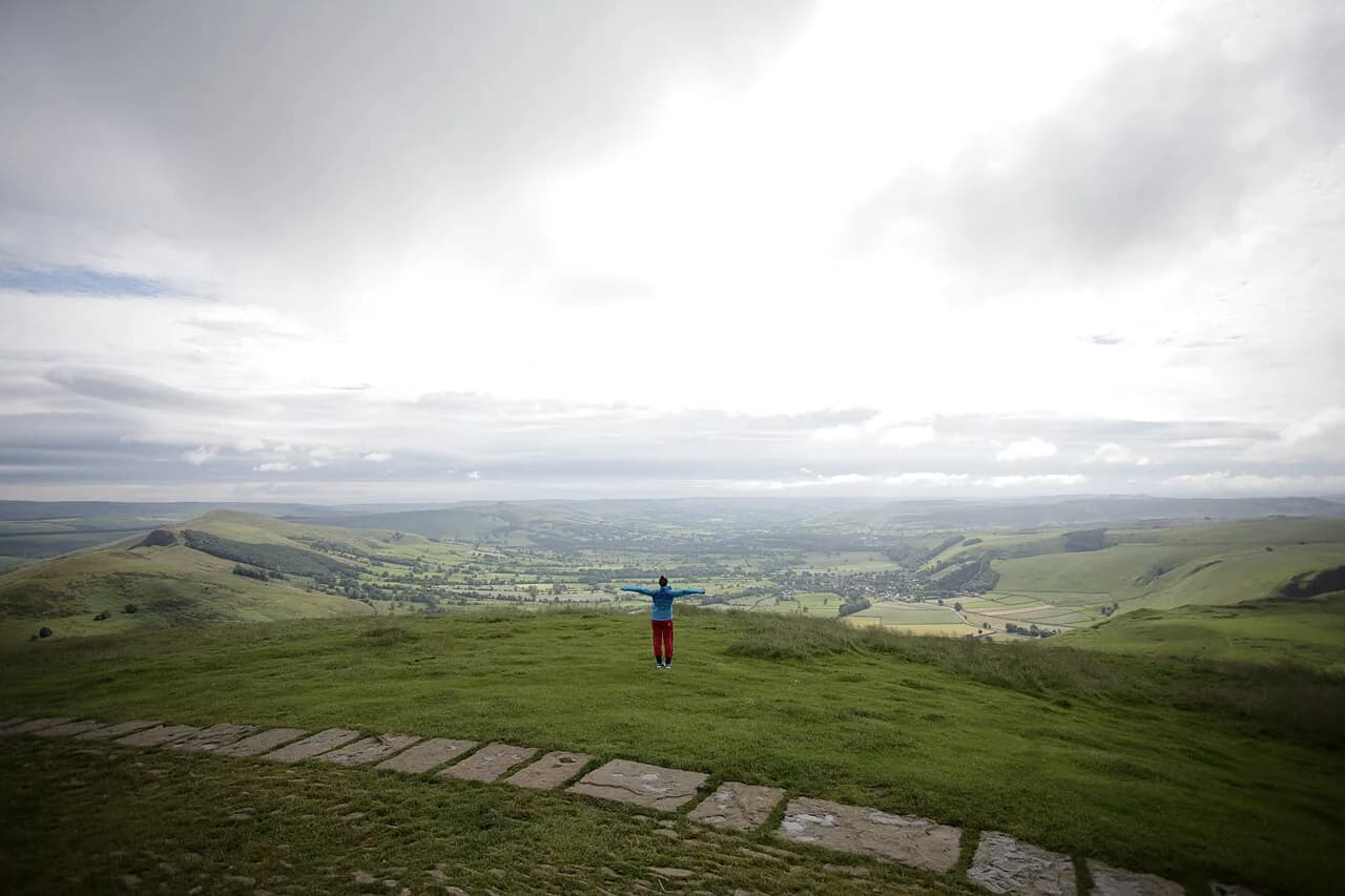
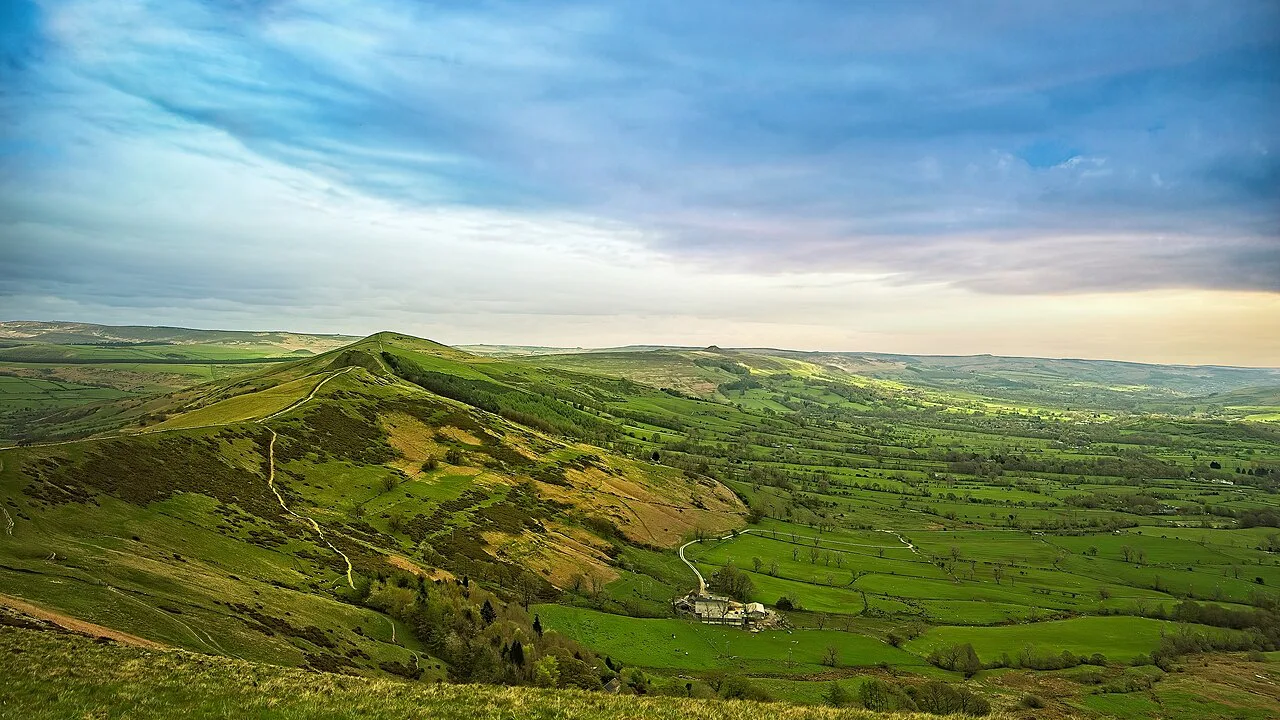
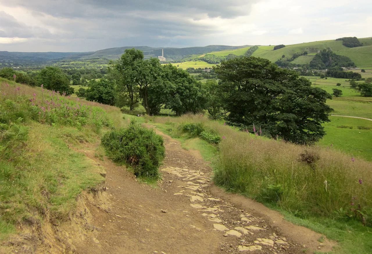
The summit is famous for the view rather than the climbing: Edale and the Hope Valley spread below, Kinder Scout's dark plateau closes the northern horizon, and the Great Ridge rolls east over Hollins Cross and Back Tor. The walk is exposed for most of its length, so the panorama comes with wind and fast weather changes; a shell jacket earns its place even on a bright morning.
Beginners, families with younger children and anyone short on time should treat Mam Nick as the base and walk up and back. Stronger walkers who want a proper half day should do the Castleton circuit that climbs via the caverns and returns over Back Tor and Lose Hill. Those exploring the wider national park by car can pair the ridge with another valley walk the following day; the broader Peak District hiking guide sets out the other classic routes.
Photographers and sunrise chasers get the best value from the short summit path, because the flagstones face east over the valley and the walk back down is quick. If you want the ridge silhouettes in your photographs rather than the view from them, plan your climb for late afternoon and descend before dusk.
Where Mam Tor is and how the Great Ridge is laid out
Mam Tor sits on the southern edge of the Dark Peak, immediately south of Edale and west of Castleton, the nearest village and the natural base for the ridge. The hill is the western anchor of the Great Ridge, a continuous crest that runs east through Hollins Cross, Back Tor and Lose Hill before dropping to the Hope Valley.
Think of the ridge as a line of four high points: Mam Tor's trig point, the low saddle at Hollins Cross where several paths converge, the short rocky pull onto Back Tor, then the final summit of Lose Hill Pike. Hollins Cross is the decision point of the whole walk; from there you can drop straight back to Castleton, continue east along the crest, or cut the day short.
Trailhead and parking: Mam Nick car park, Castleton car parks and roadside laybys
Mam Nick is the National Trust car park on the road between Castleton and Chapel-en-le-Frith, with the summit path leaving from the back of the car park. There are no toilets here, and the small refreshment van in the car park operates seasonally, so arrive self-sufficient. Payment is by phone, with a small charge that is free for National Trust members who scan their cards at the machine.
Castleton has the alternative trailheads: the main village car park by the visitor centre and the Peak Cavern all-day car park on Buxton Road, both of which put you on the walking route through the village rather than at the summit. The trade-off is simple: Mam Nick buys you the shortest ascent, while Castleton gives you a full ridge day and a village with pubs, cafés and shops at the finish.
Roadside laybys along the Castleton road are used by many walkers, and wardens ticket cars left on double yellow lines, so park only in marked bays. On sunny weekends and school holidays the summit car park fills early; a late-afternoon start is the quieter option.
By bus and on foot: reaching the start without a car
Walkers staying in Castleton can leave the car behind entirely, since the ridge route begins on the village's lanes and footpaths. Staying in Hope works the same way, with the riverside path linking the two villages and the ridge reachable from either.
If you are arriving by public transport, the nearest useful rail and bus connections serve the Hope Valley, and local services link the valley villages with Sheffield and Manchester. Timetables vary by season, so confirm the current service before committing to a return time; a missed last bus turns a day walk into an unplanned night out.
Distance, ascent and time for each route option
The direct summit path from Mam Nick covers 550 m (0.3 miles) to the trig point with a steep stone staircase, and most walkers take 20 to 30 minutes up and less down. The classic circular from the same car park runs 4.2 km (2.6 miles) with about 239 m (784 ft) of total ascent, through Hollins Cross and back along Broken Road, and families with young children should allow two and a half to three hours.
The visitor-sourced Castleton route is 6.5 miles (about 10.5 km) with an option to extend to 8 miles (about 13 km) by returning along the river through Hope. That format takes three to four hours of steady walking, more with stops at the caverns or on the summits.
A longer valley-to-ridge version starting from Hope reaches around 14.5 km (9 miles) and five to six hours, which suits fit walkers who want the full crossing rather than an out-and-back. Whichever distance you choose, the ascent is concentrated on the climb to the summit and the short pull onto Back Tor.
Short summit route from Mam Nick car park
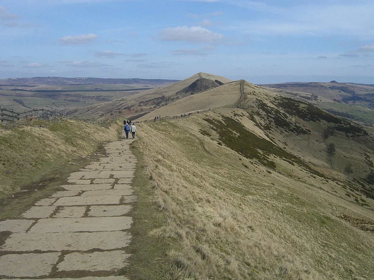
From the back of the Mam Nick car park, a flagstone staircase climbs steadily to the trig point, gaining height quickly and giving views over Castleton within minutes. The steps are the steepest sustained section of any Mam Tor route, and walkers with limited mobility or small children should set a slow pace and use the benches on the way.
At the summit, the trig point sits on a grassy plateau with room to spread out, and paragliders often launch from the slopes in summer. If the wind is strong on the top, drop a few metres down the eastern side and the ridge shelters you almost immediately.
Descend the way you came, or extend the descent along Broken Road back to the car park for a loop rather than a reversal. The short version is the right call for a half-day, an evening or a summit sunrise.
Classic circular from Mam Nick via Hollins Cross and Broken Road
This loop climbs to the trig point, follows the flagstones east to Hollins Cross, drops through woodland and returns along the old landslide-closed road beneath the summit. The road was abandoned after landslips in the 1970s and remains a broken, cracked surface, which makes it a strange and memorable finish.
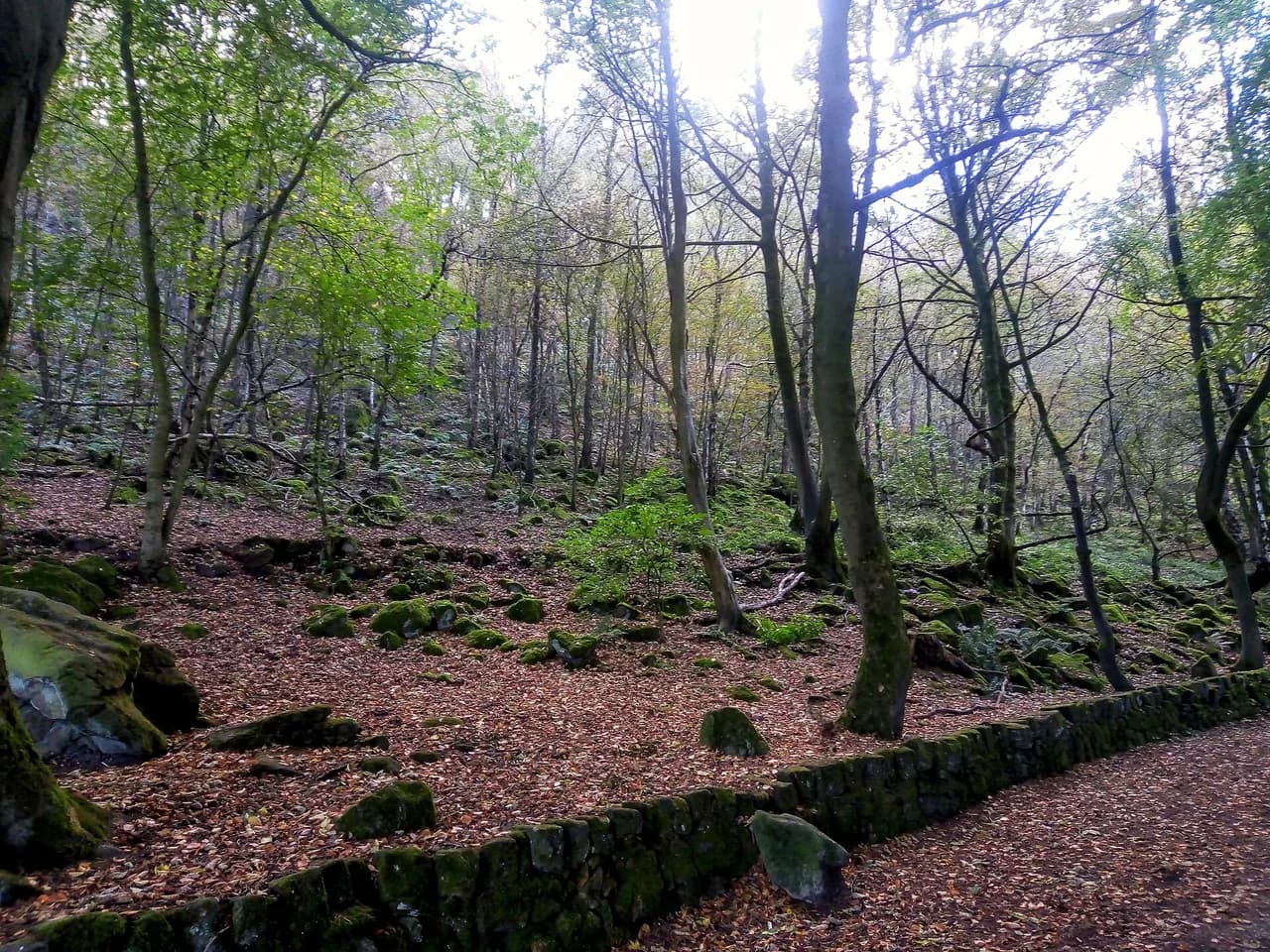
From the trig point, the ridge path reaches Hollins Cross after passing two wooden gates, and from there a right-hand turn drops you down toward the woods. The woodland path can be exceptionally muddy after rain, so boots beat trail shoes in winter, and the walk back up Broken Road past Blue John Cavern is a steady rather than steep climb.
The final approach passes the Blue John Cavern entrance, where a small outdoor café opens seasonally, before rejoining the car park by a footpath that keeps you off the busy road. Allow two and a half to three hours if you are walking with children.
Castleton to Mam Tor and the Great Ridge over Back Tor and Lose Hill
The long route starts in Castleton and climbs past both show caverns, Treak Cliff and Blue John, before joining the summit path above the road. From the summit it follows the crest east to Hollins Cross, scrambles briefly onto the craggy top of Back Tor, then continues to Lose Hill Pike with views back along the whole ridge.
From Lose Hill the descent drops to Spring House Farm, where the choice opens up: turn right for the shortest return to Castleton, or head left through fields to Hope and walk back along Peakshole Water. The riverside extension adds roughly 1.5 miles (about 2.5 km) and is the gentler finish.
Back Tor is the only section that needs hands, a short rocky step that most walkers manage without difficulty. In return you gain the finest view of the day across Edale toward Kinder Scout, so save some energy for it.
Route section by section: Castleton, caverns, Mam Tor, Hollins Cross, Back Tor, Lose Hill, Spring House Farm
Leaving Castleton, the route runs up the main road, turns by the Castle Inn and follows a narrow lane past the old youth hostel before crossing fields to the cavern road. Treasure the first stretch: it is the only part of the day on paved ground, and the show cavern car parks are useful landmarks to match against the map.
From the caverns, field paths and gates lead up to the road below Mam Tor, where the stepped path climbs to the summit. Then come the four ridge points in order, each separated by a short descent that you have to earn back: Hollins Cross, Back Tor, Lose Hill, and finally the drop to Spring House Farm.
Treat the ridge as a series of short climbs rather than one continuous ascent, and check the map at Hollins Cross, where several paths cross and it is easy to take the wrong arm. The return from Spring House Farm to Castleton is signposted, but the field crossings are numerous and a paper map with the route on it saves time.
Huts, cafés and facilities on the route
There are no mountain huts on the Great Ridge and no water taps on the tops, so carry everything you need and refill in Castleton before you start. Pubs and cafés in both Castleton and Hope provide the post-walk meal, and the Cheshire Cheese Inn is one of the village's best-known pubs.
On the ridge itself, facilities are limited to the seasonal coffee van at the National Trust car park and the seasonal café by Blue John Cavern. Both can be closed outside the main season, so plan your food and drink around Castleton rather than the summit.
When to go: best months, crowds, sunrise and sunset
Late spring through early autumn gives the best odds of clear views and dry flagstones, with long evenings for a sunset descent from the short summit path. Summer weekends and school holidays are the busiest, so start early or come late and treat the summit as a place to pass through rather than linger.
The ridge is fully exposed, and weather can turn from sunshine to hail and lightning within hours, so a forecast check the night before is worth more than any gear upgrade. If thunderstorms are forecast, save the ridge for another day; there is nowhere to hide on the crest.
Winter ice, flagstones and weather on the ridge
In winter the stone flagstones up to the summit and along the Great Ridge become exceptionally icy, and the steps turn treacherous underfoot. Crampons or microspikes, poles and an axe-free walking line are the sensible response; if you cannot arrest a slide, turn back at the first icy step.
Snow rarely lies deep for long, but wind on the ridge is the bigger winter problem, stripping warmth on the summits even on calm days in the valley. Pack a warm layer and a windproof shell and you can still enjoy the short summit path on a crisp January morning.
Dogs and livestock on the Great Ridge
Dogs are welcome on the ridge, and the flagstone paths are kind to paws. Keep dogs on a short lead from 1 March to 31 July to protect rare ground-nesting birds, and watch for livestock in the fields on the Castleton and Hope approaches.
The busy summit and the stepped sections are the tricky parts for dogs, and in icy conditions the flagstones are as slippery for them as for you. Carry water for them from Castleton, since there is no supply on the ridge.
What to take and map to carry
A day pack with water, food, a warm layer, a waterproof shell and a charged phone covers most Mam Tor days. Walking boots rather than trainers make the difference on the muddy woodland section and the loose sections of Broken Road.
Carry the Ordnance Survey Explorer OL 01 Dark Peak map, which covers the whole ridge, the caverns and the Castleton paths, even if you navigate by phone. If you want a flatter valley day between ridge walks, the railway path of the Monsal Trail is a straightforward alternative.
Where to base yourself: Castleton and Hope
Castleton is the best base: the ridge route starts on its doorstep, the caverns are within walking distance and there are pubs, cafés and shops for the evening. Its village car parks make it the natural overnight stop for anyone doing the full Great Ridge traverse.
Hope, a mile or so east, is quieter and cheaper for beds and gives you the riverside walk as a finish from Spring House Farm. Walkers without a car find the valley villages better connected than the summit car park, which has no room to stay and fills early on weekends.
Plan Your Mam Tor Day
Choose the short Mam Nick summit path for a quick hit, the 4.2 km Broken Road loop for a family half-day, or the Castleton traverse for the full Great Ridge experience. Each uses some of the same flagstones, so winter ice and summer crowds affect them all equally. If you enjoy linking summits along a crest, the Yorkshire Dales hikes offer a similar ridge-day format.
Book a bed in Castleton or Hope if you want the ridge on foot, park at Mam Nick only if you are heading straight up, and check the forecast before you commit to the tops.
Frequently Asked Questions
How long of a walk is Mam Tor?
The shortest option is about 550 m from Mam Nick car park to the trig point, a 20 to 30 minute climb. A popular circular from the same car park covers 4.2 km with roughly 239 m of ascent and takes two and a half to three hours with young children. The full Castleton route runs around 10.5 km, or 13 km with the riverside extension.
Is Mam Tor a difficult walk?
The summit path is short but steep, with a sustained stone staircase that most hikers manage with stops. The ridge routes are moderate in effort but exposed, with a short rocky step onto Back Tor and repeated climbs between Hollins Cross, Back Tor and Lose Hill. Winter ice on the flagstones raises the difficulty considerably.
Is there an easy walk to Mam Tor?
The easiest approach is the stone path from the back of the Mam Nick car park, which reaches the summit in 550 m. Coming from Castleton involves a longer climb past both caverns before you reach the stepped summit path, so it suits walkers after a half day rather than a quick outing.
Where is the best place to park for the Mam Tor circular walk?
The National Trust car park at Mam Nick puts you directly on both the short summit path and the Broken Road loop, but it has no toilets and fills early at weekends. Parking in Castleton instead gives you village facilities and the ridge route on foot, at the cost of a longer climb at the start.
How long does it take to walk from Castleton to Mam Tor and back?
The circular from Castleton, over Mam Tor, Hollins Cross, Back Tor and Lose Hill with a return via Spring House Farm, is around 10.5 km and takes three to four hours of walking. Extending the return along the river through Hope adds distance and roughly an hour.
Can you walk Mam Tor with dogs?
Dogs are welcome, but they must be kept on a short lead from 1 March to 31 July to protect ground-nesting birds, and livestock grazes the fields below the ridge. Carry water from Castleton, as there is no supply on the tops, and take care on icy flagstones in winter.
Sources
Trail notes for your next trip
Optional updates when we add or revise hiking guides.
You might also like
Continue reading
More guides you'll find useful