E4 Crete: Hiking Trail Guide West to East Across Crete
The E4 trail crosses Crete from Kastelli-Kissamos to Kato Zakros in about three weeks, with a choice of coastal and mountain routes along the way.
On this page
The E4 on Crete is one of the great island traverses in Europe: a waymarked long-distance path that strings together the island's gorges, its White Mountains, high plateau country and a long run of south-coast villages. It suits experienced trekkers with three weeks to spare, and it also rewards walkers who only want a handful of stages as day hikes from Paleochora, Sougia, Loutro or Agia Roumeli. The route is hard rather than technical, and its character changes completely depending on which of the two forks you take.
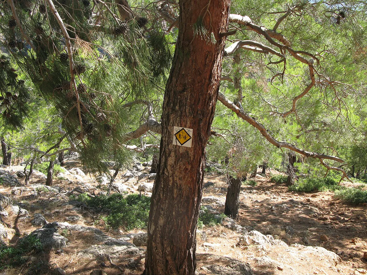
The path forms part of the wider European E4 network that crosses the continent, and within Greece it is the Hellenic Federation of Mountaineering and Climbing that looks after it. On Crete it is marked with yellow paint and yellow-and-black arrows, though not with equal generosity everywhere. Some stretches are newly and clearly painted; others are faint, overgrown and best followed with a GPS track alongside the map.
The Route at a Glance: Length, Direction and Duration
The Cretan E4 runs about 500 km (311 miles) from Kastelli-Kissamos in the far west to Kato Zakros on the eastern coast, taking in the island's most interesting walking country. A full crossing takes roughly three weeks at a steady pace, so plan on a little more if you want rest days in the villages or a weather buffer in the mountains. Other recordings of the route come in longer, at about 560 km (348 miles), because the two main forks and the many variants add distance.
Walk it from west to east. Starting at Kissamos puts the clearer marking and the more established southern-village stages under your boots first, and leaves the road-heavy eastern sections until your feet are hardened to Cretan stone. The alternative, starting at Kato Zakros, front-loads highway miles and puts you on markers that were laid out for walkers coming the other way.
The Two Forks: Coastal or Mountain at Sougia and Frangokastello
At Sougia the trail splits, and this is the decision that shapes your whole crossing. The coastal line stays low along the Libyan Sea through Agia Roumeli, Loutro and past Sweetwater beach; the alpine line climbs into the Lefka Ori by way of Agia Irini and the Kallergi and Katsivelli refuges before dropping to Askifou and Frangokastello. The two branches meet again on the south coast near Frangokastello, where they immediately part company a second time.
Choose the coastal branch if you want village beds, tavernas and sea views, and accept that the going is rough in places and cut by the odd road stretch. Choose the alpine branch if you want high, empty country, shepherd huts and refuge nights, and accept that you must carry food and manage water. Both are hard walking; the coastal one is rougher underfoot than its low altitude suggests.
Section 1: Kissamos to Sougia
The first section hugs the western coast and makes a gentle introduction to the trail. Kissamos to Sfinari is 22 km (about 14 miles) with 6 hours of walking, Sfinari to Chrisokalitissa 31 km (19 miles) and 8 hours, Chrisokalitissa to Paleochora 14.5 km (9 miles) and 4.5 hours, and Paleochora to Sougia a further 15 km (9 miles) and 6 hours. Paleochora is the obvious place to break the section in two, with beds, shops and buses.
Treat these times as walking estimates rather than schedules, since the figures for each stage vary between route descriptions. Paleochora and Sougia both work as bases if you would rather do this corner as day walks than as the opening of a three-week trek.
Section 2: The Coastal Line from Sougia to Frangokastello
The coastal branch is the connoisseur's choice for landscape and the harder one for footing. Sougia to Agia Roumeli is 20 km (12 miles) and around 10 hours, Agia Roumeli to Loutro 14 km (9 miles) and 5 hours, and Loutro to Frangokastello 19.5 km (12 miles) and 7 hours. The long first day is the one to respect, and splitting it by the coast path's rough ground is not straightforward.
Tucked between Sougia and Agia Roumeli is Sweetwater beach, an easy hour east of Loutro and a fine reason to slow the itinerary down. Loutro itself has no road access, so the village is reached on foot or by boat, which makes it a natural rest stop rather than a place to pass through.
Agia Roumeli sits at the seaward end of the Samaria Gorge, and walkers on the E4 arrive here just as day hikers pour out of the gorge in the afternoon. If you want the Samaria Gorge hike as a separate outing, base yourself in the village and take it as a there-and-back rather than folding it into the traverse.
Section 2, Alpine Option: Into the Lefka Ori via the Refuges
The mountain branch trades the sea for the White Mountains, and its stages are where the E4 feels most like real trekking. Sougia to Agia Irini is 13.5 km (8 miles) and 5 hours, Agia Irini to Kallergi Refuge 20.5 km (13 miles) and 5 hours, Kallergi to Katsivelli Refuge 18 km (11 miles) and 7.5 hours, Katsivelli to Askifou 20 km (12 miles) and 10 hours, and Askifou to Frangokastello 19 km (12 miles) and 6.5 hours. The Katsivelli to Askifou day is the longest and the one to start at first light.
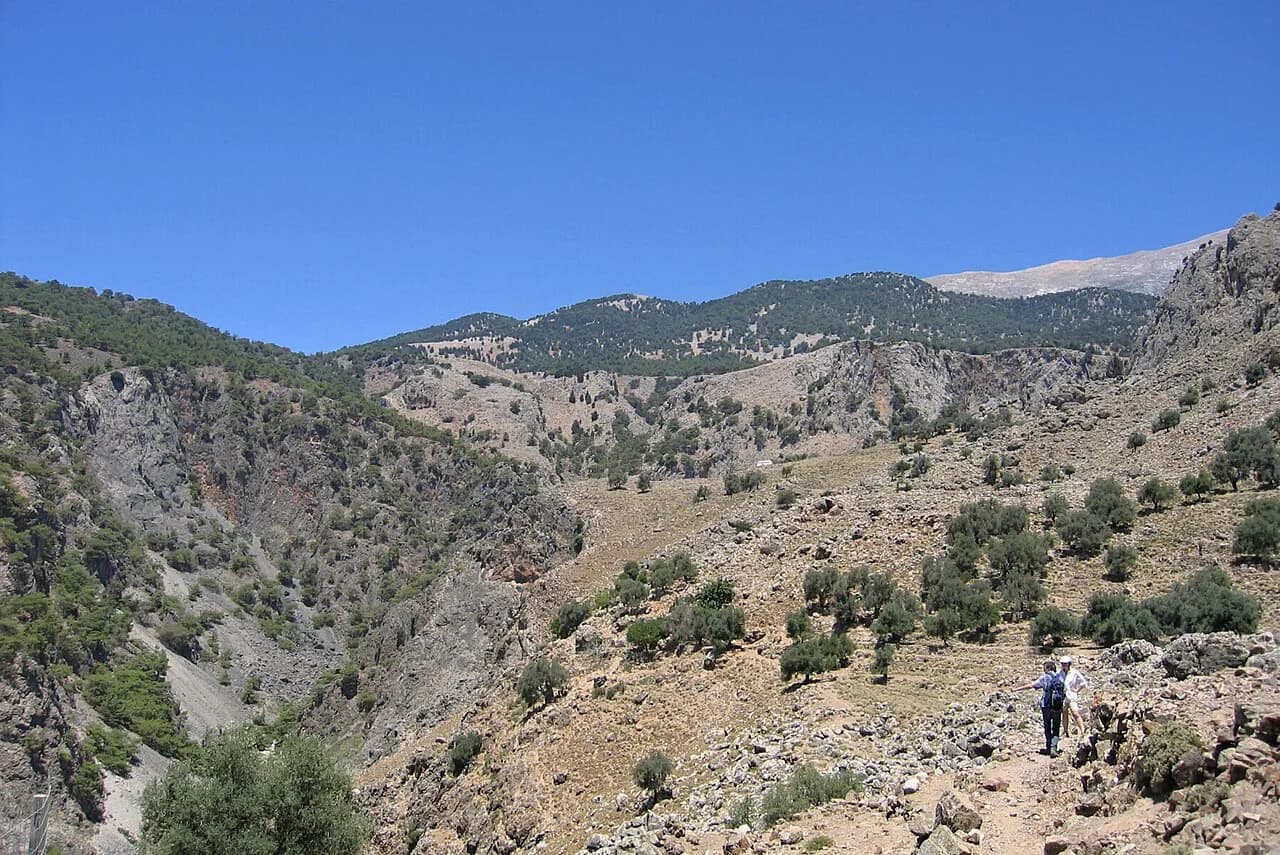
The country up here is desolate and open, with shepherd huts and high peaks as the main landmarks and water scarce in summer, so carry more than you think you need between refuges. The reward comes at the crests, where the ground falls away to views of both the Libyan and Mediterranean seas. Two refuges on this line, Kallergi and Katsivelli, are what make the branch walkable without a tent.
Descending off this high ground, the Agia Irini gorge offers a lower, greener way to reach Sougia and is a strong day hike if you are staying in the village. The Samaria gorge, further east, is the island's best-known canyon and demands its own day even for strong walkers. If you are weighing island gorges against each other, hiking in Corfu offers a greener, gentler contrast to Crete's stone canyons.
Section 3: Frangokastello to the Nida Plateau
This is where the trail forks again and where the route descriptions diverge most. The southern branch runs Frangokastello to Argyroupolis at 27 km (17 miles) and 9 hours, Argyroupolis to Agouliana at 23 km (14 miles) and 8 hours, Agouliana to Spili at 13.5 km (8 miles) and 4 hours, Spili to Gerakari at 18.5 km (12 miles) and 8 hours, Gerakari to Fourfouras at 15 km (9 miles) and 5 hours, Fourfouras to the Mount Prinos refuge at 10 km (6 miles) and 4 hours, and the refuge to the Nida plateau at 20 km (12 miles) and 6 hours.
The northern branch takes in more villages and history: Kato Rodakino at 14 km (9 miles), Agios Konstantinos at 20.5 km (13 miles), Armeni at 15 km (9 miles), Arkadi at 29 km (18 miles), Garazo at 32 km (20 miles), Anogia at 16 km (10 miles) and the Nida plateau at 22 km (14 miles). The Arkadi and Garazo days are the two big efforts, at 10 and 11 hours respectively, and suit walkers who like long days with beds and food at the end of them.
The southern line's Mount Prinos refuge puts you high on the massif below the Nida plateau, which is the natural gathering point before the eastern half of the island. Anogia, on the northern line, is the largest settlement on this stretch and a sensible place to restock and take a zero day.
Section 4: Nida Plateau to Kato Zakros
The eastern section is long, varied and often on tracks and minor roads, and the trail here is the least dramatic of the crossing. From the Nida plateau you can drop to Zaros through Kamares in 25 km (16 miles) and 7 hours, or through the Rouvas canyon in 19 km (12 miles) and 5.5 hours. Zaros to Ano Asites is 21.5 km (13 miles) and 9.5 hours, Ano Asites to Ano Archanes 9 km (6 miles) and 3 hours, and Ano Archanes to Kastelli 28.5 km (18 miles) and 10 hours.
East of there the stages string together Agios Georgios, Selakano, Prina, Vassiliki, Ghryssopigi, Ziros and finally Kato Zakros, at 16.5 km (10 miles) and 7 hours for the last day. Expect stone tracks between terraced fields, long ridge traverses and little shade. Kato Zakros finishes at the sea, next to the Minoan palace site, and the village has rooms and tavernas for the night after.
Gorges Worth Building a Stage Around
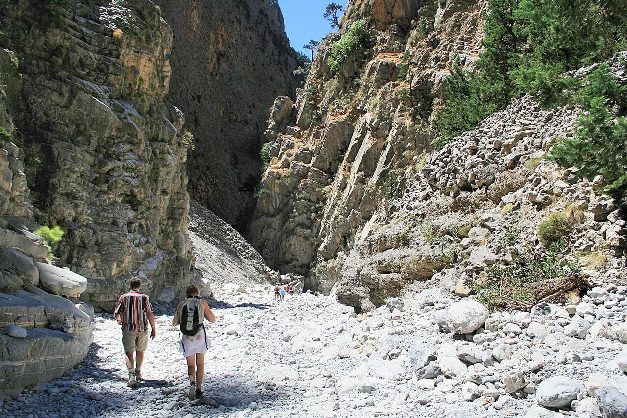
Crete's gorges are the memory you take home, and the E4 threads several of them. The Kalikratis and Tripiti gorges stand alongside Samaria for spectacle, though neither is cut as sheerly into the surrounding mountains, and both are far quieter. The Samaria is the famous one and needs a full day of its own.
The Samaria National Park is the island's flagship walk, dropping from the Omalos plateau to Agia Roumeli on the coast, and it is the one route where the gorge is the whole day. Because it ends at the sea, arranging your return before you set off matters as much as the walking itself.
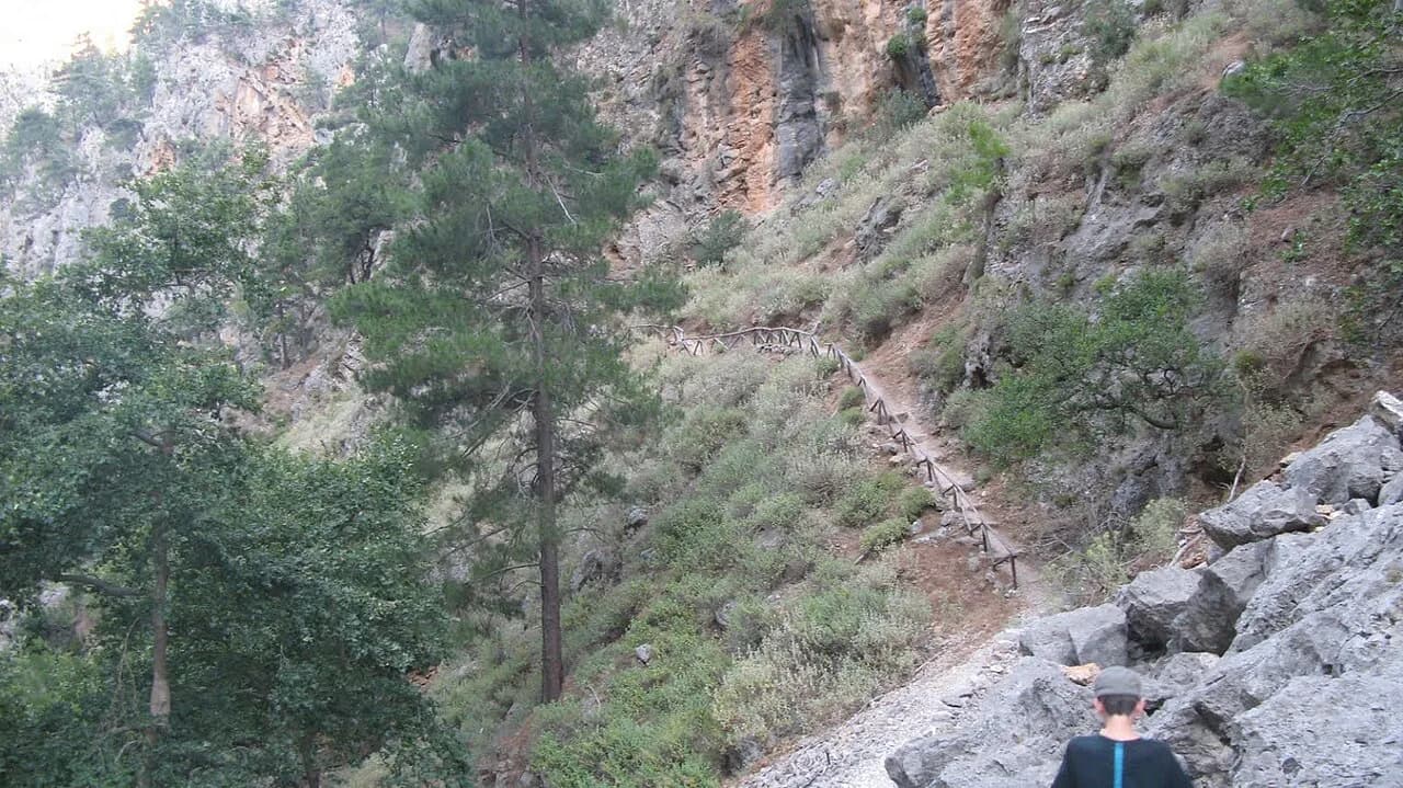
The Aradena gorge offers a steeper, more exposed alternative on the same stretch of coast, entered from the Aradena bridge high above the village of Aradena. For walkers with scrambling confidence and a head for heights, it is the most satisfying low-level route in the southwest. Check locally before committing, since loose ground and old via ferrata fittings have a habit of changing the character of the descent.
Huts, Villages and Water on the Route
Sleeping on the E4 splits into three kinds of night: village rooms on the western and eastern stages, mountain refuges on the alpine branch, and camping where you can arrange it. The Kallergi, Katsivelli and Mount Prinos refuges are the fixed points on the high ground, and they are the difference between a lightweight traverse and a tent-carrying one. Book each refuge directly well before you travel, and ask directly about opening dates for your season.
Free camping in Greece is technically illegal, and the reality on Crete is patchy: quiet corners of the southwest rarely cause a problem, while settled areas and the coast near villages are more sensitive. Treat camping as a fallback for the remote stretches rather than a plan for the whole island, and use village rooms when you can.
Water is the constraint that governs your days in the White Mountains and on the eastern tracks: springs and taps thin out badly in high summer, and the shepherds' huts are shelter rather than supply points. Carry a filter or treatment and top up at every village you pass through, because the gaps between reliable water are longer than the map suggests.
Marking, Maps and Navigation
Marking is yellow paint and yellow-and-black arrows, and its quality swings wildly. Recent years have brought a lot of new paint, but other stretches remain faint, overgrown and slow to follow, and signposts occasionally point only one way along the route. Budget time for route-finding errors on the first days of each section.
Carry the Anavasi walking maps, which cover the mountainous parts of the route rather than the whole island, and back them with a GPS track. The Cretan Way guidebook, published in English and Italian, follows the E4 largely from east to west with some alternative lines, and the German-language E4 guide from Conrad Stein Verlag offers GPS tracks with its described tours. Both are easier to buy before you fly than to find on the island.
When to Go
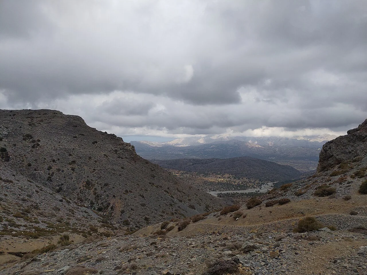
Spring and autumn are the windows that work. In mid-April the trails into the White Mountains were still under enough snow to make the path impractical without winter gear, so the high crossings are a late-spring proposition rather than an early one. Summer brings heat and water scarcity on the exposed eastern tracks, and afternoon storms build over the mountains through the warmer months; start early and be off the high ground by mid-afternoon.
If your only free weeks fall in high summer, use the coastal branch through the southwest villages and leave the alpine stages for another year. Guided options let you hand the logistics to someone else while still walking the same country, and crete walking holidays that focus on the southwest put you on the best of the coastal and gorge sections.
Getting to the Start and Back from the Finish
Kastelli-Kissamos is the western trailhead, reachable by bus from Chania on the north coast, and the town has rooms and shops for the night before you set off. Kato Zakros at the eastern end is a small coastal village, so build in a day to reach Sitia or Palekastro and pick up onward transport rather than expecting to walk off the trail and straight onto a long-distance bus.
Along the south coast, Loutro has no road and is served by boat, so any itinerary through it needs a sailing time that suits you, and Agia Roumeli and Sougia are likewise easiest to link by ferry or seasonal boat. Check current sailings for your dates, because they set the shape of a coastal itinerary more than the walking does.
Doing the E4 in Slices: The South-Coast Villages as Bases
You do not need three weeks to get the best of this trail. Paleochora, Sougia, Loutro, Agia Roumeli and Frangokastello are all good bases for three or more days of short hikes, and each sits within reach of a different gorge or coastal stretch. Using them turns the E4 into a series of day walks without the weight of a full pack.
Sougia and Paleochora make the obvious first base for the western coastal stages and the Agia Irini gorge. Loutro and Agia Roumeli are the pair for the central stretch, between them covering Sweetwater beach, the Samaria gorge and the Aradena descent.
The forks at Sougia and Frangokastello make natural loop routes for a shorter trip, giving you a mix of coast and mountain without committing to the east. Plan one loop from Sougia and one from Frangokastello if you have ten days, and you will have walked the best of the island's variety.
Planning Your E4 Crossing
Decide first whether you are walking the whole island or using the south coast as a base, because the two plans demand different kit, different fitness and different amounts of time. Three weeks suits the full traverse from Kissamos to Kato Zakros; ten days suits a pair of loops out of Sougia and Frangokastello with village beds each night.
Whichever you choose, take the alpine branch seriously, carry water for the dry stages and keep a GPS track alongside your map for the faint sections. Build the trip around spring or autumn rather than high summer, and the E4 will give you the island at its best.
Frequently Asked Questions
Where does the E4 start and finish on Crete?
The Cretan E4 runs from Kastelli-Kissamos in the west to Kato Zakros on the eastern coast, a distance of roughly 500 km (311 miles). Some recordings of the route come in longer, around 560 km (348 miles), because of the two main forks and the many variants along the way.
How long does it take to walk the E4 across Crete?
A full crossing takes about three weeks at a steady pace. Plan on a bit more if you want rest days in the villages or a buffer for weather in the White Mountains, and note that the alpine branch's stages include several days of 7 to 10 hours of walking.
Is the E4 in Crete hard?
It is hard rather than technical. The route mixes asphalt road walking with serious mountain trekking in the White Mountains and rough, rocky gorge paths, and parts of it are faint or overgrown. Experienced trekkers with good navigation skills will be comfortable; beginners should start with the shorter coastal stages.
Can you walk the E4 on Crete without camping?
Largely yes, using village rooms on the western and eastern stages and the Kallergi, Katsivelli and Mount Prinos refuges on the alpine branch. Loutro has no road access and is reached on foot or by boat, which shapes how you link the south-coast stages.
What is the best time of year for the E4 on Crete?
Spring and autumn work best. Trails into the White Mountains can still hold enough snow in mid-April to make the high crossings impractical without winter gear, and high summer brings heat, scarce water and afternoon storms over the mountains.
Which way should you walk the E4 on Crete, west to east or east to west?
Walk it from west to east, starting at Kissamos. The marking is easier to follow that way, the southern-village stages come first, and the long road stretches on the eastern half arrive when your feet are hardened to the terrain.
Do you need special gear for the E4 on Crete?
Bring a GPS track and the Anavasi walking maps, which cover the mountainous sections rather than the whole route. Add water treatment for the dry stretches, winter gear if you cross the White Mountains early in the season, and a head for heights for the gorge descents.
Can you hike short sections of the E4 instead of the whole route?
Yes. Paleochora, Sougia, Loutro, Agia Roumeli and Frangokastello all work as bases for three or more days of short hikes, and the forks at Sougia and Frangokastello make good loop routes for a trip of around ten days.
Sources
Trail notes for your next trip
Optional updates when we add or revise hiking guides.
You might also like
Continue reading
More guides you'll find useful