Hiking in Greece: Best Trails, Islands and Mountain Routes
Plan hiking in Greece with named gorge, mountain and island trails, route lengths and walking times, season notes and how to mix walks with island ferries.
On this page
Greece offers three quite different hiking holidays in one country: sea-cliff paths between island villages, deep limestone gorges cut into the mainland, and high mountains where you sleep in a refuge and scramble to a summit the next morning. The trails suit hikers who are happy to build a day around a boat, a bus or a one-way descent rather than a neat loop.
This guide groups the best-known routes by region so you can match a walk to the ferry or bus you are already taking, and it gives published length, difficulty and walking time side by side where those figures exist. Use it to shortlist two or three days, then read the detailed route notes before you commit.
How to choose a region
Crete is the mountain and gorge island, with the White Mountains in the west and the Samaria Gorge as its signature descent. Epirus and Zagori in the northwest hold the Vikos Gorge and the alpine lake above Mikro Papigo, while the Cyclades offer shorter island walks such as the Zas loop on Naxos and the ancient route across Santorini. The Peloponnese adds the Loussios Gorge on the Menalon Trail, and Mount Olympus in Macedonia is the one place on this list where a hike becomes a scramble to Greece's highest summit.
If you want a single base for a week, Crete gives you the widest spread of day routes; if you want to combine walking with island hopping, the Cyclades and Ionian islands work better because each walk is short enough to fit around a ferry. Deciding this first saves you from criss-crossing the Aegean on consecutive days.
Samaria Gorge, Crete: Xyloskalo to Agia Roumeli
The Samaria Gorge is a 14.6 km (9.1 mi) descent from Xyloskalo to Agia Roumeli, rated 1/5 for difficulty and taking about 6 hours at a steady pace. The path is well arranged and waymarked, but it is almost entirely downhill, which is hard on the knees over a full day, and the gorge widens and narrows between cliffs that rise to around 1,500 m (4,900 ft).
Agia Roumeli has no road access, so the day ends with a ferry along the south coast rather than a walk back to your car. That single fact decides your plan: leave a car at the Xyloskalo end only if you are returning for it, and build the boat into your afternoon instead of counting on walking out. Carry more water than you think you need, because the descent is hot and exposed through the middle of the day.
Sfakia to Agia Roumeli on the E4
The E4 coastal stage from Sfakia to Agia Roumeli runs 20.8 km (12.9 mi) and is rated 1/5 for technical difficulty, but it takes around 9 hours, so the challenge is length rather than scrambling. The path reaches Loutro early, then crosses easier ground to Marmara, a sheltered spot with swimming and a place to stay overnight if you want to split the walk.
Beyond Marmara the route overlooks the coast toward Agios Pavlos before dropping to the shoreline and on to Agia Roumeli, which has the shops and rooms you will want at the end. Daily ferries run back to Sfakia, so a one-way walk is practical. The exposed coastal stretches have little shade, so start early and treat the afternoon as the deadline rather than the goal.
Vikos Gorge and the Loussios Gorge
The Vikos Gorge is 12.5 km (7.8 mi), rated 2/5, and takes about 6 hours, usually walked from Monodendri down to Vikos or Mikro Papigo. The ravine is friendly at both ends and darker in the middle, below walls that climb toward a thousand metres, and although the route is well trodden you will step into water in two or three narrow places. The overall trend is downhill, but the finish includes a solid uphill pull, so save energy for the last hour.
In Arcadia, the Loussios Gorge on the Menalon Trail covers 12.8 km (8 mi), rated 1/5, in about 5 hours, with rich waymarking, rest places, and fountains at the Prodromos and Philosophy convents. Bridges, monasteries and villages sit among cliffs above the river, which makes it the most rewarding single day in the Peloponnese if you only have one. Both gorges are walkable without a guide, but the Vikos route rewards an early start because the middle section holds the shade.
Papigo to Lake Drakolimni and the Astraka refuge
From Mikro Papigo, the trail to Lake Drakolimni climbs 8.5 km (5.3 mi) past the Towers and the Astraka refuge to the largest of Greece's alpine lakes, sitting at around 2,000 m (6,560 ft) between the peaks of Tymfi. It is rated 1/5 for technical difficulty and takes about 4.5 hours, with the final rise to the lake gentler than the climb to the refuge.
The Astraka refuge is the natural overnight stop and serves food, which turns the walk into a two-day outing and puts you at the lake in the morning before the cloud builds. This is a popular route, so do not expect solitude on the main path. Above the refuge the ground is rocky and the weather changes quickly; a map, a warm layer and an early start matter more here than on the island walks.
Naxos: Filoti to Zas summit loop
The loop from Filoti via the Cave of Zas, the summit of Zas and the chapel of Agia Marina covers 9 km (5.6 mi), is rated 2/5 and takes around 4 hours. Zas is the highest point of the Cyclades, and the climb is mostly bare rock and sun, so the views open up quickly but so does the heat.
Because the route returns to Filoti, you can reach the start by bus or car and finish with a meal in the village rather than depending on a boat. That makes it the easiest full-day mountain walk to slot into a Cyclades ferry itinerary. Start at first light in summer and carry water for the whole loop, since the upper section has no reliable supply.
Santorini: Kamari to Perissa via ancient Thera
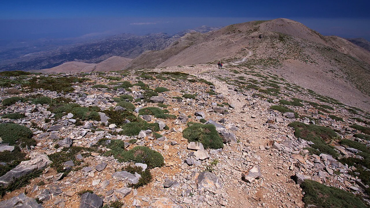
The crossing from Kamari to Perissa is only 3.2 km (2 mi), rated 1/5, and takes about 1.5 hours, but it packs in the chapel of Zoodochos Pigi, the pass at Selada and the archaeological site of ancient Thera. From Selada, the high point of the route, you can detour to the ruins before the smooth descent past the Panagia Katefiani chapel to Agia Irini at the edge of Perissa.
Treat it as a half-day walk with time at the site rather than a trek, and carry water because the route is largely shadeless volcanic ground. The two ends are both resorts with buses, so you can leave your accommodation at one and return from the other.
Ionian Islands: Kefalonia, Paxos and Meganisi
Behind Fiskardo on Kefalonia, the Cypress Trail runs 8 miles (roughly 13 km) with 887 ft (about 270 m) of ascent through a protected natural area, climbing past ruins out of town and returning along the road south of the village. It is the longest day on this Ionian list and the one that rewards an early coffee and a full morning.
On Paxos, a walk from Lakka leads to the lighthouse on the northwest shore, established in 1825, and although the tower itself is locked you can circle it and pick up paths to coastal viewpoints. On Meganisi, the climb from behind Porto Spiglia to the hill village of Spartachori ends at a square with a church, wide views north over the mainland and islands, and a small hotel for an overnight.
These are half-day to day walks with village starts rather than wilderness routes, and they fit neatly between ferry connections. Note that the Acheron River trails at Ammoudia lie on the mainland, outside the Ionian islands, if you are extending a sailing trip.
Long-distance routes: Corfu Trail, Andros Route, Menalon Trail and the E4
The Corfu Trail crosses the island south to north over 220 km (137.7 mi) through olive groves and unspoilt villages, with Mount Pantokrator at 906 m (2,972 ft) as its high point. Walking the whole route takes weeks, but the northern sections around the mountain make a satisfying short trip based in the quieter villages.
Andros has built a network of over 300 km (186 mi) of interconnecting paths including the long-distance Andros Route, and Crete's E4 path runs the length of the island and links the coastal stages described above. The Menalon Trail in Arcadia holds the Loussios Gorge as one of its stages. For a wider menu of multi-day European routes to compare against these, the best hikes in europe collection covers hut-to-hut options from the Alps to the Atlantic coast, and hikers weighing up a mountain-based week instead can turn to our guide to hiking in the Dolomites.
Getting to trailheads by bus, ferry and on foot
Gorge routes usually start high and finish low, which means your transport problem is at the far end: Agia Roumeli is reached by ferry, and the Samaria and Sfakia stages both rely on daily coastal boats. Check sailing times with the ferry operator before you set off, because the walk is only as long as the last boat allows.
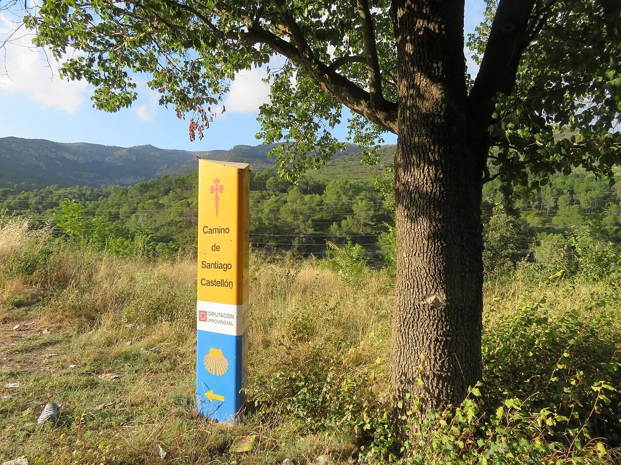
Island loops such as Filoti to Zas return to the same village, so a local bus or your own car solves the day. Kefalonia's Cypress Trail starts and finishes at Fiskardo, which makes it the simplest logistically of the Ionian walks. If you are building a longer trip, the camino de santiago shows how a fully waymarked long route handles daily transport and beds, which is a useful comparison when planning a Greek long-distance walk.
When to go
Spring and autumn are the walking seasons: April to May and mid-September to October bring warm days and cooler air for climbing, and the sea is still swimmable in early autumn. Summer is hot, busy and expensive, and winter brings reduced ferry and flight schedules that make island-hopping difficult even though the weather is mild.
High routes hold snow later than the coast suggests, and the White Mountains of Crete can stay white into late spring. Plan the Samaria and Sfakia stages for after the snow clears and the boats run, and save the island loops for the shoulder months when the rock is not radiating heat.
Where to sleep: mountain refuges and village guesthouses
On the Drakolimni route the Astraka refuge provides beds and meals and sits below the final climb to the lake, so you can split the walk and reach the water early. On the coast, Loutro and Marmara break the Sfakia to Agia Roumeli stage, and Agia Roumeli itself has rooms and tavernas for the night after the gorge.
Book refuges and village rooms through the local tourist office, and treat the booking as part of the route plan rather than an afterthought, because a full refuge changes your day. The Greek long-distance trails generally run through villages with guesthouses rather than a continuous chain of huts, so you have more flexibility on where you stop; check current prices and dates before you travel.
Hazards: exposure, loose rock and afternoon heat
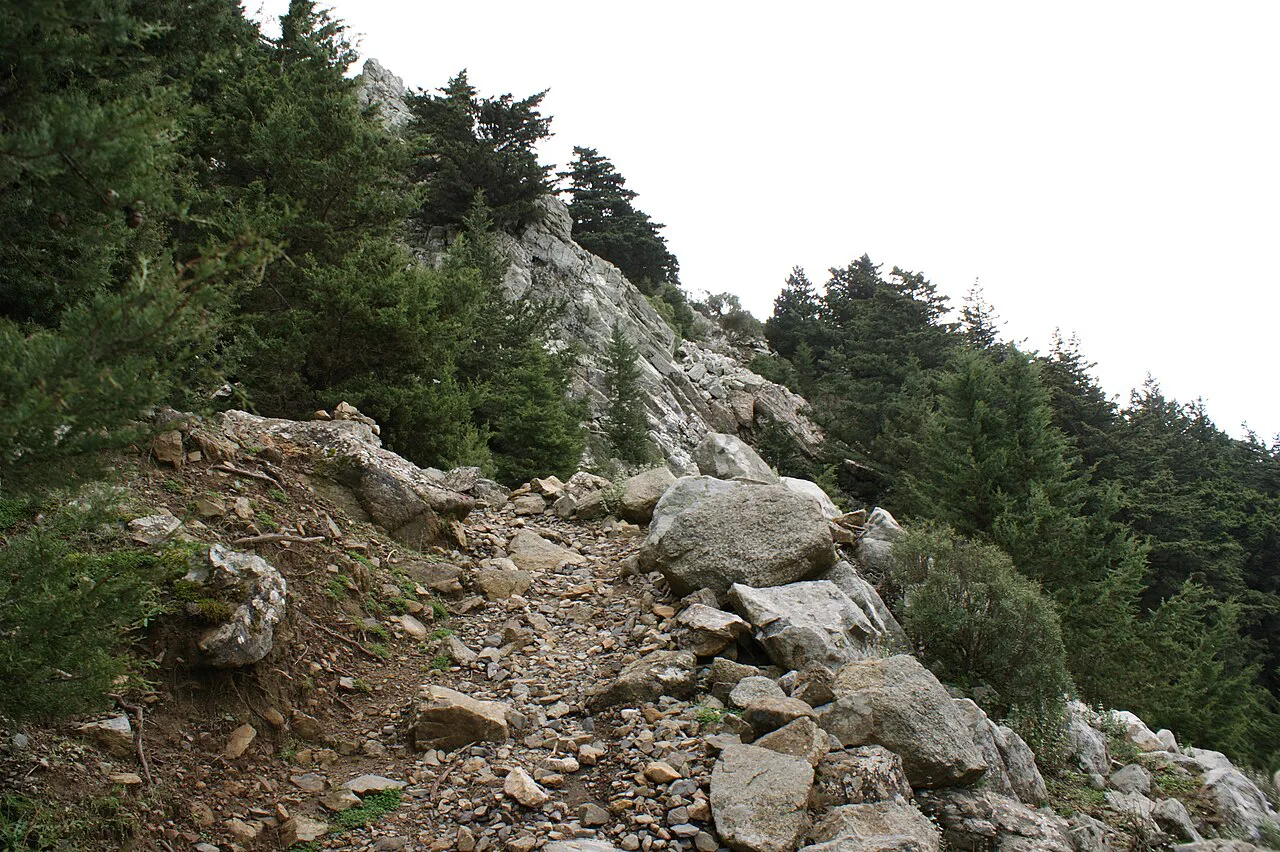
Most Greek trails are technically easy but physically demanding: long descents, shadeless limestone and sustained heat are the standard hazards on the island and gorge routes, and the response is an early start and generous water. Coastal paths can be cut off by tide or rockfall, so check the state of the path locally before committing to a through-walk.
The exception is Mount Olympus, where the 12.4 km (7.7 mi) route from Gortsia to Mytikas, rated 4/5 and taking around 7.5 hours, ends with a steep scramble up the Mytikas couloir between the summit towers. That corridor is closer to easy climbing than walking, and loose rock from other parties is a real concern, so many hikers climb it with a guide and descend by the gentler Kakoskala traverse.
Suggested one-week combinations by fitness and season
For a first trip with moderate fitness, base yourself in Chania and walk the Samaria Gorge one day, then take the coastal E4 stage from Sfakia to Agia Roumeli on another, using Loutro for a swim and a night. Fill the rest with short island walks such as Kamari to Perissa on Santorini, which suits tired legs at 1.5 hours.
Stronger hikers should head for Epirus and give a day to Vikos Gorge, a day to Papigo and the Astraka refuge with the lake beyond, and a spare day for the drive between trailheads. In spring and autumn both plans work; in high summer, shift to the shorter island routes and start before dawn.
Plan Your Visit
Pick one region, one long day and two short walks, then build transport around the finishes rather than the starts, since Greek gorge days end where the road does not reach. Cite the ferry operator and refuge for the dates that matter, and pack for heat and rock whatever the month.
Frequently Asked Questions
Which Greek island is best for hiking?
Crete gives the widest choice, with the Samaria Gorge and the long E4 coastal stages in the White Mountains. For shorter walks mixed with ferry hopping, Naxos has the Zas summit loop and Kefalonia has the Cypress Trail behind Fiskardo. Santorini's Kamari to Perissa route is the shortest and easiest option.
How long does the Samaria Gorge hike take?
The descent from Xyloskalo to Agia Roumeli covers 14.6 km and takes around 6 hours at a steady pace. It is rated technically easy, but the length and the downhill walking make it a full day, and you finish in a village reached by boat, so plan your afternoon around the ferry.
Do you need a guide for the Vikos Gorge?
No. The Vikos Gorge route is well trodden and waymarked, and the main challenge is the uphill finish and the few narrow places where you step into water. An early start is more useful than a guide, and sturdy footwear with grip matters on the wet sections.
When is the best time of year to hike in Greece?
April to May and mid-September to October give warm but manageable walking weather and keep ferries running. Summer is hot and crowded, while winter reduces ferry and flight schedules and leaves snow on the higher mountains. Spring and autumn suit both island paths and mountain routes.
How do you get back from Agia Roumeli after the Samaria Gorge?
Agia Roumeli has no road access, so the return is by coastal ferry, and daily services also link the village to Sfakia and the E4 stage along the coast. Check the sailing time with the ferry operator before you start the descent, because the walk is planned around that boat.
Sources
Trail notes for your next trip
Optional updates when we add or revise hiking guides.
You might also like
Continue reading
More guides you'll find useful