Kungsleden Trail Guide: Stages, Cabins and How to Plan
Plan the Kungsleden in Swedish Lapland: stages from Abisko to Hemavan, STF mountain cabins, distances, the alpine Abisko–Nikkaluokta section and when to go.
On this page
The Kungsleden, or King's Trail, is Sweden's signature long-distance route: a marked path of just over 450 km (280 mi) between Abisko in the north and Hemavan in the south, crossing four national parks and some of Lapland's wildest mountain country. It suits hikers who want big Arctic landscapes without technical climbing, and it can be walked as a short stage or a multi-week thru-hike.
Most people treat it as a trail of stages rather than a single expedition. The Abisko–Nikkaluokta leg is the most alpine and the most walked in all of Sweden, while the southern stretch through the Vindelfjällen reserve is quieter and emptier. Choosing between them is mostly a question of how much exposure and solitude you want.
This guide covers the section layout, the huts and stations that make lightweight hiking possible, the access chain by train, bus and boat, and the seasonal trade-offs between summer walking and winter skiing. If you are still comparing long routes across the continent, the best hikes in europe collection puts the Kungsleden alongside other multi-day trails.
What the Kungsleden is and how it is waymarked
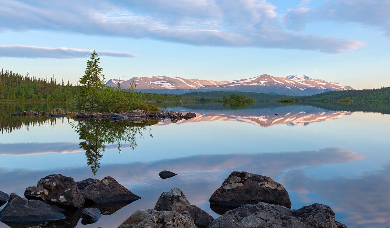
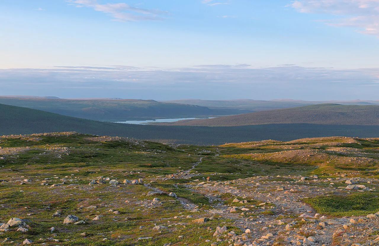
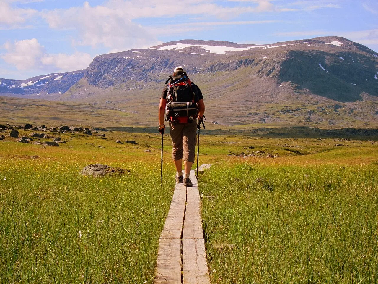
The trail was established by the Swedish Tourist Association (STF) in the early 20th century to link the finest scenery in the Swedish mountains, and it is waymarked with bridges over the difficult water crossings. It alternates between bare alpine terrain and mountain birch forest, passing lakes, dramatic peaks and small mountain villages.
The route runs through Abisko, Stora Sjöfallet (Stuor Muorke), Sarek and Pieljekaise national parks, and through the Vindelfjällen nature reserve, one of Europe's largest. For much of its length it crosses Sápmi, the land of the indigenous Sámi, and the grazing land of fifteen Sámi communities between Hemavan and Abisko.
Published lengths vary between roughly 430 km and 470 km (267–292 mi) depending on the source and how side links are counted, so plan by stages rather than by a single total. STF gives just over 450 km and names Abisko, Vakkotavare, Saltoluokta, Kvikkjokk, Ammarnäs and Hemavan as the common start and end points.
Reindeer herding is practised along the whole route, and calves are born in the mountains in late spring. Keep a distance from animals and herds, do not approach calves for photographs, and give working herders room.
Which section fits your time
Think of the Kungsleden as five linked stages: Abisko–Nikkaluokta, Nikkaluokta–Saltoluokta, Saltoluokta–Kvikkjokk, Kvikkjokk–Ammarnäs and Ammarnäs–Hemavan. STF spaces its huts 10–20 km (6–12 mi) apart along the northern and southern sections, which sets a natural daily rhythm for anyone walking hut to hut.
For a first visit with limited time, the Abisko–Nikkaluokta stage gives the biggest scenery per day and the easiest logistics, with five STF cabins on the trail and seven more nearby. It covers 105 km, usually over five to seven days.
The middle stretch between Kvikkjokk and Ammarnäs has no STF huts, only limited other accommodation, and the fewest hikers. It rewards self-sufficiency and navigation confidence rather than convenience, so treat it as a step up rather than a first section.
South of Ammarnäs the trail enters the Vindelfjällen reserve, where the cabin network thickens again and the days are gentler. This is the section for hikers who want wooded valleys, birdlife and space more than high passes.
The classic alpine stage: Abisko to Nikkaluokta
This is the most alpine part of the Kungsleden and the most travelled trail in Sweden, running from Abisko Turiststation through Abiskojaure, Alesjaure, Tjäktja, Sälka and Singi. At Singi you either continue south towards Vakkotavare or turn east towards Kebnekaise mountain station and out to Nikkaluokta, which adds the approach to Sweden's highest mountain.
The stage totals 105 km (65 mi) and is normally walked in five to seven days, with food available at Abisko, Abiskojaure, Alesjaure, Kebnekaise, Sälka, Vistas and Unna Allakas during the staffed season. Several of those cabins have saunas, which matters more than you expect after a wet day on the plateau.
The high point is Tjäktja Pass, reached just beyond the Tjäktja hut and roughly halfway between Abisko and Nikkaluokta. An emergency shelter sits at the pass, and the descent beyond it is the steepest section of the whole route, so save energy for it rather than sprinting the climb.
Treat the pass with respect in any season: wind here is frequent and strong, and it cuts the effective temperature far below the forecast. Start early when a windy day is forecast and be ready to wait a day at Tjäktja rather than push through the worst of it.
Abisko to Nikkaluokta day by day
Day one from Abisko to Abiskojaure is a warm-up of about 13 km (8 mi) with a gentle climb of around 100 m (330 ft), and it stays inside Abisko National Park. Camping in the park is restricted to designated sites, so tent users should plan this first night accordingly.
The second day, Abiskojaure to Alesjaure, is the hardest of the northern stage at roughly 20 km (12 mi) and 400 m (1,310 ft) of ascent. The third is shorter but ends with a steeper 300 m (985 ft) climb to the Tjäktja hut, which faces north and gives good odds of northern lights on a clear night.
From Tjäktja the route crosses the pass and drops to Sälka over about 13 km (8 mi), then continues to Singi over a short, easy 12 km (7 mi) with little climbing. Keep that short day in your plan: it doubles as a weather buffer if a storm pins you down earlier.
The last two days run from Singi over a pass and down a deep valley to Kebnekaise mountain station, then about 20 km (12 mi) out to Nikkaluokta. Kebnekaise is the natural place to recharge devices and dry out before the long exit.
Middle stages: Nikkaluokta, Saltoluokta and Kvikkjokk
From Nikkaluokta the route rejoins the main trail and continues towards Saltoluokta, 52 km (32 mi) of walking beyond Kebnekaise with a bus link at Vakkotavare. To reach STF Saltoluokta mountain station you take a bus to the pier at Kebnats and then a boat across the lake, so the station is not a roadside stop.
Saltoluokta to Kvikkjokk is the transition from alpine country into forest, and the station itself is the most comfortable resupply point on the middle route, with a restaurant and a view over lake Langas. Many hikers treat a night here as the reward for finishing the northern stages.
Beyond Kvikkjokk, the trail enters its remotest stretch towards Ammarnäs, where huts are scarce and services are limited to small private accommodation. This is where you carry more food, plan for longer days and accept that the trail is a route through working land rather than a serviced path.
Southern stages: Ammarnäs to Hemavan
The southern section runs through Vindelfjällen, one of Europe's largest nature reserves, from Ammarnäs south to Hemavan. Ammarnäs makes a good base: both the Kungsleden and the Vindelvaggeleden start from the village, and there are day loops for rest days.
The stretch between Ammarnäs and Jäckvik is among the least walked parts of the trail but one of the most varied, dropping off Björkfjället, crossing into Pieljekaise national park and passing through open mountain birch. The section around lake Tärnasjön was added when the trail was extended to Hemavan in the 1970s.
Birders should allow extra time in Vindelfjällen: the reserve hosts long-running research on breeding birds, and the lesser white-fronted goose passes through Ammarnäs on migration. Carry binoculars and keep to the trail where vegetation is fragile.
Getting to the start and back
Abisko Turiststation has its own stop on the northern railway line, and direct overnight trains from Stockholm Arlanda run to it, which makes the northern trailhead the simplest to reach with a heavy pack. Flying to Kiruna and continuing by bus and train also works, but adds transfers that are awkward with a sledge or a large rucksack.
From Nikkaluokta, buses run to Kiruna, and the same road is the standard exit for hikers coming off the Kebnekaise detour. For the middle route, plan the Vakkotavare bus and Kebnats boat as a single connection, because missing the boat leaves you on the wrong shore.
The southern trailhead at Hemavan and the village of Ammarnäs are both served by regional road transport, and Saltoluokta can be reached by car and boat for a short visit. Check timetables with the transport operator before you commit to a finish date, since bus frequencies along these roads are low.
Huts, mountain stations and booking
STF operates 16 mountain huts along the Kungsleden between Abisko and Hemavan, spaced 10–20 km (6–12 mi) apart, plus staffed mountain stations at Abisko, Kebnekaise and Saltoluokta. Huts are simple: shared rooms, cooking facilities and water carried from a source that may be up to a kilometre away.
In summer there are cabin hosts at most cabins, food for sale at the staffed ones, and the chance to walk with a lighter pack than a full self-catering trip requires. Winter is different: the huts open on published dates rather than all season, and the Swedish Tourist Association (STF) posts the current dates and per-night rates on its booking pages.
Booking ahead matters most at Kebnekaise and Abisko, and equipment rental such as sledges for winter trips should be reserved months in advance. Membership of STF brings discounts on accommodation and on some train tickets, which is worth pricing before you commit to a long hut chain.
Camping and public access inside the parks
Sweden's public access right allows tenting on open ground, but the Kungsleden passes through national parks where camping is limited to designated sites. In Abisko National Park, tent users must stay at the marked spots near Abiskojaure, and the park authority publishes the current rules.
If you camp beside a staffed hut, you can usually pay to use its kitchen, sauna and water even without a bed. That hybrid approach keeps pack weight down on the northern stage without committing to a full hut-to-hut booking.
When to go
The summer season runs from June to mid or late September, and this is when cabin hosts are in place and food is sold along the northern stages. Early summer brings long daylight and residual snow on the higher passes; September brings autumn colour, cooler nights and the first real storms.
Late March to early April is the pick of the winter window: days are long enough for a full stage, temperatures are less severe than in February, and there is still a chance of northern lights. Daylight lengthens quickly through April, which reduces aurora hours even as travel gets easier.
Whichever season you choose, plan around weather rather than forcing a schedule. On the exposed sections, wind and snow can turn a straightforward day into a long one, so keep one spare day in any itinerary longer than three nights.
Winter on the Kungsleden: skis or snowshoes
Winter shortens the route because the lakes freeze and the trail runs across them, but the extra kit makes the days slower. Local hikers almost all use skis, which are faster on the flat lake sections and let you enjoy the gentle downhills; snowshoes only make sense for steep ground, which the Kungsleden largely lacks.
Expect temperatures well below freezing, with strong winds that make the windchill the real hazard rather than the thermometer reading. Most of the trail lies outside avalanche terrain, but fresh snow and wind loading change that, so ask at the huts for local conditions before committing to a pass.
Not every hut has a sauna or reliable power, so carry power banks and a spare battery for navigation. Kebnekaise mountain station is the first place on the northern route where you can recharge properly.
Fitness, pack weight and the lightweight option
The northern stage is not technically hard, but 105 km (65 mi) with a full pack over exposed plateau is a serious week. Train on consecutive long days with the load you intend to carry, and decide before you book whether you are walking hut to hut or carrying tent and food.
Buying food at staffed cabins removes several kilos from the pack and turns the Kungsleden into a genuinely light trip, at the cost of higher daily spending and less flexibility at the ends of the season. Self-catering is cheaper but demands a resupply plan built around the huts that actually sell supplies.
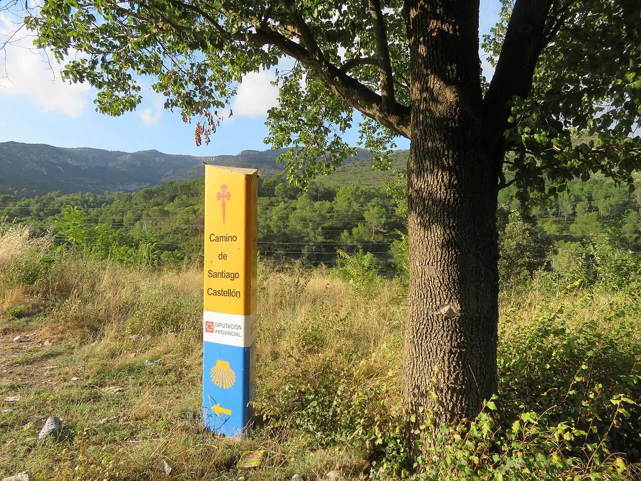
If you enjoy long trails but want warmer weather and more villages, compare the camino de santiago, which trades Arctic exposure for pilgrim infrastructure and daily services. For a colder but equally well-marked alternative with a strong hut network, see the Mont Blanc hiking guide.
Practical kit and communications
Carry a physical map and compass alongside a phone: the trail crosses long stretches without phone coverage, and STF describes its online map as a planning tool rather than a substitute for navigation. A waterproof shell, warm mid-layers and a hat that stays on in wind are minimum kit even in July.
Water comes from streams and lakes along the route, and huts may require a walk to a source, so carry a bottle you can fill quickly. Bug repellent earns its place in early summer, when mosquitoes are at their worst in the birch forest.
Is the Kungsleden worth it?
Yes, if you want Arctic scenery, a marked route and a hut network that lets you choose your own weight and comfort level. The Abisko–Nikkaluokta stage delivers the drama in under a week, and the southern stages offer solitude for hikers with more time and confidence.
It is less appealing if you want short days, guaranteed weather or frequent resupply. The trail rewards preparation: pick your section, book the stations and huts that matter, and build in one buffer day.
Plan Your Kungsleden Stage
Start by choosing a single section rather than the whole trail. Abisko to Nikkaluokta gives the classic experience in five to seven days, while Ammarnäs to Hemavan suits a quieter walk with a village at each end.
Then fix your logistics: train to Abisko Turiststation, bus and boat via Kebnats for Saltoluokta, and buses out of Nikkaluokta and Hemavan. Book the huts and stations you depend on, and keep one day spare for weather on the exposed stages.
If you are weighing other European long routes for the same year, the GR20: A Practical Guide to Corsica's North–South Mountain Traverse is a very different proposition: sharper, hotter and more technical than the Kungsleden's rolling Arctic plateau.
Frequently Asked Questions
How difficult is the Kungsleden?
The marked route is not technical, but the northern stage crosses an exposed plateau with a steep descent from Tjäktja Pass and long days of 13 to 20 km. Fitness and pack weight matter more than scrambling ability, and winter travel on skis demands genuine cold-weather experience.
How long does it take to walk the Kungsleden?
The whole trail takes several weeks, so most hikers choose a section. Abisko to Nikkaluokta covers 105 km and is usually walked in five to seven days, while the middle stretch between Kvikkjokk and Ammarnäs needs more days because huts are scarce.
Is the Kungsleden worth it?
For Arctic scenery and a well-marked hut-to-hut route, it is one of Europe's best long walks. The Abisko–Nikkaluokta stage gives the alpine drama in under a week, and the southern Vindelfjällen section offers solitude for hikers with more time.
Can you hike the Kungsleden in winter?
Yes, on skis rather than on foot, and most local hikers use skis because the frozen lakes make the route faster. Huts open only for a defined winter window, and windchill plus avalanche conditions after fresh snow are the main hazards to plan around.
Do you need to book STF huts in advance?
Booking ahead is sensible at the mountain stations, especially Kebnekaise and Abisko, and sledge rental for winter should be reserved months ahead. STF publishes current availability and rates, and membership reduces accommodation costs.
Which section of the Kungsleden is the most beautiful?
Abisko to Nikkaluokta is the most alpine and most travelled, with the Tjäktja Pass high point and the Kebnekaise detour. The Ammarnäs to Jäckvik stretch is less visited but unusually varied, dropping through birch forest into Pieljekaise national park.
Sources
Trail notes for your next trip
Optional updates when we add or revise hiking guides.
You might also like
Continue reading
More guides you'll find useful