Lago di Braies Hike: Which Dolomites Trail to Choose
Plan the Lago di Braies hike: the 4 km (2.5 mi) lakeside loop, the steep 900 m climb to Rifugio Biella, bus and road access, and when to walk it in the Dolomites.
On this page
Lago di Braies, also called Pragser Wildsee, is a green lake at the end of the Braies Valley in Italy's northern Dolomites, and it gives you two excellent walks that share one trailhead. The first is a flat 4 km (2.5 mi) circuit around the lake; the second is a steep climb to a mountain hut on the Alta Via 1. This guide treats them as separate hikes because they demand very different fitness and time.
The lakeside loop suits families, casual walkers and anyone with a couple of hours to spend on the water's edge. The climb to Rifugio Biella is a half-day mountain outing with about 900 m (2,950 ft) of ascent, and it earns you a quiet perch high above the crowds. Both are part of the wider hiking in the Dolomites, but they start from the same small parking area and reward an early start.
Where Lago di Braies sits
The lake lies at the head of the Braies Valley (Valle di Braies), inside Fanes-Sennes-Braies Nature Park in South Tyrol. The nearest villages are Braies itself, Dobbiaco and Villabassa, which makes the lake a natural day trip from anywhere in the upper Puster Valley. The main access road leaves the SS49 near Monguelfo, and the lake has no train station.
Because this is a valley end, the way in shapes your day. Drivers reach the trailhead directly, bus passengers ride in from Dobbiaco or Monguelfo, and walkers can even come up from Segheria on foot. Plan the trailhead first and the route second, because the bus and parking systems carry their own booking rules in summer.
Getting to the trailhead
By car, take the SS49 and follow the signed turnoff for Pragser Wildsee or Lago di Braies up the valley to the lake. In peak season, the road and lakeside parking use an advance-booking system, so a car alone does not guarantee access. Outside that period, you drive up and pay for a space on arrival.
By bus, routes 442 from Dobbiaco and 439 from Monguelfo serve the lake, with the 439 running as a seasonal shuttle across the peak of summer. Advance booking applies to these buses between roughly mid-July and mid-September, and the South Tyrol guest card is not valid on them then. Check timetables and booking rules through Südtirolmobil before you build your day around a departure.
The walking option is the fallback that always works. From Segheria, a scenic path climbs to the lake in about 1 to 1.5 hours, passing the small San Vito church on the way. It carries gentle elevation gain and is entirely doable without special gear, which makes it a realistic plan if the car parks are full.
The trailhead at the lake is also the start of the Alta Via 1, so you will see multi-day trekkers setting off from the south end. If you are hiking the whole route rather than a day walk, plan it alongside the Alta Via 1 Guide.
Parking and peak-season road access
Four car parks serve the lake, labelled P1 to P4, and they sit at different distances from the water. P4 is right by the lake and is the pick for sunrise, while P3 is a short walk away and often the easiest option with a van. P2 is about 800 m (2,600 ft) from the shore and has a café and toilets, and P1 lies 5.5 km (3.4 mi) away in Segheria and serves the walking and shuttle back-up.
In midsummer, the lakeside car parks and the access road operate an advance-booking system, so book before you drive up. Arriving before the booking window or later in the afternoon, when the crowds thin, avoids the worst of the squeeze. Payment at the lake lots is sometimes taken in cash or at departure, so carry some and allow for a backup.
The lakeside loop
The loop starts and finishes at the boathouse on the northern shore. The official route figures put it at 4 km (2.5 mi) with about 50 m (165 ft) of elevation gain and loss, roughly 1.5 hours of walking with photo stops, and an easy rating. The surface is largely forest path, so trail shoes are enough.
The western half stays almost level and is wheelchair friendly, while the eastern half climbs a little. Doing the circuit clockwise puts the flatter half first and the climbing half second, so you finish with the descent behind you. The best views back toward the hotel and boathouse come from the far shore.
The climb to Rifugio Biella
The hut walk begins at the south end of the lake on path 1, marked for Seekofel Hütte and Rifugio Biella. The round trip is 14.6 km (9.1 mi) with about 900 m (2,950 ft) of ascent and descent, around 7 hours of walking, and a moderate rating. This is a proper mountain day rather than a lake stroll.
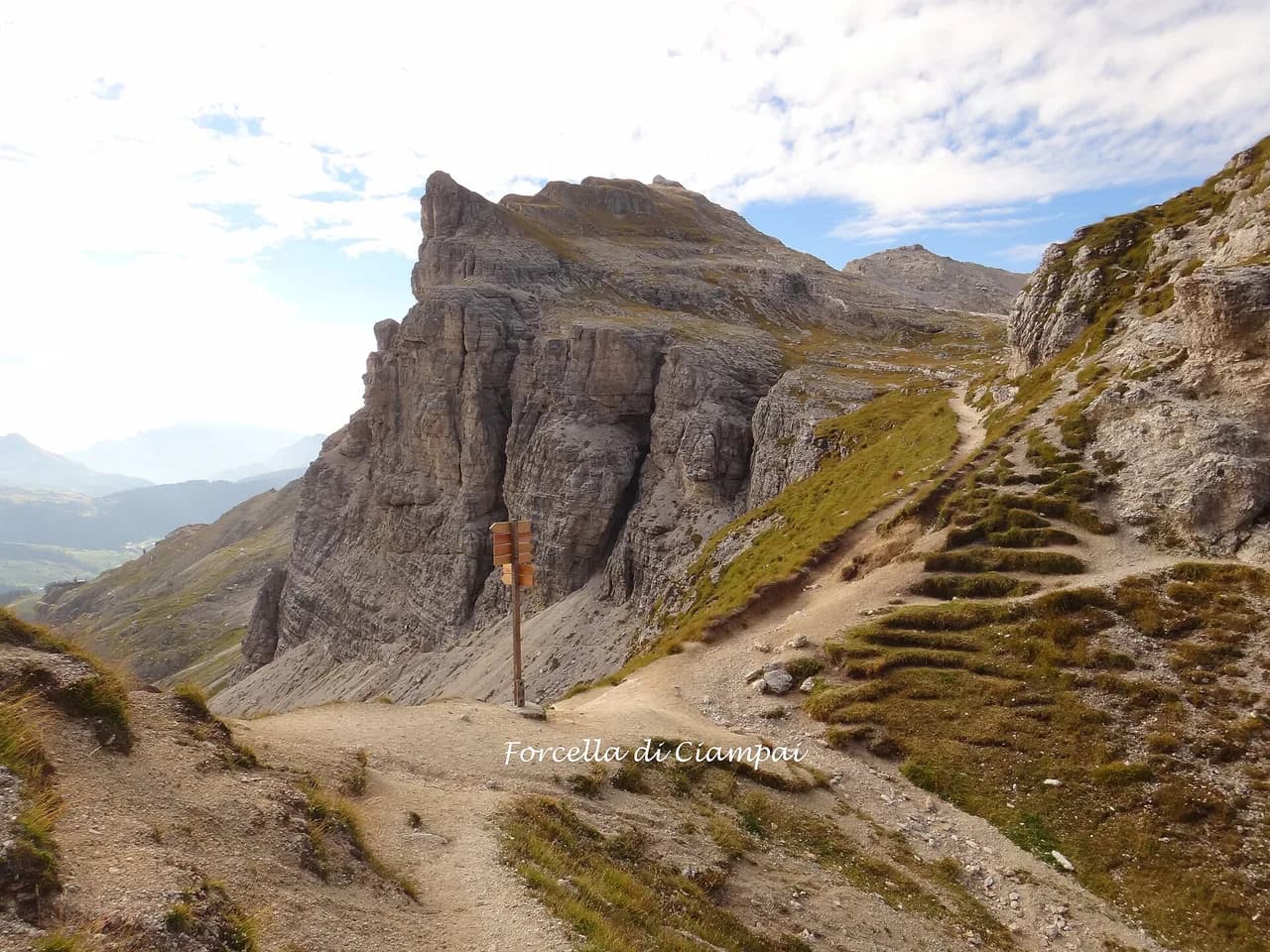
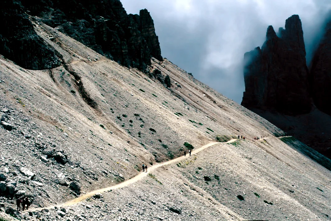
From the trailhead, switchbacks and scree lead upward, and chains help you scramble over rocks near the top of the boulder field. The path continues to the Forcella Sora Forno, a notch on the ridge, before an easier descent to the hut. Go at a steady pace, keep your hands free on the chain sections, and start early enough to be off the high ground before afternoon storms build.
The Croda del Becco summit extension
From Rifugio Biella, experienced hikers can continue toward the Croda del Becco summit. The extension climbs about 1.5 km (0.9 mi) of steep scree with fixed chains, and it adds roughly 2 hours to the day. People who are comfortable on exposed rock finish back down the way they came, but this is not a beginner's route.
Sasso del Signore / Herrenstein
The ridge route to Sasso del Signore, also called Herrenstein, starts from the eastern shore of the lake. It follows a forestry road and then branches onto an exposed traverse to the Zwölf Apostel notch before crossing curvy rock slabs to the ridge and the summit. The official figures are 4.0 km (2.5 mi) one way, 739 m (2,425 ft) of ascent and 80 m (262 ft) of descent, an activity time of 2 hours 21 minutes, a high point of 2,155 m (7,070 ft) and a start at 1,491 m (4,892 ft).
The signpost is no. 58, and the route is rated as very demanding, requiring vertigo tolerance and slip resistance. It is a linear route, so you must retrace or arrange a pickup. The exposure comes early, with sections of rock wall and a near-ridge traverse before the summit, so only take it on in dry, settled weather.
When to go
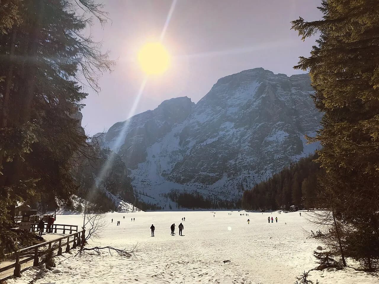
The lakeside loop is at its best in June and early July, then again from September into October, when the crowds thin and the light turns golden. The loop closes after the first significant snowfall, so winter visits mean a frozen or snow-covered lake with no circuit route. The hut climb runs later than the lake loop and is best from late June to early September, after the snowfields have melted.
At the height of summer the advance-booking system makes the lake a rigid start, so go early, or come late in the afternoon for calmer light. Snow and ice linger on the passes into early summer and return in late autumn, so check conditions before committing to the hut extension.
Huts and water on the route
Rifugio Biella is the mountain hut on the climb, and its opening season covers the late June to early September window. Overnight beds and meals are available; lunch does not require a booking, but sleeping space is best reserved as the route is popular. Hotel Lago di Braies at the lake gives you a base right at the trailhead if you want a short morning walk-in.
The lakeside loop has cafés and huts near the boat house and hotel. Carry a full bottle and a wind layer, and treat the summit extension as an alpine day rather than a casual walk.
Base villages
Braies is the closest base and gives the shortest run to the lake for sunrise, but it is small and fills quickly. Dobbiaco gives you bus access, bike rental and more beds, and the lake is a short drive or a scenic bike ride away. Villabassa is quieter, with easy access to the Monguelfo shuttle and the Segheria walking route. If you are weighing which alpine valley to base a longer trip in, the Val Gardena hiking guide covers the same choice of trails and villages further west.
Beyond the water's edge
Wooden rowboats at the lake's boathouse rent from mid-May to late October, weather permitting, and early arrival avoids the queue. The small Capella di Maria on the shore is worth a pause. Hikers who want a bigger Dolomites hit can pair this day with the Adolph Munkel Trail under the Odle/Geisler massif in Puez-Odle Nature Park, which is outside this valley.
Plan Your Visit
Decide on the hike before you book the trip: the loop suits a relaxed half day, and the hut climb is a full day with real ascent. Mid-July to mid-September on the lake requires advance booking through the South Tyrol transport operator and the parking operator, so set those first and build the day around them.
Base in Dobbiaco for bus flexibility or Braies for lake proximity, and walk from Segheria if parking is full. Pack layers, water and cash, and treat the exposed ridge routes as things you do only in settled weather.
Frequently Asked Questions
Is Pragser Wildsee the same lake as Lago di Braies?
Yes, Pragser Wildsee is the German name for Lago di Braies, and both names appear on road signs and maps in South Tyrol. Directional signs often show both, so follow either.
How long is the Lago di Braies lakeside loop?
The circuit is about 4 km (2.5 mi), with roughly 50 m (165 ft) of elevation, taking around 1.5 hours with stops. It rates as easy, and the east side is the only part with any real climb.
How do I get to Lago di Braies without a car?
Buses 442 from Dobbiaco and 439 from Monguelfo serve the lake, and both require advance booking during the busiest summer weeks. Walking up from Segheria takes about 1 to 1.5 hours and needs no ticket.
How hard is the hike to Rifugio Biella from Lago di Braies?
It is a moderate 14.6 km (9.1 mi) round trip with about 900 m (2,950 ft) of ascent, roughly 7 hours. Chains aid the scrambling on the boulder field, and the Croda del Becco extension is for experienced hikers only.
When is the best time to hike at Lago di Braies?
June and early July or September into October give the best conditions and fewer people on the loop. The hut climb fits the late June to early September window, and snow lingers on the high passes outside it.
Do I need to book parking at Lago di Braies in summer?
The lakeside lots and the access road run an advance-booking system in midsummer, so you do need a booking for those weeks. Outside the window you drive up and pay at the lot.
Can you walk around Lago di Braies in winter?
The loop closes after the first significant snowfall, so a winter visit means a snowy or frozen shore rather than the full circuit. The hut climb is also out of season in midwinter.
Is the Croda del Becco summit suitable for beginners?
No. The extension from Rifugio Biella climbs 1.5 km (0.9 mi) of steep scree with fixed chains and adds about 2 hours, so it suits experienced hikers with steady footing on exposed rock.
Sources
Trail notes for your next trip
Optional updates when we add or revise hiking guides.
You might also like

Continue reading
More guides you'll find useful