Alta Via 1: Dolomites Hut-to-Hut Route, Stages & Season
Plan the Alta Via 1 in the Italian Dolomites: the Lago di Braies to La Pissa stages, distance, ascent, huts, season and how to reach each end of the trail.
On this page
The Alta Via 1 is the Dolomites' classic hut-to-hut traverse, running north to south across limestone towers, high pastures and First World War ground between Lago di Braies and the Belluno valley. It suits fit mountain walkers who can handle five to eight hours of walking a day, including rough and exposed passages, but who do not want technical climbing or a glacier.
The route is usually walked over eight or nine days, with every night in a rifugio apart from the start and finish. Because the huts fix the stages, beds rather than fitness set your itinerary, and bookings open roughly a year ahead. If you want the wider picture of trails across the range, the hiking in dolomites guide is a useful starting point.
Where the Alta Via 1 starts and finishes
The northern trailhead is Lago di Braies, the mountain lake at the edge of the Dolomites in South Tyrol; Alpine Exploratory describes the route running from Dobbiaco in the north to Belluno in the south, while Bookatrekking puts the start at Lago di Braies and the finish at La Pissa near Belluno. Both describe the same line: the lake is where the climbing begins, and the southern end is a road stop rather than a town.
Lago di Braies is reached by bus from Cortina, which is also where most people spend their first night. At the southern end the route descends to La Pissa near La Stanga on the Agordo to Belluno road, where buses run into Belluno. That bus finish keeps the trek at a consistent level of difficulty, without the via ferrata descent from the Schiara.
Options for getting to Lago di Braies and back from Belluno are covered in the Dolomites hiking tours pages if you would rather have transfers arranged than organise buses yourself.
Distance, ascent and how many days
Alpine Exploratory gives the route as about 120 km (75 miles) from Dobbiaco to Belluno, typically walked over nine stages, with around 6,665 m (21,833 ft) of height gain and a high point at Rifugio Lagazuoi at 2,752 m (9,029 ft). Their standard schedules run from eight days for a faster trip to twelve days for a slower one that savours the scenery.
Bookatrekking publishes a different set of figures for the full route: 116.4 km over eight hiking days, around 6,230 m of total ascent and an average day of about 14.6 km, with the longest stage being the final 18.3 km descent to La Pissa. The difference comes largely from the variants taken and the way nights are counted, so treat neither total as exact.
The northern stages on the Bookatrekking line are the biggest: 14.4 km with 1,210 m of ascent from Lago di Braies to Rifugio Pederü on day one, then 15.8 km with 980 m to Rifugio Scotoni and 12.2 km with 900 m to Rifugio Scoiattoli. Days six and seven, at 9.2 km and 13.6 km, work well as recovery stages.
Getting to the start and back from the finish
Most hikers fly in through Venice and travel up to Cortina d'Ampezzo by bus, which is a common low-cost approach if you are happy to move between the two towns without a hire car.
At the end, the descent through woodland reaches Rifugio Bianchet and then a winding track to La Pissa on the main road, where buses connect to Belluno. Alpine Exploratory notes that this is not a walk directly into town; the bus ride is the practical finish.
Northbound and southbound are not equal in logistics: starting at Lago di Braies means a bus from Cortina on day one, while finishing at La Pissa means finding a service down to Belluno and then a train or bus onward. Plan the return leg before you commit to hut dates.
The northern stages: Lago di Braies to Lagazuoi
The first climb out of Lago di Braies up to Rifugio Biella at 2,300 m (7,545 ft) is steep but varied, and Alpine Exploratory describes it as a stiff introduction of around 900 m (2,952 ft) of ascent. Just before the refuge an optional ascent leads to Croda del Becco at 2,810 m (9,219 ft), with wide views across the northern Dolomites.
The second stage drops to Rifugio Pederü and its roadhead before climbing steadily to the Fanes plateau huts at around 2,060 m (6,758 ft). Most of this ground is on wide, smooth tracks through open alpine pastures, which makes it a gentle day for distance even when the profile looks large.
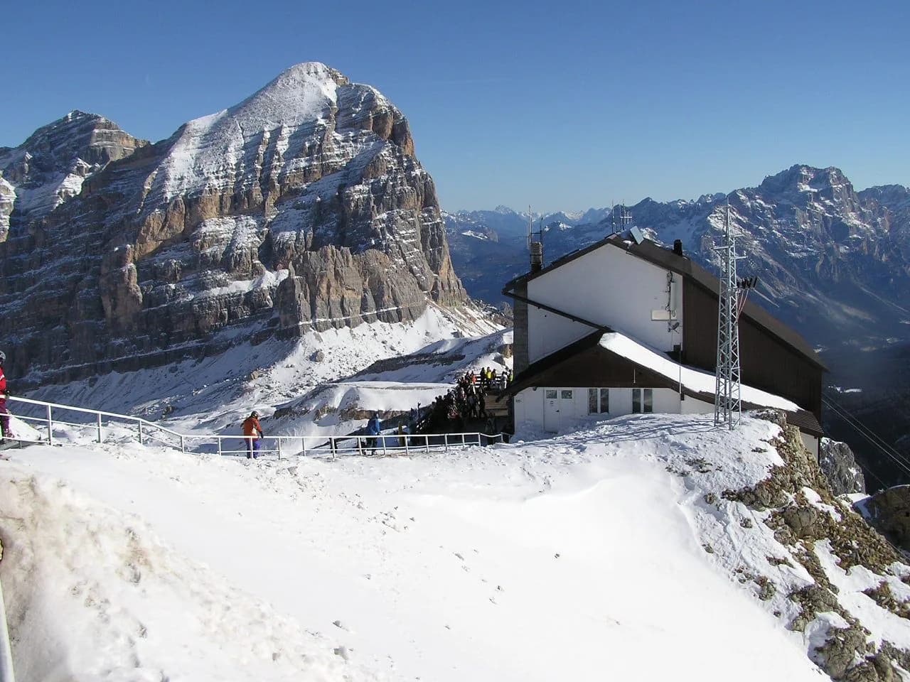
Stage three crosses the Fanes high ground past Malga Fanes Grande at 2,102 m (6,896 ft) to Forcella di Lech at 2,486 m (8,156 ft), then descends on switchbacks before a long pull up to Rifugio Lagazuoi, the highest point on the route. The descent from Forcella di Lech is steep and loose, so take it steadily with poles if you use them.
From Lagazuoi the route drops to Pian dei Menis and can take in the Galleria Lagazuoi, a restored First World War tunnel built by Italian troops to attack the Austrian summit position; a torch is needed inside. From there you climb back to Rifugio Nuvolau at 2,575 m (8,448 ft), perched on a rocky hill with 360-degree views.
The ridge around Nuvolau and Cinque Torri belongs to a wider set of routes if you want to explore the Dolomites via ferrata at higher difficulty, but the standard Alta Via 1 stays on walking terrain with fixed cables used only as handrails. For a sense of the landscape at the northern end, compare this section with Lake Braies walks around the same lake.
The southern stages: Lagazuoi to La Pissa
From Nuvolau the route heads over Passo Giao and around Monte Formin, then drops through pasture and woodland to Rifugio Città di Fiume at 1,918 m (6,292 ft). These are mostly grassy, gentle hillsides, a change of pace after the exposed northern passes.
Beyond Passo Staulanza the route climbs to Rifugio Coldai at 2,132 m (6,995 ft) on the flanks of Monte Civetta, passing the Coldai lake before continuing to Rifugio Tissi and Rifugio Vazzoler. The next day's ground around Monte Civetta is well defined but hard going on steep, rocky and rooty paths to Coll dell'Orso before dropping to Passo Duran at 1,601 m (5,252 ft).
The last big stage is the toughest on the southern line: rough ground to Rifugio Pramperet, large open combes, and a final climb almost to the Cime de Zita at a col of 2,395 m (7,858 ft) before a long descent to Rifugio Pian de Fontana at 1,632 m (5,354 ft). This is the one day that Alpine Exploratory says some trekkers may feel approaches the level of the Walker's Haute Route in terrain and situation.
The final short stage climbs to Forcella la Varetta at 1,701 m (5,580 ft), then descends through woods to Rifugio Bianchet and the bus road at La Pissa. The southern half suits fit hikers prepared for longer, looser days and less company than the northern highlights around Lagazuoi and Cinque Torri.
The character of the traverse is closer to the zig-zag tracking routes of the Adolf Munkel trail in the Odle/Geisler massif than to a technical ascent, with good paths and occasional rough sections rather than scrambling. Hikers who want a shorter taste of this style of walking in Puez-Odle Nature Park can build it around a hut-to-hut trip.
Huts on the route and how booking works
Most nights are in mountain huts owned by the Club Alpino Italiano or run by local families, with a mix of private rooms and dormitories. The northern huts are of a higher standard than the southern ones, which become more basic as the trail grows more remote.
Bookatrekking counts around 30 rifugios within reach of the main trail and notes that bookings open about a year ahead, with the northern huts filling for July and August by November or December. The practical implication is that your route version is decided by which beds you can get, not the other way round.
Macs Adventure is clear that bag transfers are not available on the hut sections, so you carry everything between the villages at each end and the huts in between. On a standard itinerary the huts include dinner and breakfast, which takes weight off your pack if you plan meals through them.
If you would rather have the reservations handled, a self-guided hut to hut hiking dolomites package books the huts and supplies route notes and an app, leaving you to walk the stages. The trade-off is less flexibility if you want to change stages mid-trek.
Short versions and north/south halves
Bookatrekking sells a four-day northern version covering 57.7 km from Lago di Braies to Rifugio Scoiattoli and then Cortina d'Ampezzo, with a daily average of 15.2 km and 920 m of ascent. Their southern version, six days from Cortina to La Pissa, covers 78.1 km with shorter walking days.
Alpine Exploratory offers the same idea over their own schedules: a northern half from Dobbiaco to Cortina and a southern half from Cortina to Belluno, each fitting into about a week. They also describe an eight-day option for walkers who want the shortest full-route days and a twelve-day version for those who can take time.
The choice between halves is mainly about character. The north delivers the famous ground at Lagazuoi and Cinque Torri with more company and easier escape routes; the south is wilder, more remote and has the long, loose day to Pian de Fontana, but fewer people on the path. If you are weighing up other Alpine bases for a similar hut-to-hut style of walking, hiking in Innsbruck makes a useful comparison.
When to go: season, snow and storms
Alpine Exploratory runs its Alta Via 1 season from mid-July to mid-September, given the chance of late-spring snow on the higher passes in early July and of deteriorating weather by late September. Bookatrekking gives a longer window, from mid-June to mid-September.
The trade-off in the middle of summer is crowds against weather. July and August are the most popular, with the busiest sections around Lago di Braies, Lagazuoi and Cinque Torri filled by day hikers. Storms also build in the afternoon from mid-July, especially above 2,000 m, so leave early and aim to be at the next hut before mid-afternoon.
Late June offers quiet trails and freshly opened huts, with a small chance of snow on the higher cols early in the month. September gives clearer air, fewer people and the alpenglow on the limestone, but nights turn cold and snow can fall on the high passes from mid-September onward. Snow can also fall in any summer month, so watch the forecast and trail conditions from the local rifugio staff and tourism offices before setting out, and check current dates and opening times ahead of your trip.
Exposure, loose ground and via ferrata options
The standard Alta Via 1 is a walk rather than a climb: no glaciers, no rock climbing and no mandatory via ferrata. Fixed metal cables appear on some passages as handrails, and there are steep drops beside the path on parts of the traverse, including the exposed stage from Passo Duran to Pian de Fontana.
Options add difficulty if you want it. The Galleria Lagazuoi on the Falzarego stage needs a torch; the standard route takes the La Pissa variant on the last day, avoiding the via ferrata descent from the Schiara.
If you are drawn to the Dolomites via ferrata, plan it as a separate outing with harness, helmet and lanyard, guided if you are new to the equipment. The Brenta Dolomites across the valley hold the biggest concentration of these routes, well away from the Alta Via 1 line.
Gear and packing for a hut-to-hut week
You will carry everything between huts, so aim for a pack you can walk eight hours with. Bring a sleeping bag liner, earplugs and a headlamp for dormitories, plus a refillable bottle: streams and hut taps supply water, but long high sections between refills need planning.
Footwear matters more than anything else, because the routes mix smooth forest tracks with rock, roots and loose switchbacks. A boot with a stiff enough sole for descents, broken in before you arrive, is worth more than a lighter shoe if you are new to multi-day walking.
Pack for cold nights even in July, since hut altitude sits mostly between 2,000 and 2,700 m and temperatures drop into single figures. A rain shell, warm midlayer, sun protection and poles cover the main conditions, and cash is useful at huts on the Italian line.
Alta Via 1 or Alta Via 2
The Alta Via 1 is the more accessible of the two: shorter days, good hut infrastructure and no obligatory via ferrata. The Alta Via 2 demands harness, helmet and ferrata gear on parts of the route and passes through more remote terrain, which makes it a step up for hikers who have already done the AV1.
For a first long-distance Dolomites trek, the Alta Via 1 is the sensible choice, and both Alpine Exploratory and Macs Adventure rate it as suitable for fit walkers with previous hill experience. If you are short of time, the four-day northern section gives you the classic scenery without committing to a full traverse.
Plan Your Visit
Choose your route version first by the days you can spare: four days on the northern half, six on the southern, eight to twelve for the full traverse. Then decide your window of mid-June to mid-September, remembering that huts, not fitness, dictate the schedule, and reserve beds as soon as your dates are fixed.
The final practical step is the transport plan: bus to Lago di Braies at the start, bus from La Pissa and then onward from Belluno at the end, and a night in Cortina or Belluno either side. Get those pieces in place and the route itself is straightforward mountain walking for a prepared hiker.
Frequently Asked Questions
How difficult is the Alta Via 1?
The Alta Via 1 is rated moderate. It is a long walk with big daily ascent and descent, some steep, loose and exposed passages, and no mandatory via ferrata, but you need to be comfortable with five to eight hours of hiking per day and prior hill experience. The first day from Lago di Braies is often the toughest introduction.
How many days does the Alta Via 1 take?
Most people take eight or nine hiking days on the full route, with a range of eight to twelve days depending on your pace and chosen stages. Short versions cover the northern section in about four days, or the southern half in about six.
Do you need via ferrata gear for the Alta Via 1?
No. The standard route uses fixed cables only as handrails on a few passages and has no obligatory via ferrata sections. Taking optional detours such as the Galleria Lagazuoi requires a torch rather than climbing gear, while the Schiara variant on the last day does involve cables and is avoided by the standard finish at La Pissa.
When is the best time to hike the Alta Via 1?
The season runs from mid-June to mid-September depending which operator you follow. Late June and early July are quieter with some snow risk on high passes, July and August are busiest with afternoon storms, and September offers clear air and fewer people but colder nights and early snow.
How do you get to the start of the Alta Via 1?
Most hikers fly into Venice and travel to Cortina d'Ampezzo, then take a bus to Lago di Braies on day one. At the end, the route descends to La Pissa on the Agordo to Belluno road, where buses run into Belluno.
Is the Alta Via 1 or Alta Via 2 better?
The Alta Via 1 is the better first choice for most hikers: it has shorter days, a strong hut network and no obligatory via ferrata. The Alta Via 2 is more technical, needs ferrata gear and is more remote, which makes it a natural next step after the AV1.
How much does the Alta Via 1 cost?
The main variable costs are beds in the mountain huts, food, and travel to the start and home from the finish, with self-guided packages handling the huts for a single price. Hut tariffs vary by season and room type, so ask the huts or your booking operator for the current rate. A budget figure some operators publish is an estimate only.
Sources
Trail notes for your next trip
Optional updates when we add or revise hiking guides.
You might also like

Continue reading
More guides you'll find useful