Whernside Walk from Ribblehead: Route, Distance and Ascent
Walk Whernside from Ribblehead Viaduct on a 12.5 km (7.5 mile) circuit, with route landmarks, ascent details, parking, trains and the longer tarn variant.
On this page
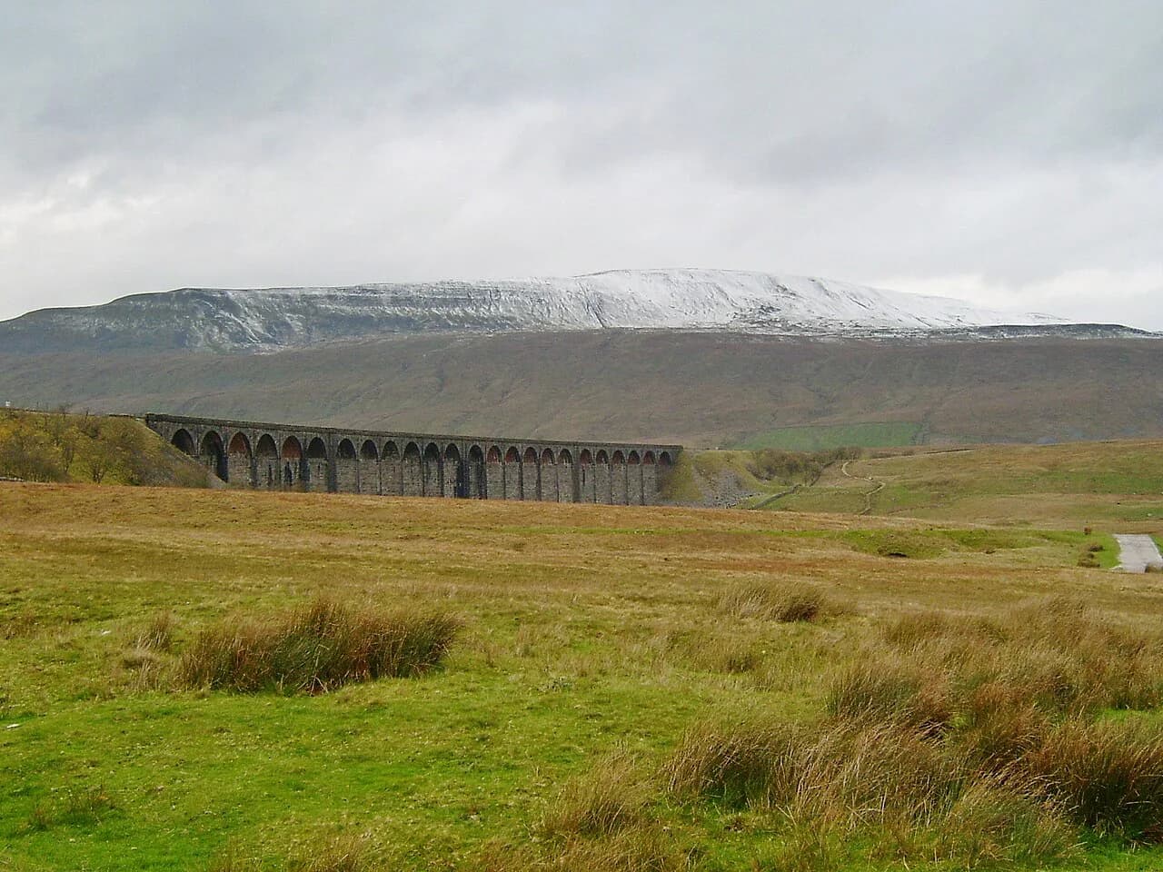
The Whernside walk gives you the highest summit in the Yorkshire Dales National Park on a long, steady ridge, with the Ribblehead Viaduct and the Settle to Carlisle railway running below and Ingleborough filling the view to the south. It suits hikers with a full day and a reasonable base of hill fitness who want a big-view summit without scrambling or technical ground. The classic circuit from Ribblehead starts and finishes at the same parking area, so you can walk it without lift or shuttle logistics.
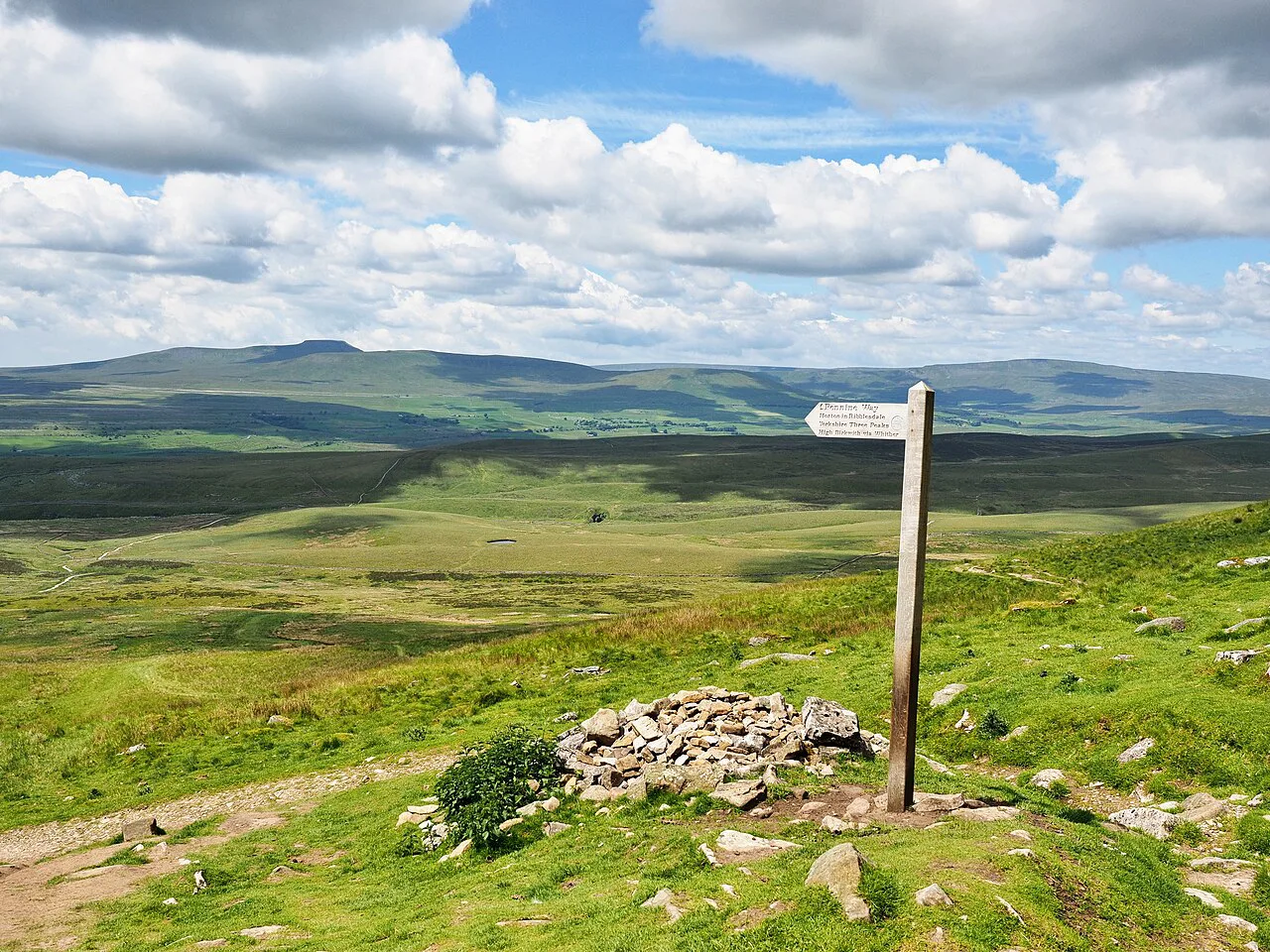
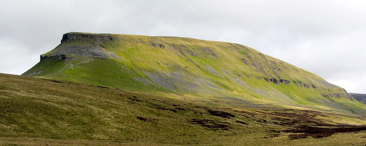
Whernside stands at 736 metres (2,414 feet) and is one of the Yorkshire Three Peaks, alongside Ingleborough and Pen-y-ghent. The mountain forms a long ridge running roughly north-north-east to south-south-west, with millstone grit capping limestone, which gives the summit its broad, whale-backed profile rather than a rocky crest.
Whernside at a glance
The summit trig point sits on the boundary between Cumbria and North Yorkshire but remains inside the national park, which surprises walkers who assume the county line follows the valley. From the top you look across Deepdale, Dentdale and Kingsdale, with the Howgill Fells visible to the north-west on a clear day. The ridge is largely grass and flagstone, and no part of the standard ascent requires hands-on scrambling.
The mountain is the highest of the three challenge peaks but not the most dramatic in shape. The trade-off is honest: you get the biggest summit and the widest panorama in exchange for a long, gradual climb rather than a short sharp pull. Walkers weighing up a long grassy ridge against more rugged ground may prefer hiking in the Lake District, where the same day-out decision comes with sharper terrain. Bank the summit for a clear day, because the reward is the view rather than the summit furniture.
Trailhead and parking at Ribblehead
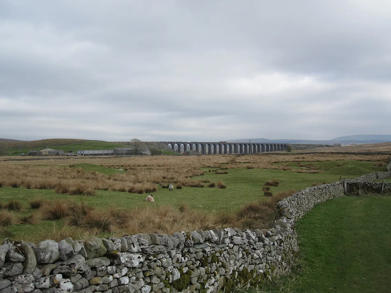
Most walkers start at the large hardstanding parking area beside the Ribblehead Viaduct, just off the B6255 Blea Moor Road. Roadside parking along the B6255 is the usual fallback, and the area is popular with both hikers and sightseers, so arriving early in the morning gives you the best chance of a space. The Station Inn sits by the viaduct, with a beer garden looking across to the arches, and there is a small cafe at the station.
From the parking area, head towards the bridge at the junction of the B6255 and the B6479, then follow the signs for the Yorkshire Three Peaks and Bleamoor Sidings towards the viaduct. Near the arches, the wide stone track bends left; take the narrower path on the right, signposted to Whernside, and climb the stepped stone path up the embankment with the viaduct on your left.
Getting there by train and bus
Ribblehead has its own station on the Settle to Carlisle line, which puts the trailhead within walking distance of the start for anyone arriving by rail. Look up departure times for Ribblehead on National Rail Enquiries and bus connections on the DalesBus timetable before you commit to a day. Staying in Settle, Ingleton or Horton in Ribblesdale gives you the widest choice of evening food and a shorter morning transfer.
Distance, ascent and walking time
The national park's circular route from Ribblehead is 12.5 kilometres (7.5 miles) and climbs steadily to the summit ridge. A longer version of the same circuit, which swings out over Whernside Tarns, runs to about 16 kilometres (10 miles) with roughly 536 metres of ascent and takes around five and a quarter hours of walking. The shorter line to the top is the direct Three Peaks ascent path; the tarn route adds distance and quiet in exchange for time.
Another family-oriented circuit from the same trailhead covers about 8.5 miles with roughly 670 m of ascent, taking the steeper line up and a longer, gentler descent. That direction matters if you have children or tired knees: you trade a stiffer climb for an easier finish. Whichever figure you plan from, budget daylight for a full day on the fell rather than a half day.
Difficulty and terrain
The climb is long and steady rather than technical, and the main path is clear and well walked, with flagstones and stepped sections on the busiest parts. There is no scrambling, but the descent from the summit towards Bruntscar and Broadrake is the steepest and most eroded part of the day, and the path has been repaired with boulders and flagstones because of the footfall. Poles help here, and so does starting the descent while your legs are still fresh.
Exposure is modest on the ridge but real in poor weather: low cloud, wind and rain can make the broad summit confusing, and the path over Craven Wold and Great Wold is grassy and indistinct in places. Carry the OS Explorer OL2 map, know how to use a compass and keep a backup beyond your phone. Afternoon storms are common on the fells, so plan to be off the summit ridge by mid-afternoon.
Route description: Ribblehead to the summit
Follow the path alongside the railway from the viaduct and ignore the first left turn, which leads through a railway tunnel. Continue past Bleamoor Sidings, where you also ignore the left-hand bridleway towards Winterscales, and stay with the bridleway signed for the Yorkshire Three Peaks and Dent. You pass the Blea Moor signal box and an abandoned railway cottage before crossing Little Dale Beck on a wooden footbridge and reaching the Force Gill Aqueduct where the path crosses the Settle to Carlisle line.
Beyond the aqueduct the route steepens up Slack Hill on the Dales High Way, reinforced with stone flags. Where the path splits, the left fork through a gate is the main Three Peaks ascent, which most walkers take and which saves about 2 miles (3.2 kilometres) on the day. Follow it up through the shoulder of the mountain, where the gradient eases briefly and the wall gives way to views down into Kingsdale.
A second family-friendly line from the viaduct heads under the arches, past the camping pods at Gunnerfleet Farm and over Winterscales Beck, then turns left on a surfaced access road. It leaves the road at a footpath sign for Ivescar, crosses fields to the farm, and picks up the bridleway signed to Scar Edge and Broadrake before joining the Three Peaks path for the climb. The farm waymarks make the navigation straightforward.
On the summit ridge the path follows the dry stone wall to the large stone seat and a gap in the wall on your left. The trig point stands just through the gap, and the wall itself marks the county boundary. The summit offers a natural picnic spot, but there is no shelter beyond the wall.
The quieter variant over Whernside Tarns
If you want distance and solitude rather than the quickest line, stay straight ahead at the split and follow the bridleway signed to Deepdale up across Craven Wold. After more than half a mile (0.8 kilometres) you reach the ruins at Duncan Sike Foot; bear left in front of them and cross Great Wold, watching for the limestone boulders on your right. At Boot of the Wold, turn left alongside the fence and wall to pick up A Pennine Journey towards the tarns.
The path passes the eastern shore of one of the larger Whernside Tarns, then a smaller tarn on Knoutberry Hill, before a final pull to a fence and stile where you join the main summit trail. Go over the stile and turn right for the last half mile (0.8 kilometres) of stone steps to the top. The tarns sit on open, boggy ground, so gaiters and waterproof boots earn their place after rain.
Descent, Force Gill and the return
From the trig point, continue past the pillar and descend alongside the dry stone wall, then follow the path where it swings left away from the wall as the gradient steepens. This stretch is paved and bouldered but still the hardest work on the knees; take it slowly and let faster groups pass. After more than three-quarters of a mile (1.2 kilometres) the path levels out near limestone boulders and a stone barn with a slate roof.
Just after the barn, turn left onto the bridleway signed to Winterscales and follow the track through the meadows and the farm at Broadrake, then on to Ivescar. From there the lane becomes tarmac, bends right and is signed to the viaduct, dropping past Gunnerfleet Farm and over Winterscales Beck. The viaduct comes back into view for the final stretch under the arches to the parking area.
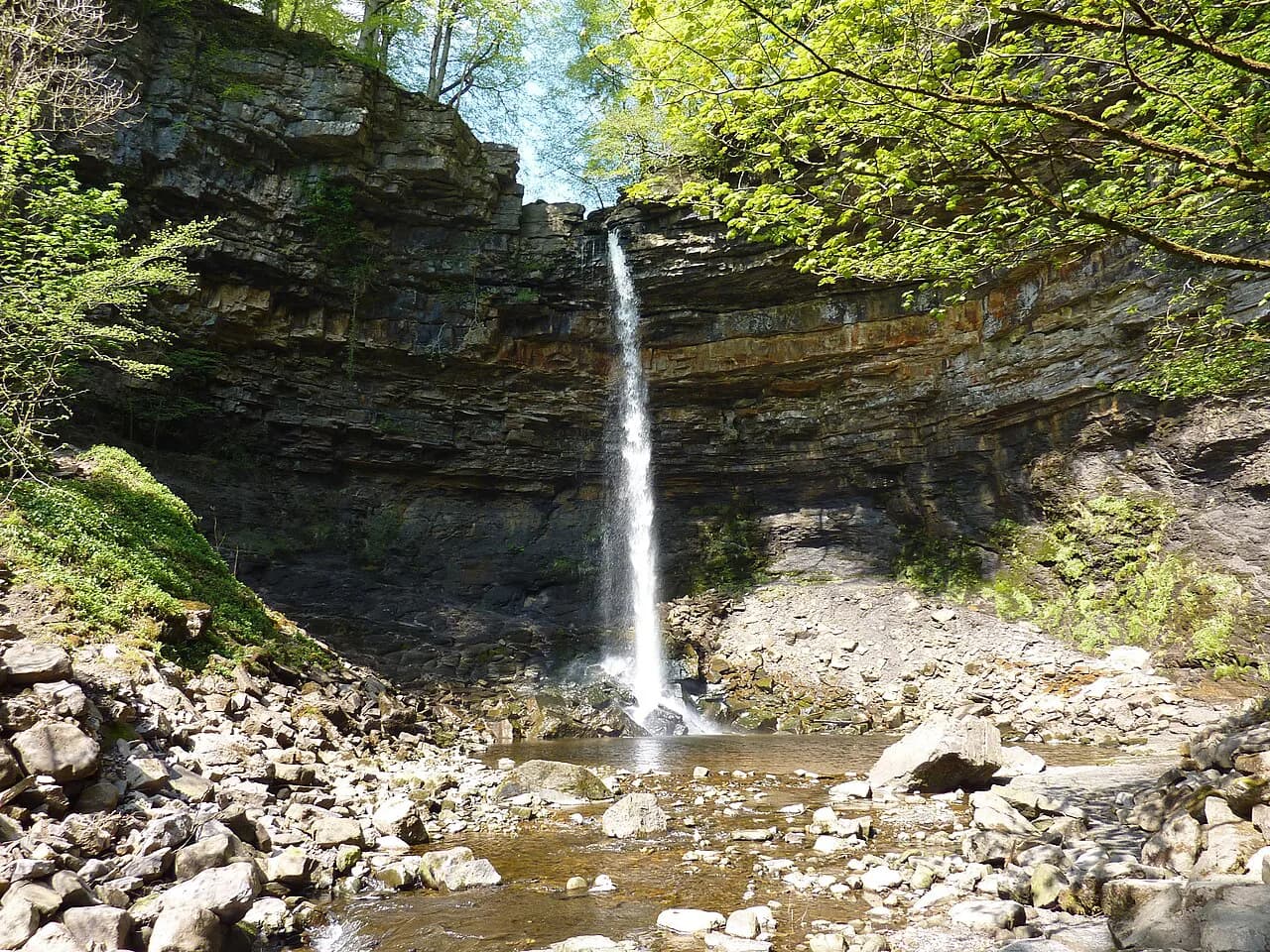
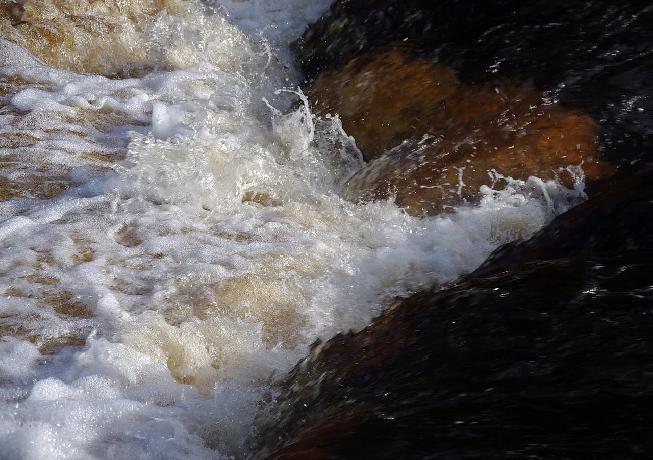
The other common return leaves the summit on the Three Peaks path and passes Force Gill waterfall, which spills over a dark cliff of limestone and shale into a plunge pool below. The fall sits on open access land, with a small formed track leading off the main path, and the ground can be boggy in places. Water levels change quickly after rain, so treat the pool and the spray with respect and keep children close.
When to go
Late spring through early autumn gives the most reliable conditions, with long daylight and the best chance of the clear summit views that justify the climb. Snow and ice linger on the summit ridge into spring and return early in autumn, and the flagged path can be slick in wet weather. In winter, the walk needs winter boots and a realistic assessment of daylight, not just a waterproof.
Check the calendar before you pick a date, because organised challenge events put large numbers of walkers on the Three Peaks routes, mostly through the middle of the day. Getting an early start is the simplest way to stay ahead of the crowds. Weekdays outside event periods are noticeably quieter on the ridge.
Facilities and water on the route
Toilets are available at Ribblehead station and at the Station Inn for customers, with public toilets in Horton in Ribblesdale, Settle and Ingleton. There is no reliable water source on the summit ridge, so carry everything you need from the trailhead, plus a little spare for a hot day. In the warmer months an ice cream van often parks near the viaduct and a second may appear at the foot of the climb.
What to carry
Wear boots with a firm sole for the flagstones and boulder-paved descent, and pack waterproof layers, warm mid-layers and gloves even in summer. Carry the OS Explorer OL2 map, a compass and a backup of your route, and do not rely on a phone alone. Food, a flask and a headtorch are worth the weight on a day that can run longer than planned.
Where to stay
Settle and Ingleton are the most practical bases, with a range of pubs, cafes and shops and a straightforward drive or bus ride to Ribblehead. Horton in Ribblesdale puts you on the Settle to Carlisle line and close to the Three Peaks paths. Camping pods and bunk barns near Ribblehead and Broadrake suit walkers who want to start on foot from the trailhead.
Whernside or the full Three Peaks
The Whernside day walk is a single summit with a return to the same trailhead; the full Yorkshire Three Peaks challenge links Whernside, Ingleborough and Pen-y-ghent in one day and is a different proposition entirely. If you want a shorter Yorkshire day with waterfalls and woodland instead of a summit ridge, the ingleton waterfalls trail follows the River Twiss and River Doe through a limestone gorge. Many walkers build up to the challenge with individual peak days first.
Plan Your Visit
Start early from the Ribblehead hardstanding, take the main Three Peaks ascent path if time is short, and save the tarn variant for a long summer day when you want quiet. Check train times for Ribblehead before you commit to a car-free day, and treat the descent from the summit as the part that deserves the most care. The summit view over Deepdale and Dentdale is the payoff.
Frequently Asked Questions
How long does it take to walk up Whernside?
The longer 16 km (10 mile) circuit over Whernside Tarns is typically walked in around five and a quarter hours of moving time, and the 12.5 km (7.5 mile) national park circuit is shorter. Add stops for photographs, food and the summit, and plan a full day out rather than a half day.
Is the Whernside walk hard?
It is a long, steady climb of over 500 metres with no scrambling, but the descent from the summit towards Bruntscar and Broadrake is steep and eroded. Fit walkers will manage it comfortably in good weather; in low cloud, wind and rain it demands solid navigation and waterproof layers.
Where does the Whernside walk start?
Most walkers start at the hardstanding parking area beside the Ribblehead Viaduct off the B6255, with roadside parking along the same road as a fallback. Ribblehead station on the Settle to Carlisle line is also within walking distance of the trailhead.
Can you get to the Whernside trailhead by train?
Yes. Ribblehead station sits on the Settle to Carlisle line, so you can reach the start of the walk by rail and check departure times on National Rail Enquiries. Bus connections are listed on the DalesBus timetable; confirm both before committing to a car-free day.
What is the shortest route up Whernside?
The direct Three Peaks ascent path from the split beyond Force Gill Aqueduct saves around 2 miles (3.2 kilometres) compared with the tarn variant. It is the line most walkers take to the summit and back.
Which is the easiest of the Yorkshire Three Peaks?
Whernside has the longest steady climb, while Ingleborough and Pen-y-ghent have shorter, steeper sections. For a first peak day, choose the route that matches your fitness and the weather; none of the three is easy.
Sources
Trail notes for your next trip
Optional updates when we add or revise hiking guides.
You might also like
Continue reading
More guides you'll find useful