Malham Cove Walk: Yorkshire Dales Route Guide
Plan the Malham Cove walk in the Yorkshire Dales: an 8 km (5 mile) circuit through Janet's Foss and Gordale Scar, starting at the National Park Centre.
On this page
The Malham Cove walk packs three distinct landscapes into a single half-day circuit: a wooded waterfall, a gorge cut by glacial meltwater and a curved limestone cliff topped with pavement. It suits hikers who are comfortable on steep climbs and rough ground and who want a full round rather than a viewpoint stop. The full loop runs about 8 km (5 miles) and takes around three hours at an easy pace with stops.
What the walk offers and who it suits
Few walks in the Yorkshire Dales deliver this much variety in a short distance. The circuit links Janet's Foss, Gordale Scar and Malham Cove, so you see a waterfall in woodland, a deep limestone gorge and the cliff face and pavement above the village in one day. Go if you want a proper hill day with real climbs; skip the full loop if anyone in the group needs step-free ground, because the complete circuit is rough in places.
Where the walk starts: Malham National Park Centre
Start at the Malham National Park Centre and its car park, then walk toward Malham village. Turn left out of the car park, pass the Methodist Church and, just before the Buck Inn, cross the road and take the stone bridge over Malham Beck. A gravel path signposted for Janet's Foss leads off from there, and you pass through a few gates before the waterfall. The National Park Centre is also the obvious place to ask about path conditions before setting out, and it is the natural trailhead for anyone planning other walks in yorkshire dales from the same village.
Parking and trailhead access in Malham
The Malham National Park Centre car park is the recommended base for the circuit, with a good number of spaces and a maintained surface. Toilets and picnic areas sit on site, which makes it a practical start and finish for a family group. Bus services and parking charges change by season, so look up the current arrangements with the Yorkshire Dales National Park Authority before you travel rather than relying on an old timetable.
Distance, ascent and walking time for the full circuit
The full circular route is approximately 8 km (5 miles) and takes around three hours, allowing for stops to enjoy the scenery. Most of the route has good paths underfoot, but there are steep climbs and some off-track moments. Plan the day as a half-day outing with time at each of the three landmarks rather than a fast lap, and carry water and food because the walking is broken up by stops.
For a longer day in the same dale, a 12 km (7.5 mile) route continues past the top of Malham Cove into the dry valley and on toward Malham Tarn and Pikedaw. That option follows the same opening leg as the cove circuit, so you can decide at the top of the cove whether to turn back or push on.
Route description: Malham village to Janet's Foss
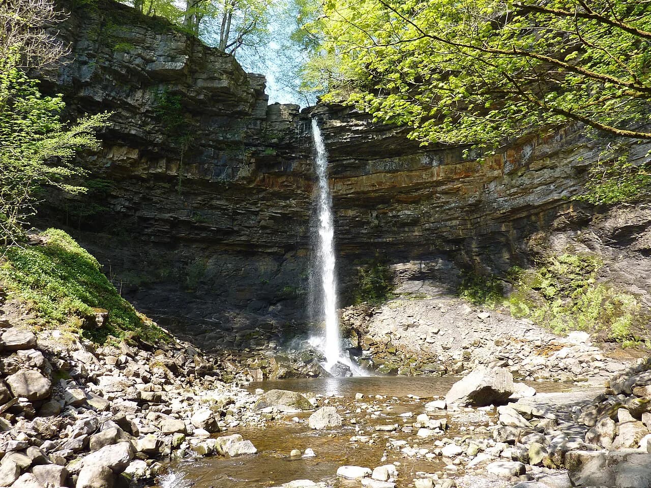
From the stone bridge over Malham Beck, follow the signposted gravel path toward Janet's Foss, passing through several gates. A kissing gate with a National Trust sign marks the approach to the falls. The beck runs beside the path through the trees, and you hear the waterfall before you see it as the path climbs gently through the wood.
Janet's Foss to Gordale Scar and the layby turning
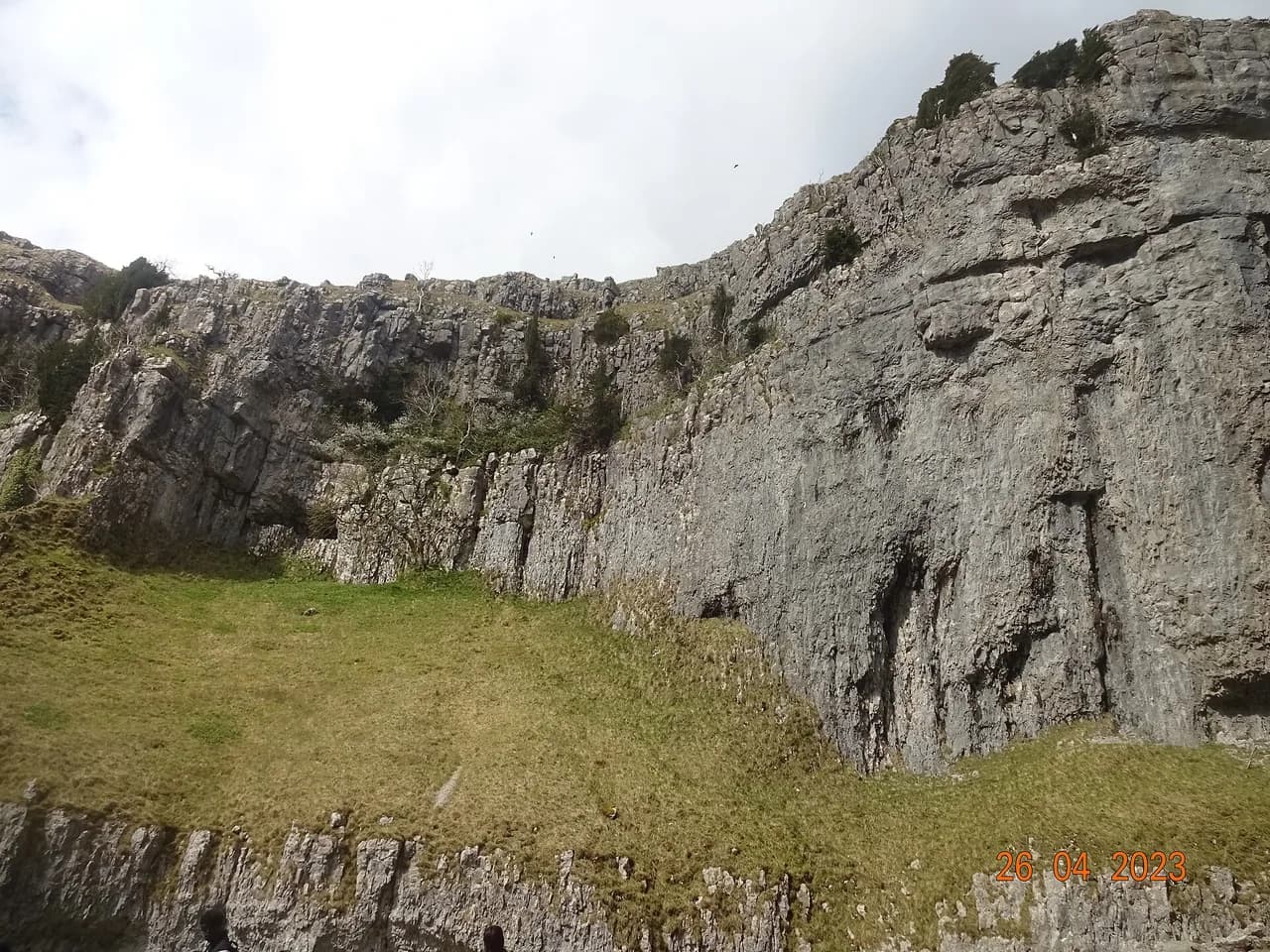
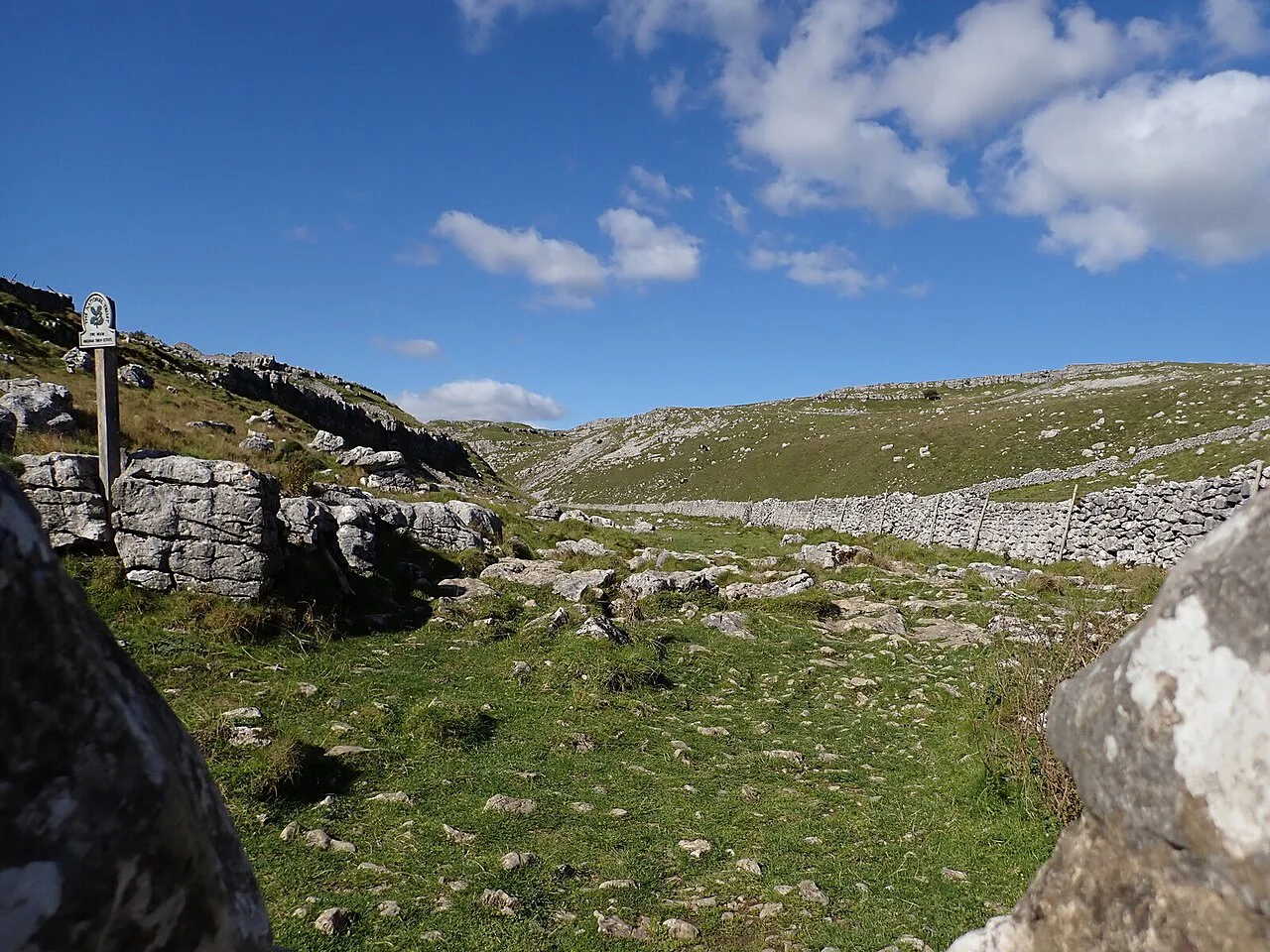
After the falls, climb the path up the right-hand side to the top of Janet's Foss and continue to a wooden gate that brings you out onto a road. About 50 m along, just after a layby that often has a snack van, a left turn is signposted for Gordale Scar. Follow that track for roughly half a mile and the gorge opens up in front of you. The cliffs were shaped by meltwater from glaciers, and after heavy rain a good flow of water comes down the scar.
Gordale Scar to the limestone pavement above Malham Cove
Retrace your steps from Gordale Scar to the layby, then continue right and cross another bridge over the beck. Go through the kissing gate and follow signs for Malham Cove as the path widens through a grass field beside a dry stone wall. Use the stile at the corner and the steps beyond to cross the field, then turn left and follow the clear path through gates onto the lane. Cross the lane and take the path signposted for Malham Cove, which climbs to the top of the cliff and brings you out on the limestone pavement. This is the section where the two landmarks connect, and it is worth being clear about the order before you start: the out-and-back to Gordale Scar adds walking before the cove leg, so deciding at the layby whether to shorten the day keeps the timing manageable.
The descent from Malham Cove and return to the village
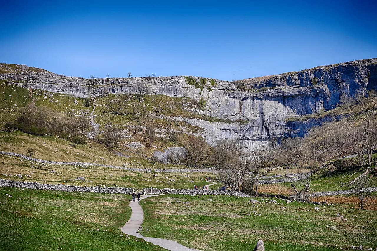
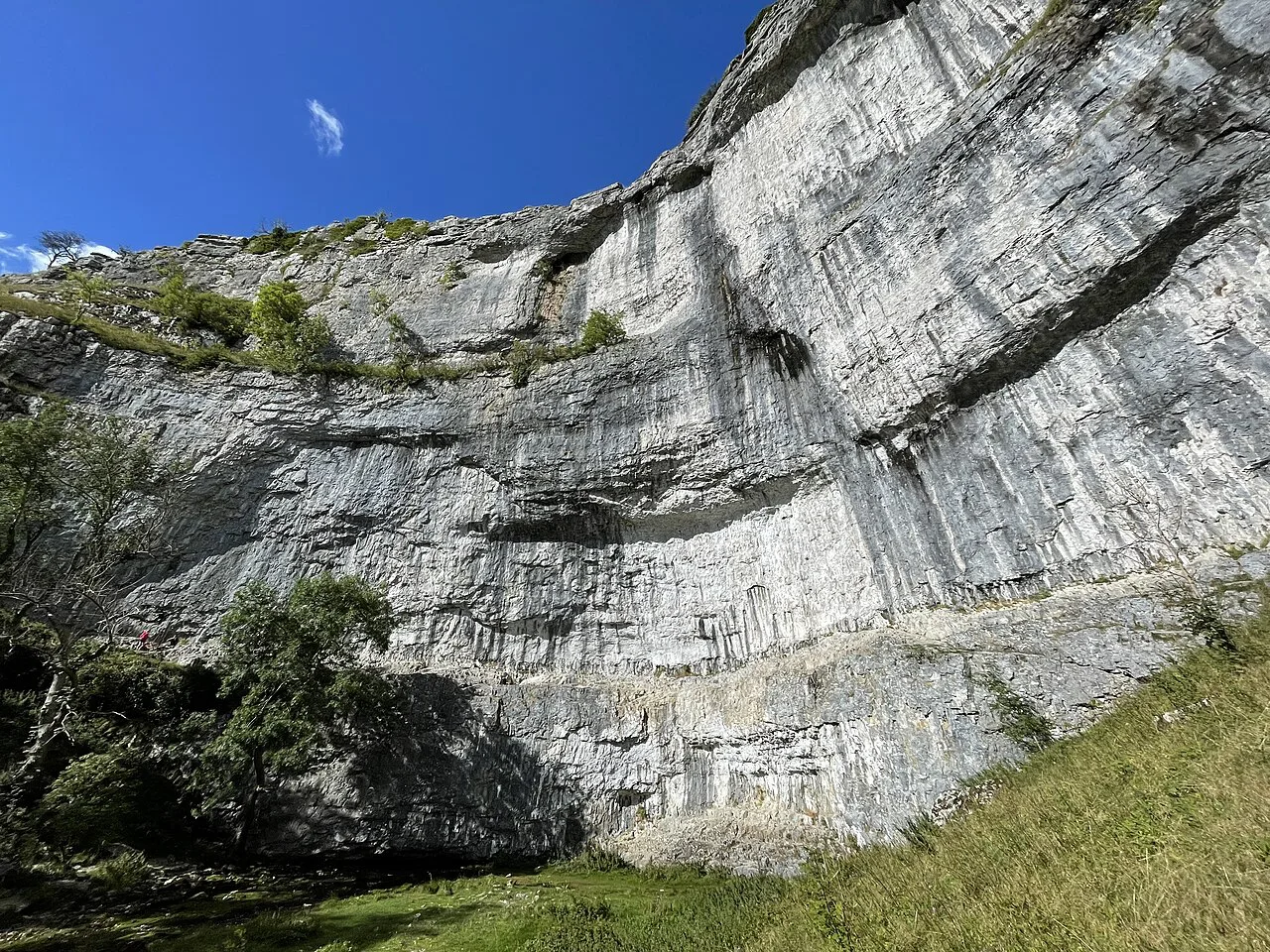
From the pavement, cross to the far side of the cove and start the descent on the steps down the cliff. The steps vary in size, so pay attention on the way down; this is the part of the route that feels harder than the approach along the top suggests. At the bottom, look back at the cove and watch for peregrine falcons, which nest on the cliff. Follow the footpath beside the beck away from the cliff, pass through two gates to reach the road, turn left and walk into Malham with the car park on your right.
Limestone pavement and the peregrine falcons at the cove
The limestone pavement on top of Malham Cove is the walk's signature sight, and it has appeared in major films, including Harry Potter and the Deathly Hallows. The clints and grykes reward a slow wander, but watch your footing rather than the view while you move across them. The cove face is also a popular climbing venue, and peregrine falcons live on the cliff, so give climbers and birds room at the rim.
Shorter options: Gordale Scar and Malham Cove as out-and-back routes
The full loop is not the only option, and mixed-ability groups can split it. Gordale Scar and Malham Cove both have excellent accessible paths from the village side, so part of the group can visit one landmark on easy ground while others take the full circuit. The full loop is not suitable for pushchairs or wheelchairs, so treat those accessible stretches as separate outings rather than a substitute for the round. If you want a waterfall walk with less climbing, the ingleton waterfalls trail offers a waymarked alternative with a very different character.
When to go: seasons, rainfall and path conditions
The walk works year-round, but the ground and the water change with the weather. Rainfall feeds the beck and the scar, so after wet spells expect more water in the gorge and softer footing on the field sections. Snow and ice on the descent steps make the cliff section a different proposition in winter, so pick a dry spell for the full circuit and save the accessible out-and-back paths for days when the tops are slick. If the weather turns you toward gentler limestone country, the Lake District hiking guide covers comparable low-level options.
Hazards on the route: steep climbs, off-track sections and steps
The circuit includes steep climbs and a few off-track moments, so wear boots with grip and keep the map handy where the path fades. The steps beside the cove vary in size, which makes the descent the most demanding part for tired legs. Damp limestone pavement is slippery, so cross it deliberately and keep children close at the rim.
Facilities at the National Park Centre and in Malham
The National Park Centre car park has toilets and picnic areas, which makes it a sensible place to base the day. Staff at the centre can answer questions about the local area, so ask there about paths and conditions before you set off. Malham village sits below the cove and the Buck Inn is a useful landmark on the walk out, with the village itself a short step from the trailhead.
Extending the day toward Malham Tarn
If three hours leaves you wanting more, the walk can be extended by heading up toward Malham Tarn from the lane above the cove, taking care along the single-track road. That adds distance and height, so start early and carry extra food if you plan to include it. The dry valley and Pikedaw route covers the longer version of the day for hikers who want a full-day outing in Malhamdale.
Nearby walking in the Dales
Malhamdale is one part of a much larger network of trails across the Dales, and the aysgarth falls walk makes a gentler companion day on the River Ure when your legs want something shorter. Hikers building a longer trip often pair valley walks with the yorkshire three peaks for a bigger challenge. Both sit outside the Malham circuit itself, so plan them as separate days from a different base.
Walking the Malham Cove circuit with a dog
The Malham Cove circular walk is approximately 8km (5 miles) and takes around 3 hours to complete the loop, allowing for stops to enjoy the scenery on route. Most of the route has good paths underfoot, but you should be prepared for steep climbs and some off track moments, which matter when you have a dog on the lead or under close control.
Gates rather than stiles are the pattern for much of the circuit: the route from Malham village to Janet's Foss passes through a few gates and a kissing gate with a National Trust sign, the path above Gordale Scar goes through a wooden gate, and the climb toward Malham Cove uses a kissing gate and gates to get onto the lane. There is, however, a stile at the corner of the dry stone wall on the way up through the grass field, and a dog may need help over it.
Water is available beside the path for much of the way. The route follows Malham Beck from the stone bridge out of the village, the beck runs beside the path in the woods below Janet's Foss, and after the descent from the cove the footpath by the beck leads back towards the village. The limestone pavement on top of the cove is uneven ground, and the steps down the side of the cove are a bit variable in size, so pay attention as you go. The peregrine falcons that call the cove home are another reason to keep a dog close at the cliff.
If the full loop feels like too much for your dog, Gordale Scar and Malham Cove both have excellent accessible paths and can be visited as out-and-back routes. The Malham National Park Centre car park has toilet facilities and picnic areas on site, and the guide in the centre will be able to answer questions about the local area too.
Plan Your Visit
The Malham Cove circuit is best treated as a half-day outing with a clear plan: park at the National Park Centre, walk to Janet's Foss, decide at the layby whether to push on to Gordale Scar, and leave enough energy for the variable steps down from the pavement. Carry food and water, wear grippy boots and choose a dry day for the full loop. Check current parking and transport arrangements with the Yorkshire Dales National Park Authority before you set out.
Frequently Asked Questions
How long is the Malham Cove circular walk?
The full circuit through Janet's Foss, Gordale Scar and Malham Cove is approximately 8 km (5 miles). Allow around three hours with stops at the waterfall, the gorge and the pavement.
Where do you park for the Malham Cove walk?
Use the Malham National Park Centre car park, which has a good number of spaces, toilets and picnic areas on site. It is the practical start and finish point for the circuit, a short walk from Malham village.
Is the Malham Cove walk difficult?
It is a moderate half-day walk rather than a stroll. Most of the route has good paths, but there are steep climbs, a few off-track moments and descent steps of varying size beside the cove.
What is Malham Cove famous for?
Malham Cove is known for its curved limestone cliff and the pavement on top, which has featured in films including Harry Potter and the Deathly Hallows. Peregrine falcons nest on the cliff, and the face is a popular climbing venue.
Can you walk to Malham Cove without climbing the steps?
Yes. There is an accessible path to view the cove from the village side, and Gordale Scar also has an accessible path, so groups can split. The full loop itself is not suitable for pushchairs or wheelchairs.
When is the best time to do the Malham Cove walk?
The circuit works in most seasons, but choose a dry spell for the full loop. Wet weather brings more water to Gordale Scar and softer ground, and ice on the descent steps makes the cliff section harder in winter.
Sources
Trail notes for your next trip
Optional updates when we add or revise hiking guides.
You might also like
Continue reading
More guides you'll find useful