Ribblehead Viaduct Walk: Routes, Parking and Trailheads
Plan a Ribblehead Viaduct walk in the Yorkshire Dales, from the short path to the arches to a longer circuit onto Whernside, with parking and rail access.
On this page
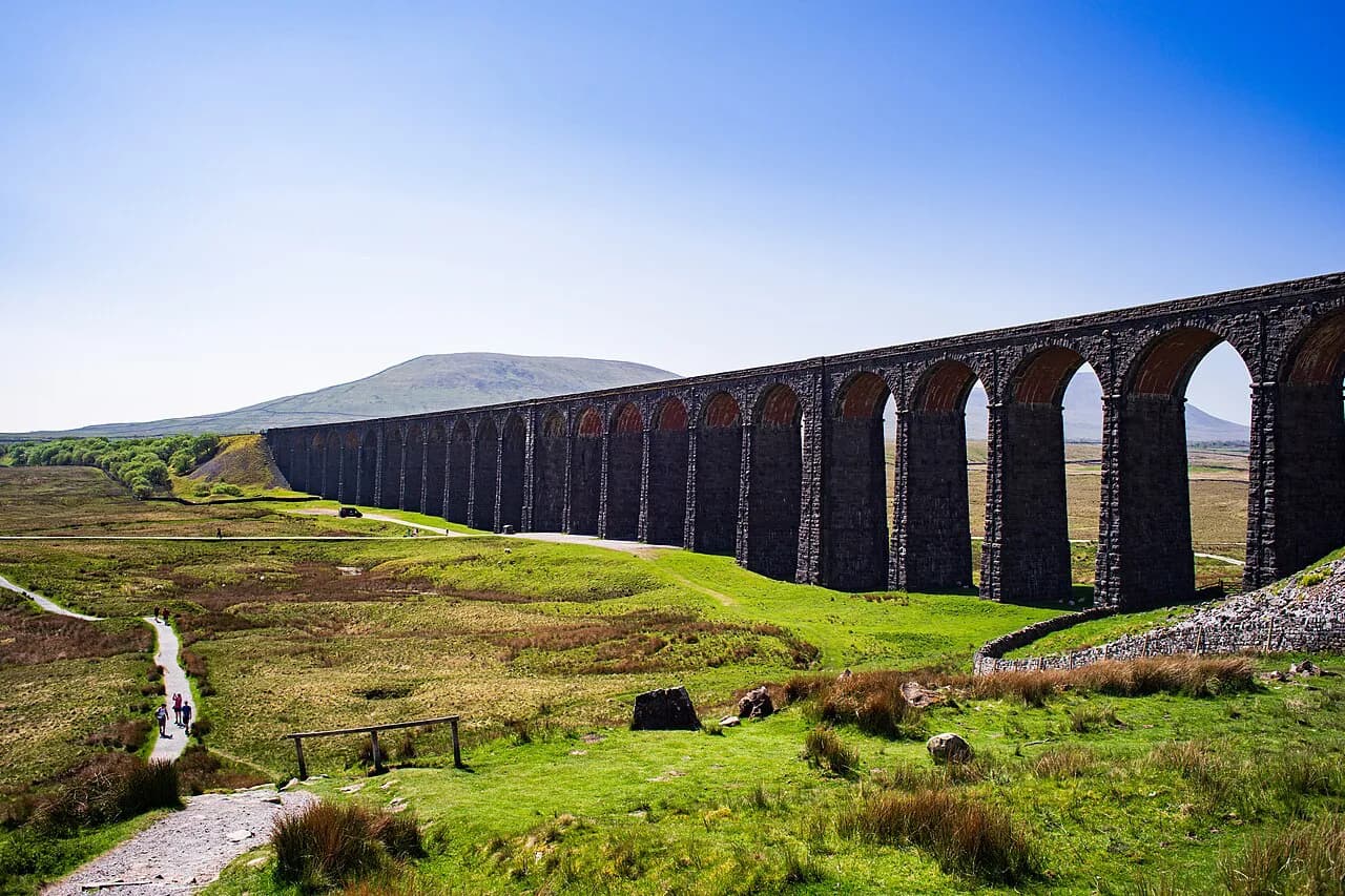
A walk to Ribblehead Viaduct puts you under 24 arches of Victorian masonry on open moorland between the Three Peaks of Whernside, Ingleborough and Pen-y-ghent. The short version is a flat amble from a roadside car park; the longer version uses the viaduct as the opening move of a fell day on Whernside.
Pick by time and fitness rather than by name. If you have an hour and want the arches and the shanty-town earthworks at Batty Green, stay low. If you want a summit, treat the viaduct as a waypoint on a circuit and read the terrain notes below before committing.
Where the Ribblehead Viaduct walk is and who it suits
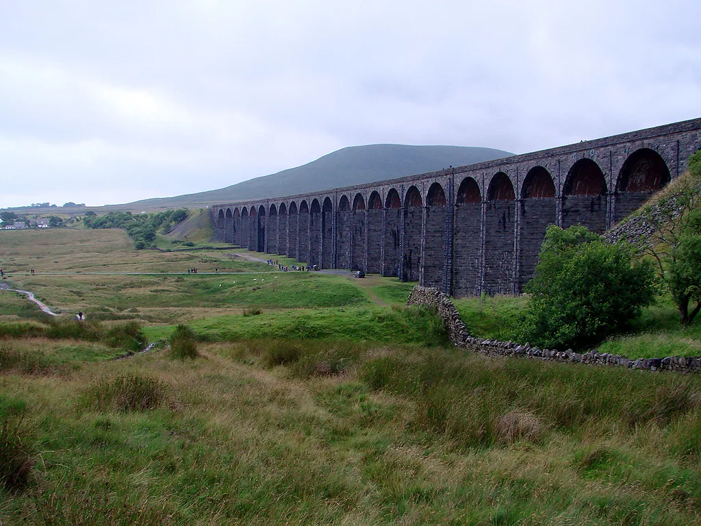
Ribblehead sits in the Yorkshire Dales where Ribblesdale meets the flanks of Whernside, right beside the Settle-Carlisle railway line. The viaduct itself stands 32 metres (105 feet) high and 400 metres (1,300 feet) long across the boggy ground of Batty Green, with the Three Peaks arrayed around it.
The low walk suits families, photographers and anyone breaking a drive along the B6255. The fell circuit suits hikers with boots, waterproofs and a full day, because the ground above the viaduct is steep, peaty and exposed; if you are still weighing up how much climbing you want, the Lake District hiking guide is a useful companion for matching a route to your level.
Getting there: parking at Ribblehead and the Settle-Carlisle line
By car, park where the B6255 Blea Moor Road meets the B6479 Gauber Road; the car park sits at grid reference SD 76545 79289, in the LA6 3AU area. From there you cross the B6255 and follow the footpath over the edge of Batty Green to the viaduct, which you can walk right up to and underneath.
By rail, Ribblehead station on the Settle-Carlisle line puts you within walking distance of the viaduct and the visitor centre, which makes a car-free day realistic. Station buildings retain their original features and are painted in the traditional Midland Railway colours.
For the longer Whernside circuit, the same trailhead works: start from the car park or the station, cross to Batty Green and pick up the path that climbs past the arches. The railway also lets strong walkers ride one way and walk back, which turns a there-and-back fell day into a linear one.
The short walk to the viaduct and Batty Green
This is the option to choose if you want the arches without a summit. From the car park, the path drops across the edge of Batty Green to the viaduct in a few minutes of easy walking, and you can stand directly beneath the span.
Look down as well as up. Some of the lumps and hollows in the moor around the path are the remains of the shanty town and construction site that housed the workforce in the 1870s, and Yorkshire Dales National Park information boards on the ground explain what you are seeing.
The visitor centre at the station is the natural add-on: exhibits and photographs cover the railway's history, and it gives you a dry place to sit if the moor weather turns.
The Whernside circuit via the viaduct
The classic longer day uses the viaduct as its opening act and then climbs Whernside, the highest of the Three Peaks. Route descriptions combine the arches, a historic aqueduct and a quiet tarn on the way up, so the day mixes industrial heritage with fell ground rather than being a pure summit bash.
Plan the climb as the hard part of the day. The ascent from the Ribblehead side is sustained, the descent steep in places, and the summit plateau open to wind from every direction; carry a map and be ready to turn back if cloud closes in.
If you want company or interpretation, the Friends of the Settle-Carlisle Line runs free heritage walks from the station yard, including a longer hiker-level route through the Ingleborough nature reserve and Gauber High Pasture on the far side of the line. That route is about 8 miles (13 km) and leaves with the train arriving at 10.38, with a lunch stop around 12.30.
Distance, ascent and time for each option
The short path to the viaduct and Batty Green is a matter of minutes each way and stays flat, so it needs no special fitness. Treat it as a leg-stretch of well under an hour, including time under the arches.
For the guided routes out of Ribblehead, the published figures give a sense of scale: around 8 miles (13 km) for the Navvy Walk, about 4.5 miles (7 km) for the Trails and Tramways walk, and 2.5 miles (4 km) for the shanty site tour. The shanty tour runs from the visitor centre at 12.30 and finishes in time for trains home.
A self-guided Whernside circuit is a full day rather than a half day. The route bundles the viaduct, aqueduct and tarn with a summit climb, so allow for several hours on your feet and start early enough to be off the high ground before evening.
Route description: the arches, the aqueduct and the tarn
Start at the car park, cross the B6255 and follow the path over Batty Green; the arches grow quickly and you pass right beneath them, where you get the clearest view of the stonework and the curve of the span.
From the viaduct, the Whernside line follows the old waterworks remains, passing a historic aqueduct and a small tarn before the ground steepens. These are the landmarks to tick off: the arches behind you, the aqueduct, the tarn, then the long pull to the ridge.
Above the tarn the path turns to peat and stone, with the summit ridge ahead and Ribblesdale dropping away behind. Save something for the descent, which is steeper than the climb on the return leg and rough underfoot after rain.
What you see from the moor: the Three Peaks
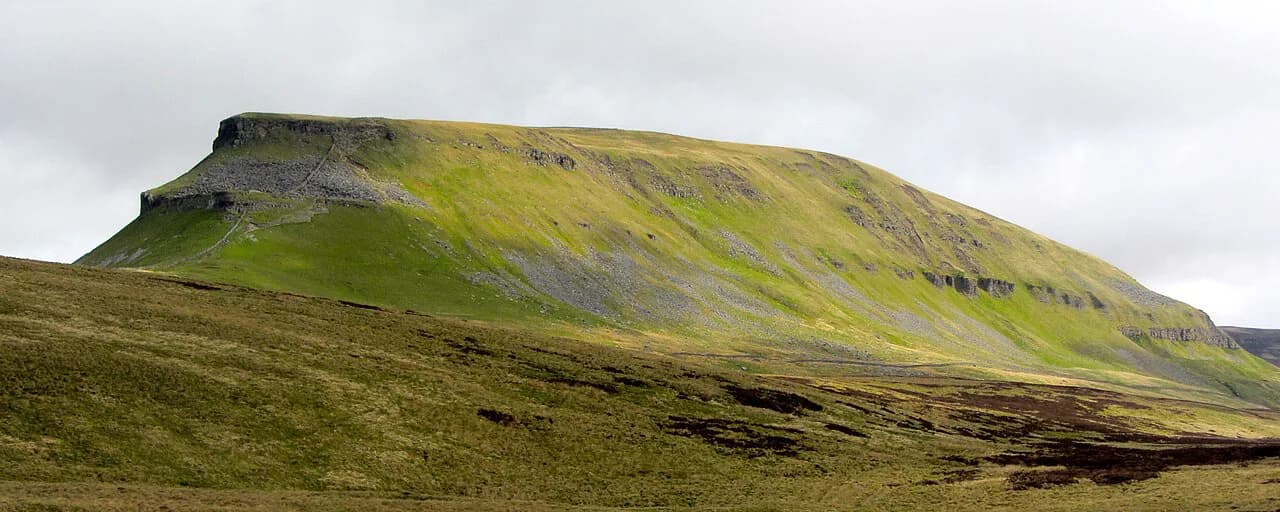
Batty Green is enclosed by the Three Peaks: Whernside above the viaduct, Ingleborough to the south and Pen-y-ghent to the east. On a clear day the guided Trails and Tramways walk promises views of all three from its stony path, which gives a sense of how much sky the moor opens up.
The Blea Moor tunnel entrance and signal box are within reach of the station-side paths, and the line cuts into the land in a way that makes the Victorian engineering obvious from above. Several longer routes in the area also drop toward Clapham, Ingleton and Settle if you want to extend the day beyond the viaduct.
For a completely different half-day nearby, the Ingleton Waterfalls Trail is a marked, well-maintained circuit with cafés and toilets, and it works well as a rest-day alternative to fell ground.
Terrain, exposure and weather on Batty Green
The moor is genuinely boggy in places, and the ground between the car park and the viaduct holds water after rain. Boots rather than trainers make the difference on the Batty Green crossing, and waterproofs should go in the pack even on a bright morning.
Weather at Ribblehead turns cold and wet quickly; the guided walks insist on boots and waterproofs and may be rerouted or cancelled in severe conditions. The same logic applies to a self-guided day: windproof layer, spare insulation, and a realistic turnaround time on Whernside.
Exposure on the summit ridge is the real hazard rather than technical difficulty. There is no scrambling on the standard line from the viaduct, but the plateau is open and navigation is by compass and map when cloud sits on the tops.
When to go: seasons and ground conditions
Late spring through early autumn gives the best odds of dry ground, but the peat holds water well into summer after wet spells. Winter visits are possible for the low viaduct path, though the fell circuit then needs winter skills and a short daylight plan.
Heritage events at Ribblehead run through the warmer months; the 2025 programme ran from April to September and included guided walks, trails, tours, outdoor theatre and exhibitions, with a downloadable brochure listing the dates. The Friends of the Settle-Carlisle Line (FoSCL) run these free volunteer-led walks and tours, so check the season's own programme before you travel.
Heritage walks and the shanty site at Ribblehead
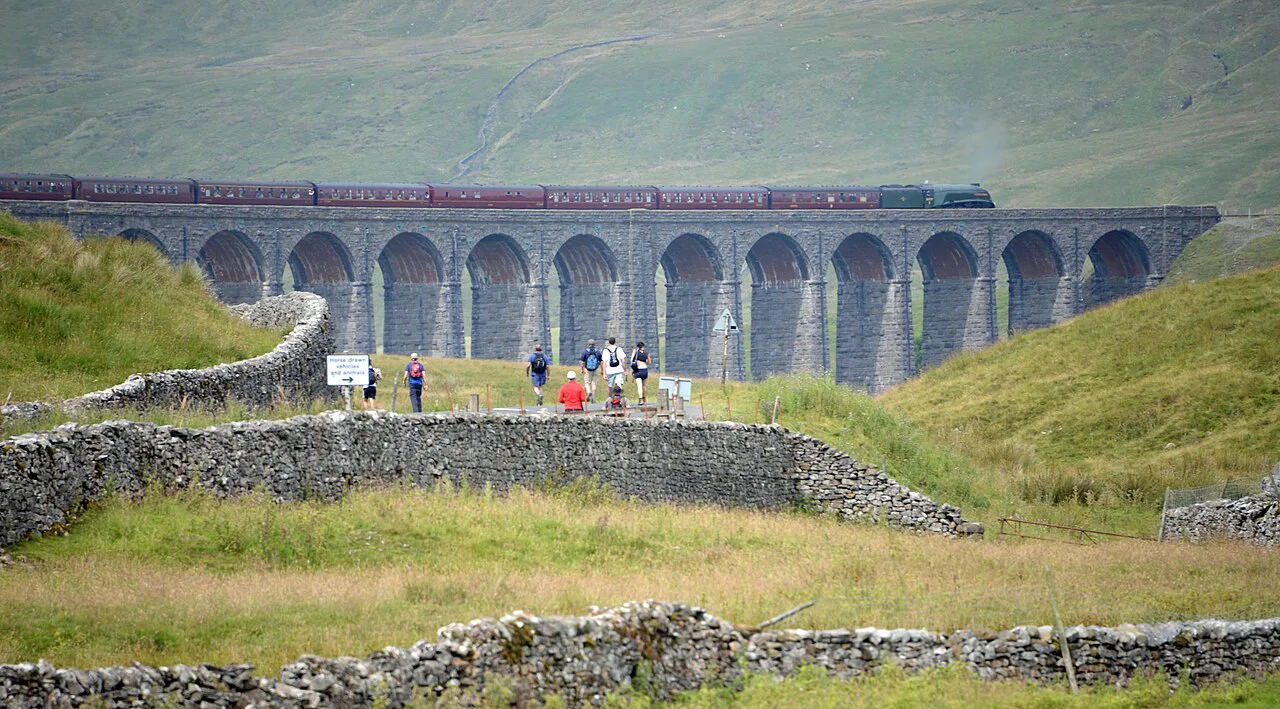
The volunteer-run heritage programme gives the viaduct its human story. The shanty site tour traces the homes, offices, shops and workplaces of the navvies who built the line, covering about 2.5 miles at a relaxed pace, and finishes with outdoor theatre at Batty Green.
The walks are free, with donations invited to keep the heritage work going, and they operate under rules worth knowing: no dogs on the walks, no children under 10, and under-18s accompanied by a responsible adult. Meet points are in the station yard or at the visitor centre depending on the route.
The station café is a useful fixed point for a pre-walk coffee or a post-walk cake, and the visitor centre offers exhibits and photographs if the weather keeps you indoors. Check the day's opening times and event details with FoSCL at the visitor centre before you travel.
Where to base yourself for the walk
Settle is the obvious base: a market town with shops and trains on the same line, which makes the Ribblehead trip a short rail hop. Horton-in-Ribblesdale and Dent sit along the line too, giving access to the Three Peaks and the viaduct without a long drive.
Farms and B&Bs around Selside, between Ribblehead and Settle, put you within a short drive or walk of the trailhead and are handy for early starts on Whernside. Ingleton and Clapham work as bases for limestone scenery and waterfalls as well as the viaduct.
Other Dales walks from the same trailhead
Once you have seen the arches, the area offers more than one day's walking. Whernside via the viaduct, aqueduct and tarn is the photogenic circuit; Ingleborough's summit gives the classic climb; and gentler routes on Twisleton Scar or the Norber erratics suit a shorter day or a change of scenery.
For contrast with the open moor, plan a day at the waterfalls and limestone of the Ingleton Waterfalls Trail, which uses marked paths along the River Twiss and River Doe. The Yorkshire Three Peaks remains the big challenge in the area for fit hikers who want all three summits in one push.
Plan Your Visit
For most visitors the right call is the short path across Batty Green to stand under the arches, with a look at the shanty-town remains and a stop at the station visitor centre. Add the Whernside circuit if you have a full day, proper boots and a forecast that will hold.
Get the trailhead right: car park at the B6255 and B6479 junction, or the train to Ribblehead station, then cross the road and follow the path to the viaduct. The park and the heritage operator publish the current event programme and access notes.
Frequently Asked Questions
How long is the walk to Ribblehead Viaduct?
The direct path from the roadside car park across Batty Green to the arches takes only a few minutes each way and is flat. A full circuit over Whernside is a day-long outing rather than a short walk, so pick according to the time you have.
Where do you park for the Ribblehead Viaduct walk?
Park where the B6255 Blea Moor Road meets the B6479 Gauber Road, in the LA6 3AU area. From the car park you cross the B6255 and follow the footpath over the edge of Batty Green to the viaduct.
Can you walk to Ribblehead Viaduct from the station?
Yes. Ribblehead station on the Settle-Carlisle line sits within walking distance of both the viaduct and the visitor centre, and heritage walks also start from the station yard. The railway makes a car-free day practical.
Is the Ribblehead Viaduct walk difficult?
The short path to the arches is easy and flat. A circuit over Whernside is a proper fell day with sustained ascent, rough ground and exposure on the summit ridge, so it suits hikers with boots and navigation skills.
What is the postcode for the Ribblehead Viaduct car park?
The location is given as Ribblehead Viaduct, Carnforth, North Yorkshire, LA6 3AU, with the car park at grid reference SD 76545 79289. Use the grid reference with a map rather than relying on satnav alone.
What else can you walk from Ribblehead Viaduct?
Options include the Whernside circuit via the old aqueduct and tarn, the lower slopes of Ingleborough, and heritage trails toward Blea Moor tunnel and the shanty site. Farther afield, Ingleton and Settle offer separate waterfall and limestone walks.
Sources
Trail notes for your next trip
Optional updates when we add or revise hiking guides.
You might also like
Continue reading
More guides you'll find useful