Tre Cime di Lavaredo Hike: Which Dolomites Route to Choose
Plan the Tre Cime di Lavaredo loop in the Dolomites: route stages, distance and ascent, huts on the way, trailhead access from Lake Antorno and when to go.
On this page
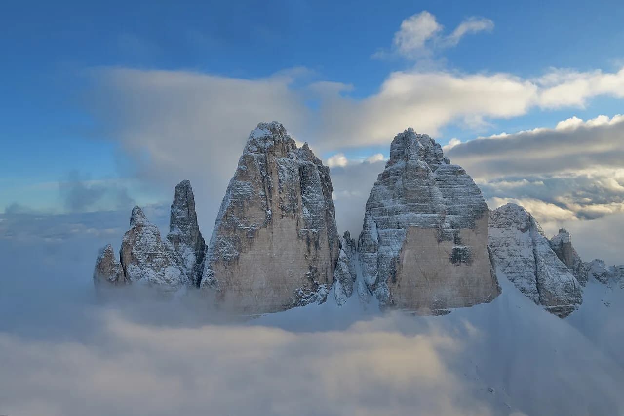
The Tre Cime di Lavaredo are three freestanding rock towers in the Italian Dolomites, and the loop that circles them delivers the classic views of all three faces without demanding a summit climb. It suits fit walkers with a full day, families with older children, and anyone who wants big alpine scenery with a choice of huts for lunch. This guide is part of our wider hiking in dolomites planning, where you can compare the Tre Cime with longer routes in the same range.
What the Tre Cime loop offers and who it suits
The circuit stays on well-maintained paths with gentle elevation gain, which is why guided operators pitch it as suitable for less experienced hikers as well as regular walkers. You pass multiple viewpoints of the three peaks, stop at mountain huts for refreshments, and cross open alpine ground where marmots and alpine flowers show up in summer. It rewards photography as much as fitness.
It is not a summit day and needs no climbing gear in normal summer conditions. The trade-off is popularity: this is the Dolomites' signature walk, so start early if you want quiet on the path. The three peaks rise to 2,999 metres (9,839 ft) and the surrounding massif forms part of the UNESCO World Heritage listing of the Dolomites, so expect company on the busiest stretches.
Where the trail starts and ends
The standard start and finish is Rifugio Auronzo, the hut on the road below the peaks, where the loop closes at the same point it began. Guided day trips meet their clients at the Auronzo Refuge and return there at the end of the circuit, so the circuit is a closed loop with no transport logistics mid-route.
The alternative is to start lower at Lake Antorno and walk up to the huts, which turns the outing into a longer day or an overnight. That approach and the two stages of the higher loop are set out in this Dolomite trails collection for the Tre Cime.
Distance, ascent and walking time
Take the short one-day circuit as roughly 10 kilometres (6.2 miles) with 3 to 4 hours of walking for most hikers, the figure most day-trippers plan around. That makes it a half-day of walking plus hut stops and photo pauses, and it is the version to choose if you have one day in the area.
The longer two-day version totals 19.8 kilometres (12.3 miles) with 1,170 metres (3,839 ft) of ascent and the same descent, split over roughly three to five hours of walking each day. Its first stage from Lake Antorno to Rifugio Antonio Locatelli covers 11.1 kilometres (6.9 miles), 960 metres (3,150 ft) up and 430 metres (1,410 ft) down, rated hard with very good fitness required. The return stage is 8.73 kilometres (5.4 miles) with 740 metres (2,428 ft) of descent and is rated moderate.
Choose the circuit if your group mixes abilities and you want a single base. Choose the two-day route if you want the climb on foot from Lake Antorno and a night at altitude under the north faces. Either way, our Cortina d'Ampezzo hiking guide is a useful comparison if you are weighing the Tre Cime against day hikes in the neighbouring valley.
Route description from Rifugio Auronzo
From Rifugio Auronzo the path runs around the massif in either direction, passing Rifugio Lavaredo and the Forcella Lavaredo saddle before reaching Rifugio Antonio Locatelli on the far, northern side. Locatelli is the natural midpoint of the day, and the guided itinerary treats a stop at the mountain huts as part of the route rather than an extra.
From Locatelli the return leg climbs back over the saddle and drops to the Auronzo trailhead. Walking counter-clockwise puts the northern viewpoints later in the day and gives the best light on the north faces in the afternoon; the reverse keeps the steepest sections fresher. Either way, watch for snow patches on the passes early and late in the season and turn back rather than cross a hard, sloping patch without an axe.
The classic viewpoints
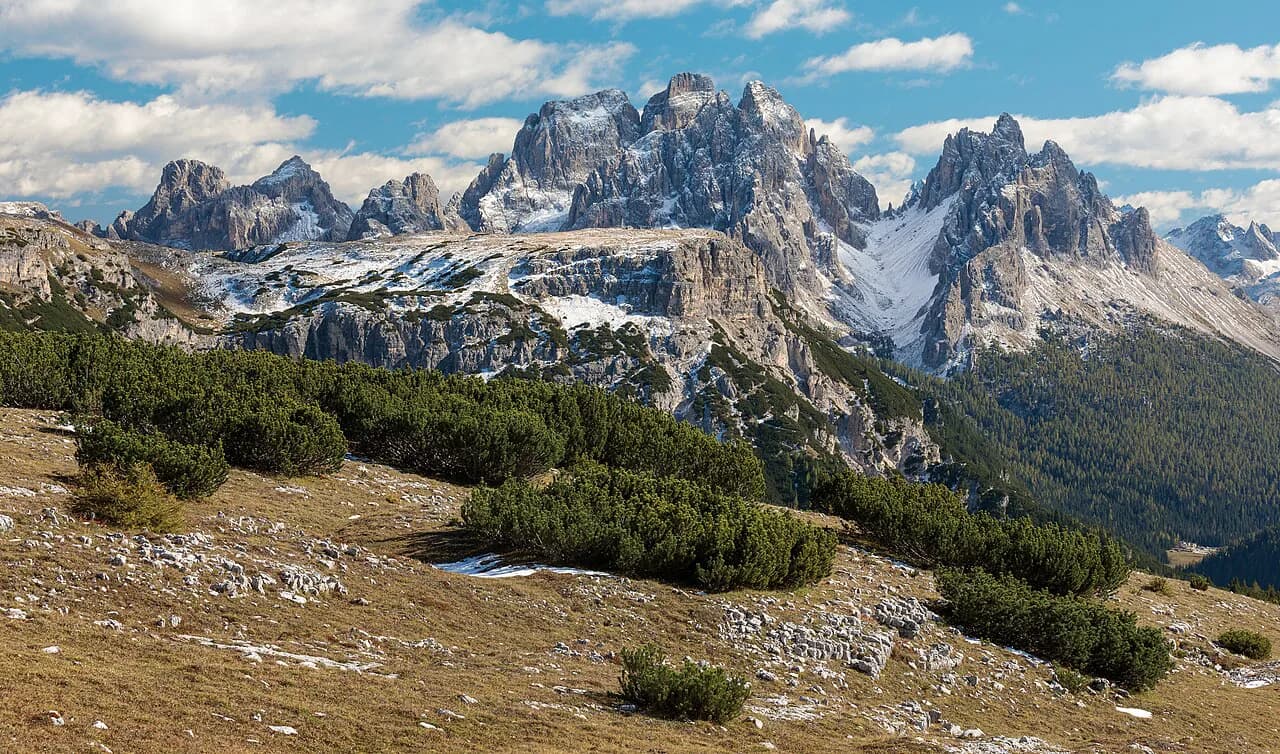
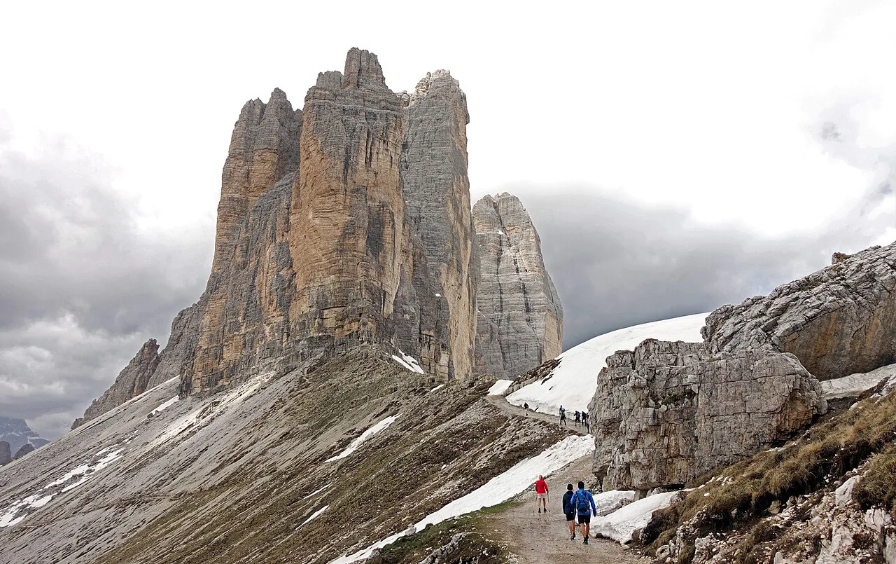
The most photographed angle is from the northern side, near Locatelli, where the three towers stand as separate spires against the sky. The southern side, close to Rifugio Auronzo and Rifugio Lavaredo, gives the more familiar block-of-rock view of all three together. Plan to linger on the north side in the afternoon and keep the south side for the morning or evening when the circuit is busy.
Photographers should carry a wide lens for the full north profile and a longer one for the separated spires, and a windproof layer for the saddle where the wind funnels between the peaks.
Huts on the route
Rifugio Auronzo, Rifugio Lavaredo and Rifugio Antonio Locatelli all sit on the circuit, so you can split the day into short legs with a plate of food or a drink at each. Locatelli is the key stop for the two-day version, since the first stage ends there and the second begins the next morning.
If you want to build a longer Dolomites trip around hut nights, our guide to hut to hut hiking dolomites explains how alpine-club and private huts handle bookings and opening seasons. Reserve rifugio beds well ahead for summer weekends, and confirm directly with the hut or its managing club before you rely on a bed.
Difficulty, footing and exposure
The circuit path is generally well marked and moderate in gradient, but it crosses stony alpine ground where sure-footedness matters, and the long version is graded hard for its ascent and length. Rockfall and loose stone near the towers are the everyday hazards; keep your group tight under the faces and wear boots with a solid sole.
Afternoon thunderstorms are the real risk on a high, open circuit with little shelter apart from the huts, so start in the morning and be off the exposed saddle by early afternoon. Snow can persist on the passes at the start and end of the season, and the paths are not a winter route without proper equipment.
When to go
The loop is a summer and early-autumn walk, and the huts on the route only serve food and beds during their operating season. Check the rifugio websites or ask the local tourist office in Auronzo di Cadore for the season's opening window before you build a trip around a hut lunch. July and August bring the most reliable conditions and the biggest crowds; late June and September give quieter paths with a higher chance of snow patches on the north side.
Trailhead access and parking
Rifugio Auronzo sits on a mountain road above Lake Antorno and Misurina, reached from Auronzo di Cadore in the Belluno province. Driving up puts you at the trailhead but the road is the plan's real bottleneck; many hikers park near Lake Antorno and walk up instead, which adds distance but removes the parking question. Parking rules, tolls and any access restrictions on the Auronzo road change by season, so check with the Auronzo tourist office or the rifugio before you drive up.
Public transport to Misurina and Lake Antorno exists in summer, but timetables vary by year and by the bus company serving the route, so treat the bus schedule as provisional rather than fixed. If you are travelling across the Dolomites by trail instead, the alta via 1 route reaches this area from Lago di Braies further north.
Two-day version with a night at Locatelli
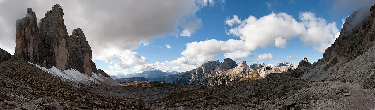
Splitting the loop with a night at Rifugio Antonio Locatelli takes the biggest climb on the first day and leaves a shorter descent for the second. Stage one from Lake Antorno is 11.1 kilometres (6.9 miles) and 960 metres (3,150 ft) of ascent, while stage two back to the lake is 8.73 kilometres (5.4 miles) with 740 metres (2,428 ft) of descent. You get the north faces at sunset and sunrise, which is what the extra night buys you.
Guided versus self-guided
Guided day tours of the loop start from the Auronzo Refuge, include a guide but not transport or food, and suit hikers who want the route explained and the hut stops arranged. Self-guided hikers get the same paths with more flexibility on timing and a lower cost. A private guided day is listed from a group rate rather than a per-person figure, so ask how the price splits across your party before you book.
For more technical ground in the same range, such as protected climbing paths, our dolomites via ferrata guide covers the gear and where a guide is advisable.
What to carry
Bring water, hiking shoes, a rain jacket, hat, sunscreen, sunglasses and a camera, the equipment list guided operators expect on this circuit. Add a warm midlayer for the saddle and a paper map or offline navigation, since phone batteries drain fast in the cold wind. Carry cash for hut stops and keep a headlamp in your pack in case the day runs long.
Plan Your Visit
Decide first between the short circuit from Rifugio Auronzo and the two-day walk from Lake Antorno, because the two versions need different transport, timing and hut bookings. Whichever you choose, start early, plan a hut stop, and check the season's opening window with the rifugio before you travel.
If the Tre Cime whet your appetite for the range, compare other trails in our Alta Via 1 Guide and the Odle/Geisler massif in the Puez-Odle Nature Park for quieter alternatives.
Frequently Asked Questions
How long is the Tre Cime di Lavaredo loop and how much ascent does it gain?
The short circuit around the peaks is commonly planned as about 10 kilometres (6.2 miles) with three to four hours of walking. The longer two-day version from Lake Antorno totals 19.8 kilometres (12.3 miles) with 1,170 metres (3,839 ft) of ascent and the same descent, split into an 11.1-kilometre first stage to Rifugio Antonio Locatelli and an 8.73-kilometre return.
Where does the Tre Cime di Lavaredo hike start?
Most hikers start and finish at Rifugio Auronzo, the hut on the road below the peaks, where the loop closes where it began. The alternative is to begin lower at Lake Antorno and climb to the huts on foot, which makes for a longer day or an overnight at Rifugio Antonio Locatelli.
Is the Tre Cime di Lavaredo loop suitable for beginners?
The circuit path is well marked with gentle elevation gain, so guided operators rate it suitable for less experienced hikers. Sure-footedness still matters on the stony ground near the towers, and the two-day version from Lake Antorno is graded hard because of its length and ascent, so beginners should take the short circuit.
When is the best time to hike the Tre Cime di Lavaredo loop?
July and August bring the most reliable conditions but the biggest crowds, while late June and September are quieter with a higher chance of snow patches on the north side. The huts only serve food and beds during their operating season, so check the rifugio websites or the Auronzo di Cadore tourist office for the season's opening window before planning a hut lunch or an overnight.
Can you hike the Tre Cime di Lavaredo loop in winter?
The loop is a summer and early-autumn walk, and the paths are not a winter route without proper equipment. Snow can persist on the passes at the start and end of the season, and afternoon thunderstorms make an early start essential on this high, open circuit.
Sources
Trail notes for your next trip
Optional updates when we add or revise hiking guides.
You might also like

Continue reading
More guides you'll find useful