Piz Boè Hike: Dolomites' Easiest 3,000 m Peak Route
The Piz Boe hike from Passo Pordoi reaches the Sella Group's 3,152 m summit. Route, distance, ascent, lift access and the best months to go.
On this page
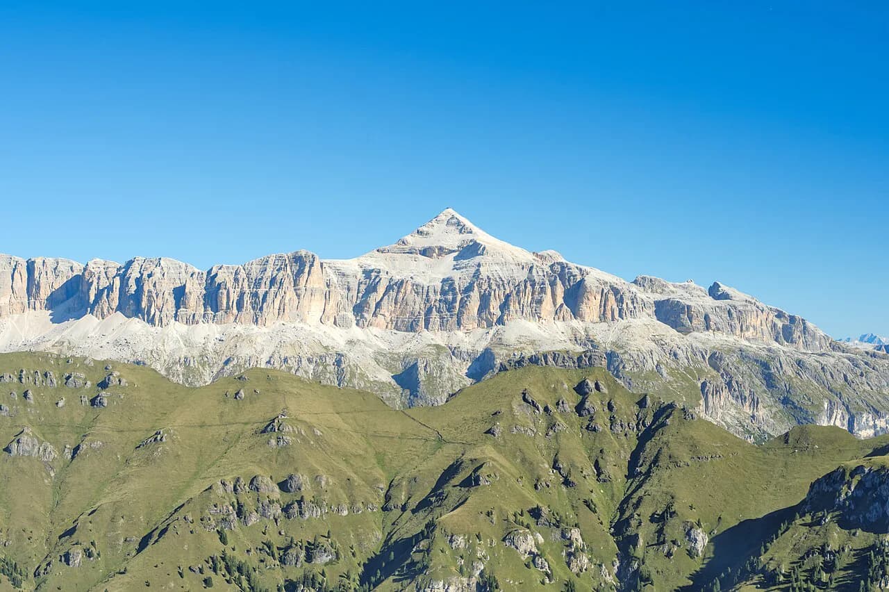
Piz Boe is the highest point of the Sella Group and, by the standard route from Passo Pordoi, the most attainable three-thousander in the Dolomites. The appeal is simple: a lunar-looking limestone plateau, a summit hut, and a short set of wire-rope steps instead of a full via ferrata. It suits fit day hikers with steady feet rather than climbers, and it rewards anyone who wants big Dolomites views without a technical commitment.
Where the route starts and finishes
The hike begins and ends at Passo Pordoi (2,239 m / 7,346 ft), a road pass on the Sella massif between Val Gardena and the Livinallongo valley. The signposted path starts just east of the valley station of the Sasso Pordoi cable car, beside the Fausto Coppi monument, so you can leave the car and be on the trail within minutes. The full circuit climbs to Forcella di Pordoi, traverses below the south faces of the Sella, and finishes at the summit hut on Piz Boe.
Getting to the Passo Pordoi trailhead
By car, the approach runs through Val Gardena via Ortisei, Santa Cristina and Selva to Passo Sella, then left at the junction after the pass up to Passo Pordoi, where a large car park sits on the right-hand side. If you come from the south, Passo Pordoi is reached from Arabba or Canazei on the SS48 road.
Without a car, the route is train to St. Lorenzen, bus 460 to Corvara, then Dolomiti Bus 472 up to Passo Pordoi. Because the 472 connections are limited, plan the day around the return bus rather than the outbound one.
The Sasso Pordoi cable car and what it saves
The cable car from Passo Pordoi to Sasso Pordoi (2,950 m / 9,678 ft) cuts just under 1.5 hours from the ascent; from the mountain station it is a 10-minute descent to Rifugio Forcella Pordoi, where you join the walking route. On the way down, using the lift saves around an hour and requires a 15-minute climb with 100 m (330 ft) of ascent back to the station.
One route report gives a single lift ride at €17 and pass parking at €10 per day, but treat these as reported figures and confirm at the ticket office on the day. Families in that report noted children under eight riding free.
Distance, ascent and time
The full walk from Passo Pordoi and back is 9.0 km (5.6 mi) with 900 m (2,953 ft) of ascent and 900 m of descent, roughly 3 hours up and 2.5 hours down. Add breaks at the huts and on the summit and the day runs to about 5.5 hours of walking.
Using the lift shortens the day to about 7.5 km (4.7 mi), with 469 m (1,539 ft) of ascent and 1,089 m (3,573 ft) of descent over roughly 4 hours. That version suits hikers who want the summit without the scree grind, though the descent on foot is longer than the climb.
Route description: Passo Pordoi to Forcella di Pordoi
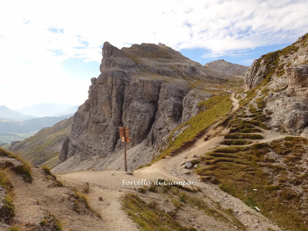
From the car park, cross the road and take the stepped path toward the south walls of the Sella, passing a grassy knoll and swinging northwest toward Sasso Pordoi. The route turns rockier after a few hairpins; the upper third climbs through scree in short switchbacks to Forcella di Pordoi (2,848 m / 9,344 ft), reached in about 1.5 hours. Rifugio Forcella Pordoi sits on the saddle and looks down into the Valon del Fos.
Route description: the plateau traverse to the summit ridge
Beyond the hut, the signposted path runs east past a wayside shrine, traverses below the south face in gentle ups and downs, then turns southeast and climbs switchbacks to the broad saddle between Piz Boe and Punta de Joel. A flat plateau crossing follows, with the summit hut visible above. The route then steepens up bends to a rocky ledge and the first secured step.
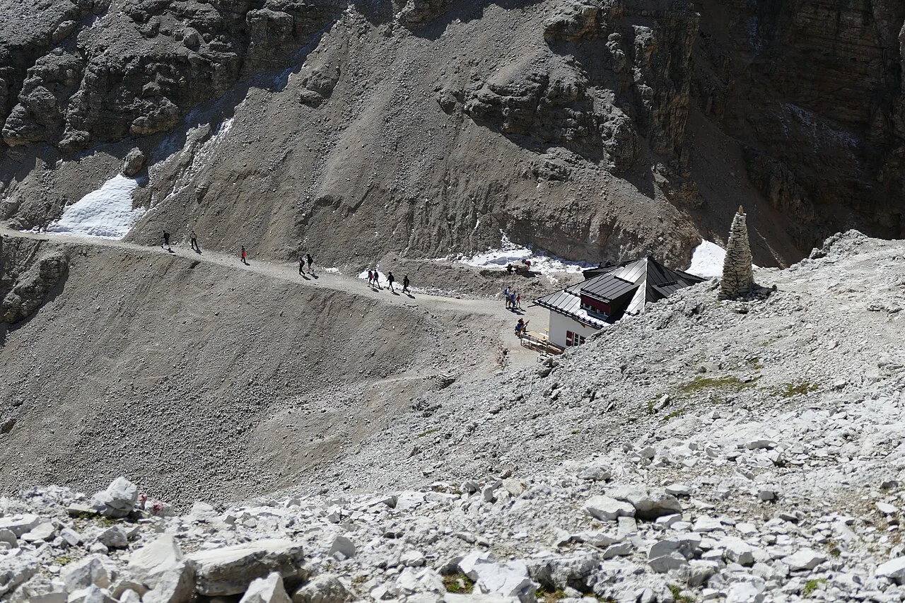
The secured rock steps below Rifugio Capanna Piz Fassa
The ridge holds three short rock steps fitted with wire ropes and steps, not a full via ferrata. The second can be bypassed on the left, though that bypass is for descending hikers, so wait and let oncoming walkers pass; the third also has a narrow bypass path on the left. Route reports say via ferrata equipment is not required, but a head for heights and careful footwork are, especially with the crowds. Confidence on exposed rock matters more than fitness here.
If you would rather learn the skills properly before tackling exposed ground, the Dolomites via ferrata pages explain the grades and gear for the region's protected routes.
The summit and Rifugio Capanna Piz Fassa
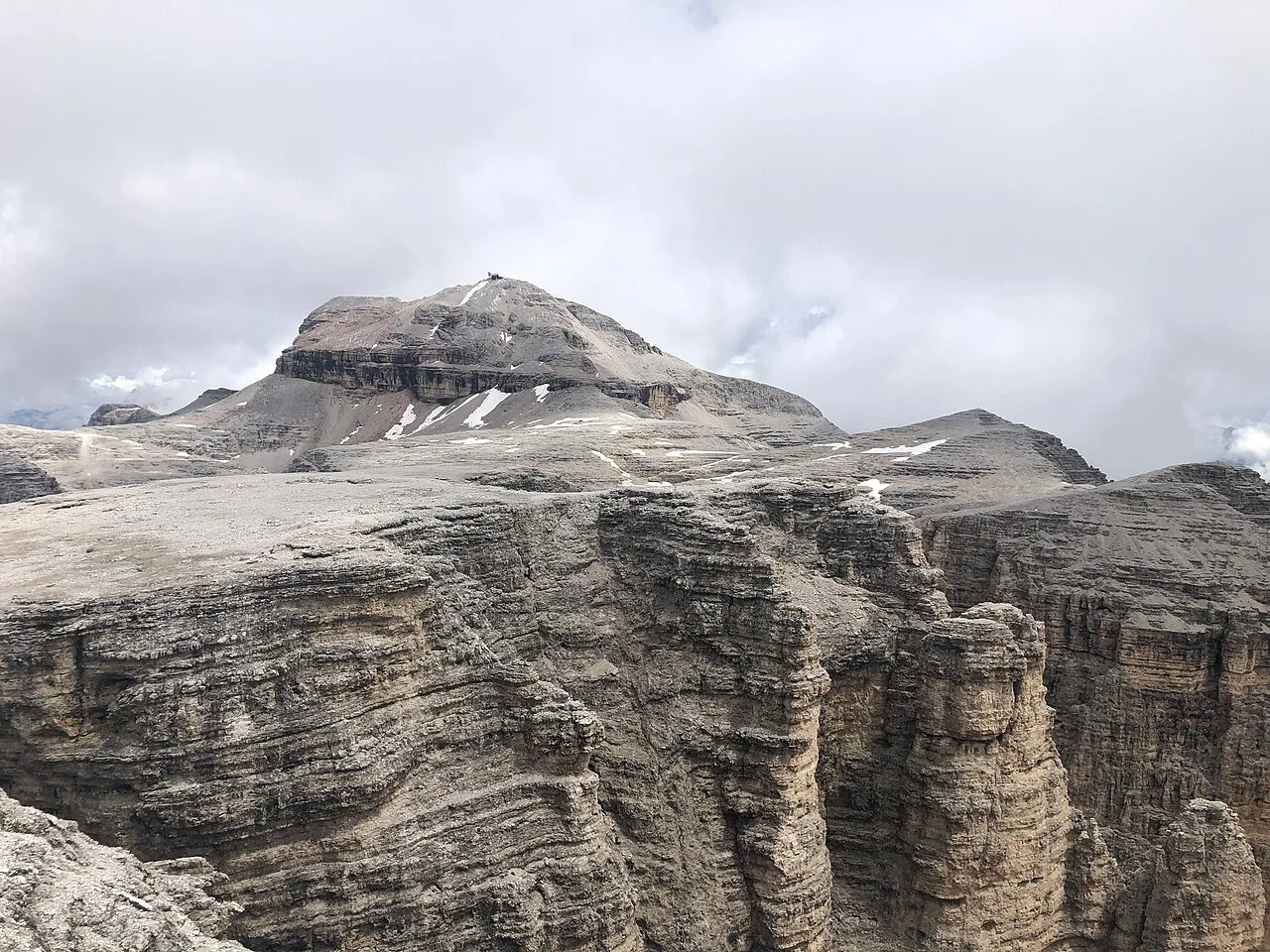
Above the steps, short switchbacks lead to Rifugio Capanna Piz Fassa on Piz Boe's summit at 3,152 m (10,341 ft), where a cross and a Madonna statue mark the top. The panorama runs from the Marmolada and Punta Penia, the Dolomites' highest peak at 3,343 m, to the Ortler, Ötztal, Stubai, Zillertal and Hohe Tauern ranges. The summit hut is the natural lunch stop, and starting your descent from it early keeps you clear of afternoon storms.
Descent options
Most hikers reverse the ascent, taking the secured steps and then following the plateau back to Forcella di Pordoi before the long switchback descent to Passo Pordoi. A quieter plateau variant heads north toward the Boè hut and loops back to Forcella Pordoi, adding distance and a separate descent line. Whichever you choose, the descent on the lower scree path is hard on knees and wants care in loose grit.
Once back at Forcella Pordoi, the cable-car route climbs 15 minutes and 100 m to Sasso Pordoi and takes the lift down. The full walk drops straight to the Passo Pordoi car park.
Huts and water on the route
Rifugio Forcella Pordoi at 2,848 m and Rifugio Capanna Piz Fassa at 3,152 m both trade from mid-June to the end of September, the summit hut weather permitting. The Boè hut below the summit is a further option on the plateau variant. Water is available at the huts rather than on the open plateau, so carry your own supply for the traverse.
When to go
Walk the route between late June and late September when the huts trade and the paths are clear of snow. The Sella plateau sits around 3,000 m, so early and late season trips can meet patches of old snow and ice on the north side of the ridge. Afternoon thunderstorms build fast on the open limestone, making a morning start the single most useful planning decision.
What to wear and carry
Approach shoes or light boots with sticky soles handle the scree and the wire-rope steps well, one of the reasons via ferrata equipment is generally listed as optional for this hike. Bring a windproof shell, a warm mid-layer for the summit, and gloves for cold metal on windy days. Poles are handy on the switchbacks but awkward on the secured steps, so stow them for the final climb.
Crowds, timing and where the route narrows
Piz Boe draws crowds, particularly near the summit and on the plateau between the lift station and the hut, and the second wire-rope bypass comes with an oncoming-traffic rule. The first cable car in the morning beats the tour groups, and a late-afternoon descent thins the queue at the secured steps. The narrow point is the ledges below the summit, where faster walkers should wait rather than push past.
Where to base yourself
Arabba, below the massif, is the natural base for bus and car access to Passo Pordoi from the south. The Val Gardena towns of Ortisei, Santa Cristina and Selva sit on the northern approach road to the pass and suit hikers exploring other walks on the same trip, such as the Adolf Munkel Trail. Passo Pordoi itself has accommodation if you want to start at the cable-car station.
For longer traverses in the same region, the Alta Via 1 long-distance route explores the Dolomites over multiple days. Hikers planning multi-day trips can read about hut to hut hiking in the Dolomites, including luggage transfer and bookings, for routes that link the region's refuges. If you'd rather compare short day summits elsewhere, hiking in Lake Garda covers similar half-day objectives around another Italian lake.
Plan Your Visit
Piz Boe works best as a half-day hike from Passo Pordoi, with the lift easing the climb and the full walk rewarding those who prefer the scree grind. Start early, carry water for the plateau, and watch the sky. The route's modest technical challenge makes it a strong first three-thousander in the Dolomites.
Frequently Asked Questions
How long does the Piz Boe hike take from Passo Pordoi?
The full route from Passo Pordoi and back is about 5.5 hours of walking, with 3 hours up and 2.5 hours down. Using the Sasso Pordoi cable car shortens the day to about 4 hours of walking.
Can you take the cable car up Piz Boe?
The cable car runs from Passo Pordoi to Sasso Pordoi, not to the summit. It saves just under 1.5 hours on the ascent and around an hour on the descent if you return on foot to the lift station.
Is the Piz Boe hike difficult?
It is a challenging mountain hike but not a technical one. You cover steep scree on the ascent and three short wire-rope rock steps below the summit, two of which can be bypassed.
Is the Piz Boe hike doable without via ferrata gear?
Yes. Route reports describe the wire-rope sections as short secured steps and say via ferrata kit is not required. A head for heights and sure feet matter more than equipment.
When do the huts on Piz Boe open?
Rifugio Forcella Pordoi and Rifugio Capanna Piz Fassa trade from mid-June to the end of September, the summit hut weather permitting. At other times, carry all food and water yourself.
How do you get to the Passo Pordoi trailhead by bus?
By train, take a regional train to St. Lorenzen, then bus 460 to Corvara and connect with Dolomiti Bus 472 up to Passo Pordoi. The 472 service is limited, so check return times before setting off.
Sources
Trail notes for your next trip
Optional updates when we add or revise hiking guides.
You might also like

Continue reading
More guides you'll find useful