Golden Cap Walk: Route, Parking and Distance Guide
Plan the Golden Cap walk on Dorset's Jurassic Coast: routes from Seatown and Langdon Hill, parking, distance, ascent and the climb to the summit.
On this page
Golden Cap rewards a short, sharp climb with one of the widest coastal panoramas in southern England: Lyme Bay on one side, the crumpled cliffs of the Jurassic Coast on the other, and Start Point visible in Devon on a clear day. The summit stands 191 m (627 ft) above the sea, so the effort is real but contained, and most hikers can fit the walk into half a day.
This is a walk for anyone comfortable on steep grass and mud, from families taking the longer woodland route to fitter hikers attacking the direct pull up from Seatown beach. Because the summit is reached by footpath only, your choice of trailhead shapes the whole day.
Where Golden Cap sits on the Jurassic Coast
Golden Cap rises near Seatown in West Dorset, between Charmouth and Bridport, and forms the high point of the National Trust's Golden Cap estate. It is the highest point on the Jurassic Coast, the stretch of Devon and Dorset shore inscribed by UNESCO as England's only natural World Heritage Site for its rocks, fossils and landforms. The surrounding landscape is protected as the Dorset National Landscape.
The hill's name comes from the distinctive yellow sandstone capping its clay base, and that geology matters underfoot: the lower paths turn slick after rain while the summit ridge drains faster. If you are building a longer trip around the region, the broader jurassic coast walks guide covers the coast path in both directions from here.
Trailheads: Langdon Hill and Stonebarrow car parks, and the Seatown start
The National Trust provides car parks at Langdon Hill and at Stonebarrow, and both sit on the ridge above Seatown with footpaths running straight from the parking areas toward the summit. Starting from either gives you a gentler gradient than climbing from sea level, at the cost of a slightly longer walk overall.
From Langdon Hill the paths climb through woodland before opening onto the grassy ridge, which makes it the better choice in wet weather because tree roots grip better than bare clay. Stonebarrow gives access to the same ridge from the Charmouth side, with open ground and picnic space at the top of the lane.
Starting from Seatown puts the sea at your feet from the first step, but you pay for it with the steepest sustained gradient of any approach. There is no vehicle access to the summit, so wherever you park, the final stretch is on foot.
Route description: the climb from Seatown to the summit
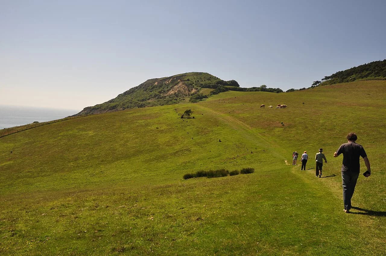
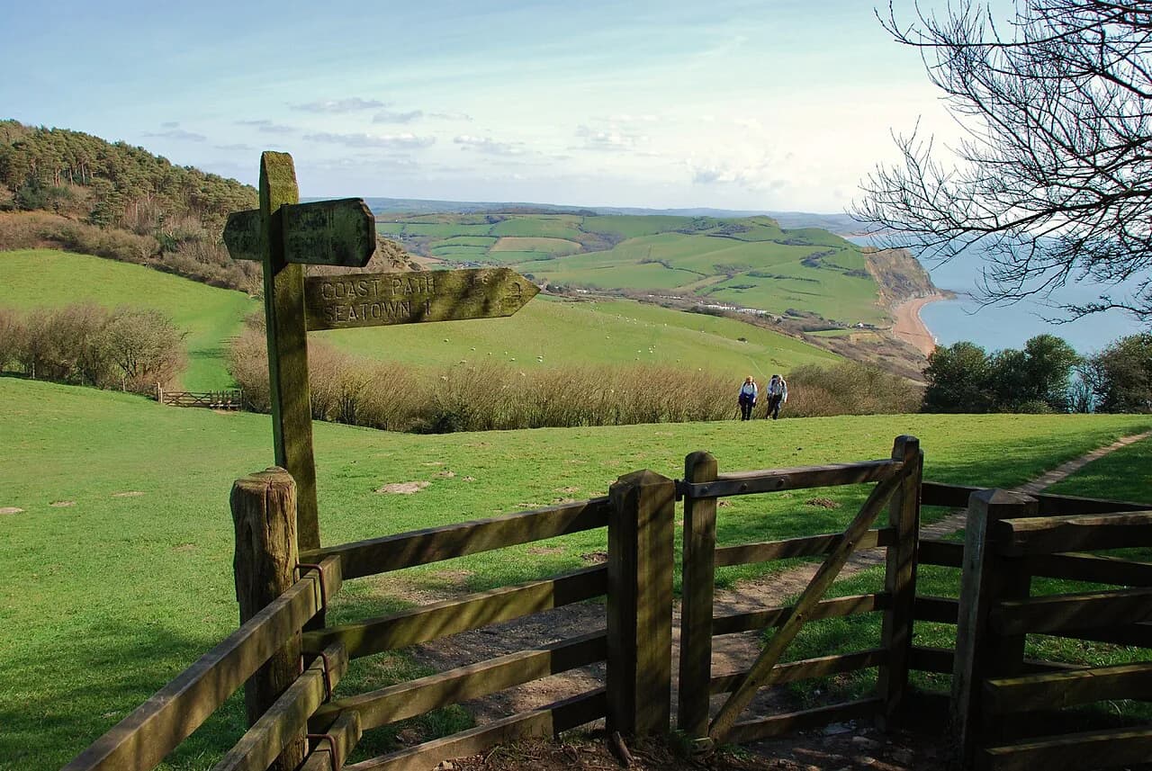
From Seatown the path leaves the hamlet, crosses the low ground behind the beach and then lifts onto the hillside, contouring before turning uphill toward the summit. The gradient steepens sharply in the upper section, where the grass is often worn and slippery after rain and the ground falls away toward the coast path below.
A circular route of roughly 7 km (4.3 mi) links Langdon Hill, Seatown Beach, St Gabriel's Chapel and St Gabriel's Wood, giving a full loop that takes in the summit ridge as well as the coast. That figure is the walking blog's measurement of that specific circuit rather than an official trail length, so treat it as a planning guide and add time for stops and photographs.
St Gabriel's Chapel, a small ruined chapel sitting in the fields above the coast, makes a useful midway landmark on the loop and a natural place to pause before the final pull.
Route description: the gentler approach from Langdon Hill and Stonebarrow
The approach from Langdon Hill is the easiest way up, with woodland paths giving way to open ridge before the summit. One route from the Langdon Hill and Stonebarrow area, covering Stonebarrow Hill, Golden Cap and Seatown, is measured at 7 miles (11 km), so it is a half-day outing rather than a quick dash.
Whichever side you start, expect a final ridge walk with the sea close on your left and the clay vale falling away inland, and expect the wind to pick up as the trees thin out.
Distance, ascent and time for the main routes
The summit height of 191 m (627 ft) above sea level sets the total climb from Seatown, and the steepness of the direct line means most hikers need longer than the short distance suggests. Allow time for the descent too, since the same grass that slows the climb is harder on the knees going down.
As a planning framework: the direct Seatown ascent suits fit hikers with two to three hours to spare, the Langdon Hill loop suits half a day at an easy pace, and the longer Stonebarrow circuit fills a morning or afternoon. Exact timings depend on ground conditions, which change with the weather rather than the calendar.
Summit views over Lyme Bay and the Jurassic Coast
The summit gives a full circle of views across West Dorset and the Jurassic Coast, with Lyme Bay spread below and the cliffs running east toward Charmouth and west toward Bridport. On a clear day the view reaches Start Point in South Devon.
Because the top is open and exposed, the panorama comes with wind, so plan to shelter below the ridge for a long lunch rather than on the trig point.
Extending the day: Bind Barrow and Hive Beach
If you want to extend the walk, the coast path runs south past Bind Barrow above Hive Beach at Burton Bradstock, reached by a short steep climb that opens broad views over the Jurassic Coast and Lyme Bay. The beach below offers a place to cool off after the descent.
Combining Golden Cap with the Hive Beach stretch turns a half-day into a full day and adds another climb, so start early if you plan to link the two.
When to go and ground conditions on the clay and sandstone
Spring and early summer give the best combination of dry ground and long daylight, while autumn brings quieter paths and softer light on the cliffs. Winter walks are possible but the clay sections stay wet for days after rain, and the exposed summit ridge is a poor place in high wind.
The path surface is the thing to watch: the yellow sandstone cap drains well, but the clay below it holds water and becomes greasy, so grippy footwear matters more than any other piece of kit.
Hazards: cliff edges, exposure and livestock
The upper slopes fall away steeply toward the sea, and the cliff edge above Seatown is undercut in places, so keep well back from the rim when the ground is wet. The summit ridge is exposed to wind and weather with no shelter once you leave the trees.
Cattle graze the National Trust land, so give herds room, keep dogs under control and close gates behind you on the ridge paths.
Practical rules: access by footpath only and National Trust land
Golden Cap is reached by footpath only, so vehicles stay at the designated car parks at Langdon Hill and Stonebarrow. The estate is National Trust land, and the wider landscape is managed as part of the Dorset National Landscape.
Car park charges and any membership concessions change from year to year, so the National Trust's own Golden Cap estate pages are the place to look before you travel. If you want a point of comparison for a coast walk elsewhere in Dorset, the Durdle Door walk from Lulworth Cove makes a logical second outing.
Nearby alternatives just outside the immediate area
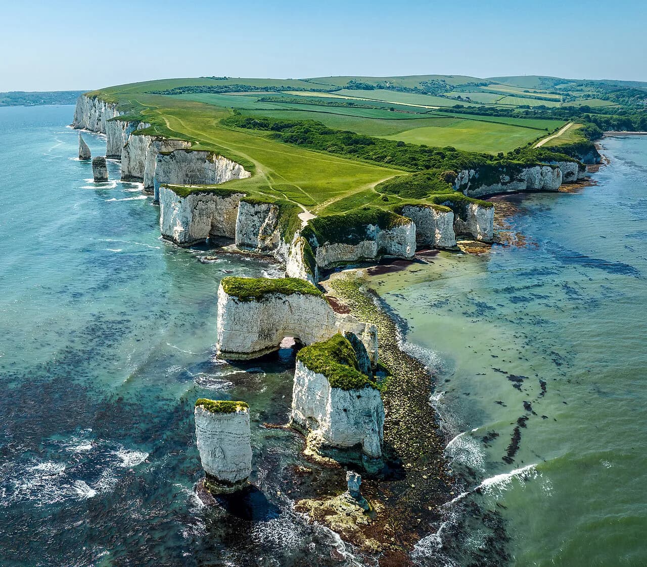
Outside the Golden Cap estate, the South West Coast Path runs east past Durdle Door and Lulworth Cove and west toward Devon, giving a range of cliff walks with different gradients and lengths. The Old Harry Rocks walk near Handfast Point is another option further east for hikers wanting a shorter coastal outing.
For a longer day on the Dorset section of the coast path, the South West Coast Path Dorset guide sets out the cliff-top stages between these landmarks.
Plan Your Golden Cap Walk
Decide first on your trailhead: Seatown for the shortest, sharpest climb, Langdon Hill or Stonebarrow for a gentler gradient and a longer loop. Check ground conditions after rain, wear footwear that grips on wet clay and carry a windproof layer for the exposed summit ridge. If you enjoy this kind of coastal and moorland walking, hiking in Cornwall and hiking in Dartmoor offer comparable day hikes in the south-west.
The summit is reached by footpath only, so plan your parking and walking time together, and leave room for the Hive Beach or Bind Barrow extension if you want a full day on the coast.
Frequently Asked Questions
How long does it take to walk up Golden Cap?
The direct climb from Seatown is short in distance but steep, so allow two to three hours for the ascent and descent at an unhurried pace. The Langdon Hill loop is a half-day outing, and the longer Stonebarrow circuit fills a morning or afternoon. Wet clay underfoot slows everything, so add time after rain.
Where do you park for the Golden Cap walk?
The National Trust provides car parks at Langdon Hill and at Stonebarrow, both on the ridge above Seatown with footpaths running from the parking areas toward the summit. Starting from Seatown puts you at sea level below the steepest line. Charges change from year to year, so check the National Trust's Golden Cap estate pages before you travel.
Can you walk to Golden Cap from Seatown?
Yes. From Seatown the path crosses the low ground behind the beach and lifts onto the hillside before turning uphill to the summit. It is the steepest sustained approach, with worn grass in the upper section that gets slippery after rain, so grippy footwear matters.
Is the Golden Cap walk difficult?
The walk is short but the Seatown ascent is steep, and the clay paths are greasy when wet. The approach from Langdon Hill through woodland gives a gentler gradient over a longer distance. Anyone comfortable on steep grass can manage it, but the exposed summit ridge is no place in high wind.
What is the highest point of the Jurassic Coast?
Golden Cap is the highest point on the Jurassic Coast, standing 191 m (627 ft) above the sea near Seatown in West Dorset. The summit gives a full circle of views over Lyme Bay and the cliffs, with Start Point in South Devon visible on a clear day.
Sources
Trail notes for your next trip
Optional updates when we add or revise hiking guides.
You might also like

Continue reading
More guides you'll find useful