Stanage Edge Walk: Circular Routes, Parking and Trailheads
Plan a Stanage Edge walk in the Peak District with ridge and circular route options, distance, ascent and walking time, car parks, rail access and the best months.
On this page
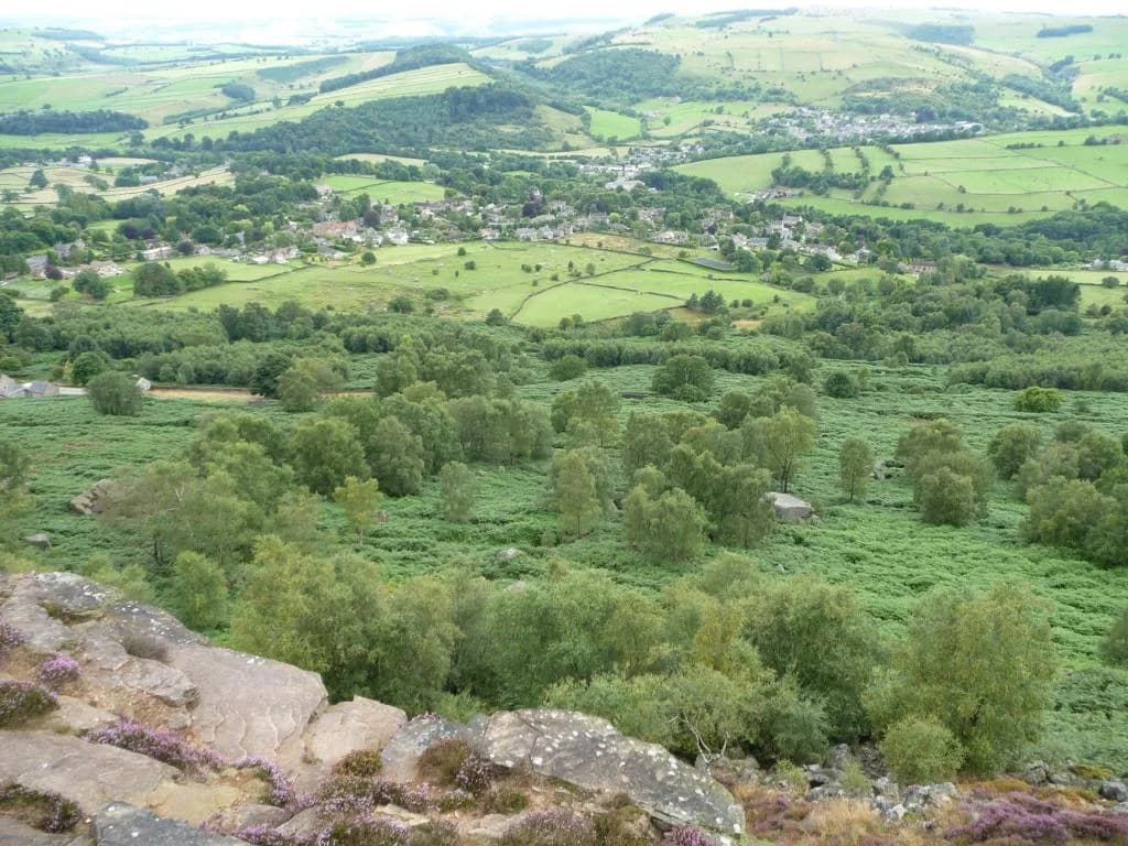
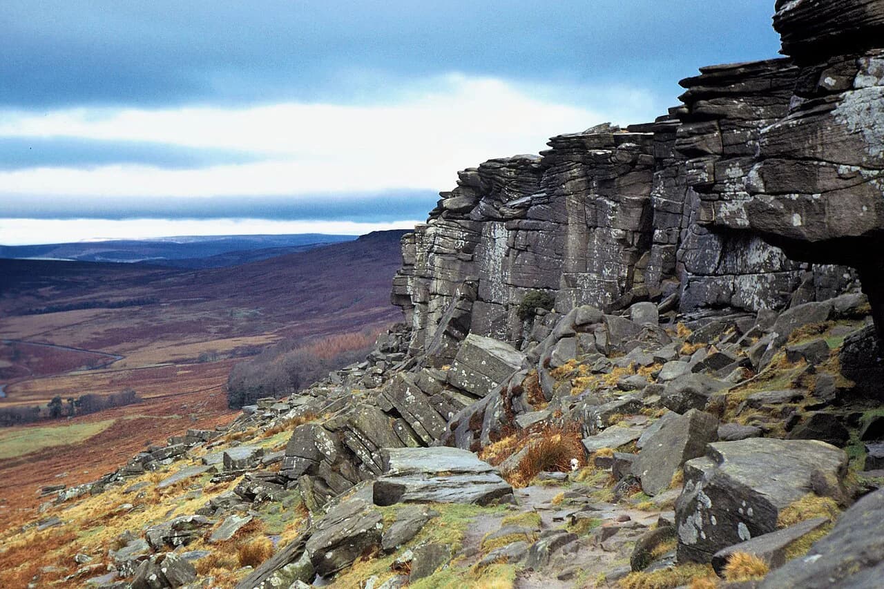
Stanage Edge is a long gritstone escarpment above Hathersage in the Dark Peak, and its appeal is simple: a firm path along the cliff top with wide views over the Hope and Derwent valleys to Kinder Scout, Mam Tor and Win Hill. Because the ridge runs north to south and has several access points, the same edge can be a 20-minute stroll from a roadside pull-in or a half-day circuit from the village. That flexibility makes it one of the most useful walks in the Peak District for mixed groups.
This guide covers the two realistic route shapes — the 7.7 km (4.8 mile) circular from Hollins Bank car park and the 9 mile (14.5 km) circuit from Hathersage — plus the short out-and-back options and the car-free approach by train. Effort, exposure and underfoot conditions matter more than distance here, so each option is described with its own trade-offs.
Where Stanage Edge is and how the ridge is laid out
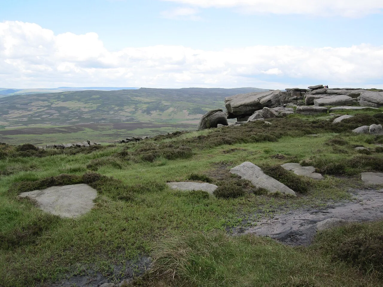
The edge rises directly above Hathersage on the western side of the Dark Peak, with the A6187 running between the village and the Upper Derwent Valley below the southern end of the ridge. The escarpment itself stretches about 6 km (3.5 miles) from the Burbage Rocks end in the south to Stanage End in the north. High Neb, the trig point near the northern half, is the high point most walkers aim for, with Crow Chin and the rocky east summit at 457 m (1,499 ft) marking the southern stretch above Upper Burbage Bridge.
Because it is a ridge rather than a single trail, route choice follows which end you start from. Join from the road and you walk the top path as an out-and-back; start in Hathersage and you climb to the edge through fields and woodland, adding distance and ascent before you reach the cliff top. There is no waymarked circular route on the ridge itself, so a map — OS Explorer OL 01 (Dark Peak) covers the whole edge — is worth carrying even on a short visit.
Trailheads and parking: Hollins Bank car park and the A6187 pull-ins
Three car parks sit along the base of the escarpment, and the one you choose determines your route. Hollins Bank, the middle car park, is the natural trailhead for the 7.7 km circular, with a grid reference of SK 2380 8368 and a postcode of S32 1BR that covers a wide area, so navigate by the map point rather than the postcode alone. All-day parking at Hollins Bank costs £6.60 and the machine takes coins; a Peak District annual parking pass displayed in the windscreen removes the charge.
At the southern end, roadside pull-ins along the A6187 give the quickest route onto the edge, with a short uphill path reaching the cliff top within minutes. These informal lay-bys fill quickly on clear weekends, and arriving before mid-morning or later in the afternoon usually means an easier time finding space. Parking in Hathersage village is the third option, and it is the better choice if you want a longer approach on foot or a post-walk stop in the village.
Reaching Hathersage by train and the walk up from the village
Hathersage station sits on the Manchester to Sheffield line, making the edge a genuine car-free day out. From the station it is roughly a 30 to 40 minute uphill walk to reach the escarpment, following public footpaths that climb gradually through fields and open moorland before the first gritstone outcrops appear. The village also clusters cafés, bakeries, small outdoor shops and public toilets around its centre, so you can stock up before climbing.
The rail approach suits walkers who want a linear day rather than a loop: climb from the village, walk the ridge as far as energy allows and descend on one of the paths back to Hathersage. Check the current train times with the operator before setting out, since services and Sunday timetables change by season. If you leave the car behind, the train also makes it easy to combine the ridge with another Hope Valley walk on the same trip.
Ridge route orientation: from Upper Burbage Bridge north past High Neb to Stanage End
Walking the top path from south to north, you start near Upper Burbage Bridge and the bouldery east summit, marked on OS maps by a spot height of 457 m (1,499 ft) and capped by a concrete trig point. From there the path follows the cliff top north-west past the rocks of Crow Chin, where the edge veers north, before reaching the High Neb trig point and finally Stanage End. The highest ground and the widest views come in that northern half.
Orientation matters because the escarpment is exposed in every direction. The edge path itself is firm and generally clear, but the ground underfoot is rocky and uneven, and the wind on the ridge can be blustery even on warm summer days, so an extra layer and sturdy boots are worth the weight. Below the cliffs, the lower path doubles back beneath the crags and gives an alternative line when the top is crowded or the weather turns.
The 7.7 km circular from Hollins Bank car park, section by section
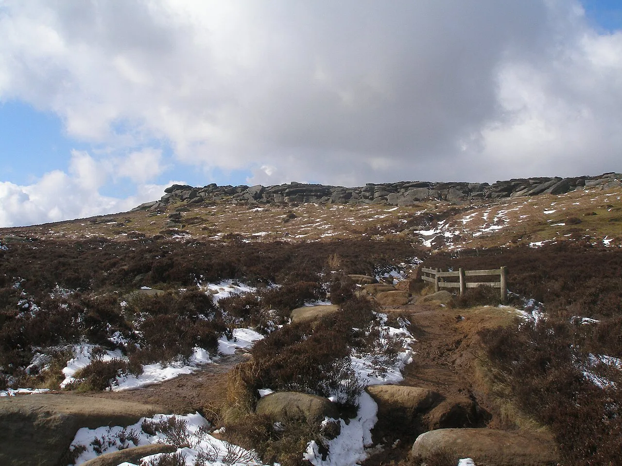
The circular runs anticlockwise from Hollins Bank: leave the car park at the rear, climb steadily through woodland to a double wooden gate and continue on the main path up to the cliff top. Turn left along the edge and, after about 300 m (328 yd), take the right fork; High Neb trig point arrives after roughly 1.2 km (0.75 miles). Continue along the top for another 1.5 km (0.9 miles) to Stanage End, descend left to the path below and follow it back for 2.4 km (1.5 miles) with the escarpment on your left, keeping to the path closest to the edge.
The total ascent is 217 m (712 ft) and, without children, the walk takes about 2.5 hours; allow at least four hours if you are exploring with young walkers. The return leg passes the discarded millstones in its final kilometre, and a ladder stile leads you back up to the fork you passed on the way out. The route is not pram or wheelchair friendly, and there is one steep stile that dogs may struggle with.
The 9 mile circuit from Hathersage via North Lees Hall
The longer circuit leaves the village car park, crosses the A6187 and follows Baulk Lane past the cricket pitch and out onto an unsurfaced track. A signed left fork before Cowclose Farm leads past Brookfield Manor to North Lees Hall, the 16th-century manor often linked to Mr Rochester's house in Jane Eyre, before a stepped path and a short stretch of road take you onto the edge. The route then follows the top path north-west to High Neb and Crow Chin.
From Crow Chin the route drops to the lower path beneath the cliffs, rejoins the top and heads south-east to the bouldery east summit, then follows the road at Upper Burbage Bridge for about 137 m (150 yd) before climbing the higher of two paths to Higger Tor. From the rocky top a path leads north-west to the Fiddler's Elbow road, then down Callow Bank to a walled track, past Toothill Farm and back to Hathersage's spired church and the Roman fort of Camp Green. The sources give the distance as 9 miles (14.5 km) but not a total ascent, so treat it as a full day and pace yourself accordingly.
Short out-and-back options from the road
If time is short, the roadside approach along the A6187 is the most efficient way in: a short uphill path puts you on the edge within 15 to 20 minutes with wide views over the Hope Valley. From there, walk south toward the Cowper Stone or north toward High Neb, the highest point on the ridge, and retrace your steps when you have had enough. A short stroll typically takes one to two hours, and the flexibility means you can match the outing to the weather rather than a fixed route.
For walkers with limited mobility, short sections near the roadside parking let you experience the views without committing to a full walk. Pushchairs and wheelchairs are not suitable on the ridge itself, and the rocky ground and steep drops make close supervision essential for children and dogs. If you want a level surfaced path instead, the trails around Ladybower Reservoir are a better fit for the same day.
Distance, ascent and walking time compared
The three realistic options differ less in difficulty than in commitment. The short out-and-back from the road covers a kilometre or two at most and fits into an hour or two; the 7.7 km (4.8 mile) circular adds 217 m (712 ft) of ascent and about 2.5 hours of steady walking; the 9 mile (14.5 km) Hathersage circuit is a half to full day with a longer approach on foot. None involves technical climbing, but the ridge path is uneven throughout and a longer section between Burbage Edge and High Neb is roughly 5 to 6 miles and takes 3 to 4 hours at a steady pace.
Choose by fitness and time rather than by the headline distance. The circular from Hollins Bank suits families and fit walkers who want the best of the northern edge in half a day, while the Hathersage circuit rewards those who enjoy the approach through fields and the North Lees Hall detour. If your priority is the classic ridge views with the least effort, the roadside out-and-back wins comfortably.
Exposure, uneven ground and weather on the edge
Stanage Edge is fully exposed to wind and weather, and temperatures on the ridge can feel several degrees lower than in Hathersage below. After rain the natural footpaths become muddy and the gritstone slippery, while frost or ice can form in colder months. Low cloud and mist can appear quickly and make the open moorland disorientating, so carry a map or offline navigation if you plan to walk any distance along the edge.
There are steep drops from the escarpment and no facilities anywhere on the ridge, so bring water, a snack and a waterproof layer whatever the forecast. Keep a safe distance from the cliff edge and supervise children and dogs closely on the rocky sections. In an emergency in the UK, call 999 and ask for mountain rescue, giving your location as Stanage Edge near Hathersage.
When to go: heather, daylight and winter conditions
Late spring through early autumn gives the most comfortable walking weather, longer daylight and clearer views across the Hope Valley. Late August brings purple heather across the hillside, though sunny weekends are busy and car parks fill early, so early mornings and evenings are quieter and offer the best light. The ridge runs roughly north to south, so sunrise lights the valley to the east and sunset illuminates the gritstone cliffs from the west.
Autumn and winter are calmer and less crowded, but the ridge is colder, wetter and occasionally icy, so insulated layers and boots with good grip matter more than distance covered. Spring and autumn often bring wind and sudden showers. Whatever the season, check the mountain forecast before setting out, since conditions on the edge change faster than in the valley.
Millstones, Stanage Pole and the Pride & Prejudice connection
Large circular millstones lie scattered across the slopes below the edge, left behind by quarry workers whose industry began to move on in the 1860s, and they are now a distinctive marker of the ridge's industrial past. They are most visible in the final kilometre of the return path on the Hollins Bank circular, where you can count them as you walk. Stanage Pole, a large wooden boundary marker standing for hundreds of years between South Yorkshire and Derbyshire, is a 600 m detour from the fork near the car park if you have energy left.
The edge also draws film pilgrims: it featured in the recent adaptation of Pride & Prejudice, and walkers come to stand on the rocks where the windswept scene was shot. The visit is worth it for the views alone, but the literary associations give the ridge an extra dimension, especially if you combine it with the North Lees Hall circuit and its Jane Eyre links.
Facilities and a post-walk stop in Hathersage
There are no facilities on the ridge, but Hathersage has cafés, bakeries, pubs and small outdoor shops clustered around its centre, and public toilets sit within a short walk of the Hollins Bank car park entrance. The village also has a playground and a heated open-air swimming pool, both handy if you are walking with children. The open-air pool requires tickets booked online in advance.
If you want a second day in the area, the gentle, traffic-free Monsal Trail gives a very different walk through the White Peak's limestone dales and old railway tunnels. It makes a sensible option when the moorland weather closes in or when legs want an easier day after the escarpment.
Nearby alternatives outside the ridge
A short drive east, the Bamford Edge walk offers a gritstone edge with views back toward Stanage and the Win Hill skyline, and it can be combined with a Hope Valley day. Further west, the Mam Tor walk along the Great Ridge gives a contrasting grassy ridge with a well-trodden path and big views over the Hope Valley. Both make good second outings if you are basing yourself in Hathersage for a few days. If you want more escarpment walking at a similar level, the Lake District hikes offer plenty of ridge days to compare with this one.
Planning Your Stanage Edge Walk
Pick your trailhead by the day you want: Hollins Bank for the 7.7 km circular and its 217 m ascent, the A6187 pull-ins for a quick taste of the edge, or Hathersage station for a car-free circuit that includes North Lees Hall. Whichever you choose, boots, a waterproof layer and a map matter more than the distance on paper.
Arrive early on sunny weekends, leave the ridge before the light goes in winter and keep children and dogs back from the cliff edge. With that done, the edge delivers one of the most rewarding and adaptable days out in the Dark Peak.
Frequently Asked Questions
How long does it take to walk Stanage Edge?
From the roadside parking, most visitors reach the viewpoint in 15 to 20 minutes, and a short out-and-back on the ridge takes one to two hours. The 7.7 km circular from Hollins Bank car park takes about 2.5 hours without children, and allow at least four hours if exploring with young walkers. The 9 mile circuit from Hathersage is a half to full day depending on how much of the edge you walk.
Is the Stanage Edge walk difficult?
It is easy to moderate. There is no technical climbing and the edge path is clear, but the ground is rocky and uneven, the ridge is fully exposed to wind and the drops from the escarpment are steep. Sturdy boots and a waterproof layer make a real difference, especially outside summer.
Where do you park for the Stanage Edge walk?
Hollins Bank car park is the trailhead for the 7.7 km circular, with a grid reference of SK 2380 8368 and a postcode of S32 1BR that covers a wide area, so use the map point rather than the postcode alone. There are also roadside pull-ins along the A6187 below the southern end of the ridge, and village parking in Hathersage for the longer circuit.
Can you reach Stanage Edge by train?
Yes. Hathersage station sits on the Manchester to Sheffield line, and from the station it is roughly a 30 to 40 minute uphill walk to reach the escarpment. Services vary by season and day of the week, so check current train times.
What is the best month to walk Stanage Edge?
Late spring through early autumn gives the most comfortable weather, longer daylight and clearer views. Late August brings purple heather, though sunny weekends are busy. Autumn and winter are quieter but colder and wetter, with frost and ice possible, so check the mountain forecast before setting out.
Sources
Trail notes for your next trip
Optional updates when we add or revise hiking guides.
You might also like
Continue reading
More guides you'll find useful