Hathersage Walks: Stanage Edge, Padley Gorge and the Derwent
Plan Hathersage walks with distances, ascent and times for Stanage Edge, Padley Gorge, Win Hill and riverside routes, plus how to reach each trailhead.
On this page
Hathersage puts you within a short walk of the gritstone escarpment of Stanage Edge and within a few miles of the wooded cleft of Padley Gorge, with the River Derwent running through the valley floor between them. That gives a rare choice: a rocky edge day with real climbing and a view, or a flat riverside circuit that a mixed group can manage.
Most of the classic routes radiate from the village, but some of the best days start at Hope, Bamford or Grindleford, which matters if you are planning around trains and buses rather than a car. This guide groups the walks by trailhead so you can choose a start instead of driving between starts, and it uses the distances and ascent figures routes publish to help you match a route to your time and fitness.
Why Hathersage Works as a Walking Base
The village sits on the Hope Valley floor at the point where the Derwent leaves the Dark Peak, with the gritstone edge of Stanage rising directly above and the Hope Valley opening east toward Castleton. That position gives you valley paths, wooded gorge and exposed moorland within a short radius, and a railway station that makes the whole cluster reachable without a car for car-free hikers.
For anyone building a week of peak district hiking, Hathersage is unusually efficient: you can walk from your accommodation to Stanage, ride one stop to Grindleford for Padley Gorge, or head to Hope for the Castleton ridge. The trade-off is that the highest and wildest ground sits above the village, so the steepest ascents begin immediately on some routes.
Getting There and Getting Around
Hathersage has its own station on the Hope Valley line, and the Steel Cotton Rail Trail links Hathersage and Bamford on a gentle riverside route through low-lying meadows with views across the Hope Valley. That section is a useful model for a car-free day: walk one way, take the train back.
If you drive, approach the edges from the roadside parking under Stanage, the Padley Gorge area or along the A57 near Ladybower. Space at those roadside spots fills quickly on fine weekends, so arriving early gives you the best chance of a place, and having a rail-based backup plan saves a wasted morning.
The Derwent Edge round from the A57 parking spot is a practical example of mixing the two: the route can be reached by bus to the Ladybower Inn and walking in from there, which adds around a mile to the day. That flexibility is why Hathersage suits hikers without a car.
Stanage Edge from Hathersage
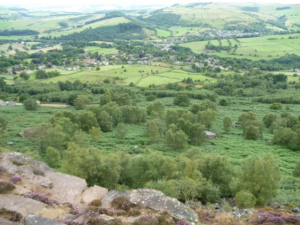
The Stanage Edge circuit from Hathersage is the local classic. The route published for the area runs about 6.28 miles (10.1 km) with roughly 1,014 ft (309 m) of ascent and the same descent, taking around 3 hours 45 minutes at a steady pace. It climbs from the village through fields and minor lanes before gaining the gritstone escarpment, then follows the edge over rock and bilberry before dropping back.
On the way you pass Little John's Grave in the churchyard at Hathersage and, on the edge itself, Robin Hood's Cave, a gritstone overhang tucked below the escarpment. The edge walk is exposed to wind and rain with little shelter on the top, and the gritstone gets slick in wet weather, so grippy footwear and a windproof layer belong in the pack even on a bright morning.
If you want a shorter taste of the same escarpment, the Bamford Edge walk gives you an alternative viewpoint with less distance, while staying on the Derbyshire side of the valley. For the full edge experience with more options to bail out, the route descriptions on the Hathersage walking page are worth reading before you commit to the circuit.
Padley Gorge and Bole Hill
Padley Gorge is the wooded, rocky valley below Grindleford, and the circuit taking in Bole Hill is a compact moderate day: about 3.55 miles (5.7 km) with around 459 ft (140 m) of ascent and 430 ft (131 m) of descent, typically 2 hours of walking. The path threads between millstones left in the woods and boulders along the stream, with short steep sections where the ground is wet.
The trailhead is at Grindleford rather than Hathersage, which makes this a train-friendly day from the village: one stop on the Hope Valley line, then a short walk to the gorge. Because the route is short, it pairs well with an afternoon in the village or a longer edge walk the following day.
Hathersage Stepping Stones and the Riverside Circuit
The stepping stones walk from Hathersage is the flat valley option: a riverside circuit of roughly 5 miles (8 km) that starts in the village and can be joined from the Inn at Leadmill Bridge. The route follows the Derwent through meadows, crosses the stepping stones, and returns on the opposite bank, so it stays easy underfoot even when the edges are cloud-covered.
Distances and time here are modest, so this is the route for a rest day, a family group or a recovery leg between bigger hill days. You can shorten it by turning back at the stones rather than completing the loop, and the level ground means you can walk it in trainers rather than boots.
Win Hill from Hope or Bamford
Win Hill is a steep, rocky viewpoint above the Hope Valley, and the shorter version from Hope covers about 4.10 miles (6.6 km) with roughly 919 ft (280 m) of ascent and a walking time of 2 hours 40 minutes. The climb onto the ridge is stiff and direct, but the summit gives you a wide view over Ladybower and the Edale valley, and the return drops through heather and riverside meadows.
The longer Win Hill and Hope Cross circuit from Bamford runs about 7.91 miles (12.7 km) with 1,253 ft (382 m) of ascent, taking around 4 hours 45 minutes and giving you more time on the ridge and the moorland above Hope Cross. Both versions start in Hope or Bamford rather than Hathersage, which matters if you are relying on the train: the stations are one or two stops along the valley.
Castleton Ridge (Lose Hill and Mam Tor) from Hope
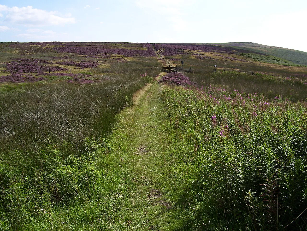
The Castleton Ridge — Lose Hill to Mam Tor — is one of the great ridge walks on the eastern side of the valley, and from Hope village the full circuit is about 7.92 miles (12.7 km) with 1,447 ft (441 m) of ascent and descent, taking around 4 hours 55 minutes. The route climbs to Lose Hill, follows the ridge crest to Mam Tor, and returns via Castleton to the start.
This is the most exposed day in the cluster. The ridge is open and broad with no shelter, so strong wind and afternoon rain turn it into a serious outing even in summer, and you should carry waterproofs and know where to drop off the crest if the weather closes in. The Great Ridge offers a shorter point-to-point option if you arrange transport at Castleton.
Derwent Edge and Ladybower
The Derwent Edge round from the A57 parking spot is about 8.22 miles (13.2 km) with 1,194 ft (364 m) of ascent and 1,204 ft (367 m) of descent, walked in roughly 4 hours 50 minutes. The route climbs from the reservoir side onto the moor and follows the edge over gritstone tors before dropping back to the water, with boggy ground underfoot on some sections after heavy rain.
The Derwent Valley reservoirs — Ladybower, Derwent and Howden — make a gentler alternative along the water itself, and the reservoir walk gives you options to follow the shore rather than climb to the edge. The A57 start keeps this low-level day short, and the bus option to the Ladybower Inn avoids the need for parking altogether.
Alport Castles and Crook Hill
For quieter moorland, the Alport Castles route from Fairholme covers about 8.81 miles (14.2 km) with roughly 1,093 ft (333 m) of ascent, taking around 5 hours. It combines the reservoirs, a moorland section and the dramatic landslip amphitheatre of Alport Castles above the Alport valley, and the paths are generally good but can turn boggy after rain.
The Crook Hill and Ladybower circuit is shorter at about 6.51 miles (10.5 km) with 738 ft (225 m) of ascent and descent, walking in around 3 hours 40 minutes, and links a hill top with a reservoir-side return. Both start around Fairholme and Ladybower rather than in the village, so plan transport accordingly.
Short Walks: Derwentside and the Hope Village Stroll
The Derwentside stroll is the easiest day here: about 2.43 miles (3.9 km) with 351 ft (107 m) of ascent and 341 ft (104 m) of descent, taking around 1 hour 25 minutes through riverside and woodland around the Hathersage Booths area. It is a good choice for a rest day or a short evening walk.
The Hope village and River Noe stroll is even shorter at about 1.40 miles (2.3 km) with only 23 ft (7 m) of ascent, a 40-minute round trip that takes in the village and a stretch along the River Noe. Keep it for an arrival afternoon or a day when the tops are in cloud.
Difficulty at a Glance
Families and half-day groups should look at the Derwentside, Hope village and Padley Gorge routes: all under 4 miles (6.4 km) and mostly on gentle ground, with the stepping stones circuit as the longer flat option. Hikers with a full day and a head for climbing get the most from Stanage Edge, Win Hill and the Castleton Ridge, which all involve sustained ascent. If the Peak District is only one stop on a longer trip, the Yorkshire Dales hiking guide offers the same distance-and-ascent matching for its own dales.
The steepest climbs are the direct ascent to Win Hill from Hope, the pull from Hathersage to Stanage, and the climb to Lose Hill at the start of the ridge day. The moorland routes to Alport Castles and along Derwent Edge are longer rather than steeper, and their main demand is distance and wet ground underfoot.
When to Go
Late spring through early autumn gives the best conditions on the edges, when the gritstone is dry and the days are long enough for a ridge crossing without a headtorch. Midges and bracken are at their worst in high summer in the wooded gorge, so Padley Gorge is more comfortable in spring or after the first frosts.
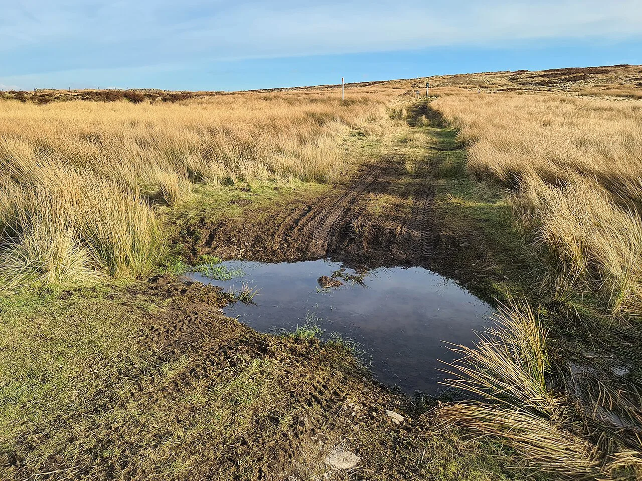
After heavy rain, the moorland paths on Derwent Edge, Alport Castles and the Bradfield moors become boggy, and you should expect slower going than the distances suggest. Snow and ice on the edges make the gritstone treacherous, so treat winter as a time for the valley and reservoir paths rather than the escarpment.
What to Wear and Carry
Grippy boots matter on gritstone, which loses friction when wet, and on the muddy field paths around Hathersage. Carry a windproof and waterproof layer on every edge walk, a map and compass for the moorland routes, and enough water for the day: there are few reliable refill points on the tops, so fill up in the village before you climb.
On the exposed ridge and edge days, plan your descent before midday if thunderstorms are forecast, because the crest offers no shelter. A headtorch belongs in the pack outside midsummer, when a slow pace can push a 5-hour route into dusk.
Where to Stay for Each Walk
Staying in Hathersage puts the Stanage Edge circuit, the stepping stones and the station within walking distance, and the inn at Leadmill Bridge sits right on the riverside route for a convenient start and finish. Staying in Hope or Castleton cuts the travel for the Win Hill and Castleton Ridge days and gives you a shorter walk home after the ridge.
If you want a single base for all the routes in this guide, Hathersage wins on transport breadth, but Hope is the better choice if the ridge and Win Hill are your priorities. Either way, booking ahead matters in summer, when the Hope Valley fills with walkers on fine weekends.
Nearby Walks Beyond Hathersage
The Monsal Trail stretches along a former railway line through the Wye valley at Bakewell, with the old stations and the Chee Dale gorge section among its high points; that route lies east of the Hope Valley and makes a separate day.
Plan Your Visit
Choose your trailhead first and the rest follows: Stanage from the village, Padley Gorge from Grindleford, Win Hill and the Castleton Ridge from Hope, and the reservoir routes from the A57 and Ladybower. Match the day's distance and ascent to your group, keep the flat riverside circuits for rest days, and carry layers for the exposed tops.
Frequently Asked Questions
What are the best walks from Hathersage?
The classic is the Stanage Edge circuit from the village, about 6.28 miles with 1,014 ft of ascent and a walking time of around 3 hours 45 minutes. The stepping stones riverside circuit is the easy flat option, while Padley Gorge from Grindleford and the Win Hill routes from Hope suit hikers who want a shorter hill day with less exposure.
How long is the Stanage Edge walk from Hathersage?
About 6.28 miles (10.1 km), with roughly 1,014 ft (309 m) of ascent and the same descent, taking around 3 hours 45 minutes at a steady pace. It climbs from the village through fields before following the escarpment and includes Little John's Grave and Robin Hood's Cave on the way.
Is the Hathersage stepping stones walk circular?
Yes, the riverside route follows the Derwent through meadows, crosses the stepping stones and returns on the opposite bank. It is about 5 miles (8 km) and flat, and it can be shortened by turning back at the stones.
Can you walk from Hathersage to Padley Gorge?
Padley Gorge's trailhead is at Grindleford, which is one stop along the Hope Valley line, so most hikers take the train rather than walk the road from Hathersage. The Bole Hill circuit from there is about 3.55 miles with 459 ft of ascent and around 2 hours of walking.
Which Hathersage walks are short and easy?
The Derwentside stroll is about 2.43 miles with 351 ft of ascent and takes around 1 hour 25 minutes. The Hope village and River Noe stroll is about 1.40 miles with only 23 ft of ascent, and the stepping stones circuit is the easiest full-day flat choice.
Where do the Win Hill and Castleton Ridge walks start?
Both start from Hope or Bamford rather than Hathersage. The Win Hill routes run about 4.10 to 7.91 miles with 919 to 1,253 ft of ascent, and the full Lose Hill to Mam Tor circuit from Hope is about 7.92 miles with 1,447 ft of ascent.
When is the best time to walk the edges around Hathersage?
Late spring through early autumn gives dry gritstone and long days. After heavy rain the moorland routes turn boggy, and snow or ice on the edges makes the rock slippery, so winter suits the valley and reservoir paths instead.
Sources
Trail notes for your next trip
Optional updates when we add or revise hiking guides.
You might also like
Continue reading
More guides you'll find useful